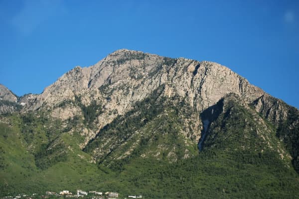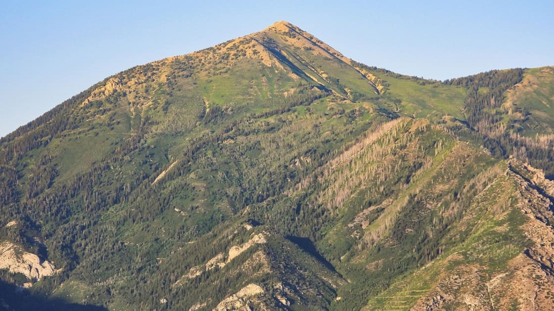

North of Timpanogos and southeast of Lone Peak there is a clean pyramid of a mountain that most of Utah Valley has looked at for years without ever learning its name. It stands above American Fork Canyon and the town of Alpine, it tops out at 11,101 feet, and on a summer weekend it sees a fraction of the people heading for Timp. That is Box Elder Peak.
It makes a natural next step for hikers who have done Timpanogos and want a big summit without the crowds, and it asks for one thing Timp does not: the last climb to the top is not on an official trail. This guide covers both ways up, that final ridge, the fees and rules, and when to go. Routes, rules and fees were checked against the Forest Service on September 30, 2026.
Quick facts
| Summit | 11,101 feet |
| Where | Lone Peak Wilderness, between American Fork Canyon and Alpine |
| Managed by | Uinta-Wasatch-Cache National Forest, Pleasant Grove Ranger District |
| Main routes | Deer Creek-Dry Creek trail from Granite Flat Campground; Dry Creek trail from Alpine |
| Round trip | Granite Flat: roughly 10.5 to 11.5 miles and 4,300 to 5,000 feet of climbing, per trail apps. Alpine: longer, with closer to 6,000 feet |
| Permit | None; no weekend ticket system like Timpooneke's |
| Fee | American Fork Canyon recreation fee to park at Granite Flat; America the Beautiful passes honored |
| Best season | July through September |
| From Provo | About 25 miles and 48 minutes to Granite Flat, or 22 miles and 42 minutes to Alpine's Dry Creek Trailhead, by OpenStreetMap routing |
The official trails go around it, not up it
Box Elder Peak is ringed by Forest Service trails, and none of them goes to the summit. The Box Elder Trail #044 is, in the agency's words, a wild and rugged 7.5-mile trail that climbs steeply to circle the peak and finishes at the Deer Creek-Dry Creek trail #043. The #043 trail, in turn, crosses the saddle at the head of Dry Creek, just north of the mountain. From that saddle, the summit is a climb up the north ridge on a path hikers have worn themselves.
That matters for two reasons. First, there are no switchbacks engineered for you on the steepest part of the day; the ridge goes up the way the ridge goes up, and it is loose near the top. Second, you are in the Lone Peak Wilderness, where the Forest Service warns that trails get little or no maintenance and tells visitors to carry a map and compass. Download the route before you leave the car, because signal is not something to count on up here.
Route one: Granite Flat Campground (the usual way)
Most people start in American Fork Canyon, because Granite Flat sits well above the valley floor and saves a lot of climbing. From I-15 take exit 284 (Alpine-Highland) and follow Highway 92 east into American Fork Canyon. At the fork above the canyon mouth, take the North Fork road (SR-144) toward Tibble Fork Reservoir, and just past the reservoir turn onto the paved road to Granite Flat Campground, about a mile further. The Forest Service lists the campground as open seasonally, run by a concessionaire, with restrooms and usually water during its season.
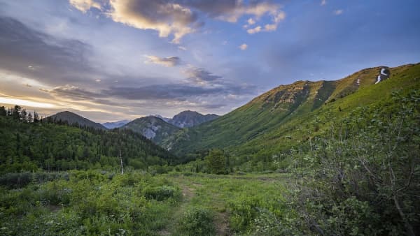
From there the Deer Creek-Dry Creek trail climbs west out of the Deer Creek drainage, through forest and a few rock fields, to an open high meadow and the saddle where the Dry Creek trail comes up from Alpine. Leave the trail at the saddle and turn south up the ridge. The path starts in spruce and breaks out above timberline partway up, and the final stretch is the steep, loose part people remember. From the summit you see the Pfeifferhorn and Lone Peak along the ridge to the north and Timpanogos filling the view to the south.
Trail apps put this out-and-back at roughly 10.5 to 11.5 miles with 4,300 to 5,000 feet of climbing, depending on the exact line on the ridge. Count on a full day.
Route two: Alpine's Dry Creek Trailhead
The Alpine side starts at the Dry Creek Trailhead, a dirt lot at the end of Grove Drive. The first stretch is a very busy trail, because it is the way to Horsetail Falls, and most of the people on it turn around at the falls. Past them, the trail keeps climbing Dry Creek to the same high meadow and the same saddle, and from there it is the same ridge to the top.
This is the longer, harder way to the summit, with closer to 6,000 feet of climbing in total, and its reward is starting from town, with no canyon drive and no American Fork Canyon fee. The access road runs through a neighborhood and the trail begins in city open space, so park only where signs allow and keep noise down early in the morning.
Route three: the loop, or a car shuttle
Because the trails ring the mountain, Box Elder lends itself to loops. A common one goes up the Deer Creek-Dry Creek trail from Granite Flat, over the summit, and down the south side to pick up the White Canyon and Box Elder trails back to the campground. Another is a point-to-point between Alpine and Granite Flat with a car left at each end.
Both are good days and both ask more of you than the out-and-back. The descent off the south side is steep and takes some route-finding, and the Box Elder Trail is the one the Forest Service calls wild and rugged. Do the out-and-back first if you have not been up before.
Timing, weather and snow
Summer into early fall. Snow holds on the upper mountain well into the season in many years. A photo on Wikimedia Commons, taken from the valley, shows the summit slopes still white on June 1, 2022. For most people July through September is the dependable window, and Granite Flat Campground's season sets the practical limits on the canyon side.
Start early. Afternoon thunderstorms build over the Wasatch summits through July and August, and both the ridge and the summit are exposed. Pick a turnaround time before you start and keep it.
Carry your water. Do not plan around refilling on the way; Dry Creek runs dry for much of the year. Take more than you think, plus layers, a headlamp and sun protection.
Fall color. The aspens around Granite Flat and on the upper trail turn in late September and early October, which makes this one of the better fall summit days in the valley, as long as the first snow has not beaten you to it.
Fees, permits and wilderness rules
There is no permit for Box Elder Peak and no weekend ticket system. That sets it apart from the Timpooneke trailhead for Mount Timpanogos, where the Forest Service has required tickets on Saturdays, Sundays and holidays since July 7, 2023.
Parking at Granite Flat does cost something. American Fork Canyon is a designated recreation fee area, and the fee attaches to stopping at a developed site such as a trailhead or campground, with the pass displayed in your vehicle; America the Beautiful passes are honored. Our American Fork Canyon guide explains what triggers the fee, and our Tibble Fork guide has the current posted rates.
Inside the Lone Peak Wilderness, the Forest Service's rules apply: no mountain bikes or other mechanized or motorized equipment (a drone counts), no shortcutting switchbacks, campfires and wood gathering discouraged, and groups capped at 15, with 8 or fewer recommended.
A checklist for the night before
- Choose your start: Granite Flat for the shorter day, Alpine for no canyon drive.
- Download the route, including the ridge above the saddle, and carry the Forest Service map.
- If you are starting at Granite Flat, bring a pass or cash for the canyon fee.
- Pack all your water, food for a full day, layers, a headlamp and sun protection.
- Set a turnaround time and tell someone your route.
- Check the summit forecast for afternoon storms.
How it compares with its neighbors
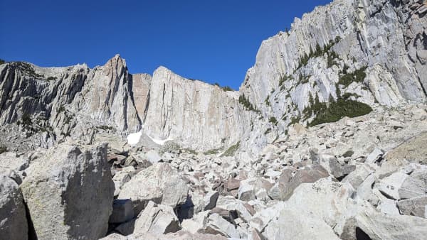
Box Elder sits between two better-known summits. Mount Timpanogos is higher and busier, with maintained trail almost to the top and a weekend permit system at Timpooneke. Lone Peak is rougher, with a steeper approach and a granite scramble at the summit. Box Elder lands in the middle: a long, steep day with real navigation at the end but no scrambling to speak of, and far more solitude than either. If you want a shorter outing on the same mountain, the walk to Horsetail Falls from Alpine is the popular half-day.
Related Guides
- Hiking Lone Peak
- Buffalo Peak and the Kyhv Peak Road overlooks
- Hiking Mount Timpanogos
- American Fork Canyon: the trails, fees and reservoirs
- Tibble Fork Reservoir
- The best hikes near Provo, easy to epic
- Living in Alpine
Frequently Asked Questions
How high is Box Elder Peak?
What is the easiest way up Box Elder Peak?
Is there a trail to the top of Box Elder Peak?
Do you need a permit to hike Box Elder Peak?
Can you hike Box Elder Peak from Alpine?
When is the best time to hike Box Elder Peak?
Is Box Elder Peak in a wilderness area?
Can I bring my dog on Box Elder Peak?
Sources
The facts in this guide were checked against these sources. Hours, fees and rules change, so confirm anything time-sensitive with the source before you go. How we make Provo.com.
- Box Elder Trail #044, USDA Forest Service, Uinta-Wasatch-Cache National Forest. Checked October 12, 2026.
- Timpooneke Trailhead, USDA Forest Service, Uinta-Wasatch-Cache National Forest. Checked October 12, 2026.
- Box Elder Peak via Deer Creek-Dry Creek Trail, AllTrails. Checked October 12, 2026.
- Box Elder Peak via Dry Creek Trail, AllTrails. Checked October 12, 2026.