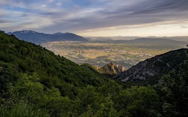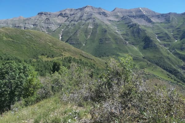

Look north from almost anywhere in Utah Valley and the skyline ends in a pale, blocky summit above Alpine. That is Lone Peak, 11,253 feet, and on a clear day you can pick it out from the Provo side of Utah Lake. It is not the highest mountain around here. Timpanogos and Nebo are both taller. But among the summits Utah County hikers talk about, it is the one people describe as the hardest day, and it earns that on steepness, rough ground and a scramble at the top rather than on height.
This guide covers both ways up, the change in Draper that makes a lot of online directions wrong, what the top is really like, and how to decide whether it is your mountain this year. Rules and gate status were checked on September 30, 2026.
Quick facts
| Summit | 11,253 feet |
| Where | Lone Peak Wilderness, on the Salt Lake and Utah county line, above Alpine and Draper |
| Managed by | Uinta-Wasatch-Cache National Forest (Salt Lake and Pleasant Grove ranger districts) |
| Main routes | Jacob's Ladder from Draper; the Hamongog route from Alpine's Schoolhouse Springs trailhead |
| Round trip | Roughly 11 to 13 miles by either main route; published figures vary by trailhead |
| Best season | Summer and fall, per the Forest Service; snow often lingers until midsummer |
| Rules | No bikes or motorized equipment; group limit 15, 8 or fewer recommended |
| Dogs | Not allowed on the Draper side above the Bonneville Shoreline Trail |
| From Provo | About 21 miles and 36 minutes to the Schoolhouse Springs trailhead in Alpine, by OpenStreetMap routing |
Utah's first wilderness, and what that means on the ground
The Lone Peak Wilderness was designated by Congress in the Endangered American Wilderness Act, signed February 24, 1978. For six years it was the only designated wilderness in Utah. The rest of the Wasatch wilderness areas, including Mount Timpanogos, Mount Olympus and Twin Peaks, came with the Utah Wilderness Act of 1984. One small wrinkle if you read the signs closely: the Forest Service's own trail page says the wilderness was established in 1977, while the law itself was signed in February 1978. The 1978 date is the one on the statute.
Wilderness is a legal category, and it changes what you can bring. The Forest Service's Lone Peak Trail page lists the rules plainly:
- No mechanized or motorized equipment, and it says specifically that this includes mountain bikes.
- No shortcutting switchbacks.
- Campfires and gathering wood for fires are discouraged.
- Groups are limited to 15 people, and 8 or fewer is recommended.
Wilderness.net, the federal wilderness information site, adds that motorized equipment and mechanical transport are prohibited across all wilderness areas. A drone is motorized equipment, so leave it in the car. What the wilderness label does not bring is much trail work. Expect a trail that gets rougher and fainter the higher you go.
Two ways up, and why many Draper directions are out of date
From Draper: Jacob's Ladder
Jacob's Ladder is the shortest and most direct way up, which is another way of saying it is steep. The route climbs out of Draper's Corner Canyon, a city-run network of trails on the mountainside, and then heads straight up the ridge toward the peak.
Here is the part that trips people up. For years, route descriptions told hikers to drive up Corner Canyon Road from the Orson Smith trailhead and park at the Jacob's Ladder trailhead partway up. You can't do that anymore. Draper City says that since July 1, 2020, the gates at Orson Smith have been closed at all times, to reduce the risk of fire and to keep access clear for the fire department. If a guide tells you to drive the dirt road, it was written before the change.
Draper now points Lone Peak hikers to Jacob's Ladder by way of the Peak View trail, starting from the Peak View Trailhead up on Traverse Ridge. The Forest Service lists Jacob's Ladder itself at 3.8 miles one way, from the Ghost Falls trailhead on Corner Canyon Road to the Lone Peak Cirque, and describes it as extremely steep, long and rugged. That figure starts at the old parking spot, so it does not include the walk in now that the road is gated. The city lists three other ways in:
- The Cherry Canyon Logging Trail, from the Orson Smith trailhead.
- The Hamongog trail from Alpine, covered below.
- The Sawmill Trail, from the Hidden Valley Trailhead in Sandy.
Two Draper rules matter before you leave the house. Dogs are not allowed in the Corner Canyon watershed, which covers everything above the Bonneville Shoreline Trail, so the Draper approach is not a dog hike. And while the lower Corner Canyon trails are shared with mountain bikers, bikes of every kind stop at the wilderness boundary.
From Alpine: Schoolhouse Springs and the Hamongogs
The Alpine route is longer and gentler in its middle, and it passes two high meadows that locals call the First and Second Hamongog. It is also the side the Forest Service describes: its Lone Peak Trail is reached from the Hamongog trail, which the Forest Service says officially begins at the wilderness boundary, a mile or two past the end of a dirt road in Alpine.
Visit Utah's directions to the Schoolhouse Springs trailhead start from I-15 exit 284 (Alpine-Highland; Visit Utah's page still says 287, but the Forest Service and the interchange signs use 284): head east on Highway 92 for about five miles to Highway 74, turn north into Alpine, and follow Main Street to Alpine Cove Drive and then Aspen Drive. There is no designated parking at the first gate, so park where you will not block anyone.
From there an old jeep road climbs about a mile and a half across city property to the national forest boundary and the First Hamongog. Stay on the road; this is private and city land, and the people who live below it have put up with trailhead traffic for decades. Past the wilderness sign, the trail heads up through the trees to the Second Hamongog, a meadow beneath Big Horn Peak, and on toward the summit. The Second Hamongog is where people who split the trip into an overnight usually camp.
Which side to pick
Pick Draper if you want the most direct line and do not mind a relentless, loose climb. Pick Alpine if you want the meadows, a more gradual middle section, or an overnight. Either way you are signing up for a long, full day and about 6,000 feet between the valley and the summit.
The top: why this mountain has its reputation
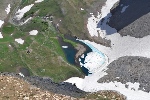
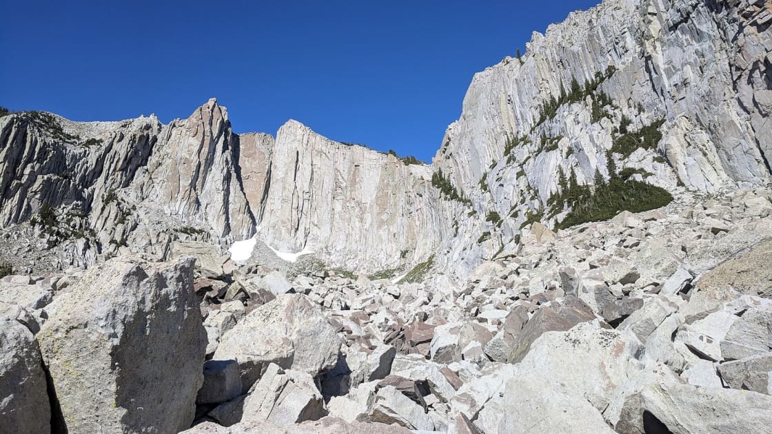
Below the high country, both routes are trails. Near the top they stop behaving like trails. On the Draper side the path fades out across big granite slabs on the way into the cirque, the bowl of cliffs under the summit. Route-finding becomes your job, and a GPS track or a paper map is not optional up here.
The true summit is a small block at the end of a ridge of broken granite. Reaching it means using your hands, with long drops on one side, and it is the step where hikers most often decide they have had enough. There is no shame in that. The cirque and the views from below the final ridge are the reason plenty of people come, and turning around there is a normal, sensible choice. If you do go on, go slowly, test your holds, and do not climb anything you would not be willing to climb back down.
The pale rock is quartz monzonite, a granite-like stone, the same kind found in Little Cottonwood Canyon just to the north, where the granite for the Salt Lake Temple was quarried. It is why the peak glows white against the sky from the valley, and why it is a climbing destination as well as a hiking one.
Timing, weather and snow
Summer and fall are the season. The Forest Service lists both. Wilderness.net notes that snow often stays on the high peaks until midsummer, which on this mountain means old snow on the upper slopes into July in many years. For most people July through September is the reliable window. October can be beautiful and can also bring the first storm of the year with little warning.
Start before dawn. A long day is only part of the reason. The summit is exposed, and afternoon thunderstorms build over the Wasatch through July and August. Set a turnaround time before you leave and keep it, whether or not the summit is in sight.
Carry all your water. Do not plan around finding water on the way. Bring more than you think you need, plus a headlamp in case the descent runs long, and warm layers for the wind on top.
Winter is a different sport. Once snow comes, the mountain is avalanche terrain and a job for people with avalanche training and gear. Check the Utah Avalanche Center forecast, and treat any winter or spring attempt as mountaineering, not hiking.
A checklist for the night before
- Decide your side: Draper's Peak View Trailhead or Alpine's Schoolhouse Springs trailhead.
- If you are going from Draper, leave the dog at home.
- Download the route and the Forest Service map; the upper route is faint.
- Pack all your water, food for a full day, layers, a headlamp and sun protection.
- Pick a turnaround time and tell someone your route and your expected return.
- Check the weather for the summit, not for the valley.
If Lone Peak is too much this year
A lot of hikers work up to it. Mount Timpanogos is taller but follows maintained trail most of the way, and it is the usual first 11,000-foot summit for Utah Valley hikers. Provo Peak and Kyhv Peak are serious climbs closer to home. For a taste of the Lone Peak Wilderness without the summit, the Silver Lake trail above American Fork Canyon climbs into it in a couple of miles; it is in our lesser-known hikes guide. And if you want the Draper foothills at a gentler grade, the lower Corner Canyon trails are some of the best in the state. Closer to Salt Lake, Mount Olympus has the same steep, scrambly finish on a shorter day.
Related Guides
- The best hikes near Provo, easy to epic
- Hiking Mount Timpanogos
- Hiking Provo Peak
- Hiking Box Elder Peak
- Kyhv Peak, formerly Squaw Peak
- Things to do in Draper
- Living in Alpine
Frequently Asked Questions
How high is Lone Peak?
How long is the Lone Peak hike?
Can you still drive Corner Canyon Road to the Jacob's Ladder trailhead?
Is Lone Peak harder than Mount Timpanogos?
Do you need a permit to hike Lone Peak?
Can I bring my dog on Lone Peak?
When is the best time to hike Lone Peak?
Why is the Lone Peak Wilderness called Utah's first wilderness?
Sources
The facts in this guide were checked against these sources. Hours, fees and rules change, so confirm anything time-sensitive with the source before you go. How we make Provo.com.
- Lone Peak Trail, USDA Forest Service, Uinta-Wasatch-Cache National Forest. Checked October 12, 2026.
- Rules & Trail Etiquette, Draper City. Checked October 12, 2026.
- Jacobs Ladder Trail #187, USDA Forest Service, Uinta-Wasatch-Cache National Forest. Checked October 12, 2026.
- Lone Peak Wilderness, Wilderness.net (University of Montana with federal agencies). Checked October 12, 2026.
- Lone Peak via Peak View and Jacob's Ladder Trail, AllTrails. Checked October 12, 2026.