
Tibble Fork is the reservoir most people in Utah Valley picture when they picture American Fork Canyon: turquoise water, a rim of pine and aspen, and a car park that fills by ten on a Saturday in July.
It is also a place with a genuinely complicated recent history, a set of posted rules that almost nobody reproduces, and one widely-asked question — is it safe to get in the water? — that has an actual documented answer almost no guide bothers to look up.
This covers all three, plus the practical business of getting there and having a good day.
Getting there
The Forest Service's own directions are the ones to follow, because the turn that matters is easy to miss.
From I-15 take the Alpine–Highland exit, number 284, and head east on Highway 92 for roughly eight miles to the mouth of American Fork Canyon. Continue about five miles up the canyon to the junction, then take the North Fork road — Forest Road 085 — to Tibble Fork Reservoir.
The junction is the decision point. Staying right on SR-92 puts you on the Alpine Loop toward Cascade Springs and Sundance. Going left onto the North Fork takes you to Tibble Fork, Granite Flat and Silver Lake Flat. Plenty of first-time visitors sail past it and end up over the top of the mountain.
The reservoir sits at roughly 6,400 feet, which is the single most useful number for planning: it is high enough that the water stays cold all summer, that spring arrives weeks later than it does on the valley floor, and that the aspens turn earlier than they do in town.
From Provo, allow about 40 minutes without traffic. On a July Saturday, allow more, and expect the last stretch to be slow.
What it costs, and the number that is out of date
The Forest Service's own recreation page for Tibble Fork Reservoir and Trailhead lists day-use at $10 per vehicle for three days, $20 per vehicle for seven days, and $60 per vehicle for the season. Interagency America the Beautiful passes and Uinta-Wasatch-Cache National Forest passes are honored in place of paying, and the requirement is explicit: have your pass on display while you are parked.
A digital day-use pass can be bought in advance through Recreation.gov, which is worth doing, because paying on site in this canyon has historically meant cash or a check.
You will still find $6 quoted widely on family blogs and travel listings for American Fork Canyon access. That was a real number once. It is not the current posted structure, and it is a good example of a pattern this valley produces constantly: the most-repeated fact about a place tends to be its oldest fact, because it has had the longest to propagate and gets copied faster than it gets corrected.
Our American Fork Canyon guide covers how the canyon's fee area works as a whole, including the useful wrinkle that visitors going only to Timpanogos Cave National Monument are not required to pay it.
The rules nobody prints
Here is the Forest Service's own posted list of year-round restrictions at Tibble Fork. Read it once, because at least three of these surprise people:
- Park in designated stalls only
- No motorized use on the banks or the reservoir
- Dogs must be on leash
- No alcohol
- No fires
- No glass
No fires is the one that ruins evenings. People arrive with a portable fire pit or a disposable grill expecting a lakeside cookout and find they cannot have one. If a fire is the point of your evening, book a site at Granite Flat Campground, less than a mile away, where fire rings are provided.
No glass matters for the obvious reason on a beach where children go barefoot.
No motorized use means no motorboats, and also no motorized anything on the banks. Kayaks, canoes, paddleboards and rafts are what this reservoir is for. There is a launch that lets you get a board on the water without wading.
And there is no drinking water on site. The Forest Service says so plainly; restrooms are vault toilets. Bring everything you plan to drink.
On parking, the Forest Service's language is blunter than usual: the site is heavily used, and ticketing and towing are strongly enforced for vehicles in no-parking zones, blocking gates, or blocking the flow of traffic — because emergency vehicles need to get in. The lot was substantially enlarged during the dam rebuild and it still fills. Before ten in the morning or after mid-afternoon is the practical answer on a summer weekend.
The Forest Service page contradicts itself, and that is worth knowing
A small but instructive thing. As of its May 2026 update, the official Forest Service page for Tibble Fork carries, within one screen of each other:
- a Current Conditions line reading "Forest Road 085 (Mineral Basin) Open"
- a General Information line reading "The 085 Mineral Basin Road is closed"
- an OHV note reading "The 085 Mineral Basin Road is currently closed"
Two against one, on the agency's own page, about its own road.
We are not going to tell you which is right, because we cannot know from outside. The transferable lesson is the useful part: being the official host of a fact is not the same as having the current version of it. This is the sixth time this pattern has turned up in our reporting on Utah Valley — after the reservation requirement a national park had already dropped, a university's campus map disagreeing with its own directions page, two official capacities for the same stadium, a dining department describing a demolished building in the present tense, and a state tourism office still selling a fixed price the operator had replaced. Tibble Fork is the first where the host disagrees with itself in a single screen.
If you are planning to drive above the reservoir, phone the Pleasant Grove Ranger District on (801) 785-3563 rather than trusting either line.
What actually happened in 2016
If you have lived here more than a decade you remember the American Fork River running black. Here is the sequence, from the state's own records rather than from memory.
In 2004, the Natural Resources Conservation Service assessed the fifty-year-old earthen Tibble Fork Dam and concluded it did not meet federal or state safety standards for a high hazard dam — a classification that means people downstream would be at risk if it failed. That triggered a $7.3 million rehabilitation project to stabilize the structure, increase storage and extend the dam's life.
To do the work, the reservoir had to be drained. Crews began releasing water in mid-to-late August 2016 — accounts differ on whether the operative date was the 19th, the 20th or the 22nd, and the state's own documents are not consistent about it either. As the last of the water went out, inflow from an upstream creek cut through the exposed reservoir bed and washed metal-laden sediment into the North Fork of the American Fork River.
Some sediment release was expected. The volume was not. Estimates of how much went downstream also differ by source: Utah's health department has used 5,100 cubic yards; the state's notice of violation, as reported at the time, put it at 8,700. Both figures are in circulation and we are recording the range rather than choosing.
The consequences were immediate and serious. Fish were killed along roughly a two-mile stretch below the dam. Access to the river was closed for weeks and caution signs went up. The sediment contained arsenic and lead from historic mining in the drainage above — the Live Yankee and Globe workings and a scatter of other abandoned gold and silver mines around Mary Ellen Gulch.
The regulatory outcome: the North Utah County Water Conservancy District was cited on multiple counts, including failing to notify the state within the statutory 24 hours — regulators learned of the spill from a third party, the National Park Service at Timpanogos Cave, and the Forest Service. In a March 2017 settlement, the district agreed to a $52,500 civil penalty and $92,633.55 in reimbursement for state sampling and monitoring costs, plus a remediation plan to return the river to pre-spill conditions.
The rehabilitation itself was completed, and the reservoir most people use today is its product: a bigger lot, an ADA ramp and viewing platform, a launch, and a sand beach built on the north shore.
One footnote that explains a common confusion. Contemporary 2016 coverage called Tibble Fork a 10-acre lake; Utah's health department now describes it as 22 acres. Both are right at different times — increasing storage capacity was one of the stated purposes of the rebuild.
So is it safe to get in the water?
This is the question the incident left behind, and it has a real answer that almost nothing online cites.
In March 2023, the Utah Department of Health and Human Services, working under a cooperative agreement with the federal Agency for Toxic Substances and Disease Registry, published a health consultation titled specifically as an assessment of exposure to heavy metals in sediment at Tibble Fork Reservoir. It looked at recreational users — people who swim, paddleboard, kayak and beachcomb — and at both beach sediment and lake-bottom sediment.
Its conclusion: touching or accidentally swallowing heavy metals in sediment during that kind of recreational exposure is not expected to harm people's health, because the levels measured in the sediment were below levels of concern.
Separately, the Utah Division of Water Quality runs seasonal recreational monitoring at the reservoir for the two things that actually change week to week — harmful algal blooms and E. coli — and posts the results, sampling at the swim beach.
Two honest qualifications. The 2023 consultation assessed sediment, which is the exposure route people were worried about; it is not a blanket statement about every possible condition at every moment. And harmful algal blooms are seasonal and can appear at any Utah water body, so checking DEQ's current advisory before a summer swim is sensible practice here as it is at Utah Lake and Deer Creek.
The greater practical risk at Tibble Fork is not metals. It is temperature. This is snowmelt held at altitude; it stays cold long after the valley is baking, there are no lifeguards, and cold-water shock affects strong swimmers as readily as weak ones. Ease in rather than jumping, keep children within reach, and put life jackets on paddlers.
What to actually do there
Paddling is the headline. The reservoir is small, motor-free and ringed by mountains, which makes it one of the best beginner paddleboard and kayak waters within an hour of Provo — see our kayaking and paddleboarding guide for rental options and the county's other put-ins.
Fishing. The Forest Service lists lake and pond fishing, river and stream fishing, and ice fishing in winter. The reservoir is fed by the American Fork River, Deer Creek and Tibble Fork Creek. Our fishing guide covers regulations and the rest of the county's water.
Walking the shoreline. Cross the dam on the west side and a shaded trail runs along the reservoir's edge for roughly half its length before it fades out on a steep slope. It is short, easy and the best view of the water.
Trailheads. Four Forest Service trails are listed from here: Tibble Fork #041, Mill Canyon #040, Holman #039 and Holman Ridge–Cabin Flat #172. This is a serious trail junction, not just a picnic spot. Our lesser-known hikes guide covers the quieter options in this canyon and elsewhere.
Camping. Granite Flat is less than a mile up, at about 6,400 feet in aspen, Douglas fir, spruce and pine, with group sites and single and double family sites, paved roads and spurs. Reserve through Recreation.gov; see camping near Provo for the wider picture.
Onward. Silver Lake Flat Reservoir sits higher up and is quieter, reached by a rougher road. The Alpine Loop is the drive over the top, and Timpanogos Cave is back down the canyon.
The road above the reservoir, and why it has three names
Most visitors treat Tibble Fork as the end of the road. It is not. It is a staging area, and what happens above it explains a great deal about the place — including why the official page can disagree with itself.
Forest Road 085 continues north and east from the reservoir and eventually comes out at Midway, in Heber Valley. That is the fact worth carrying away: there is a forest road connecting American Fork Canyon to the Heber side of the mountains, climbing past Mineral Basin and over toward Pole Line Pass and Dutchman Flat.
It is known by at least three names — Mineral Basin Road, the American Fork–Snake Creek Road, and Snake Creek Road — which is very likely why an official page can carry an "085 open" line above an "085 closed" line without anyone catching it. Different segments, different signage, different sources, one number.
Off the main road, the branches are what people actually come for. Mary Ellen Gulch, the trailhead for which sits roughly four and a half miles up from the reservoir, climbs an old mining road past abandoned gold and silver workings from the late 1800s and comes out with a view of the back side of Snowbird. Mineral Basin itself is at the difficult end of the scale — loose shale and sharp quartzite, genuinely built-rig territory.
Practical rules if you are riding:
- Tibble Fork's car park is the OHV staging area, and it has room for trailers. It also fills on weekends, so early matters even more than usual.
- Motorized travel is restricted to designated routes. Some trails in this canyon are hiker and bike only.
- Utah OHV registration is required for residents; visitors need a non-resident permit, available through Utah State Parks.
- Late June through early October is the realistic window. Snow lingers at the top well into June.
- When the road is closed to motorized use, it stays open for mountain biking, running and backcountry skiing — which is a genuinely good reason to come in the shoulder seasons.
One naming trap, because it has caught riders out. Tibble Fork is a reservoir, a creek, a Forest Service hiking trail (#041), and an expert-only downhill mountain bike trail — and the mountain bike trail does not start at the reservoir. It begins high on a ridge and finishes on the Mill Canyon trail, with the usual approach being a shuttle or a long climb from a South Fork trailhead. If somebody tells you they rode Tibble Fork, they did not mean the shoreline. Our mountain biking guide covers the canyon's network properly.
Accessibility
This is one of the better-adapted mountain sites in the county, and it is rarely mentioned.
The dam rehabilitation added an ADA ramp leading to a viewing platform over the water, alongside accessible parking spaces and a substantially enlarged, paved lot. The result is that someone using a wheelchair can get to a proper view of the reservoir and the Wasatch behind it without leaving hard surface — which is not true of most alpine water in Utah Valley.
The shoreline beyond the developed area is a different matter: it is uneven, and it gets steep when the water level drops through late summer.
Seasons
Summer is peak everything: peak beauty, peak crowding, peak parking difficulty. Early morning is transformative — still water, no queue, and the light on the Wasatch behind the reservoir.
Autumn is the best trade. The canyon's aspens turn through late September and early October, the crowds thin sharply after Labor Day, and the water goes glassy. Our fall guide has the timing.
Spring is unpredictable. Runoff can raise the water and steepen the shoreline, and the upper canyon opens later than people assume.
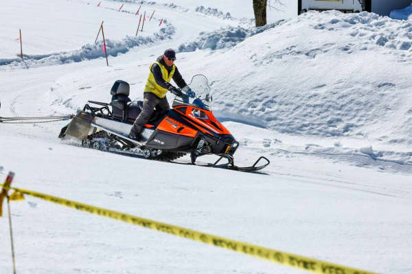
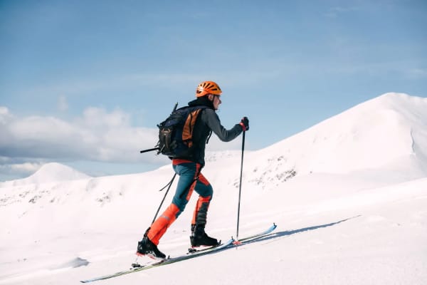
Winter is listed as open, with ice fishing, cross-country skiing, snowshoeing and snowmobiling among the site's activities — but everything depends on how far up the canyon the road is maintained, and the Alpine Loop above closes for the season. Confirm with the ranger district rather than driving up on optimism. Our winter activities guide covers the county's reliable cold-weather options.
The short version
Ten dollars for three days, no fires, no alcohol, no glass, no motors, no drinking water, park in a marked stall or get towed. Go early. The 2016 spill was real and serious, the state studied the recreational exposure question directly in 2023 and found sediment metals below levels of concern, and the thing most likely to hurt you at Tibble Fork is how cold the water is.
Related Guides
- Hiking Mount Nebo: The Highest Peak in the Wasatch, and Nobody Agrees How High
- Hobble Creek Canyon: The Name Springville Gave Away
- Things to Do in American Fork, Utah (2026)
- Snowmobiling Near Provo
- Utah Valley Hidden Gems: 25 Places Locals Keep to Themselves
Frequently Asked Questions
How much does it cost to go to Tibble Fork Reservoir?
Can you swim at Tibble Fork Reservoir?
Is Tibble Fork Reservoir contaminated?
Are motorboats allowed on Tibble Fork Reservoir?
Can you have a campfire or a barbecue at Tibble Fork?
Where do you park at Tibble Fork Reservoir?
Is there drinking water at Tibble Fork Reservoir?
Can you visit Tibble Fork in winter?