
Look east from Provo and the next summit north of Kyhv Peak, the old Squaw Peak, is Buffalo Peak. It is the rare summit above the city that most families can stand on with almost no hiking at all: the road that climbs behind the mountains comes within about half a mile of the top. Pair it with the overlooks on the way up and it is one of the best evenings out close to Provo.
This guide covers the drive in order, the walk to the top, the longer version for people who want a real hike, and when the road is open. The rename and the road's rules are covered in more depth in our Kyhv Peak guide.
Quick facts
| The walk | About a mile round trip from the road, with roughly 250 to 300 feet of climbing, per route guides and trail apps |
| The longer hike | From the Kyhv Peak Overlook: a little over 4 miles round trip and about 1,400 feet, per trail apps |
| The road | Kyhv Peak Road, formerly Squaw Peak Road, off US-189 about two miles up Provo Canyon |
| Surface | Paved switchbacks, then dirt and gravel past Hope Campground |
| Season | The road closes for snow in winter; dates vary |
| Land | Uinta-Wasatch-Cache National Forest |
The drive, in order
The turnoff. Kyhv Peak Road leaves US-189 on the right about two miles up Provo Canyon. Signs and some apps still say Squaw Peak; it is the same road.
The paved switchbacks. The lower road climbs in tight bends with pullouts along the way. The views start early, which is why plenty of people never go farther than this, especially at sunset.
The fork. Partway up, the road splits. The right branch climbs to the Kyhv Peak Overlook, the paved viewpoint with a railing and parking that is the valley's standard panoramic photo. The left branch is the way to Buffalo Peak. Directions to the two places sound nearly identical for exactly this reason, and they land in different spots.
Past Hope Campground. On the left branch the road passes Hope Campground, and the pavement ends soon after. From here it is dirt and gravel. In dry weather most people drive it slowly in an ordinary car; a high-clearance vehicle is more comfortable on the rough stretches, and nobody should try it in mud.
The saddle and the trailhead. The road climbs to its high point and crosses a saddle. Route guides put the Buffalo Peak trail on the right here, with parking beside the road.
Farther on. A short way past the trailhead the dirt road reaches the Rock Canyon Overlook, which looks down into the canyon rather than across the valley, and beyond that Rock Canyon Campground, the starting point for the shorter approach to Kyhv Peak.
The walk to the top
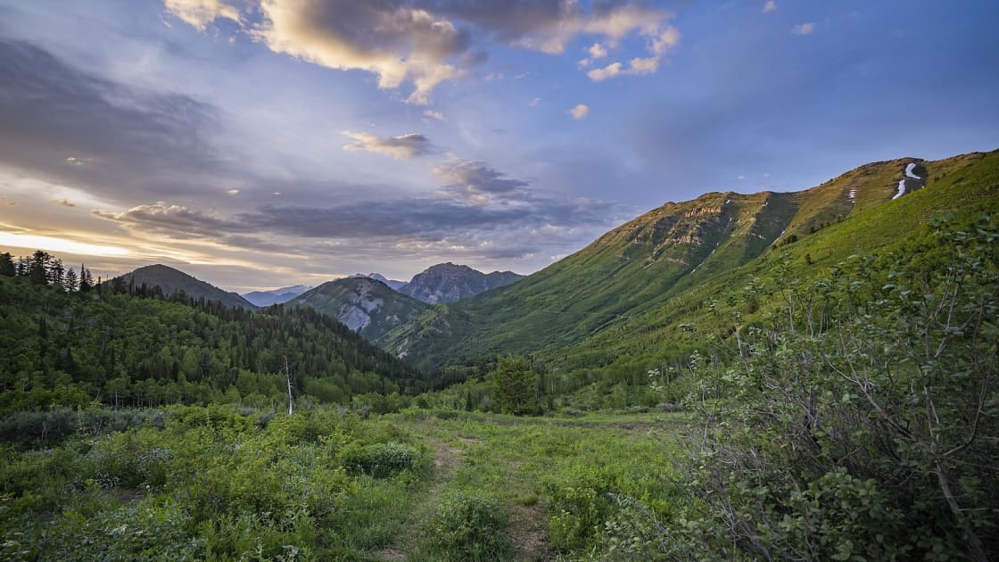
The trail leaves the road through a gap in the fence and climbs a wide path that soon levels out, with views opening in several directions. A few side paths branch off; stay on the one heading for the obvious high point ahead. The last pitch to the summit is short and steep, and loose in places, so take it slowly with small children.
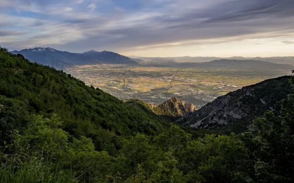
From the top the view runs across Utah Valley and Utah Lake, with the Wasatch stacked to the north. On a clear day the view south reaches Mount Nebo above the far end of the valley; a Forest Service photographer caught exactly that view from the top of this road in July 2019.
Most people are up and back in well under an hour, which leaves time for the overlooks on the way down.
Making a real hike of it
If the short walk feels like cheating, start at the Kyhv Peak Overlook instead. A trail runs from the overlook to Buffalo Peak, and trail apps put the out-and-back at a little over four miles with about 1,400 feet of climbing. It is a good conditioning hike early in the season and a quiet one on weekday evenings.
For the full climb, the route to Kyhv Peak itself starts down in Rock Canyon and gains around 3,000 feet; our Kyhv Peak guide and our Rock Canyon guide cover it.
When to go
May through October, roughly. The road closes for snow in winter, and the dates move with the weather. Do not drive up assuming it is open in the shoulder months; check with the Forest Service.
Fall color comes early here. These slopes are among the first in the county to turn, which makes late September and early October the busiest weeks of the year on the road. Go on a weekday if you can. Our fall guide covers timing across the valley.
Sunset and after. The overlooks are busiest at sunset, for good reason. Stay a little longer and the height and the ridge between you and the city make this one of the closest usable stargazing spots to Provo; our stargazing guide compares it with darker sites farther out.
Practical notes
- There are no services at the Buffalo Peak trailhead; bring water, especially for kids.
- Park fully off the road, and never block a Forest Service gate.
- Much of the surrounding national forest allows dispersed camping, and the road is a well-known corridor for it; our camping guide covers the rules.
- Afternoon thunderstorms are common in summer, and an exposed summit is the wrong place to be in one.
Related Guides
- Kyhv Peak, formerly Squaw Peak: the hike, the road and the overlook
- Rock Canyon Trail
- Hiking Box Elder Peak
- Hiking Lone Peak
- The best hikes near Provo, easy to epic
- Stargazing near Provo
Frequently Asked Questions
How long is the Buffalo Peak hike?
How do you get to the Buffalo Peak trailhead?
Is Squaw Peak Road the same as Kyhv Peak Road?
Can a regular car make it to Buffalo Peak?
When is Kyhv Peak Road open?
Is Buffalo Peak a good hike for kids?
Can you hike to Buffalo Peak from the Kyhv Peak Overlook?
Which overlook on Kyhv Peak Road has the best view?
Sources
The facts in this guide were checked against these sources. Hours, fees and rules change, so confirm anything time-sensitive with the source before you go. How we make Provo.com.
- Hope Campground, USDA Forest Service, Uinta-Wasatch-Cache National Forest. Checked October 12, 2026.
- Buffalo Peak Trail, AllTrails. Checked October 12, 2026.
- Kyhv Peak Overlook to Buffalo Peak, AllTrails. Checked October 12, 2026.