
From Utah Valley, the two summits that frame the east side of the Salt Lake Valley are an hour's drive and a different kind of hike from the ones at home. Mount Olympus is the steep, rocky one that ends in a hands-on scramble. Grandeur Peak is the steady one, a hard but straightforward climb out of Millcreek Canyon. Between and around them, Neffs Canyon and the Pipeline Trail give the same front at easier grades, and Millcreek is the canyon where dogs are welcome.
Trail distances and climbs below are from AllTrails. Rules come from Salt Lake City Public Utilities, the Forest Service and Trails Utah. Drive times are OpenStreetMap routing (OSRM) from Center Street and University Avenue in Provo, without traffic.
The short list
| Hike | Round trip | Climbing | Note |
|---|---|---|---|
| Mount Olympus | 7.2 mi | about 4,180 ft | scramble at the top |
| Grandeur Peak from Church Fork | 6.5 mi | about 2,580 ft | Millcreek fee |
| Grandeur Peak west face | 4.6 mi | about 3,310 ft | steepest, no fee |
| Neffs Canyon | 7.4 mi | about 3,560 ft | quieter canyon |
| Pipeline: Rattlesnake Gulch to overlook | 4.0 mi | about 670 ft | the easy one |
Mount Olympus
7.2 miles round trip · about 4,180 feet · Mount Olympus Wilderness · 51 minutes from Provo
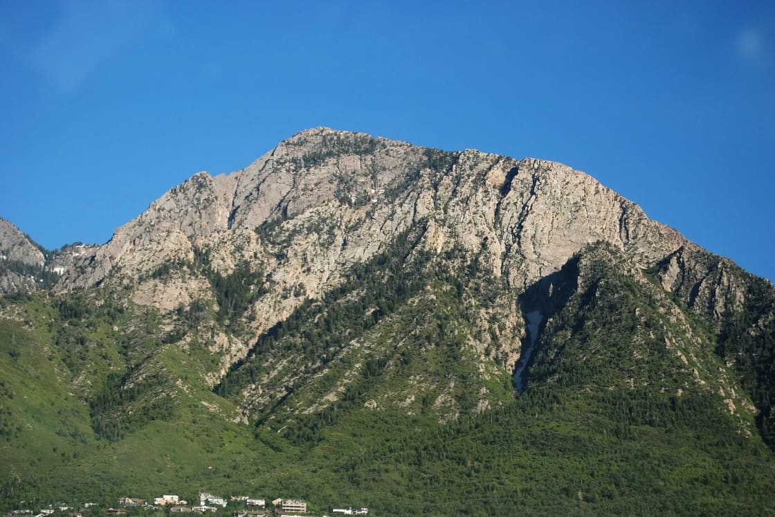
Olympus rises directly above Holladay and the Wasatch Boulevard trailhead. AllTrails rates it strenuous, a step above hard, and its description lays out the two halves of the day:
- To the saddle, the trail is Class 1 and 2 hiking: steep, sustained, but a trail. AllTrails puts the high point of the route near 9,020 feet.
- From the saddle to the summit is Class 3 scrambling, meaning you use your hands on rock. AllTrails says this section is "not well-marked," and it recommends downloading an offline map because cell service is unreliable.
Why it is harder than it looks. About 4,180 feet of climbing in 3.6 miles each way is a steeper average than the Timpanogos trails, and the descent of that same grade is where tired legs slip. Start early in summer; AllTrails specifically recommends hiking as early as possible to avoid extreme heat.
Traction. Whenever snow or ice is present, in winter or the shoulder seasons, AllTrails says traction devices are required, and crampons and training may be needed depending on conditions. In late October that can mean any day after a storm.
Trailhead. The Mount Olympus Trailhead is at 5425 South Wasatch Boulevard in Holladay. It is outside Millcreek Canyon, so there is no canyon fee.
Dogs. Salt Lake City's watershed brochure lists the Mount Olympus Trail as dog-friendly; check trailhead postings for leash rules. The scramble is not dog terrain.
A shorter goal. AllTrails also tracks a 6-mile round trip from the same trailhead to Heughs Creek Falls via the Heughs Canyon Trail, with about 1,490 feet of climbing.
Grandeur Peak: two ways up
From Church Fork (east trail)
6.5 miles round trip · about 2,580 feet · Millcreek Canyon · 58 minutes from Provo
The standard route. AllTrails says the trail begins at the upper parking lot of the Church Fork picnic area: drive Millcreek Canyon Road to Church Fork, then follow the picnic-area road a short way to the trailhead. When that gate is closed, you park on the canyon road and walk in. The trail climbs through forest, gets rockier near the top, and tops out around 8,290 feet.
It is rated hard, but there is no scrambling, which makes it the right Salt Lake summit for someone who has done the Y or Rock Canyon and wants more.
Winter. AllTrails does not recommend this route in winter, citing nearby avalanche terrain and steep, snow- and ice-covered sections.
The west face
4.6 miles round trip · about 3,310 feet · from Wasatch Boulevard
The short, brutal way. AllTrails lists the start at the Parleys Crossing area near 2900 South Wasatch Boulevard and warns that Cascade Way is resident permit parking only; do not park in the neighborhood. It gains more than the Church Fork route in less distance, with gravelly, rocky footing and little shade. AllTrails lists it as open year-round, and it is popular for snowshoeing, but it is steep enough that poles and traction earn their weight. You can come down a different way by linking the Pipeline Trail, which AllTrails mentions as a flatter option.
Because it starts outside the canyon, the west face has no Millcreek fee.
Neffs Canyon
7.4 miles round trip · about 3,560 feet (or a 1.3-mile loop with about 420 feet)
Neffs Canyon, on the same front, is the quieter choice for a long climb. AllTrails lists the full canyon trail at 7.4 miles round trip, rated hard, and a short Neff's Canyon Loop of 1.3 miles that works for families. Salt Lake City's brochure lists Neffs Canyon among the places dogs are allowed.
The Pipeline Trail: the easy one
The Pipeline Trail runs along lower Millcreek Canyon above the road at a nearly level grade, which is why AllTrails rates its long middle section easy.
- Rattlesnake Gulch to the Pipeline overlook: 4.0 miles round trip, about 670 feet, rated moderate. The climb up the gulch from the canyon road is the only real work.
- Burch Hollow to Church Fork: 3.1 miles round trip, about 100 feet of climbing, rated easy and kid-friendly by AllTrails.
On a late-fall afternoon when the summits are icy, this is the outing that still works.
Millcreek Canyon: the rules that matter
Fees. Trails Utah lists $5 per vehicle per day, $3 for seniors, paid when you leave at the canyon's booth. Annual passes are $50 ($30 seniors). The Forest Service says America the Beautiful, interagency and Uinta-Wasatch-Cache passes are not valid in Millcreek; it runs its own pass. Salt Lake County lists the toll booth phone as 385-468-1861.
Dogs. Millcreek is outside Salt Lake City's protected watershed, which is why it is the dog canyon. Trails Utah's rules: dogs are allowed every day; off leash on odd-numbered dates, on leash on even-numbered dates; and leashed in parking lots, camping areas and at trailheads every day. Next door, Big and Little Cottonwood ban dogs entirely, even inside cars; our Cottonwood family hikes guide explains that rule.
The upper canyon is closed. A federally funded rebuild of the upper road has closed the canyon beyond the winter gate. Trails Utah says construction runs from May 1, 2025, to spring 2027, later than the original end-of-2026 target, with work paused from mid-December to late March so the road can be groomed for skiing and foot traffic. Major through trails stay open with a road crossing at Elbow Fork, though some upper trails are affected. Confirm which trailheads are reachable on the county's construction page before you drive.
The winter gate. In a normal year the upper gate closes to cars on November 1 and reopens around July 1, according to Trails Utah, with the road beyond it groomed for skiing, snowshoeing, fat biking and sledding.
Getting there from Utah Valley
All of these trailheads sit along Wasatch Boulevard on the east bench. From Provo the route is I-15 north and I-215 east.
| Trailhead | Distance | Drive (OSRM) |
|---|---|---|
| Mount Olympus, 5425 S Wasatch Blvd | 42 mi | about 51 min |
| Millcreek Canyon fee station | 45 mi | about 53 min |
| Grandeur Peak, Church Fork | 47 mi | about 58 min |
That is close enough for a morning hike with lunch in Holladay or Millcreek afterward. For a weekday, the drive home through the Point of the Mountain at rush hour is the variable; plan to be off the trail by early afternoon or wait it out.
How these compare with Utah Valley's peaks
If you know the home mountains, these comparisons help:
- Grandeur from Church Fork (about 2,580 feet) climbs less than AllTrails' full Y Mountain trail route beyond the letter (6.8 miles, about 3,340 feet) but ends on a true summit. If you have been past the Y, you are ready for it.
- Mount Olympus has nearly the climbing of Mount Timpanogos from Timpooneke in half the distance, and ends with a scramble Timp does not have. Lone Peak is the closer comparison for the rock at the top.
- The Pipeline Trail is the Salt Lake cousin of our Bonneville Shoreline Trail: a contouring walk with views, good in any season.
Before you go
- Start early. Summer afternoons on this front are hot and exposed, and the Wasatch is prone to afternoon storms.
- Carry water. None of these trails has reliable water near the top.
- Download a map. AllTrails flags spotty cell service on Olympus.
- Bring traction from late October onward. A storm can leave the upper switchbacks icy for days.
- Fall is hunting season on national forest land. Bright colors are a good idea; our hunting guide explains the seasons.
Related Guides
- Things to do in Cottonwood Heights, Holladay and Millcreek
- Cottonwood Canyon hikes for families
- Ensign Peak and Salt Lake City's short foothill walks
- Hiking Mount Timpanogos
- Hiking Lone Peak
- Dog-friendly hikes near Provo
Frequently Asked Questions
How hard is the Mount Olympus hike?
Which is easier, Grandeur Peak or Mount Olympus?
Can you take a dog on Mount Olympus or Grandeur Peak?
How much does Millcreek Canyon cost?
Is Millcreek Canyon open right now?
How far is Mount Olympus from Provo?
Can you hike Grandeur Peak in winter?
What is an easier hike on the Millcreek front?
Sources
The facts in this guide were checked against these sources. Hours, fees and rules change, so confirm anything time-sensitive with the source before you go. How we make Provo.com.
- Millcreek Canyon reservations, Salt Lake County Parks & Recreation. Checked October 20, 2026.
- Passes (Mill Creek Canyon exclusions), USDA Forest Service, Uinta-Wasatch-Cache NF. Checked October 20, 2026.
- Dogs and the Wasatch Front Watershed (brochure, 2023), Salt Lake City Public Utilities. Checked October 20, 2026.
- Millcreek Canyon, Trails Utah. Checked October 20, 2026.
- Mount Olympus Trail, AllTrails. Checked October 20, 2026.
- Heughs Creek Falls via Mt Olympus and Heughs Canyon Trail, AllTrails. Checked October 20, 2026.
- Grandeur Peak East Trail, AllTrails. Checked October 20, 2026.
- Grandeur Peak Trail (West Face), AllTrails. Checked October 20, 2026.
- Neffs Canyon Trail and Neff's Canyon Loop, AllTrails. Checked October 20, 2026.
- Pipeline Overlook via Rattlesnake Gulch, AllTrails. Checked October 20, 2026.
- Burch Hollow to Church Fork via Pipeline Trail, AllTrails. Checked October 20, 2026.
- What to expect as massive project to fix Millcreek Canyon's aging road begins, KSL. Checked October 20, 2026.
- OSRM routing API (OpenStreetMap data), drive times from Center St & University Ave, Provo, Project OSRM / OpenStreetMap contributors. Checked October 20, 2026.
- Google Maps place data (trailhead addresses and coordinates), Google Maps Platform (Places). Checked October 20, 2026.