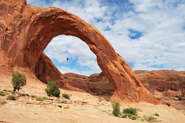
Hole-in-the-Rock Road runs south from Highway 12 near Escalante across open desert to a notch in the cliffs above Lake Powell. The National Park Service calls it a 62-mile one-way drive. Along the way you pass Devils Garden, the turnoff for the Dry Fork slot canyons, Dance Hall Rock and the old camps of the 1879 to 1880 pioneer company the road is named for. The last miles are four-wheel-drive country.
Check before you go. When we looked on Thursday, Nov. 12, 2026, the newest Hole in the Rock entry on the BLM's Grand Staircase-Escalante travel page was dated Oct. 27 and read, in part: "Road becomes impassable after Dance Hall Rock! Recommend HC-4WD for last 7 miles." That may have changed since. Call or stop at the Escalante Interagency Visitor Center, and note that its hours change on Nov. 13 (details below).
This page covers the drive and the road. For the hikes off it, see our Escalante slot canyons guide. For the full history of the expedition, see The Hole-in-the-Rock Expedition: Utah's Hardest Pioneer Road.
| Quick fact | Detail | Source |
|---|---|---|
| Length | 62 miles one way from Escalante; the Hole is at mile 55.3 from Highway 12 | NPS |
| Start | Highway 12 junction about 5 miles east of Escalante | BLM |
| Surface | Unpaved; high-clearance 2WD in dry weather for most of it | NPS, BLM |
| Four-wheel drive | Recommended for the last 7 miles | NPS, BLM road report |
| Status Nov. 12 | Oct. 27 report: impassable after Dance Hall Rock | BLM travel page |
| Services | None; Escalante is the last stop for supplies | NPS |
| Day-use fees | None listed at Devils Garden or Dry Fork | BLM |
| Overnight permit | Free at the Escalante Interagency Visitor Center | NPS |
| Conditions phone | 435-826-5499 (NPS) or 435-341-0530 (BLM) | NPS, BLM |
Getting there from Provo
An OpenStreetMap routing estimate (OSRM, no traffic) from downtown Provo to the Escalante Interagency Visitor Center at 755 W. Main St. comes to about 235 miles and five hours. The route runs south on I-15, east on US-50, onto SR-260 and SR-24 through the Torrey area, then down Highway 12 over Boulder Mountain into Escalante.
The other option is through Panguitch and past Bryce Canyon on Highway 12 from the west. The same router puts that at about 268 miles and a little over five hours. It pairs well with our Bryce Canyon guide, and a common plan is to go one way and return the other.
From the visitor center, the BLM says the Hole-in-the-Rock Road begins about five miles east of town at the Scenic Byway 12 intersection. The BLM's Hole in the Rock Highway 12 wayside, a paved pullout 6 miles east of Escalante with an interpretive sign and a view of the Straight Cliffs, is a good place to stop before you turn off. The BLM says the Straight Cliffs extend about 50 miles toward the Colorado River, which gives you an idea of the country the road follows.
At five hours each way before you even reach the dirt, this is not a day trip from Utah Valley. Plan at least one night in Escalante or nearby, and more if you intend to reach the end of the road.
The road itself
Length. The Park Service describes a 62-mile one-way road from Escalante to the Hole-in-the-Rock. Its mile-by-mile guide starts at 0.0 at the Highway 12 junction and puts the Hole at mile 55.3. The guide says its mileages do not allow for side trips and your odometer may read slightly differently. Most of the road is in Grand Staircase-Escalante National Monument, and the Park Service says it enters Glen Canyon National Recreation Area at mile 45.7.
Surface. It is a rough, unpaved road. The Park Service says most of it is passable to high-clearance, two-wheel-drive vehicles in dry weather. An earlier BLM road report this fall, with entries dated Oct. 2, 2026, described the road as "very washboarded" with some deep crossings from recent flooding. Washboard is the rippled surface that shakes a car hard at speed, and it is the normal state of this road, not a sign that something is wrong.
The last miles. The Park Service says the last few miles in Glen Canyon are best done on foot, by bicycle or in a four-wheel-drive vehicle, and its accessibility section recommends four-wheel drive for the last seven miles. The mileage table goes further and says the road becomes four-wheel-drive only from the Glen Canyon boundary at mile 45.7. The BLM's road report also recommends high-clearance four-wheel drive for the last 7 miles. Read those together as: past the recreation area boundary, do not count on a two-wheel-drive car.
When wet. The Park Service warns that sudden heavy rain, especially in summer, can make the road impassable, and that in a storm you may not be able to reach the paved highway even with four-wheel drive. The BLM adds that driving wet or flooded dirt roads, especially those with high clay content, ruts them, and the ruts harden and make the road hard for everyone after you. If the road is wet, wait.
No help nearby. The Park Service says no agency routinely patrols the road, cell service is limited, and you should be prepared to get yourself out of difficulty. Escalante is the last stop for supplies and repairs. There are no restrooms or shade structures along the road, per the Park Service, though the BLM lists toilets at Devils Garden. For emergencies, call 911 if you can get a signal.
Daylight. The Park Service says the road is best traveled in daylight and ends at a long drop into Lake Powell.
Side roads. The Park Service says many side roads are recommended only for four-wheel drive. Off-road travel, including by mountain bike, is prohibited in the Glen Canyon section, according to the Park Service's Hole-in-the-Rock page. The BLM's Dry Fork page asks visitors to stay on the indicated road.
Stops along the way
These mileages come from the National Park Service's mile-by-mile guide unless noted, measured from the Highway 12 junction.
| Mile | Stop | What the agencies say |
|---|---|---|
| 0.0 | Highway 12 junction | Escalante is the last stop for supplies and repairs |
| 4.2 | Ten Mile Spring | The expedition's first major camp |
| 12.0 | Devils Garden | Rock formations about half a mile off the road; BLM Outstanding Natural Area |
| 14.0 | Twenty Mile Spring | Now Collett Wash, where pioneers dug in sand for water |
| 26 | Dry Fork turnoff (BLM) | 1.7 miles to the trailhead for Dry Fork narrows, Peekaboo and Spooky |
| 36.4 | Dance Hall Rock | Sandstone amphitheater where pioneers held dances |
| 37.1 | Forty Mile Spring | Expedition base camp and rendezvous point |
| 39.1 | Carcass Wash | Major obstacle; site of a 1963 accident that killed 13 Boy Scouts |
| 45.7 | Glen Canyon boundary | Four-wheel drive only from here, per the NPS table |
| 48.7 | Fifty Mile Spring | Mission camp; first child born on the journey was born here |
| 50.1 | Hole-in-the-Rock Arch | Commemorative plaque and faint wagon tracks nearby |
| 55.3 | Hole-in-the-Rock | The notch the company cut to reach the Colorado River |
Devils Garden
Devils Garden is the easiest stop on the road and the one most people should make. The Park Service puts it at mile 12, with rock formations about half a mile off the road, and calls it a BLM Outstanding Natural Area. The BLM's Devils Garden page agrees on the distance: a "Devil's Garden" sign 12 miles down the unpaved road, then a dirt road to the right. The BLM's Dry Fork page, describing the toilets there, gives 13 miles south of Highway 12. Watch for the sign rather than your odometer.
The BLM describes sandstone formations including hoodoos and natural arches, and lists hiking, sightseeing and photography. It lists no fee. This is the BLM's Devils Garden in Grand Staircase-Escalante, not the trail of the same name in Arches National Park.
Because it is only about a dozen miles in, Devils Garden is a reasonable turnaround for a car that is not built for the rest of the road, as long as the road is dry.
Dry Fork and the Dry Fork narrows
The BLM says to continue 26 miles down the Hole-in-the-Rock Road to the Dry Fork turnoff, then 1.7 miles to the trailhead. Low-clearance vehicles should park in the first parking area and walk the remaining mile, according to the BLM. The trailhead is day use only, with no fee.
The BLM describes three canyons here:
- Dry Fork Narrows, which the BLM calls an easy section of narrows, on your left when you first reach the Dry Fork drainage. This is the gentlest of the three.
- Peek-A-Boo Gulch, 100 yards downstream of the Dry Fork Narrows, with a 12-foot climb to get in.
- Spooky Gulch, about half a mile downstream from Peek-A-Boo, only 10 inches wide in places, with two climbs.
The BLM says to expect to climb obstacles, wade water and cross sticky mud, and to be ready to turn back. It also says human waste is a problem at Dry Fork and asks visitors to use the toilets at Devils Garden, 13 miles back up the road.
Our Escalante slot canyons guide covers the Peekaboo and Spooky loop, Zebra Slot and the Coyote Gulch trailheads farther down this road in more detail, so we will not repeat it here.
Dance Hall Rock and Forty Mile Spring
Dance Hall Rock, at mile 36.4, is a sandstone amphitheater where the Park Service says the pioneers held dances. Forty Mile Spring, less than a mile beyond at 37.1, was the company's base camp and rendezvous point. Our expedition history notes that the company gathered at Forty-Mile Spring in November 1879, per the Park Service.
This is also the point where the BLM's Oct. 27 report said the road "becomes impassable." If that report still stands when you go, Dance Hall Rock is your end of the road. Ask at the visitor center.
Carcass Wash to Hole-in-the-Rock Arch
The Park Service calls Carcass Wash, at mile 39.1, a major obstacle, and notes that it was the site of a 1963 accident that killed 13 Boy Scouts. Past the Glen Canyon boundary at mile 45.7, the Park Service lists Fifty Mile Spring at 48.7, where it says the first child born on the journey was born, and Hole-in-the-Rock Arch at 50.1, with a commemorative plaque and faint wagon tracks nearby.
The end: Hole-in-the-Rock and Lake Powell
The road ends at mile 55.3 at the Hole-in-the-Rock, the notch the 1879 company cut to reach the Colorado River. The Park Service says the builders used blasting powder and picks, and that a shelf on the cliff face known as "Uncle Ben's Dugway" was built.
From the end of the road, the Park Service says the passage down is 0.5 mile each way. Plan at least an hour for the round trip, bring water and wear sturdy hiking shoes; the Park Service says the trail is very rocky. It also says about one-third of the original trail is now under Lake Powell, and most of it is listed on the National Register of Historic Places.
Remember that whatever you walk down, you have to climb back up, and then you are still about 55 miles of dirt road from pavement.
You can also reach the site by water. The Park Service puts it at buoy 66, about 66 miles uplake from Glen Canyon Dam, or about 30 miles downlake from Bullfrog and Halls Crossing, with boaters tying up on the rocky shoreline. Our Lake Powell guide covers the lake side.
Permits and fees
Day drive. The Park Service says no reservations are needed and there is no fee beyond the park entrance fee. Its trip listing for the road says "Activity Fee: No (Entrance fees may apply)." The BLM lists no fee at Devils Garden, at the Dry Fork trailhead or at the Highway 12 wayside. If you are unsure whether an entrance fee applies to your plans in the Glen Canyon section, ask the visitor center.
Overnight. The Park Service's camping page says backcountry permits are required for all overnight stays in the Escalante District of Glen Canyon National Recreation Area, available at the Escalante Interagency Visitor Center or at an entry trailhead. Day use needs no permit, but you should sign the trail register. The Park Service's driving guide says the overnight permit is free. On the monument side, the BLM's safety page recommends a free permit from a local visitor center, which it calls crucial if search and rescue becomes necessary.
Camping rules in Glen Canyon. The Park Service's camping page, updated Sept. 16, 2026, says dispersed camping is not allowed near developed areas such as trailheads, that groups should not exceed 12 people and 3 vehicles when camping away from the lakeshore outside campgrounds, and that human solid waste must be contained and carried out, at least 300 feet from water sources.
Pets. The Park Service allows pets in most of the recreation area on a leash no longer than six feet, with owners cleaning up after them. Pets are not allowed at archaeological sites, in Cathedral Wash between the road and the Colorado River, or in Coyote Gulch within the recreation area, with an exemption for guide and hearing dogs in Coyote Gulch.
Where to check conditions
Escalante Interagency Visitor Center, 755 W. Main St., Escalante. The BLM says it is staffed by the BLM, National Park Service and Forest Service and can give current road conditions and trail information. The Park Service lists 435-826-5499 for road and travel conditions; the BLM lists 435-341-0530.
Hours change this week. The BLM's page lists current hours as Tuesday through Saturday, 9 a.m. to 4 p.m., closed Sunday and Monday. Starting Nov. 13, 2026, it lists Monday through Friday, 9 a.m. to 4 p.m., closed weekends. That means a Saturday-morning permit stop will not work this winter. Pick up any overnight permit on a weekday, or ask about trailhead permits.
BLM road report. The BLM's Grand Staircase-Escalante travel information page posts a road-by-road table and says it is "typically updated weekly, more frequently if road conditions warrant." Look for the date on the Hole in the Rock line. An entry two weeks old is history, not a forecast.
Weather. The National Weather Service office in Salt Lake City has a flash flood information page with point forecasts for the Escalante Interagency Visitor Center, Peek-A-Boo and Spooky Gulch and Coyote Gulch, plus a Southern Utah flash flood potential rating. The Park Service's own advice is short: check the weather report before heading out on this road.
November on Hole-in-the-Rock Road
The Park Service lists the road as open in every season and says fall is usually the most comfortable time. Its temperature range for the area runs from over 100 degrees in summer to near 0 in winter. In November you are on the cool side of that range, and nights can be cold.
A few things matter more this month:
- The visitor center schedule. Weekday-only hours start Nov. 13. Plan around them.
- Short days. The Park Service says to travel the road in daylight. November evenings come early, and you do not want to be bouncing over washboard or picking through the last four-wheel-drive miles after dark.
- Recent storm damage. This fall's BLM reports mention deep crossings from flooding and, as of Oct. 27, an impassable section after Dance Hall Rock.
- Boulder Mountain. The northern route from Provo crosses Boulder Mountain on Highway 12. Check UDOT before you leave, and see our winter driving guide if your tires are marginal.
- Cold-weather risk. The BLM warns that hypothermia can strike above freezing and is worse with wetness, wind, exhaustion and lack of food. Wading the Dry Fork slots in November means cold, wet feet.
Flash floods
The Park Service says flash floods can occur quickly and warns against entering washes or narrow canyons when rain is falling or threatened. The BLM's safety page adds that rain upstream can cause flooding where it is not raining, that dry washes show where past floods have run, and that you should never camp in a wash bottom. If flooding starts, it says, get to high ground and wait for the water to drop.
On the road itself, the BLM says plainly: "Do not attempt to cross flood waters on foot or in a vehicle." Several of the crossings on this road are washes. If water is running across the road, stop and wait.
What to bring
Based on what the Park Service and BLM tell visitors:
- Water. At least one gallon, about 4 liters, per person per day (NPS). The BLM says to drink only from developed systems and to treat or boil anything else.
- Food, extra clothing and blankets for an unplanned night, per the BLM.
- A full tank and a good spare. Escalante is the last stop for supplies and repairs (NPS). There is no fuel on the road.
- A written itinerary left with someone at home, since cell service is limited (NPS) or sparse to unavailable (BLM).
- A paper map or downloaded map, for the same reason.
- Sturdy shoes for the rocky half-mile at the end (NPS).
- Waste bags if you plan to camp in Glen Canyon, where solid waste must be carried out (NPS).
- A trash bag. The Park Service asks you to pack out all trash and food scraps and not to feed wildlife.
Who should skip it, or stop short
- Low-clearance cars. Devils Garden in dry weather is a reasonable goal. The BLM tells low-clearance drivers to park at the first lot on the Dry Fork spur, and the last seven miles call for four-wheel drive.
- Rental cars. Read your rental agreement's rules on unpaved roads before you go.
- Anyone in a hurry. At 55 miles of rough dirt each way, the full road is a long day by itself on top of the five-hour drive from Provo.
- Rainy forecasts. The Park Service says rain can strand you even with four-wheel drive.
- People who cannot handle an exposed, rocky descent and climb back. The road's end is a cliff edge. Enjoy the view from the top and skip the walk down.
- Families with small children, for the full road. Devils Garden and the Dry Fork narrows are better fits than the last miles to the lake.
The pioneer story, briefly
The road takes its name from the route a Latter-day Saint company took in 1879 and 1880 on its way to settle on the San Juan River. The Park Service says the company gathered at Forty-Mile Spring in November 1879 with 250 people, 83 wagons and more than 1,000 head of livestock. Lamont Crabtree's entry in the Utah History Encyclopedia, published by Utah's state history division, gives 250 people, 80 wagons and 1,000 cattle. Other sources give other counts, a point our history page goes into.
Their "short-cut" ran into the gorge of the Colorado. Crabtree writes that workers spent six weeks cutting a wagon road down the Hole-in-the-Rock crevice, anchoring it to the north wall with oak stakes set at two-foot intervals. The Park Service says the descent to the river is nearly 2,000 feet, averaging 25 degrees and reaching 45 degrees in places, and that the company went down on Jan. 26, 1880, and crossed by ferry. Crabtree describes the gorge as about 1,200 feet deep, one of several figures that do not agree.
The trip was planned for six weeks and took six months, per the Park Service. No one died and two babies were born, according to both the Park Service and Crabtree. The company founded Bluff City on April 6, 1880, Crabtree writes. The road served as a vital link for about a year before Hall's Crossing bypassed its roughest stretches, per Crabtree.
The Hole in the Rock Foundation runs the Bluff Fort historic site in Bluff, which it says was established in 1880 by the Hole-in-the-Rock pioneers. Admission is free. Its listed winter hours, Nov. 1 to Feb. 28, are 10 a.m. to 5 p.m., with closures on Nov. 25 and 26, Dec. 24 through 26 and Jan. 1. The BLM's Hole-in-the-Rock Trail page covers the far end of the route, from the Colorado to Bluff, through its Monticello Field Office.
For the full account, including the descent, the personal stories and where the sources disagree, read The Hole-in-the-Rock Expedition: Utah's Hardest Pioneer Road.
Sources used
This guide draws on the National Park Service's "Driving the Hole in the Rock Road" (last updated Aug. 17, 2023), its Glen Canyon Hole-in-the-Rock history page (July 28, 2023), its Glen Canyon camping page (Sept. 16, 2026) and its Escalante trip-ideas page; the BLM's pages for Devils Garden, Dry Fork Road, the Escalante Interagency Visitor Center, the Highway 12 wayside, the Hole-in-the-Rock Trail, and Grand Staircase-Escalante travel information and safety; the National Weather Service Salt Lake City flash flood page; Lamont Crabtree's Utah History Encyclopedia entry on Utah History To Go; and the Hole in the Rock Foundation's Bluff Fort page. All were read Nov. 12, 2026. Drive times are OSRM routing estimates without traffic.
Related Guides
- Bryce Canyon from Provo
- The Hole-in-the-Rock Expedition: Utah's Hardest Pioneer Road
- Escalante slot canyons from Provo
- Lake Powell from Provo
- Capitol Reef from Provo
- Day trips from Provo
Frequently Asked Questions
How long is Hole-in-the-Rock Road?
Can a regular car drive Hole-in-the-Rock Road?
What are the road conditions right now?
How far down the road is Devils Garden?
Do I need a permit or pay a fee?
Is there gas, water or cell service on the road?
How long does it take to drive from Provo to the start of the road?
What is the Hole-in-the-Rock itself?
Sources
The facts in this guide were checked against these sources. Hours, fees and rules change, so confirm anything time-sensitive with the source before you go. How we make Provo.com.
- Driving the Hole in the Rock Road, National Park Service. Checked November 12, 2026.
- Hole-in-the-Rock (Glen Canyon NRA history), National Park Service. Checked November 12, 2026.
- Camping - Glen Canyon National Recreation Area, National Park Service. Checked November 12, 2026.
- Escalante Access to Glen Canyon Wilderness, National Park Service. Checked November 12, 2026.
- Devil's Garden, Bureau of Land Management. Checked November 12, 2026.
- Dry Fork Road (Peek-A-Boo and Spooky Gulch), Bureau of Land Management. Checked November 12, 2026.
- Escalante Interagency Visitor Center, Bureau of Land Management. Checked November 12, 2026.
- Current Travel Information at GSENM, Bureau of Land Management. Checked November 12, 2026.
- Safety and Conditions at Grand Staircase-Escalante National Monument, Bureau of Land Management. Checked November 12, 2026.
- Hole in the Rock HWY12 Wayside, Bureau of Land Management. Checked November 12, 2026.
- Hole in the Rock Trail, Bureau of Land Management. Checked November 12, 2026.
- Flash Flood Information, National Weather Service Salt Lake City. Checked November 12, 2026.
- The Hole-in-the-Rock Trail (Utah History Encyclopedia, Lamont Crabtree), Utah Division of State History, Utah History To Go. Checked November 12, 2026.
- Bluff Fort / Hole In The Rock Foundation, Hole In The Rock Foundation. Checked November 12, 2026.