Most drives out of Utah Valley start the same way: you check the weather on your phone, glance at the sky over Timpanogos and go. That works until it doesn't. A canyon gate that closed last week, a traction restriction posted the night before a storm, or a national park road shut by snow can turn a planned day into a long detour or a U-turn at the top of a canyon.
This guide lists where to look before you leave Provo or Orem, which source covers which roads, and what each one cannot tell you. The short version: start with UDOT Traffic for state highways and interstates, use the seasonal roads list for the high-country routes that close every winter, check with the Forest Service for its own gated roads, and check each national park's conditions page for roads inside the park. Every hour, phone number and closure in this guide comes from an agency page or news report we read on Nov. 13, 2026; conditions change daily, so treat the status snapshots below as a record of that day, not a forecast.
| Source | What it covers | How to reach it |
|---|---|---|
| UDOT Traffic website | State highways and interstates: incidents, construction, cameras, road weather, plows | udottraffic.utah.gov |
| UDOT Traffic app | Same data, with alerts and Drive Mode | Free on iOS and Android |
| UDOT 511 line | Statewide travel information by phone | Dial 511; 866-511-8824 (per Zion NPS) |
| UDOT Seasonal Roads page | Nine state roads that close in winter | udottraffic.utah.gov/seasonalroads |
| UDOT Road Restrictions page | Active traction and other restrictions | udottraffic.utah.gov/roadrestrictions |
| UDOT Cottonwoods | SR-190 and SR-210 status | cottonwoodcanyons.udot.utah.gov, @UDOTCottonwoods on X |
| Forest Service | Nebo Loop and forest gate roads | Uinta-Wasatch-Cache National Forest, 801-999-2103 |
| National Weather Service | Watches, warnings, travel and snow forecasts | weather.gov/slc, 801-524-5133 |
| Park conditions pages | Roads inside each national park | nps.gov park sites and park phone lines |
Who this is for
The people who need this most are the ones who drive the same canyons often enough to stop checking: BYU and UVU students heading home for the holidays over Spanish Fork Canyon or down I-15, families planning a Saturday drive up American Fork Canyon, skiers going to Sundance, Park City or the Cottonwoods, and anyone driving to the national parks between November and May. It is also for visitors who know Utah from summer photos and do not expect that some of the most famous scenic roads near Provo simply close for half the year.
If your trip is entirely on I-15 in town in clear weather, you probably do not need more than a map app. Once a route climbs into a canyon, crosses a mountain pass or ends at a park, the official sources below carry information a general navigation app may not.
UDOT Traffic: the main source
UDOT Traffic is the Utah Department of Transportation's traveler information site. When we opened it on Nov. 13, the map offered layers named Traffic Speeds, Incidents, Construction, Future Construction, Cameras, Overhead Digital Signs, Mile Posts, Current Road Weather Conditions, Forecasted Road Weather Conditions, Snow Plows, Mountain Passes, Weather Stations, Rest Areas and Bike Lanes. The menu links to separate Seasonal Roads, Road Restrictions, Road Weather and Cameras pages, plus a text report of traffic events, road conditions, overhead signs and rest areas.
For a typical trip out of Provo, the useful sequence is:
- Turn on Incidents and Construction for your whole route. Crashes and lane closures on I-15 through Lehi or on US-6 matter more to your arrival time than weather most days.
- Turn on Current and Forecasted Road Weather if your route climbs. Provo Canyon on US-189 toward Heber, Spanish Fork Canyon and Soldier Summit on US-6, and I-15 south of Nephi all run well above the valley floor, so what falls as rain in Provo can be a different story up the road.
- Open the Cameras along the highest point of your drive. A camera image shows you whether the pavement is wet, white or dry in a way a text label cannot.
- Check Mountain Passes and Snow Plows during or after a storm, to see whether plows have been through.
The site also includes route planning, with start and destination fields, drive and transit modes and an "Avoid Tolls" option. If you create an account, you can save routes, build a "My Cameras" view and set up "My Routes & Notifications" for event alerts by text message, with options to limit them to weekdays and 6 a.m. to 6 p.m. A student who drives the same canyon commute every week, or a parent who drives to a ski area every Saturday, gets the most out of a saved route.
UDOT also links from the site to neighboring states' 511 systems, which helps if your trip continues into Idaho, Wyoming, Colorado, Arizona or Nevada.
What UDOT Traffic does not promise
UDOT's disclaimer is blunt. "Information is published automatically; accuracy or timeliness cannot be guaranteed," it says, and the site is monitored Monday through Friday, 7 a.m. to 6 p.m., excluding state holidays. It also says that a listing of snow or ice conditions is not a guarantee that UDOT has plowed or salted that road, and that "plowing and salting is done based on a priority system" set by local maintenance officials. "Weather and road conditions change swiftly," the disclaimer adds, and drivers who rely on the information do so at their own risk.
In practice, that means a weekend storm that arrives at 9 p.m. Saturday may show up on cameras and weather sensors before it shows up in a written condition report. Look at the cameras and the road weather layers, not only the event list.
The UDOT Traffic app
UDOT's Mobile Apps page calls the app free and lists Apple iOS and Android downloads. According to that page:
- Traffic colors show travel speeds by default.
- Drive Mode turns on automatically, conserving battery and data while still giving audio alerts.
- Audio alerts announce traffic events "based on your current location."
- Traffic Alerts send a daily notification if there are issues on your saved route.
- Saved cameras and routes synchronize from your account on the UDOT Traffic website.
The app is the easiest way to get the alert that matters most in winter: UDOT's traction requirements page lists the app among the ways it notifies drivers when the traction law is in effect. Set up your saved route on the website at home, then let the app warn you while you drive. Do not try to read cameras while you are moving; pull over at a gas station or have a passenger check.
Calling 511
UDOT's FAQ lists dialing 511 as one way to get traveler information. If 511 does not connect, for example from an out-of-state phone, Zion National Park's conditions page lists 866-511-8824 for UDOT road conditions, and Cedar Breaks National Monument's conditions page lists 801-965-4000 for UDOT. Phone lines are useful where data coverage drops out, which happens in parts of the canyons and on the long stretches of US-6 and I-70 between Utah Valley and Moab.
The traction law and the Road Restrictions page
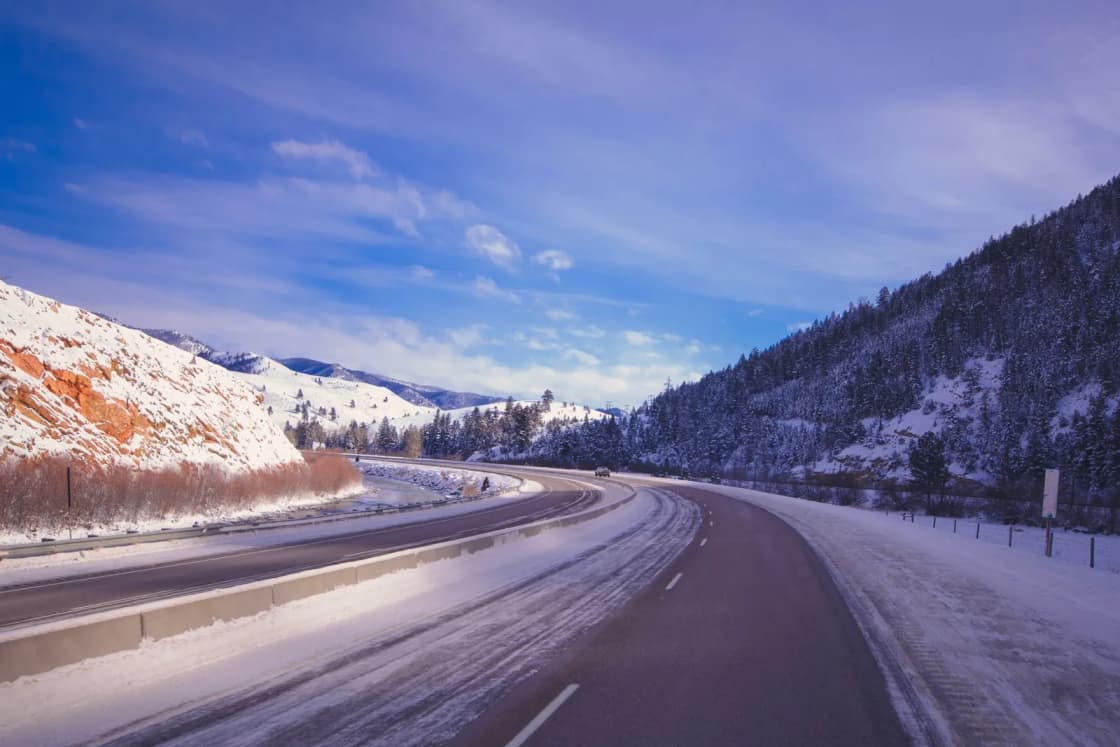
Utah's traction law is switched on by conditions, not by the calendar. UDOT's requirements page says UDOT or law enforcement decides when it applies and that drivers are alerted by road signs, message boards, the UDOT traffic app and UDOT social media. It also says: "Be prepared, you may be required to be in compliance up to 24 hours before a storm."
When the law is in effect, UDOT lists these minimums:
| Vehicle | Minimum when the law is active |
|---|---|
| AWD or 4WD | M/S, M+S or 3PMSF tires, or chains, cables, snow socks or studs on at least 2 drive tires |
| 2WD passenger car or light truck under 12,000 lb | 3PMSF tires, or traction devices on all drive tires |
| Over 12,000 lb | Traction devices on all drive tires |
The rule itself is Utah Administrative Code R920-6, and UDOT's page links to a Winter Chains Required Routes map so you can see whether your route is on it. Active restrictions are listed on the Road Restrictions page at udottraffic.utah.gov/roadrestrictions. That page loads its list dynamically, so open it in a browser rather than relying on a preview or a cached copy.
For students and families, the practical point is the 2WD line. A front-wheel-drive sedan on ordinary all-season tires meets the requirement only with traction devices on the drive tires. Our Utah winter driving guide explains the tire markings and the stricter Cottonwood Canyons rules in more detail.
Seasonal road closures: the nine state roads
UDOT keeps a list of state routes it closes each winter. Its seasonal roads page says they "typically" close "November through May or June, depending on the weather," and gives no fixed dates for any single road. When we checked the live status page on Nov. 13, 2026, it showed:
| Road | What it connects | Status Nov. 13, 2026 |
|---|---|---|
| SR-92 American Fork Canyon/Alpine Loop | American Fork Canyon to the Sundance side | Closed until spring 2027 |
| SR-190 Guardsman Pass | Brighton to Park City | Closed until spring 2027 |
| SR-224 Guardsman Pass | Park City to the Summit/Wasatch County line | Open until further notice |
| SR-150 Mirror Lake Highway | East of Kamas to near the Wyoming border | Open until further notice |
| SR-35 Wolf Creek Summit | East of Francis to west of Hanna | Open until further notice |
| SR-39 Monte Cristo | East of Ogden | Open until further notice |
| SR-65 East Canyon | Northeast of Salt Lake City | Open until further notice |
| SR-153 Mount Holly | West of US-89 in Junction to Puffer Lake | Closed indefinitely due to the Cottonwood Fire and flood damage |
| SR-148 Cedar Breaks | East of Cedar City | Open until further notice |
"Open until further notice" in mid-November means a road can close on short notice, often right before or after a storm. Check the page the day you drive, not the week before.
The Alpine Loop
SR-92 is the seasonal road closest to Provo and the one most Utah Valley drivers run into. KUTV reported that UDOT closed it at 7 a.m. on Monday, Nov. 2, 2026, and that Guardsman Pass between Brighton and Park City closed at 8 p.m. on Friday, Oct. 30. UDOT gave KUTV this reason for the Guardsman closure: "This steep, narrow road has no winter plowing operations."
Our news report on the Alpine Loop closure has UDOT's description of the closed section, from Pine Hollow in American Fork Canyon to Aspen Grove above Sundance, and notes that Sundance stays reachable through Provo Canyon and Tibble Fork Reservoir through American Fork Canyon, weather and road conditions permitting. For the summer drive itself, see our Alpine Loop scenic drive guide. Our Cascade Springs guide covers the side road off the loop.
When does it reopen? UDOT does not promise a date. In 2026, its news release said SR-92 and SR-150 reopened on May 22, the last of Utah's seasonal roads to open "ahead of Memorial Day weekend." That is a record of one year, not a schedule.
Mirror Lake Highway
SR-150 was still open when we checked on Nov. 13, but it is on UDOT's seasonal list and it closes for the winter once the snow comes. If you are planning a late-season drive to the Uintas from Provo, check the seasonal roads page on the morning of the trip. Our Mirror Lake Highway guide covers the route from Provo through Heber and Kamas.
Cedar Breaks
The National Park Service says SR-148, the main road through Cedar Breaks National Monument, "closes each year due to snowpack," typically from mid-November to mid-May, with the exact dates depending on snow. SR-143 across the northern end of the monument "remains open almost year-round," the park says, with brief closures in heavy snow or strong wind until it is plowed in daylight. In winter, the North View Overlook can be reached by car on SR-143, while Point Supreme, Sunset View and Chessman Ridge are reachable only by snowmobile, cross-country skis or snowshoes. When we checked on Nov. 13, the park listed both SR-148 and SR-143 as open. Our Cedar Breaks and Brian Head guide covers the summer trip.
Roads UDOT does not post: Forest Service gates
Several of the canyon roads Utah Valley residents use most are not state highways, so they do not appear on UDOT's seasonal list. UDOT's seasonal roads page says that for non-state routes such as the Nebo Loop and Pine Canyon between Midway and Park City, drivers should "inquire locally," and its May 2026 release names the USDA Forest Service as one of those maintenance departments.
On the Uinta-Wasatch-Cache National Forest, the Spanish Fork Ranger District manages the gates in Utah County. The Daily Herald reported on Nov. 18, 2025, that most of the district's gates were scheduled to close by Nov. 30 that year, "depending on snowfall," and that the lower gates on the south end of the Nebo Loop closed Dec. 15. By that date, the paper said, gates were already closed on roads including Diamond Fork Road at the Three Forks Trailhead, Hobble Creek Canyon's Right Fork at Balsam Campground, Kyhv Peak Road from Provo Canyon, Maple Lake Road, Santaquin Canyon Road at Trumbolt Picnic Area, the Nebo Loop at Devil's Kitchen and at the Upper Grotto Trailhead, and Timpooneke Road. The 2026 schedule may differ, so check with the Forest Service rather than assuming last year's dates.
The Forest Service's Nebo Loop page lists the current conditions for the area; on Nov. 13, 2026, it showed "Site Open" with the note "Monument & North Peak TH Closed," and it lists the forest Supervisor's Office at 801-999-2103. It does not publish closure dates for the byway itself. Our Nebo Loop guide and our canyon and commute conditions page track the Utah County gates.
Two rules from the Herald's report apply to every gate: do not park in front of a closed gate, because emergency vehicles need access, and if you hike, bike or ski past one, carry the gear to handle a delayed rescue, since responders may take longer to reach you.
Big and Little Cottonwood Canyons
UDOT runs a separate site for SR-190 in Big Cottonwood Canyon and SR-210 in Little Cottonwood Canyon. It shows a live status feed for both roads; if no posts appear, the site says, there are no active alerts or closures and the roads are open without planned closures or traction restrictions. UDOT points drivers to its @UDOTCottonwoods account on X, along with Instagram and Facebook stories, for updates, and notes that "SR-190 & SR-210 are dead-end roads in the winter." With Guardsman Pass closed, there is no back way out of Big Cottonwood to Park City.
These canyons have stricter traction rules than the rest of the state. Our Little Cottonwood traction law and closures guide covers the tread-depth requirement and how avalanche control closures work.
National park roads
UDOT Traffic covers the highways that get you to a park. Inside the gate, the National Park Service is in charge, and each park handles road information differently. Our ranking of Utah's national parks from Provo by drive and season is the place to choose a park; this is how to check its roads.
- Zion. The Park Service says it tries to keep the Zion-Mount Carmel Highway open year-round, but it is "sometimes closed due to snow, ice, rockfall, or traffic congestion," and large vehicles are barred between Canyon Junction and the East Entrance. Kolob Terrace Road "usually closes for several months due to snow" from fall to spring, and Kolob Canyons Road "closes frequently in winter." Closure alerts are posted at the top of the conditions page. The park lists 435-772-3256, with rangers answering from 10 a.m. to 5 p.m. Mountain Time. Our Zion in winter guide covers what stays open.
- Bryce Canyon. The park's conditions page sends visitors to the alerts at the top of the page for road conditions and closures and links to UDOT Traffic for roads outside the park. Its phone is 435-834-5322.
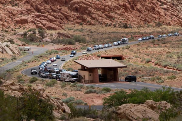
- Arches. The park says "unpaved roads may require 4WD or even be impassable following summer storms," that winters bring "occasional snowy or icy conditions," and that on busy days it may temporarily delay entries, in which case visitors "may try back in a few hours." It encourages a look at the park webcam before driving and lists 435-719-2299.
- Capitol Reef. The park publishes a road table for the Scenic Drive and its backcountry roads. On Nov. 13 it listed the Scenic Drive as 2WD, Cathedral Valley as high-clearance 2WD with the spur to the Temples high-clearance 4WD, the Notom-Bullfrog Road as high-clearance 4WD, and the Burr Trail as high-clearance 2WD. It says the website is updated weekly and that "the park road condition phone line has the most up to date information": 435-425-3791, then option 4.
For the drive to Moab, Arches and Canyonlands, US-6 through Spanish Fork Canyon and over Soldier Summit is the stretch to check most carefully in winter. Our Moab from Provo guide describes the route.
Weather: the National Weather Service in Salt Lake City
Road status tells you what is happening now. The National Weather Service tells you what is coming. The Salt Lake City office's site at weather.gov/slc offers watches, warnings and advisories (including an hour-by-hour view), a Graphical Hazardous Weather Outlook, a Travel forecast, a Forecast Discussion, a Probabilistic Snow Forecast and a page of avalanche and mountain weather. Its phone number is 801-524-5133.
Two products are worth adding to a winter routine. The Forecast Discussion is where forecasters explain timing and their confidence, which helps when you are deciding whether to leave Friday night or Saturday morning. The Probabilistic Snow Forecast shows a range of outcomes rather than a single number, which matters more for a canyon drive than the valley forecast does.
For backcountry travel on foot, skis or snowmobile past a closed gate, the avalanche forecast matters too. The NWS page links to the regional avalanche center; read it before going beyond the plowed road.
Timing: when to check, and how often
- The night before: look at NWS warnings and the Forecast Discussion, and check whether UDOT has posted a traction restriction, since it can require compliance up to 24 hours before a storm.
- The morning of: check UDOT Traffic incidents, cameras and road weather for every canyon or pass on your route, the seasonal roads page if you are going high, and the park's alerts if a park is the destination.
- Before the return trip: conditions can flip during the day. A dry canyon at 8 a.m. can be snow-packed by the 4 p.m. drive home if a storm arrives early.
- In shoulder seasons: late October through November and April through June are when seasonal roads change status. "Open until further notice" is the phrase to watch.
Getting out of Provo: the routes to watch
- North on I-15 through Lehi and Point of the Mountain toward Salt Lake: construction and crashes are the usual problem, more than snow. UDOT Traffic incidents, Construction and the Traffic Speeds layer are the tools, and the Future Construction layer shows planned work.
- Provo Canyon (US-189) toward Heber, Midway, Park City and Sundance: check cameras and road weather before ski trips.
- Spanish Fork Canyon and Soldier Summit (US-6) toward Price, Green River and Moab: check road weather, cameras and incidents. Have a backup plan if it closes, and a full tank before you leave Spanish Fork.
- I-15 south toward Nephi, Fillmore, Cedar City and St. George: long, open stretches where wind and snow on the passes matter. Check road weather for the full length, not just Utah County.
- American Fork Canyon (SR-92): open to Tibble Fork in winter, weather permitting, but not over the top to Sundance once the Alpine Loop gate closes. Our American Fork Canyon guide covers the lower canyon.
What to bring
None of the agency sources we read publishes an official kit list, so use judgment for your trip. For any winter canyon or mountain pass drive from Provo, a reasonable minimum is a phone charger, water and snacks, warm layers and a blanket for everyone in the car, a scraper and brush, a flashlight, and chains or other traction devices if your tires do not meet the traction law for your vehicle. Carry the phone numbers above written down or saved offline, because data service is unreliable in parts of the canyons and on long rural highways.
Who should skip the drive
- Two-wheel-drive cars without 3PMSF tires or traction devices when a storm is forecast or the traction law is active. UDOT's minimums are listed above.
- Anyone whose plan depends on a seasonal road in November or late spring. If the day only works with the Alpine Loop, Guardsman Pass or the Nebo Loop open, have a second plan.
- Drivers new to snow heading over US-6 or through the canyons during an active storm warning. Waiting a day is often the safer and faster choice once plows have worked.
- Large vehicles headed into Zion from the east, since the Park Service bars large vehicles between Canyon Junction and the East Entrance.
Safety notes
UDOT's own words are the best summary: listings of snow and ice "do not guarantee" a road has been plowed or salted, and conditions "change swiftly." Leave extra time, slow down on canyon curves where shade keeps ice through midday, and turn around if the road ahead does not match what you saw online. Do not drive around a closed gate or a road-closed sign. For roads beyond Forest Service gates, remember the Herald's point that rescues take longer there.
What to check before you go
- UDOT Traffic (udottraffic.utah.gov or the free app): incidents, construction, cameras, road weather and plows on your route.
- Road Restrictions (udottraffic.utah.gov/roadrestrictions): whether the traction law is active.
- Seasonal Roads (udottraffic.utah.gov/seasonalroads): status of the nine state seasonal roads.
- UDOT Cottonwoods (cottonwoodcanyons.udot.utah.gov or @UDOTCottonwoods): SR-190 and SR-210.
- Forest Service: Nebo Loop and other gated forest roads; Uinta-Wasatch-Cache Supervisor's Office, 801-999-2103.
- NWS Salt Lake City (weather.gov/slc): warnings, travel forecast, snow forecast.
- Park pages: the alerts at the top of each park's conditions page, and Capitol Reef's road line at 435-425-3791, option 4.
- By phone: 511, or 866-511-8824 from outside the 511 system.
Sources
- UDOT Traffic, home page, Seasonal Road Status, Mobile Apps, FAQ and Disclaimer pages, Utah Department of Transportation, read Nov. 13, 2026.
- "Seasonal Roads" and "Snow Tire, Chain and Traction Device Requirements," UDOT, read Nov. 13, 2026.
- "UDOT announces all seasonal roads now open," UDOT, May 22, 2026.
- UDOT Cottonwood Canyons road status site, read Nov. 13, 2026.
- "Seasonal roads begin closing for winter with dates set for Guardsman Pass, Alpine Loop," KUTV, Oct. 30, 2026.
- "Seasonal canyon roads begin closing in Utah County: What to know," Daily Herald, Nov. 18, 2025.
- Nebo Loop National Scenic Byway page, Uinta-Wasatch-Cache National Forest, USDA Forest Service, read Nov. 13, 2026.
- Current conditions pages for Cedar Breaks National Monument, Zion, Bryce Canyon, Arches and Capitol Reef national parks, National Park Service, read Nov. 13, 2026.
- National Weather Service Salt Lake City home page, read Nov. 13, 2026.
Related Guides
- Utah Winter Driving: The Traction Law, Chains and Canyon Rules
- The Utah National Parks from Provo, Ranked by Drive and by Season
- Alpine Loop Scenic Drive
- Mirror Lake Highway and the Uintas from Provo
- Nebo Loop Scenic Byway
- Moab from Provo: Planning the Drive, Arches and Canyonlands
- Zion in Winter: What Is Open
- Canyon and Commute Conditions
Frequently Asked Questions
What is the best place to check Utah road conditions?
Is there a UDOT Traffic app?
What number do I call for Utah road conditions?
Which Utah roads close every winter?
Is the Alpine Loop closed right now?
Does UDOT post the Nebo Loop closure?
How do I know if the Utah traction law is in effect?
Does UDOT Traffic cover roads inside national parks?
Sources
The facts in this guide were checked against these sources. Hours, fees and rules change, so confirm anything time-sensitive with the source before you go. How we make Provo.com.
- Utah Department of Transportation: UDOT Traffic, Utah Department of Transportation. Checked November 13, 2026.
- UDOT Seasonal Road Status, Utah Department of Transportation. Checked November 13, 2026.
- Mobile Apps | UDOT Traffic, Utah Department of Transportation. Checked November 13, 2026.
- UDOT Traffic FAQ, Utah Department of Transportation. Checked November 13, 2026.
- UDOT Traffic Disclaimer, Utah Department of Transportation. Checked November 13, 2026.
- Road Restrictions | UDOT Traffic, Utah Department of Transportation. Checked November 13, 2026.
- Seasonal Roads, Utah Department of Transportation. Checked November 13, 2026.
- Snow Tire, Chain and Traction Device Requirements, Utah Department of Transportation. Checked November 13, 2026.
- UDOT announces all seasonal roads now open, Utah Department of Transportation. Checked November 13, 2026.
- UDOT Cottonwood Canyons, Utah Department of Transportation. Checked November 13, 2026.
- Nebo Loop National Scenic Byway, USDA Forest Service, Uinta-Wasatch-Cache National Forest. Checked November 13, 2026.
- Cedar Breaks National Monument: Current Conditions, National Park Service. Checked November 13, 2026.
- Zion National Park: Current Conditions, National Park Service. Checked November 13, 2026.
- Bryce Canyon National Park: Current Conditions, National Park Service. Checked November 13, 2026.
- Arches National Park: Current Conditions, National Park Service. Checked November 13, 2026.
- Capitol Reef National Park: Current Conditions, National Park Service. Checked November 13, 2026.
- National Weather Service Salt Lake City, National Weather Service. Checked November 13, 2026.
- Seasonal roads begin closing for winter with dates set for Guardsman Pass, Alpine Loop, KUTV. Checked November 13, 2026.
- Seasonal canyon roads begin closing in Utah County: What to know, Daily Herald. Checked November 13, 2026.