
Ice fishing is the only form of fishing where the first decision has nothing to do with fish. Before the rod, before the bait, before the question of which reservoir is producing, there is a more basic question that a surprising number of people answer by looking at the parking lot and deciding it seems fine. That question is whether the surface will hold.
Utah Valley makes this harder than it needs to be, because the water closest to Provo is the water least suited to the sport, and the water best suited to it is an hour away over a mountain pass. This guide is organized around that fact.
The four-inch rule, and what it does not mean
The Utah Division of Wildlife Resources gives anglers a single number to hold onto: do not go onto ice that is less than four inches thick. It is a good number and it is worth memorizing.
It is also routinely misread. Four inches is the minimum for a person walking, on new clear ice, in stable conditions. It is not a target, it is not a promise, and it is not the figure for anything with an engine. The DWR pairs it with a second instruction that matters more and gets quoted less: ice thickness is not the same across a body of water, so you have to keep checking as you move rather than testing once and treating the result as a property of the whole reservoir.
That second half is the part that saves people. A four-inch reading at the boat ramp is a statement about the boat ramp.
Why ice is uneven, in terms you can act on
Ice thins where water moves and where something conducts heat into it. In practice, on a Utah reservoir, that means a short list of places to avoid or approach carefully.
Inlets and outlets. Anywhere a stream enters or the dam draws water out, there is current, and current keeps ice thin or open. Deer Creek has the Provo River running through it; that is not an abstraction.
Springs. Some reservoirs have them, they are invisible from the surface, and locals usually know where they are. This is the single best argument for asking at a tackle shop rather than working it out alone.
Pressure ridges and cracks. Ice expands and contracts, and where sheets meet they buckle. Ridges can be thick on one side and hollow on the other.
Anything dark and protruding. Rocks, stumps, weed beds and dock pilings absorb sunlight and radiate heat into the surrounding ice.
Recently drilled holes and old shelter sites. Refrozen holes are weaker than the sheet around them, particularly after a warm afternoon.
The tool that answers all of this is a spud bar or an auger and the willingness to use it every twenty or thirty yards on unfamiliar ice. It feels excessive on the way out. It stops feeling excessive the first time the readings drop.
Strawberry Reservoir: the one that works
If you want the highest chance of a good winter trip from Provo, you drive to Strawberry.
It sits at about 7,600 feet in Wasatch County, reached over Daniels Canyon on US-40 past Heber. That elevation is the whole argument. Water at 7,600 feet caps earlier in the season, holds ice longer into spring, and rides out the midwinter warm spells that repeatedly undo lower reservoirs. It is also large — roughly seventeen thousand surface acres when full — which means a soft area near one arm does not end the day.
Strawberry is best known for cutthroat trout alongside stocked rainbows, and it runs a slot limit system built specifically to protect fish in the larger size classes. Slot rules have changed more than once, they are not intuitive, and they are enforced. Pull the current regulations for Strawberry itself rather than assuming the statewide trout rules apply, because at Strawberry they frequently do not.
Practical notes: the named access areas are how everyone gives directions here, US-40 over Daniels can close or slow badly in a storm, and the DWR publishes ice condition updates through the season. Read them before you leave the house, not after you arrive.
Deer Creek: closer, and much more variable
Deer Creek Reservoir is the nearest realistic option, roughly twenty-five minutes up Provo Canyon and then along US-189, at about 5,420 feet and covering up to about 3,000 acres behind a dam completed in 1941.
It freezes. It also spends a great deal of each winter in a state that ice reports describe with words like transition — open water in some areas and several inches in others, on the same reservoir, on the same day. That is not unusual for a mid-elevation reservoir with a river running through it and an active outlet; it is the normal condition, and it is why Deer Creek rewards local knowledge more than it rewards enthusiasm.
If you fish Deer Creek in winter, the rules of thumb tighten. Stay off the ice near the inlet and near the dam. Do not assume last week's photograph tells you about this week's ice. And treat a reservoir this close to valley elevation as something that responds to a warm week, because it does.
Our guide to Deer Creek and Jordanelle covers both reservoirs across the full year, including what stays open in winter on the facilities side.
Utah Lake: the question everyone asks first
Utah Lake is enormous, it is right there, and it is the wrong place to start.
The lake covers roughly 95,000 surface acres at an average depth of about nine or ten feet. Shallow water loses heat fast, so Utah Lake can cap over in a hard cold snap more quickly than a deep reservoir would. The same shallowness is the problem: there is very little thermal mass holding conditions steady, the lake is wide open to wind, and a sheet that formed over three cold nights can be broken into plates by one windy afternoon.
The result is ice that varies dramatically between winters and between parts of the lake in the same winter. Some years it supports fishing. Some years it never becomes trustworthy at all.
Experienced anglers who have watched this lake for decades do fish it. That is a different situation from a family driving down to try something new. If you want to understand the lake itself rather than just its ice, our Utah Lake guide covers the whole picture, including how much its surface elevation moves.
The roads decide the map
Winter access removes more water from consideration than ice conditions do.
The Alpine Loop and the Nebo Loop both close seasonally with the snow. Between them they carry the access to a substantial share of the county's high-elevation lakes — exactly the water that would otherwise freeze most reliably. American Fork Canyon remains open partway, which keeps Tibble Fork in the winter conversation, but the drive-up alpine fishing that defines a Utah Valley summer simply is not there in January.
What that leaves is a short list of reservoirs on plowed roads. It is worth accepting this early rather than planning a trip around a lake you cannot reach.
Canyon roads also change what your vehicle needs to be. A reservoir that is a pleasant twenty-five-minute drive in July is a different proposition in a storm, and our guide to winter tires and canyon driving covers what matters on these specific roads.
Licenses, and the thing people get wrong
You need a Utah fishing license. It is the same license that covers open water — there is no separate ice permit — and anyone twelve or older needs one.
The detail that catches people is that Utah licenses run 365 days from the date of purchase rather than expiring on 31 December. A license bought in February is good through the following February, which means a winter purchase is not the stub of a calendar year.
Utah also permits fishing with a second pole under an additional setup permit. On open water that is a convenience. On ice it changes how you fish, because working two holes at different depths is close to standard practice and it is how most people find the productive layer. Our full guide to fishing and hunting licenses in Utah covers the purchase mechanics and the sequencing traps.
Shelters, shanties and the overnight rule
Utah does not require a permit to use a portable ice shelter. What it does regulate is leaving one out.
Most waters prohibit leaving a shelter on the ice unattended overnight without specific authorization, and the exact conditions vary by water and by managing agency. That last point is worth pausing on, because a single reservoir can involve a state park, a national forest and a wildlife management area with overlapping jurisdictions and non-identical rules.
For nearly everyone, the answer is a portable pop-up or flip-over shelter that comes off the ice when you do. It sidesteps the overnight question, it is warmer than most people expect, and it is the difference between a two-hour trip and a full day with children who are still enjoying themselves.
One caution that belongs with shelters rather than with fish: if you run a propane heater inside an enclosed shelter, ventilation is not optional, and fire restrictions can apply at higher-elevation sites in ways that surprise people who associate them with summer.
Gear, assessed
The barrier to entry is lower than the sport's reputation suggests.
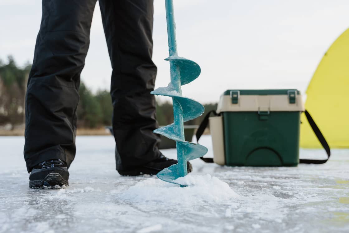
An auger is the one necessary purchase. Hand augers are fine for early-season ice and get miserable through a foot of it; battery-powered units and drill adapters have made the powered option far cheaper than it was.
Short rods, roughly two to three feet, with light line. Ice rods are cheap.
A skimmer to clear slush from the hole, which otherwise refreezes while you watch.
A five-gallon bucket, which is a seat, a tackle box and a fish container in one object, and a plastic sled to drag everything.
Layers, and traction. Wet-cold on a reservoir at 7,600 feet is a different animal from cold in the valley, and the surface you are standing on is by definition slippery.
Electronics — flashers and sonar — are the genuine advantage purchase, because they turn blind fishing into targeted fishing. They are also the thing to borrow before buying.
What the fish are doing under there
Ice changes fish behavior in ways that explain most of what separates a good winter angler from a frustrated one, and almost none of it is intuitive.
Cold water slows a trout's metabolism. It eats less, it moves less, and it will not chase a lure any distance. The aggressive presentation that works in June — cover water, trigger a reaction — is close to useless in February. Winter fishing is a game of putting something small directly in front of a fish and making it hold there.
A capped reservoir also goes quiet and dark in a way open water never does. Ice damps wave action, cuts light, and stops wind from mixing the upper layers. Fish that scattered across the reservoir in summer concentrate, often relating tightly to a specific depth band or a structural edge — a drop-off, a submerged creek channel, a weed line that has not yet died back.
That is why finding the right depth matters more than finding the right lure, and why two holes fished at different depths beats one hole fished perfectly. It is also why a flasher earns its price faster here than in any other kind of fishing: it tells you whether anything is down there before you have spent forty minutes proving it is not.
Late in the season, dissolved oxygen becomes a factor in shallow, productive water. Fish move toward inlets and any source of fresh oxygenated water — which is, inconveniently, exactly where the ice is thinnest.
How to read an ice report without over-trusting it
The DWR publishes condition updates through the season, and local tackle shops and angler forums fill in the gaps. Both are useful and both are routinely over-read.
An ice report is a dated observation from a specific part of a specific reservoir. When one says a reservoir has six inches, that came from wherever the person doing the reporting stood. When another says the same reservoir has open water in places and six inches in others, that is not a contradiction — it is the more complete version of the same fact.
Three habits make reports useful rather than misleading. Check the date, and treat anything more than a few days old as history rather than information, because a warm spell or a wind event rewrites conditions fast. Read the wording for hedges — phrases like use caution, in transition and not safe yet are doing real work and are not boilerplate. And weight negative reports far more heavily than positive ones, because a report saying the ice is bad is nearly always right, while a report saying it is good is right about one location on one day.
Then drill anyway.
Cold is the risk, not just the water
The dramatic hazard is going through the ice. The common one is being cold, wet and a long way from the car with hands that no longer work.
Wind on an open reservoir strips heat faster than the air temperature suggests, and a windbreak matters more than an extra layer. Carry dry gloves in a sealed bag; wet gloves are the most reliable way to end a day early. Eat and drink more than feels necessary, because being cold burns through both.
If someone does go in, the sequence is: do not follow them, get low and spread your weight, extend something — a rope, a spud bar, a sled — rather than a hand, and call for help early. A pair of ice picks worn around the neck costs very little and gives a person in the water something to grip on a surface that offers nothing.
When to go, and what the season looks like
Ice fishing near Provo is a January and February activity in most years, with the shoulders varying enormously by elevation and by winter.
Early season is when ice is thinnest and most anglers get hurt. Late season is when it looks thick and has been undermined by sun and melt from beneath — a foot of rotten spring ice is weaker than four inches of new black ice, and it does not announce the difference.
The productive hours are less brutal than open-water fishing suggests. Morning and late afternoon are strongest, but a frozen reservoir at midday is a reasonable place to be, which is part of why it works as a family outing in a way that a summer dawn start does not.
For a broader look at what the valley does between December and March, our roundup of winter activities in Provo covers the alternatives — and if the ice reports look bad, the Provo River tailwaters keep fishing all winter precisely because a dam-fed river does not freeze the way a lake does.
The short version
Go to Strawberry if you want the best odds and can spare the drive. Fish Deer Creek if you know the water or are going with someone who does. Leave Utah Lake until you have several seasons behind you. Check the DWR's ice reports before you commit, drill as you walk, and treat four inches as a floor rather than a plan.
The sport is accessible, unusually cheap to try, and one of the few things in this valley that gets better the colder it is.
Frequently Asked Questions
How thick does ice need to be before you walk on it in Utah?
Which water near Provo is the most reliable for ice fishing?
Does Utah Lake freeze enough to ice fish?
Do you need a fishing license to ice fish in Utah?
Can you leave an ice shanty out overnight?
Is it safe to drive a truck or ATV onto the ice?
What do you catch through the ice near Provo?
Can you get to the high mountain lakes in winter?
Sources
The facts in this guide were checked against these sources. Hours, fees and rules change, so confirm anything time-sensitive with the source before you go. How we make Provo.com.
- Utah Division of Outdoor Recreation: Ice Safety, Utah Division of Outdoor Recreation. Checked October 12, 2026.
- Strawberry Valley Project, U.S. Bureau of Reclamation. Checked October 12, 2026.
- Deer Creek State Park: Discover, Utah State Parks. Checked October 12, 2026.
- Provo River Project, U.S. Bureau of Reclamation. Checked October 12, 2026.
- How Does Utah Lake Measure Up?, Utah Lake Commission. Checked October 12, 2026.
- 2026 Annual Monitoring Report (Utah Lake), Utah State Legislature (interim committee materials). Checked October 12, 2026.
- Utah Fishing Guidebook, Utah Division of Wildlife Resources. Checked October 12, 2026.
- What to know when ice fishing this winter, Utah Division of Wildlife Resources. Checked October 12, 2026.