Most guides treat Deer Creek and Jordanelle as two separate day trips that happen to be near each other. They are not. They are two impoundments of the same river, twenty minutes apart, and once you see that, everything else about them makes sense.
The Provo River comes out of the Uinta Mountains, is caught first by Jordanelle Dam, runs about eight miles through Heber Valley as the Middle Provo, is caught again by Deer Creek Dam, and then drops through Provo Canyon past Bridal Veil Falls and into Utah Lake. Jordanelle is the upstream lake and the higher one. Deer Creek is the downstream lake, lower and warmer, and the one you reach first from Provo.
That upstream-downstream relationship explains the temperature difference, the size difference, why the river between them is one of the best trout fisheries in the American West, and why both lakes have rules that a purely recreational lake would not. Both of them, together, supply culinary drinking water to Wasatch, Utah and Salt Lake counties — you are swimming in the tap.
Which one should you go to?
Go to Deer Creek if you want to be on a boat, you are towing something, you have half a day rather than a whole one, you want the shortest drive from Provo, or you want a sandy beach to sit on.
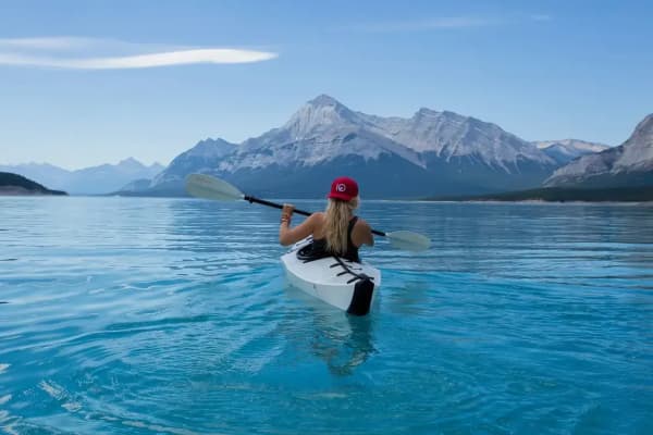
Go to Jordanelle if you want to paddle, you want to camp, you want quiet, you are bringing children who are learning on the water, you want to see wildlife, or you want a trail as well as a lake.
Go to the river between them if you came to fish.
Deer Creek Reservoir
The basics. Deer Creek State Park sits at about 5,420 feet, roughly a thousand feet above Provo and far enough up to take the edge off a valley heatwave while still being warm enough to swim. Two paved boat launch ramps, two marinas, and a sandy beach on the northeast shore.
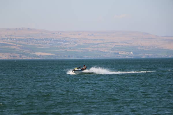
The daily wind cycle is the thing to plan around, and almost nobody writes it down. Deer Creek develops a reliable pattern: glassy in the morning, choppy in the afternoon. That single fact sorts the whole lake by time of day. Waterskiers and wakeboarders go early or go midweek. Wave-runners, windsurfers and kiteboarders show up when the wind does. If you drive up at two on a Saturday hoping for mirror water, you have picked the wrong half of the day — and if you drive up at seven in the morning hoping to windsurf, likewise.
Fishing. Roughly April through November for rainbow trout plus smallmouth and largemouth bass, fishable from shore and from a boat. Our guide to fishing near Provo covers regulations and species in more detail.
Swimming. The northeast beach is the usual spot. Two real cautions: the water is snowmelt-fed and stays genuinely cold long after the air is hot, and harmful algal blooms have affected parts of Deer Creek in some summers. The state posts advisories that can change within hours, so check the day you go rather than the week before.
Why it gets busy. Deer Creek is one of the closest true mountain reservoirs to a major Wasatch Front population center. On a July Saturday, the ramps back up. Midweek and mornings are a different lake entirely.
Jordanelle Reservoir
Jordanelle is bigger, higher, and split into three recreation areas that function almost as separate parks. Note that older write-ups — including some still-live listings — describe Jordanelle as having two recreation areas. Ross Creek is the newer addition; Utah State Parks' own site now lists three. Do not be thrown if a source you find names only Hailstone and Rock Cliff.
Hailstone — the developed side
The main entrance and the busy one. An eight-lane boat ramp, a separate personal-watercraft ramp, wet slips, a full-service marina store and pro shop, cabanas, modern restrooms and showers, RV and tent campgrounds, a reception center and group pavilions.
Hailstone also has a large wake-free zone, which is the single best reason to bring a beginner here rather than to Deer Creek. It is a genuinely good place to learn to stand-up paddleboard, and rentals are available on site. Hailstone's main and PWC ramps are plowed through the winter until ice forms, which makes it one of the more usable cold-season access points in the area.
Rock Cliff — the quiet side
On the eastern shore, tucked into tall cottonwoods where the Upper Provo River comes in. Rock Cliff is a wetland and a nature reserve as much as a boat access: elevated boardwalks and interpretive trails cross the marsh, there is a small single-lane ramp, and a nature center.
The wildlife is the point here. More than 200 forms of bird and mammal life have been recorded — golden eagles, red-tailed hawks, hummingbirds, mule deer, elk and moose along the river corridor. The Rock Cliff campground and nature center reopened in June 2025 after a period closed, so any guide written before then describing Rock Cliff as shut is out of date.
Anglers rate the water off the Rock Cliff ramp for its underwater structure.
Ross Creek — the trailhead
At the far north end, and the least developed of the three. Ross Creek is primarily access to the Jordanelle Perimeter Trail, a non-motorized route running between Crandall Point and Ross Creek, used by hikers and mountain bikers in summer and snowshoers in winter. Facilities are minimal — pit toilets, hitching posts, information kiosks.
Getting to Jordanelle
The two main entrances are on opposite sides of the reservoir and are not quick to drive between, so pick before you leave. Hailstone is signed off US-40 at the Mayflower exit. Rock Cliff is reached via SR-32 and then Rock Cliff Road. Jordanelle sits roughly ten miles from Park City, which means a Jordanelle day combines naturally with Park City, Heber Valley or the Mirror Lake corridor into the Uintas.
The river between them is the real headline
If you fish, the reservoirs are not the destination — the Middle Provo is. The eight-ish miles of river between Jordanelle Dam and Deer Creek Reservoir is a tailwater: water released from the bottom of a deep reservoir runs cold and at a steady temperature year-round, which is exactly what a trout fishery wants. It is blue-ribbon water and it draws fly fishers from across the country.
Below Deer Creek, the Lower Provo runs down through Provo Canyon toward the city, and is fished between Deer Creek Dam and the Olmsted Diversion.
This is the part of the system that makes the two-reservoir arrangement more than a coincidence of geography, and it is why our fishing guide treats the Provo River rather than either lake as the crown jewel.
There are two drowned towns under Jordanelle
This is the part of the story almost no recreation guide tells, and it is the reason one of the three recreation areas is called Hailstone.
Hailstone and Keetley were real places. Both sat in the valley the reservoir now fills. Hailstone stood near the junction of the highways and had a lumber operation and farms; Keetley was a mining town tied to the Ontario mine workings, named for Jack Keetley, the engineer of the Ontario Drain tunnel — and, before that, a Pony Express rider credited with carrying mail 340 miles in roughly 31 hours. Accounts of the towns' final years put the combined population at around 72 people. The Keetley railroad depot was physically moved to Park City in 1976 and repurposed rather than left to drown.
Keetley also has a piece of history that has nothing to do with water. During the Second World War, a rancher there leased land to a group of Japanese-Americans who farmed the valley as an alternative to being sent to an incarceration camp — a colony organized by Fred Wada. Park City–area historical accounts treat the Keetley farm as a genuine and unusual episode in Utah's wartime history. The fields are under the reservoir now.
In low-water years the old road to Keetley reappears at the shoreline, which is the closest thing the lake has to a ghost.
The reservoir was almost somewhere else entirely. The Central Utah Project's first preference was not to build a new dam at all but simply to raise the existing Deer Creek Dam, which would have partially submerged Charleston, a small Heber Valley town of roughly 200 people. The backlash from Wasatch and Summit county residents — one local newspaper editorial warned the plan "would spell doom for our county" — killed the proposal and pushed planners to study a new site north of Heber instead. That study, begun in the 1960s, eventually became Jordanelle.
Construction ran from 1987, and the dam was finished in the early 1990s. ⚠ Published completion dates differ: some sources say 1992, others 1993, and at least one gives a precise April 1993 date. Utah State Parks opened Jordanelle State Park in 1995, after the reservoir filled. The sources also disagree about exactly which settlements went under — most name Hailstone and Keetley, one adds Elkhorn, and another lists a third name that appears to be a garbling of Hailstone. Where they conflict, both versions are given here rather than one picked.
Objections at the time were not only sentimental. Conservationists argued for leaving the Provo River in its natural state, which is why a substantial constructed wetland sits at the foot of the dam today. Others raised geological concerns, pointing at the catastrophic 1976 failure of the Teton Dam in Idaho.
Deer Creek is the older sibling by half a century: the Deer Creek Dam and Reservoir were completed in 1941, covering roughly 2,700 acres at full capacity.
Size, and what the figures mean
| Deer Creek | Jordanelle | |
|---|---|---|
| Position on the Provo River | downstream | upstream |
| Surface elevation | about 5,420 ft | about 6,200 ft |
| Approximate surface area | ~2,700 acres at capacity | ~3,000–3,300 acres |
| Storage | — | 320,300 acre-feet |
| Dam completed | 1941 | early 1990s (see above) |
| State park opened | — | 1995 |
| Recreation areas | one park, two ramps, two marinas | three — Hailstone, Rock Cliff, Ross Creek |
| Character | open-water boating, reliable afternoon wind | larger, quieter, wake-free zone, wildlife |
The 800-foot elevation difference is not trivia. It is why Jordanelle runs colder, why its season starts later, and why Deer Creek is the more comfortable swim.
Jordanelle is also the busier of the two in absolute terms — one regional account put annual visitation just under 600,000 — but it is spread across three separated areas and a much larger surface, so it feels emptier than Deer Creek on the same Saturday.
Camping and rentals
Jordanelle is the camping lake. Hailstone has RV and tent campgrounds with showers and hookups; Rock Cliff has a smaller, quieter campground that reopened in June 2025. Both are reservable through the Utah State Parks reservation system, and summer weekends book out well in advance — this is not a lake to turn up at on a Friday evening hoping for a site.
Rentals are available at the Hailstone marina, which is the practical answer for anyone who wants to paddle or boat without owning anything. Several Park City–based operators also run paddleboard, sailing and rowing programs on Jordanelle. Our rentals guide compares what each lake's marina rents, from pontoons to paddleboards, and the courses renters need.
Deer Creek is more of a day-use lake for most Provo visitors, with two marinas serving boaters.
Because operators, seasons and rates change, confirm directly rather than trusting any published rate — including the ones you will find on aggregator sites, which in this area go stale quickly.
The rules that catch people out
Utah's boating requirements are stricter than most visitors expect, and — this is the part people miss — they apply to paddleboards and kayaks, not just motorboats.
- The mussel-aware boater education course is annual and mandatory. Complete it, and carry proof. Motorized vessels also pay an aquatic invasive species fee, which for 2026 the Division of Wildlife Resources put at $20 for residents and $25 for non-residents.
- Stop at every operating inspection station you pass — at ramps, leaving a waterbody, or at a highway checkpoint. If a station is closed you are not required to stop.
- Lake Powell is currently the only Utah water with confirmed quagga mussels. If your craft has been there, or out of state, within the previous 30 days, you need a professional decontamination or a full clean-drain-dry including the required dry time before launching anywhere else in Utah.
- Pull your drain plugs when transporting.
- Jordanelle State Park was scheduled to get a decontamination dip tank operational during 2026, joining a small number of such stations statewide.
- Life jackets: a PFD for every person aboard, and children 12 and under must wear one.
None of this is onerous — an inspection is usually a few minutes — but arriving without the course completed is the standard way to lose an hour of a Saturday.
Seasons
Summer is the obvious season and the busy one. Go on a weekday, or go early.
Autumn is under-rated at both lakes: warm afternoons, no crowds, and color on the surrounding slopes. Facilities begin closing down.
Winter is quieter but not closed. Ice fishing happens on both. Hailstone's ramps stay plowed until the ice comes in. The Perimeter Trail takes snowshoes. Assume campgrounds, stores and the nature center are shut unless you have confirmed otherwise.
Spring is the awkward one — high, cold, fast water from runoff, and variable facility opening dates. Call ahead.
Making a day of it from Provo
The drive up Provo Canyon is itself part of the trip. Between Provo and Deer Creek you pass Bridal Veil Falls and Vivian Park, and the Provo River Parkway shadows the road for much of the way.
A natural full-day loop: up Provo Canyon to Deer Creek, on to Heber, and back either the way you came or — in season, when the road is open — over the Alpine Loop past Cascade Springs and down through American Fork Canyon. That loop is only available roughly late May to late October; the Alpine Loop closes with the snow.
If you would rather stay closer to home, our day trips from Provo guide covers the shorter options in the same direction.
One last naming warning
"Deer Creek" means two different waters in this area. Deer Creek Reservoir is the lake described above, in Wasatch County on the Provo River. Provo Deer Creek is a small stream on the Cascade Springs side of the Alpine Loop, crossed by a footbridge on the Cascade Springs trail. Photographs of the two get filed interchangeably online. If an image search for "Deer Creek Utah" returns a mossy little creek in the woods rather than a large open reservoir, that is the other one.
Related Guides
- Kayaking & Paddleboarding in Provo (2026)
- Lincoln Beach: Utah Lake's Quiet South Shore, and What to Check Before You Drive
- Jolley's Ranch: Camping in Hobble Creek Canyon, Twenty Minutes from Provo
- Camping Near Provo: Best Campgrounds & Tips (2026)
- Things to Do in Provo, Utah: A Local's Guide (2026)
- Utah Lake: The Complete Guide (2026)
- Ice Fishing Near Provo: Which Water Freezes, and the Four-Inch Rule
- Where to See Moose, Elk and Deer Around Utah Valley
- Wasatch County Fair Days: the Heber derby, the PRCA rodeo and how to get tickets
Frequently Asked Questions
What is the difference between Deer Creek and Jordanelle?
How far is Deer Creek Reservoir from Provo?
Do I need to pay to get into Deer Creek or Jordanelle?
Can you swim at Deer Creek Reservoir?
What do I need before launching a boat, kayak or paddleboard in Utah?
Which reservoir is better for fishing?
Are Deer Creek and Jordanelle open in winter?
Is Deer Creek Reservoir the same as Provo Deer Creek?