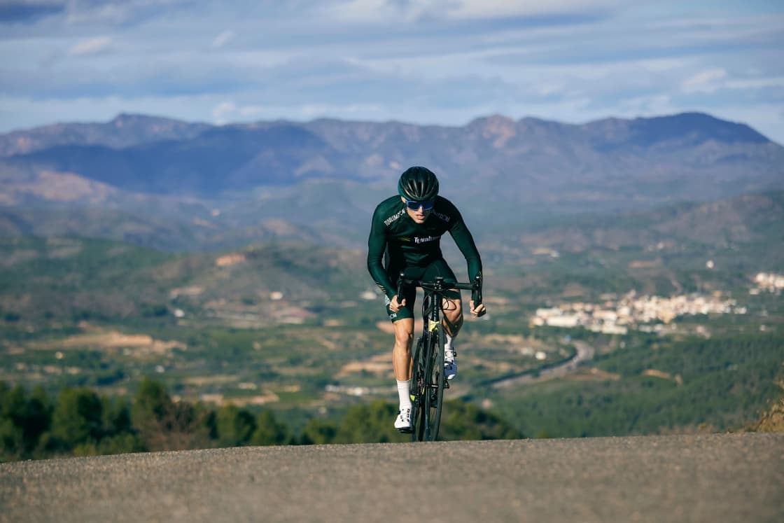

Road cyclists who move to Utah Valley tend to arrive with low expectations and revise them within a month. The valley floor is flat and fast, four serious canyon climbs start within a short ride of Provo and Orem, and the weather is dry for most of the year.
It is a good place to ride a road bike, and outside the local scene almost nobody says so.
This covers the climbs, the loops, the trail network, the group-ride culture, the law and the altitude problem. Road conditions, canyon access and fee rules change seasonally — verify current status before planning a ride around anything here.
What makes this valley work
Three things, stacked conveniently.
Vertical. The Wasatch rises directly off the valley floor, which means a climb of several thousand feet begins within twenty minutes of most Provo or Orem addresses. There is no long approach ride to get to the mountains.
Flat. The valley floor between the mountains and Utah Lake is flat, gridded and long, which gives you somewhere to do steady endurance and interval work without climbing.
Weather. Utah Valley is dry. From spring through autumn, most days are ridable, and the humidity that makes summer riding miserable elsewhere is largely absent.
The trade-offs are real — winter shuts a lot of it down, midsummer valley heat is serious, and the canyon roads are shared with recreational traffic — but the base is strong.
The Alpine Loop, the signature ride
The Alpine Loop connects American Fork Canyon over a high summit and down into Provo Canyon, and it is the ride people come here for.
It is a proper climb: sustained, steep in places, at altitude, with switchbacks and views of Timpanogos that justify the effort. Combined with a return along the canyon and valley, it makes a substantial day.
It is seasonal. Snow closes the upper road through winter and into spring, and the opening date moves every year. It is also within a Forest Service fee area, and access rules and fees are subject to change.
Verify the road is open and check current access requirements before planning around it. Riding to a closed gate is a well-established local rite of passage that is entirely avoidable.
Provo Canyon and the US-189 corridor
Provo Canyon runs from Orem up past Bridal Veil Falls toward Deer Creek and Heber, and it is the workhorse climb of the valley — steady, long, and accessible year-round at the lower end.
The important thing to know is that a separated paved trail runs alongside much of the canyon. That gives you the option of climbing without sharing a lane with canyon traffic, which changes the risk calculation considerably, particularly for newer riders.
The canyon has been subject to major road construction, and conditions change. Check current status before riding, especially if you intend to use the roadway rather than the trail.
Our Provo Canyon guide covers the corridor in general, including the stops and the seasons.
Squaw Peak Road
The climb up out of Provo Canyon on Squaw Peak Road is short, steep and mean, and it is the local benchmark effort.
It gains altitude quickly with sustained gradient and rewards you with one of the better views of the valley available from a bicycle. It is popular precisely because it packs a hard climb into a short window, which makes it the after-work option.
The road surface and seasonal access vary. It is not a winter ride.
The Nebo Loop
The Nebo Loop, running from Payson at the south end of the valley over the shoulder of Mount Nebo and down toward Nephi, is the biggest single ride in the county and one of the great scenic byways in the state.
It is long, high, and seriously committing — this is a full-day ride with limited services and substantial elevation. It is also spectacular, particularly in autumn.
It closes for winter, and the open window is shorter than most people assume. Our Nebo Loop guide covers the drive; the cycling version demands more planning, more water and a hard look at the weather forecast.
Suncrest and the north end
The climb over the Traverse Ridge at Suncrest, between Utah County and Salt Lake County, is a well-known and heavily ridden effort at the north end of the valley.
It is a road climb on a residential road with traffic, which is a different proposition to a canyon. It is popular because it is a reliable, measurable, year-round-ish climb close to the Lehi and Draper population.
For riders in the north county it is the default hard effort, in the way Squaw Peak is for Provo riders.
The valley loops
Not everything has to go uphill. The valley floor supports long, flat loops that are useful for building endurance.
Riding the western side toward Utah Lake and the lakeshore roads gives you open country, big skies and considerably less traffic than the eastern corridor. Wind is the variable here — the valley funnels it, and a flat ride can become a hard one.
The southern end of the county, around Salem, Payson and Santaquin, has quiet rural roads through farmland with the mountains on both sides. It is the most pleasant flat riding in the county and the least known.
The paved trail network
Utah Valley has a substantial network of separated paved trails, and for road cyclists it functions as traffic-free mileage.
The Provo River Parkway runs from the lake up into Provo Canyon. The Murdock Canal Trail runs seventeen mostly flat miles along the bench through the north county. The Jordan River Trail heads north toward Salt Lake County.
They connect imperfectly but they connect. Our guide to every paved trail in Utah Valley covers how the network fits together.
The caveat is that these are shared-use trails. Pedestrians, dogs, children and other cyclists all use them, and they are not the place for a fast group ride. Treat them as endurance and recovery infrastructure, and ride at a speed you can stop from.
The altitude problem, taken seriously
The valley floor sits around 4,500 feet. The climbs go substantially higher.
If you have moved here from sea level, your power will be down, your heart rate will be up, and you will feel worse than your training suggests you should. This is normal and it takes weeks to months to adapt, not days.
The dryness compounds it. Sweat evaporates immediately in Utah air, so you do not feel as wet as you are and you dehydrate faster than your thirst indicates. Carry more water than you would elsewhere and drink before you want to.
New arrivals routinely blow up on their first Alpine Loop attempt for exactly these reasons and conclude they have lost fitness. They have not. They have changed altitude.
Sun, and the thing that causes damage
At this elevation with this little cloud cover, sun exposure on a long ride is significant. Sunscreen, reapplied, is not optional in July, and the classic cyclist tan line here is a burn line by August.
Eye protection matters more than at sea level for the same reason.
And heat on the valley floor in midsummer is dangerous in the afternoon. The local solution is to start early — dawn starts are standard in July and August — and be off the flats before the worst of it.
The law, and the passing rule
Utah statute addresses how cyclists position themselves on the roadway, when riding two abreast is permitted, and what motorists must do when passing a cyclist, including a minimum passing distance.
Those rules have conditions attached and they have been amended over time. Rather than repeat a version that may be out of date, read the current statute directly, or ask a shop that runs group rides — they generally know it well because they have to.
What is universally true: lights and reflectors are required in low light, and a rear light in daylight is one of the cheapest safety improvements available.
The group-ride scene
There is a real one, and it is larger than a valley this size would predict, sustained by a big student population, a strong local racing tradition and the terrain.
Bike shops are the way in. Most either host a ride or can tell you who does. Shop rides tend to be the most welcoming and the most predictable in pace.
Ask about pace before showing up. Group rides here range from social to fast, and the difference between a no-drop ride and a race-pace ride is the difference between a good evening and a miserable one.
Ride etiquette is standard — point out hazards, hold your line, do not half-wheel, call out cars. If you have ridden in a group anywhere else, it transfers.
The university populations create a seasonal rhythm: the scene is busier during semesters and quieter in the summer, which is the reverse of what you might expect.
Bike shops and getting a bike serviced
The valley has a good supply of shops, spread across Provo, Orem and the north county, serving road, mountain and commuter riders.
Because mountain biking is the larger sport here, some shops are stronger on that side. If you ride road specifically, it is worth finding a shop that does, and the group-ride question is a good proxy — a shop that runs a road ride knows road bikes.
Our guide to mountain biking near Provo covers the other half of the local scene, and plenty of riders here do both.
Commuting, which is a different thing
If your interest is transport rather than sport, the answer is different and mostly better. Provo and Orem are flat, gridded and compact, with bike lanes and the trail network.
Our guide to bike commuting in Provo covers routes, winter riding and the multimodal option of combining a bike with transit, which works well here.
Gearing, and what to bring from sea level
The most common equipment mistake new arrivals make is bringing gearing suited to where they used to live.
The climbs here are long and steep enough that a cassette which was adequate at sea level will feel wrong at 7,000 feet. A wider range at the back is the cheapest and most effective change most riders make in their first season here, and nobody has ever regretted having an easier gear on the Alpine Loop.
Tires matter less than people think on the paved climbs, but canyon road surfaces vary and some of the descents are fast enough that you want confidence in them. Descending the Alpine Loop or Nebo is not the place to discover your brakes need attention.
Carry more than one bottle, or plan a refill. Services in the canyons are sparse to nonexistent, and on the Nebo Loop in particular there are long stretches with nothing at all.
Wildlife, cattle and the things on the road
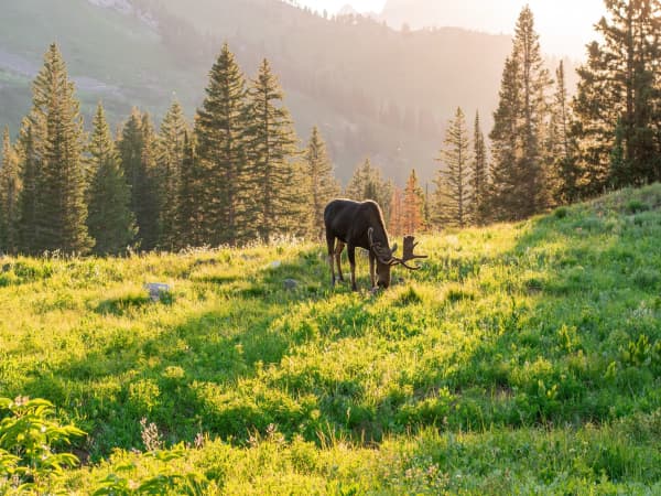
Canyon roads here have deer, and deer are most active at dawn and dusk, which is exactly when riders are out in summer.
Open-range and grazing areas exist in parts of the county, which means cattle on or beside the road in places. They are placid and slow and they will still put you down if you hit one.
Loose dogs are a factor on some rural valley roads at the south end. Nothing dramatic, but worth knowing.
Descending fast on a canyon road at dusk in deer season is the single highest-risk thing a road cyclist does in this valley, and it is entirely avoidable by timing.
Riding with traffic in the canyons
Canyon traffic is recreational traffic, which means drivers looking at scenery rather than at the road, towing trailers, and unfamiliar with the corners.
Volumes are heaviest on summer weekends and during autumn color season, when the Alpine Loop in particular becomes busy. Weekday mornings are quieter by an order of magnitude.
If you ride the canyons only once a week, make it a weekday morning. It is safer, quieter, cooler and the light is better. This is the single most useful piece of local knowledge in this guide.
Events and organized rides
Utah has a substantial calendar of organized road events through the summer, ranging from charity centuries to competitive stage racing, and several of them use Utah County terrain.
Organized rides are a good way to ride closed or marshalled roads on routes you might not tackle alone, and they come with support that a solo Nebo attempt does not have.
Dates move year to year and events come and go, so check current calendars rather than assuming an event you have heard of is still running. Our running races calendar covers the endurance-event rhythm of the valley generally, and the cycling season follows a similar shape.
Where each climb sits on the difficulty ladder
Useful if you are working up rather than diving in.
Provo Canyon on the trail is the gentlest introduction — steady, low gradient at the bottom end, and separated from traffic. Turn around whenever you like.
Suncrest is the next step up: a real climb on a real road, but short enough to be an evening ride and close enough to the north-county population to be convenient.
Squaw Peak is the local benchmark — short, steep and hard, with a definite summit and a view that makes it worth repeating.
The Alpine Loop is the day ride: long, high, seasonal, and the one people plan around.
The Nebo Loop is the expedition — the biggest, highest, most remote and most committing ride in the county, and not one to attempt as a first big day.
Working up that ladder over a season is a sensible plan and produces a rider who can handle the top of it by autumn.
Winter, honestly
Winter road riding in Utah Valley is limited. Ice on shaded roads, road salt, short days and inversion air quality all argue against it.
The local answers are the same as anywhere: indoor training, fat biking, or skiing instead. A lot of serious road riders here simply become skiers for three months, which is one of the genuine advantages of the location.
If you do ride outdoors in winter, the valley floor is more viable than the canyons, midday is the only sensible window, and salt will destroy a drivetrain that is not cleaned.
A first month here, if you are new
Start on the parkway trails to get used to riding at altitude without traffic.
Add valley loops on the west and south sides for distance.
Take a first canyon climb on a weekday morning, ride it slower than you think you should, and carry more water than you think you need.
Find a shop ride once you can hold a steady effort for an hour. That is where the routes, the conditions knowledge and the company come from, and it is the fastest way to stop riding alone.
Frequently Asked Questions
Is Utah Valley good for road cycling?
What is the best-known climb?
Do I need to worry about altitude?
Are there group rides?
Is it legal to ride two abreast in Utah?
When is the season?
Is there anywhere flat and traffic-free?
What about the canyon traffic?