
Ask someone in Provo or Orem for a fall drive and they'll tell you to do the Alpine Loop. It's a good answer. It's also the answer everyone else got, which is why the pullouts above Sundance look like a parking lot on the last Saturday in September.
Twenty-five minutes south, a longer, higher and emptier road climbs out of Payson and crosses the southern end of the Wasatch Range to Nephi. The Nebo Loop National Scenic Byway has better sustained views than the Alpine Loop, a red-rock formation that has no business being there, and a fraction of the traffic. Most people in Utah Valley have heard of it. Fewer have driven it.
Here's what it involves.
The route
The byway runs roughly 37 to 38 miles between Payson and Nephi, climbing above 9,000 feet as it works along the back side of Mount Nebo, which the Forest Service calls the highest peak in the Wasatch. It's paved the whole way, and it's narrow and winding rather than technical. A normal car handles it fine.
It is worth knowing that despite the name, this is not a loop. It's a point-to-point road. You either drive it and come back the same way, or you finish at the far end and return on I-15, which adds about forty-five minutes.
From the north (Payson). Take I-15 to Payson, head east on 800 South, then turn right onto 600 East, which becomes the Nebo Loop Road — Forest Road 015 — and climbs into the mountains. Signage varies and a few sources describe slightly different street approaches through town, so follow the byway signs once you're headed east rather than trusting a single set of turns.
From the south (Nephi). Take I-15 to Nephi, then head east on State Route 132 for about five miles and watch for a left turn north onto Forest Road 015.
Most people from Utah Valley start at the Payson end, which is about a half-hour from Provo. Starting at Nephi and driving north has one real advantage: you finish pointed at Utah Valley, and the descent toward Payson opens up long views over Utah Lake.
The seasonal closure, honestly
This is the part worth reading carefully, because it's where trip plans fall apart.
The Nebo Loop closes with snow every winter and reopens when the road clears. That much is certain. What isn't certain is when — and published sources disagree. Some describe the road as typically open from May through November. The City of Nephi has described it as closed from late October until June or even July in heavy years.
Both can be true in different years, because the road doesn't open on a date. It opens when the snowpack at 9,000 feet lets it, and that varies by months across a decade.
So: check before you go. The road is managed by the Uinta-Wasatch-Cache National Forest, Spanish Fork Ranger District — the older name Uinta National Forest still appears on signs and in older write-ups. Call or check current forest conditions before driving out, and don't rely on any specific date you read online, this article included. In shoulder season the upper section can be gated while the lower few miles from Payson are perfectly drivable, which catches people out.
In winter the road becomes a snowmobiling and snowshoeing route, so "closed" means closed to cars, not abandoned.
What the drive looks like
The byway is more varied than a single photograph suggests, because it climbs through several distinct vegetation zones and back down again.
The lower sections at either end run through oak and juniper — dry, scrubby, and unremarkable enough that first-timers sometimes wonder what the fuss is about in the first ten minutes. Keep going. As the road gains elevation it moves into maple, then aspen, and finally into spruce and fir near the high point. The transition is quick enough that you notice it happening, and it's the reason the fall color staggers rather than turning all at once.
In summer, the middle and upper elevations carry diverse wildflowers, and the Forest Service notes they're often best along the side roads branching off the main paved route rather than on the byway itself. If you're the kind of person who pulls over for flowers, budget extra time and be willing to explore a spur.
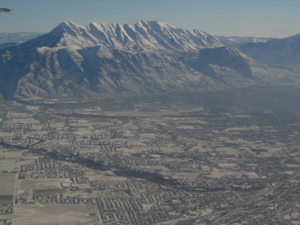
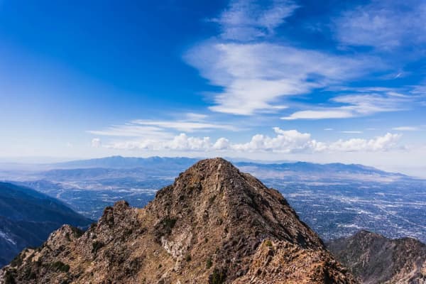
The views split by direction. Eastward and south you're looking into Nebo Creek Valley and out toward Central Utah — open, dry, big-sky country that feels a long way from the Wasatch Front. Northwest, on the Payson descent, the valley opens onto Utah Lake and Utah Valley laid out below, which is the single best view on the drive and the argument for driving south-to-north if you have the choice.
The southern approach near Nephi runs up the valley of Salt Creek, which cuts the range at that point — and just off State Route 132 there's an unusual formation of salt pillars worth a look on the way past.
Devil's Kitchen
If you make one stop, make it this one.
Devil's Kitchen is a geologic site where deep red rock has eroded into pinnacles and spires, forming a small amphitheater that looks like someone airlifted a piece of southern Utah into a green Wasatch canyon. The contrast is the whole appeal — you've been driving through fir and aspen for half an hour and then there's this.
It's often called Utah Valley's "Little Grand Canyon," which oversells the scale considerably. Go for the strangeness rather than the size.
Practically, it's the most accessible stop on the byway: a picnic area, a short paved trail, and an observation deck. You can be out of the car and looking at it in a couple of minutes, which makes it the one stop that works even with small kids or anyone who doesn't want a hike.
Payson Lakes
About twelve miles up from Payson, the Payson Lakes Recreation Area is the byway's other main stop and the one people spend actual time at. There's a developed recreation area with paved trails, improved picnic sites, camping and fishing.
It's the natural turnaround point if you don't want to commit to the full drive to Nephi — Payson to the lakes and back makes a comfortable couple of hours from Provo, and you still get the climb, the views and a place to eat lunch.
Note that individual sites and areas within the recreation area can be closed in a given season for maintenance or conditions. Visitors have reported arriving to find portions shut, so it's worth confirming rather than assuming.
Short walks and longer hikes
Grotto Falls is the short one people recommend, about eight miles south of Payson per the Forest Service. It's a fairly level walk to a small waterfall, with a few stream crossings on logs along the way. Kids generally find those crossings fun; anyone unsteady on their feet may not. It's the best low-effort payoff on the drive.
At the other extreme, the byway provides access to the Mount Nebo Wilderness and to the summit of Mount Nebo itself. The summit routes, including the Nebo Bench Trail, are long and steep; AllTrails measures the full Nebo loop route at about 15 miles with roughly 5,500 feet of gain. Any summit attempt is a strenuous full-day outing at high elevation, not something to attempt on a whim after a scenic drive. Between those two extremes sit a number of trailheads and interconnecting trails; signage doesn't always make the connections obvious, so carry a map rather than improvising.
In between, the drive is dense with overlooks and pullouts. The views split in two directions — down into Nephi Valley and Central Utah on one side, out over Utah Lake and Utah Valley on the other. Wildlife along the road is common enough to be worth watching for, and cattle graze the roadside in places, which is its own reason to keep your speed down.
When to go
Summer brings wildflowers through the middle and upper elevations, and the altitude makes it meaningfully cooler than the valley floor — useful in July and August when Provo is in the nineties.
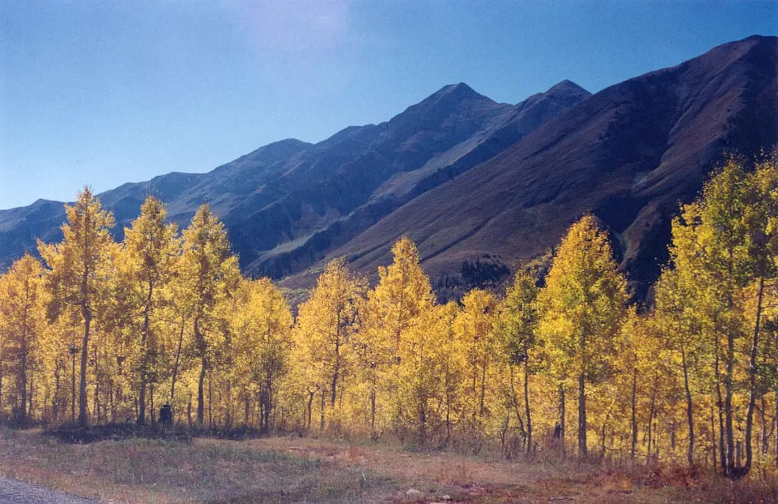
Fall is what the byway is known for, and the reputation is earned. Color typically peaks late September into early October, but because the road spans thousands of feet of elevation, it doesn't all turn at once. High aspens go gold first; the scrub oak and maple lower down, closer to Payson, turn red afterward. That staggering is a genuine advantage — miss peak in one section and another is usually on.
The flip side is company. Peak-color weekends are busy, and the pullouts fill up. A weekday morning in that window is one of the better outings available in Utah Valley.
A half-day plan that works
If you want this handed to you rather than assembled, here's a version that works well from Provo or Orem on a fall Saturday.
Leave early — before eight if it's peak color, because the pullouts fill and the light is better anyway. Drive south to Payson (roughly half an hour) and start up the byway from the north end. Stop at the first two or three overlooks as the road climbs out of the oak; they're the ones most people skip because they're impatient at the start of a drive.
Walk out to Grotto Falls about eight miles in — figure an hour with the stops and the log crossings. Continue to Payson Lakes and eat there; it's the one stop with real facilities and a comfortable place to sit. From the lakes, keep climbing to Devil's Kitchen, which is the visual payoff and the photograph everyone wants.
At that point you have a decision. Turn around and retrace to Payson for a four-to-five-hour outing total, or continue over the top and down to Nephi, returning north on I-15 for something closer to six or seven hours. The full traverse is the better drive; the out-and-back gets you home for dinner.
Either way, eat in Payson or Nephi rather than planning on food along the route. There isn't any.
Camping and practicalities
Several campgrounds sit along the byway. Developed campgrounds close in the fall (the Forest Service lists Payson Lakes' season as about mid-May to mid-October), reservations for developed sites run through recreation.gov, and dispersed camping is available on the surrounding forest. The Payson Canyon section below has the detail; note that the Forest Service has closed the whole Blackhawk area toward the Nephi end, including the campground, its roads, trailhead and trails, to all use, so check its status before planning around it. Payson Lakes Campground is closed for the rest of 2026; Recreation.gov expects it to reopen around May 7, 2027.
A few practical notes that matter more here than on the Alpine Loop:
- There are no services on the byway. No fuel, no food, no reliable water. Fill up in Payson or Nephi.
- Cell coverage is patchy to nonexistent for long stretches. Download maps before you leave town and tell someone your plan.
- Weather at 9,000 feet is not valley weather. Afternoon thunderstorms build fast in late summer, and it can be twenty-plus degrees cooler at the top. Bring a layer even in August.
- Fees vary by site. Developed campgrounds and some recreation areas carry their own fees. We weren't able to confirm a single byway-wide fee structure, so check with the ranger district rather than assuming your American Fork Canyon pass covers this — that's a different canyon with its own fee area.
- Watch fuel range if you're driving the full route and returning by freeway; it's a longer commitment than the map suggests.
Payson Canyon, the destination rather than the drive
The northern end of the byway is Payson Canyon, and it is worth treating as a place in its own right rather than as the first fifteen minutes of a longer drive. Plenty of people come up here, spend the day, and never go over the top toward Nephi at all.
Getting in. From I-15 take the Payson exit, head south on Main Street to 100 North, east to 600 East, and south past the Peteetneet Academy for about three and a half miles to the canyon mouth, where the road becomes Forest Road 015 and the byway proper begins.
Maple Bench is the first campground up, a small timbered site with picnic tables and fire rings. Check its listing for water and site details. Firewood is usually available from the host.
Maple Lake sits about a mile beyond it, roughly five miles up from Payson. It is small, tent-oriented and deliberately so: the road in has tight turns and the sites are short, so trailers and larger RVs are not accommodated. Published site counts differ between sources, vault toilets are provided, and reports indicate no potable water — bring your own. There are day-use sites around the lake itself, and the Red Lake Trail leaves from the upper camping area into the Mount Nebo Wilderness, which makes this a quietly good base for a walk that most byway traffic drives straight past. Reported operating windows for recent seasons have run from around early May into late September; confirm before you go, because these dates move with snow and with maintenance.
Grotto Falls, about eight miles up, is the short one with the big payoff — a mostly level walk to a small waterfall with log crossings on the way. We cover it properly in six lesser-known hikes, including what changes when the gate closes for winter and the walk gets considerably longer.
Payson Lakes, about twelve miles up, is the anchor. Big East Lake is a day-use water with rainbow and brown trout, with a designated swimming area, canoeing, paved trails and improved picnicking alongside the campground. Reservations run through recreation.gov, with some first-come sites. It is the natural turnaround for a half day from Provo.
Further along sit Tinney Flat in neighboring Santaquin Canyon and, toward the Nephi end, Bear Canyon and Cottonwood.
If what you want is the summit rather than the scenery, the trailheads for hiking Mount Nebo are further up this same road — and that is a very different day out.
Riding it
The byway is also a road-cycling route, and a serious one. Both ends are sustained climbs to a high point above 9,000 feet, with no services and thin air at the top — this is a fitness ride, not a casual spin, and the descents are fast on a winding two-lane road with no shoulder to speak of.
If you're driving it in summer or early fall, expect to come around blind corners onto cyclists, and give them room. If you're riding it, the same corners apply to you in reverse, along with the cattle. Either way, the road rewards a slower speed than it invites.
Fall Color on the Nebo Loop, and How It Differs From the Alpine Loop
Both byways are leaf drives, and people treat them as interchangeable in autumn. They are not, and the difference is elevation rather than latitude.
Read the color as elevation, not as a date. This is the same rule the Alpine Loop guide sets out, and it applies with more force here because the Nebo Loop climbs higher. Color arrives at the top of a canyon first and works downward over a period of weeks, so the useful question is never "has fall started" but "how high is it today". A drive that looks too early at the bottom is often in full color a thousand feet up.
The Nebo Loop holds a longer window because it spans more vertical. Its high points sit well above the Alpine Loop's, and the road runs a long way along the upper contour rather than crossing it once. In practice that means the loop gives you more chances to intersect peak color on a single drive, and it means a visit that is past peak up top can still be at peak partway down.
The Alpine Loop is the denser display; the Nebo Loop is the longer view. The Alpine Loop runs tight through canyon walls, so the color is close, enclosing and photographs as texture. The Nebo Loop spends much of its length on open shoulders above the valley, so the color reads as landscape — whole slopes at once, with Mount Nebo behind them. Which is better depends entirely on the picture you are trying to take.
Traffic is the real differentiator on an autumn Saturday. The Alpine Loop is closer to the population center of the valley, narrower, and has the cave and the Timpanogos trailheads feeding it, which is why it congests. The Nebo Loop is longer, further south and less used, and on the same Saturday it is the calmer drive by a wide margin. If someone tells you the leaf drive was ruined by traffic, they were probably on the other one.
Both close for winter, and the closure is the hard stop on the season. The seasonal-closure section above covers the Nebo gates. Plan a late-season color drive against the gate date rather than against the forecast, because an open road with mediocre color is still a drive and a closed road is not.
Nebo Loop or Alpine Loop?
This is the actual question most people are asking, so here's a straight answer.
Drive the Alpine Loop if you have a spare ninety minutes, you're starting from Provo or Orem, or you want to combine the drive with Timpanogos Cave or Sundance. It's closer, shorter, and the famous one, and the fall color is excellent.
Drive the Nebo Loop if you have half a day, you want sustained high-elevation views rather than a canyon drive, you'd rather not share the overlooks, or you've already done the Alpine Loop and want the version locals talk about but don't get around to. It climbs higher, runs longer, and on a September weekday you can have an overlook to yourself — something that essentially never happens above Sundance in fall.
There's also a straightforward pairing argument. The Alpine Loop is in American Fork Canyon at the north end of the valley; the Nebo Loop starts in Payson at the south end. Between them they cover both ends of Utah Valley's mountain front, and they're different enough that doing both in one autumn isn't repetitive.
For more options at a range of drive times, see our guide to day trips from Provo.
Facts current as of July 24, 2026.
Related Guides
- Things to Do in Payson, Utah (2026)
- Utah Valley Hike Finder — filter every trail by difficulty, length, season, dogs and fees
- Canyon & commute conditions — the Nebo gates close in three waves, and the south end goes last of anything in the county
- Things to Do in Mapleton, Salem and Santaquin
- Snowmobiling Near Provo
- Payson Lakes and Payson Canyon: The Complete Guide
- Sanpete's summer festival circuit
Frequently Asked Questions
How long does the Nebo Loop take to drive?
When is the Nebo Loop open?
When do the fall colors peak on the Nebo Loop?
What is Devil's Kitchen on the Nebo Loop?
Is the Nebo Loop better than the Alpine Loop?
Sources
The facts in this guide were checked against these sources. Hours, fees and rules change, so confirm anything time-sensitive with the source before you go. How we make Provo.com.
- Nebo Loop National Scenic Byway, USDA Forest Service, Uinta-Wasatch-Cache National Forest. Checked October 12, 2026.
- Mount Nebo Scenic Byway (Nebo Loop): Wildflower Viewing Area, USDA Forest Service, Intermountain Region. Checked October 12, 2026.
- Recreation.gov (Uinta-Wasatch-Cache National Forest): Payson Lakes, Recreation.gov (Uinta-Wasatch-Cache National Forest). Checked October 12, 2026.
- Mount Nebo Scenic Loop, Nephi City. Checked October 12, 2026.
- Grotto Trail #086, USDA Forest Service, Uinta-Wasatch-Cache National Forest. Checked October 12, 2026.
- Uinta-Wasatch-Cache National Forest - Alerts, USDA Forest Service. Checked October 12, 2026.
- Mount Nebo via North Peak, Nebo Peak, and Nebo Bench Loop, AllTrails. Checked October 12, 2026.