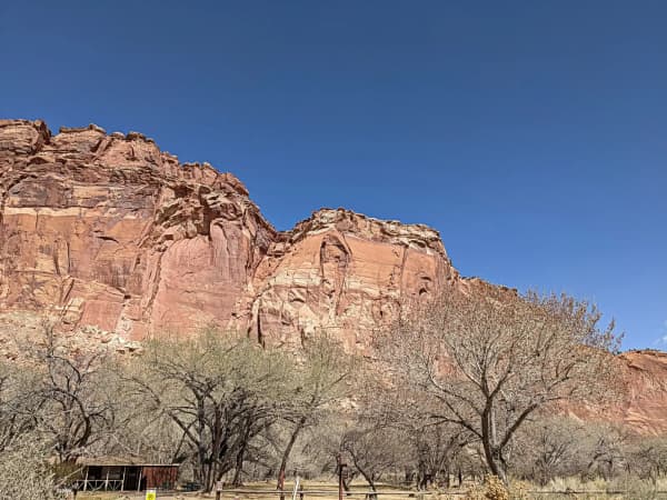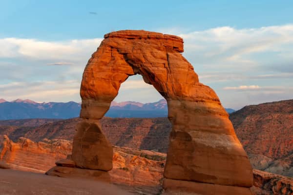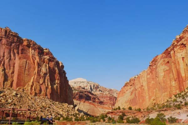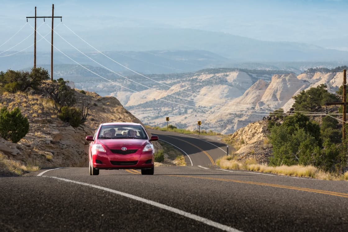
Scenic Byway 12 links two of Utah's national parks by the long way. It leaves US-89 near Panguitch, passes the turnoff to Bryce Canyon, crosses the Escalante canyons and the top of Boulder Mountain, and ends at SR-24 near Torrey, about 11 miles from the Capitol Reef visitor center. Capitol Reef National Park puts the drive at about three hours. The Federal Highway Administration's advice is to "allow three hours to drive or three days to experience the byway."
This guide takes the road west to east, from the Red Canyon end to Torrey, segment by segment: what is at each stop, what it costs, when it is open as of this week, and where to buy gas and food. Our Bryce Canyon from Provo guide covers the park at the west end, and Capitol Reef from Provo covers the east end. This page covers the road in between.
Hours, fees and road status below come from agency pages checked on Nov. 12, 2026. Several change this month, so confirm before you leave.
Quick facts
| Item | Detail | Source |
|---|---|---|
| Endpoints | US-89 near Panguitch to SR-24 near Torrey | Utah rule R926-13, NPS |
| Length | 122.863 to 124 miles, depending on the source | Visit Utah, NPS, FHWA |
| Designation | All-American Road, June 13, 2002 | Utah rule R926-13 |
| Driving time | About 3 hours without stops | NPS Capitol Reef |
| Highest point | 9,600-foot summit on Boulder Mountain | NPS Capitol Reef |
| Elevation range | 4,000 to 9,000 feet | FHWA |
| Gas listed | Tropic, Cannonville, Escalante, Torrey | Garfield County tourism, NPS |
| Provo to west end | About 212 miles, 3 hr 45 min | OSRM estimate |
| Torrey to Provo | About 170 miles, 3 hr 20 min | OSRM estimate |
| Road status | udottraffic.utah.gov or dial 511 | UDOT |
How long the byway is, and why the numbers differ
You will see three lengths. Visit Utah says "122.863 miles (to be exact)." The Park Service at Capitol Reef rounds to 123 miles. The Federal Highway Administration and Garfield County's tourism office, which calls itself Bryce Canyon Country, both say 124. The differences are small and come from where each agency starts and stops counting. For trip planning, call it about 123 miles.
The road carries two designations. Utah's administrative rule on scenic byways lists State Route 12 from US-89 near Panguitch to SR-24 near Torrey as a state scenic byway, and lists it separately as "Scenic Byway 12 All-American Road," designated June 13, 2002. Visit Utah notes that only about a third of the country's scenic byways hold the All-American Road label.
Getting to the start from Provo, and the loop home
To the west end. An OpenStreetMap routing estimate (OSRM, no traffic) from downtown Provo to the Red Canyon Visitor Center, 3.5 miles in from the US-89 junction, is about 212 miles and 3 hours 45 minutes. The route is I-15 south for about 168 miles, SR-20 east over to US-89, then US-89 south through Panguitch to the SR-12 turnoff. The Dixie National Forest says the turn is about 7 miles from Panguitch.
Across the byway. The same routing service puts the Red Canyon Visitor Center to Torrey at about 117 miles and 2 hours 40 minutes of driving, close to the Park Service's three-hour figure.
Home from Torrey. OSRM's fastest route back is about 170 miles and 3 hours 20 minutes: SR-24 west through Loa, SR-260 and US-50 to I-15 near Scipio, then north. Our Capitol Reef guide describes the alternative through the Sanpete Valley on US-89, which is mostly two-lane highway.
That makes the full loop roughly 500 miles and nine and a half hours of driving before a single stop. Most people from Utah Valley split it over two or three days, with a night near Bryce, in Escalante or Boulder, or in Torrey. You can run it in either direction. Driving west to east, as this guide does, puts the Boulder Mountain summit late in the day, so in November leave enough daylight for it. Driving east to west puts the summit first.
Segment 1: Red Canyon and the Bryce Canyon junction
Red Canyon comes almost immediately after the turn off US-89. Garfield County's tourism office describes hoodoos of red Claron limestone in the Dixie National Forest that "follow the byway for about four miles." Visit Utah notes that drivers pass through two red rock arches here.
The Red Canyon Visitor Center sits about 3.5 miles east of the US-89 junction, near Red Canyon Campground, at 7,100 feet. The Forest Service lists flush toilets, drinking water, picnic tables and interpretive displays, and no fee. Its posted hours, dated June 17, 2026, were Friday through Sunday 8:30 a.m. to 5 p.m. and Monday through Thursday 10 a.m. to 3 p.m., but the same page now carries a "Site Closed" notice and directs visitors to the Dixie National Forest Supervisor's Office at 435-865-3700. Treat it as closed for the season unless the office tells you otherwise.
From the visitor center, the Forest Service puts Bryce Canyon National Park about 13 miles farther on. The park's entrance road is UT-63, which turns south off Highway 12; the park's directions page says the visitor center sits one mile inside the boundary. Bryce charges $35 per private vehicle for seven days, and the park says it does not accept cash. Non-U.S. residents 16 and older pay an additional $100 per person unless they hold an annual or America the Beautiful pass. Our Navajo Loop and Queen's Garden guide covers the most popular hike if you stop.
Segment 2: Mossy Cave and Tropic
East of the UT-63 junction, Highway 12 heads toward Tropic and passes the park's Mossy Cave trailhead. The Park Service lists the Mossy Cave Trail as an easy 0.8-mile round trip, "located outside of the amphitheater on highway 12 going toward Tropic." The park says the waterfall there flows from May to October, so in November expect a dry or frozen creek rather than falling water.
Tropic is the first town on the byway after Bryce. Garfield County's tourism office says it has a small visitor center, groceries, a gas station and a post office. Visit Utah notes that the Tropic Shale, a Mesozoic rock formation, takes its name from the town.
Segment 3: Cannonville and Kodachrome Basin
Cannonville comes next. Garfield County lists a campground and a gas station. The Bureau of Land Management's Cannonville Visitor Center at 10 Center Street is "closed until further notice," and the BLM directs questions to the Escalante Interagency Visitor Center at 435-826-5499.
Kodachrome Basin State Park is a detour off the byway, not on it. Garfield County says the park "lies just nine miles south of Cannonville." Utah State Parks describes 67 "monolithic stone spires, called sedimentary pipes," and says the name dates to a 1948 National Geographic Society expedition.
- Hours: park 8 a.m. to 6 p.m. daily; visitor center 8 a.m. to 8 p.m., as posted Nov. 12.
- Day use: $10 per vehicle for up to eight people; $5 per person on a bike, motorcycle or foot; $5 per vehicle for Utah residents 62 and older.
- Phone: 435-679-8562.
The round trip from the byway is about 18 miles on top of whatever hiking you do, so decide in the morning whether it fits the day.
Segment 4: Henrieville to Escalante
Past Henrieville, which Garfield County describes as a historic farming town, the road climbs onto open country. The county's tourism office lists The Blues, a badlands of mudstone and sandstone "rich in fossil history from the Cretaceous Period," about 12.5 miles east of Henrieville, with upper and lower overlooks facing Powell Point. About eight miles beyond is the Upper Valley Granaries wayside, an Ancestral Puebloan structure built into a cliff face and believed to have stored grain, with a viewing tube to help you find it.
Escalante is the place to fill the tank. Garfield County lists "lodging and camping, restaurants and grocery stores, gas and service stations." The Escalante Interagency Visitor Center at 755 W. Main St. houses BLM monument staff and is the place to ask about road, trail and canyon conditions. The BLM says its winter schedule starts Nov. 13, 2026: Monday through Friday, 9 a.m. to 4 p.m., closed weekends. It is also closed Thanksgiving, Christmas and New Year's Day. If you are driving through on a Saturday or Sunday this winter, call ahead instead (435-826-5499).
Escalante Petrified Forest State Park sits on Wide Hollow Reservoir near town. Utah State Parks mentions nature trails through a petrified forest and swimming, kayaking and paddleboarding on the reservoir in season.
- Hours: listed as open 24 hours with posted hours of 6 a.m. to 10 p.m., and no gate. Closed Christmas and New Year's Day.
- Day use: $10 per vehicle; $5 per vehicle for Utah residents 62 and older.
- Winter: the visitor center and museum are closed for the winter and reopen at the end of February. Showers close from mid-November to mid-March.
- Alert: the Bailey Wash entrance is closed because of flood damage, according to an update dated Nov. 2, 2026. The main entrance is open.
- Phone: 435-826-4466.
By OSRM's estimate, the run from the Red Canyon Visitor Center to the state park is about 55 miles and an hour and 25 minutes of driving.
Escalante is also the turnoff for Hole-in-the-Rock Road and the slot canyons. Those are a separate trip, covered in our Escalante slot canyons guide, which also explains the July 2026 change to the Grand Staircase-Escalante National Monument boundaries. The BLM's monument page now lists 181,541 acres.
Segment 5: Head of the Rocks and the Escalante River
East of town the road heads into the Escalante canyons. Garfield County's tourism office lists three waysides on this stretch:
- Head of the Rocks Overlook, with views of the Boulder Mountains to the north, the Henry Mountains to the east and Navajo Mountain to the southwest.
- Boynton Overlook, above a winding section of the Escalante canyons, named for rancher John Boynton, who the county says was wanted for murder in 1878.
- The Escalante River Trailhead, just upstream of the Escalante River bridge, with access to the river trail. The county advises checking river conditions before you set out.
Segment 6: Lower Calf Creek Falls
The BLM puts Calf Creek Recreation Area about 15 miles east of Escalante on Highway 12, and Garfield County says it is about five minutes past Boynton Overlook. It is the main day hike directly off the byway.
- Trail: 6 miles round trip to the 126-foot Lower Calf Creek Falls. The BLM calls it moderately difficult because of sandy sections and "a good introductory hike to the Escalante Canyons."
- Fee: $5 per vehicle for day use. Interagency pass holders get free day use.
- Waste rules: the BLM requires hikers to carry out solid human waste in a portable containment system, such as a WAG bag, and to pack out all trash, including toilet paper and food waste. Restrooms are at the trailhead.
- Campground: open year-round, with 13 sites according to Garfield County. The BLM says it does not accommodate oversized vehicles, and leashed pets are allowed.
- Along the trail: the BLM mentions beavers, pictographs, granaries, oak trees and prickly pear, and springs that flow all year.
The hike and the drive do not combine casually. Six miles of sand takes a few hours, and in November that time comes out of a short day with Boulder Mountain still ahead. If you want both, consider sleeping in Escalante or Boulder and hiking in the morning.
Segment 7: The Hogback to Boulder
North of Calf Creek the road climbs onto the Hogback, the best-known stretch of the road. Garfield County's tourism office calls it "The Million Dollar Road to Boulder," says the Civilian Conservation Corps built it in 1935, and describes "a narrow, paved slickrock ridge with drops of about 2,000 feet on each side." Visit Utah calls it the "vertiginous 'Hogsback' stretch," where "hairpin turns dare you on a road that drops off drastically" into the canyons.
By OSRM's estimate, Calf Creek to the Anasazi State Park Museum in Boulder is about 12 miles and 20 minutes of driving.
Who should think twice. None of the agency pages we checked restricts trailers or RVs on this section. That is not the same as saying it suits everyone, and the descriptions above are the reason to decide in advance:
- If anyone in the car has a strong fear of heights, decide before you leave Escalante, not on the ridge.
- If you are towing or driving a large RV, consider the hairpin turns and the exposure. Note that the Calf Creek campground just south of the ridge does not take oversized vehicles.
- In wind, ice or fog, wait. A ridge with drops on both sides is the wrong place to discover the road is slick.
If the Hogback is a dealbreaker, the alternative is to skip the middle of the byway: reach Bryce by US-89 and Capitol Reef by SR-24, and drive each end of Highway 12 as an out-and-back. Our Capitol Reef guide recommends the first 30 miles from Torrey on their own.
Segment 8: Boulder and the Anasazi State Park Museum
Boulder is a small town, and services are limited. We could not confirm fuel in Boulder from an official source for this guide. Plan to fill up in Escalante, and treat anything in Boulder as a bonus. Garfield County's listing for the museum mentions a motel across Highway 12 and a food truck at the park that serves breakfast and lunch; confirm either before counting on it in winter.
The Anasazi State Park Museum preserves an Ancestral Puebloan village that Utah State Parks says was likely occupied from A.D. 1050 to 1200. A portion of the original site is visible, and a life-sized six-room replica of a dwelling stands outside the museum. The park sits at 6,700 feet.
- Hours: 9 a.m. to 4 p.m. daily, closed Thanksgiving, Christmas and New Year's Day.
- Admission: the fee page lists $8 standard, $5 discounted and $20 family, but says the park is "currently not charging admission due to remodel."
- Exhibits: the park says renovations are not complete and the exhibits are "a work in progress."
- Phone: 435-335-7308.
Our Ancestral Puebloans in southeast Utah guide explains the term "Ancestral Puebloan" and why older signs say "Anasazi."
Segment 9: Boulder Mountain and the Dixie National Forest summit
From Boulder the byway climbs north over Boulder Mountain, the high plateau between the canyon country and Torrey. Capitol Reef National Park says SR-12 tops out at 9,600 feet on Boulder Mountain. Garfield County says the mountain itself ranges over 11,000 feet and holds about 80 lakes. Visit Utah describes aspen and pine groves and meadows on this section.
Two Forest Service overlooks break up the climb. The Forest Service manages both through the Fremont River Ranger District in Loa.
- Homestead Overlook, which the Forest Service puts about 26 miles south of Torrey on the east side of the road. Garfield County puts it 11.5 miles past the Anasazi museum at 9,400 feet and lists views from Capitol Reef to Navajo Mountain, including the Henry Mountains, the Kaiparowits Plateau and the Waterpocket Fold. The Forest Service lists a vault toilet, no drinking water and no fee, and a season of use from June through October for dispersed camping.
- Larb Hollow Overlook, about 15 miles from Torrey on the east side of the road, with views of the Waterpocket Fold and the Henry Mountains. The Forest Service lists a vault toilet, a kiosk and paved parking, no water and no fee, and a season of use from May through September, with use in daylight hours only.
By OSRM's estimate, Boulder to Torrey is about 37 miles and an hour of driving, with no listed services between them.
Winter on Boulder Mountain. This is the section to plan around in November. Capitol Reef's directions page says SR-12 "can be hazardous to drive in the winter" and tells visitors to check road conditions and UDOT cameras before the trip. Visit Utah says ice can make the Boulder Mountain stretch hard to drive and that sections may be impassable after major storms until they are plowed. Garfield County says high-elevation backcountry roads on the mountain can close for snow as early as November, while the byway itself is maintained.
The Fishlake National Forest's road conditions page listed Hwy-12 as open in its Fremont River Ranger District table, last updated Oct. 16, 2026. Our Utah scenic byways ranking notes that Highway 12 is not on UDOT's seasonal closure list, unlike the Alpine Loop and the Mirror Lake Highway. Open is not the same as clear. Check the morning you drive.
Segment 10: Torrey and Capitol Reef
The byway ends at SR-24 on the edge of Torrey. Capitol Reef National Park says the nearest gasoline to the park is in Torrey, 11 miles west of the visitor center, and that there are no restaurants or gas stations in the park. The park also says groceries are available seasonally in Torrey and year-round in Loa, 28 miles west, and that "many local businesses are closed during the winter off-season, as well as on Sundays year-round."
Capitol Reef National Park charges $20 per private vehicle. The visitor center, at Highway 24 and the Scenic Drive, is open 8 a.m. to 4:30 p.m., moving to winter hours of 9 a.m. to 4:30 p.m. from Nov. 29, 2026, through March 6, 2027. It closes Thanksgiving (Nov. 26), Christmas Eve, Christmas and New Year's Day. Our Hickman Bridge, Cassidy Arch and Grand Wash guide covers the hikes closest to the road.
Gas and food: where the services are
The pattern on this road is clusters of services with long gaps between them. Based on what Garfield County and the Park Service list:
| Town | Fuel listed | Notes |
|---|---|---|
| Tropic | Yes | Groceries, small visitor center |
| Cannonville | Yes | BLM visitor center closed |
| Escalante | Yes | Restaurants, groceries, lodging |
| Boulder | Not confirmed | Small; check ahead |
| Torrey | Yes | Groceries seasonal; many closures in winter |
The practical rule: fill the tank in Escalante before the Hogback and Boulder Mountain, and again in Torrey if you are heading home. Escalante to Torrey is the longest stretch without fuel we could confirm, at nearly 70 miles by OSRM's estimates.
For food, assume less is open than the internet suggests. Visit Utah mentions a coffeehouse near milepost 73, between Escalante and Boulder. The Park Service's warning about winter and Sunday closures in the Torrey area applies to the whole corridor in practice. Many restaurants and lodges here run seasonally, so call or check a business's own site before you plan a meal around it, and carry lunch and snacks regardless.
Road status: where to check
- UDOT Traffic (udottraffic.utah.gov) shows incidents, construction, live cameras and road weather. UDOT says current road-weather conditions are collected from Nov. 1 to April 30, with forecasts for the next 24 hours in three-hour blocks. The site also tracks snowplows and offers alerts for saved routes.
- Dial 511. UDOT's FAQ lists "dialing 511 on your telephone" among the ways to get traveler information.
- The UDOT Traffic app carries the same information and traction-law notices.
- The Escalante Interagency Visitor Center (435-826-5499) for conditions in the monument, weekdays this winter.
- The Fremont River Ranger District in Loa (435-896-1020), weekdays 8 a.m. to 4:30 p.m., for the Forest Service side of Boulder Mountain.
Traction rules. UDOT says traction devices are required in certain locations during severe winter weather, and that drivers may be required to comply up to 24 hours before a storm. For two-wheel-drive cars and light trucks, the minimum is tires with the three-peak mountain snowflake symbol, or traction devices on all drive tires. For all-wheel and four-wheel drive, M+S or snowflake tires, or devices on at least two drive tires. UDOT says drivers are notified by road signs, message boards, the app and social media. On Nov. 9, 2026, UDOT launched an online quiz at connect.udot.utah.gov that tells drivers whether their vehicle meets the requirements for the roads they plan to drive. Our Utah winter driving guide and winter tires guide go deeper.
Driving it in November
Mid-November on Highway 12 means short days, cold nights and services shutting down for winter. Several of the changes noted above take effect within weeks of this guide: the Escalante visitor center's weekday-only schedule starts Nov. 13, the Petrified Forest showers close mid-November, Capitol Reef's winter hours start Nov. 29, and Thanksgiving closes the Anasazi museum, the Escalante visitor center and Capitol Reef's visitor center.
Plan the day so Boulder Mountain comes in daylight. Leaving Bryce in the morning, a stop at Calf Creek and a short visit to the Anasazi museum will fill most of the day. If the afternoon gets away from you, stopping for the night in Boulder or Escalante is a better choice than crossing the summit after dark on an unfamiliar road. Our Escalante guide makes the same point about crossing Boulder Mountain in late fall.
What to bring
- A full tank leaving Escalante, and a plan for the next fill-up.
- Downloaded maps. Capitol Reef's directions page warns against relying on GPS to guide you into the park and says some phones route drivers onto South Draw Road, an unmaintained high-clearance 4WD road the park does not recommend.
- Food and water for the whole day, since restaurant hours are seasonal.
- Warm layers. The road runs from canyon country to 9,600 feet.
- Winter gear in the car in November: traction devices if your tires do not meet UDOT's rules, a blanket, a shovel and a phone charger.
- WAG bags if you hike Lower Calf Creek, which the BLM requires for solid waste.
- Cards and passes. Bryce does not take cash. The BLM gives interagency pass holders free day use at Calf Creek; the state parks charge their own fees.
Related Guides
- Bryce Canyon from Provo
- Capitol Reef from Provo
- Escalante Slot Canyons from Provo
- Utah Scenic Byways from Provo, Ranked
- Capitol Reef: Hickman Bridge, Cassidy Arch and Grand Wash
- Utah Winter Driving, Traction Law and Chains
Frequently Asked Questions
How long is Scenic Byway 12?
How long does the drive take?
How far is Scenic Byway 12 from Provo?
What is the Hogback on Highway 12?
Where can I get gas on Scenic Byway 12?
Is Highway 12 open in winter?
How much does it cost to stop at the parks along the way?
Should I drive the Hogback with a trailer or if I'm afraid of heights?
Sources
The facts in this guide were checked against these sources. Hours, fees and rules change, so confirm anything time-sensitive with the source before you go. How we make Provo.com.
- National Park Service, Capitol Reef National Park: Directions, National Park Service, Capitol Reef National Park. Checked November 12, 2026.
- Fees and Passes, National Park Service, Capitol Reef National Park. Checked November 12, 2026.
- Local Services, National Park Service, Capitol Reef National Park. Checked November 12, 2026.
- Visitor Center, National Park Service, Capitol Reef National Park. Checked November 12, 2026.
- Fees and Passes, National Park Service, Bryce Canyon National Park. Checked November 12, 2026.
- National Park Service, Bryce Canyon National Park: Directions, National Park Service, Bryce Canyon National Park. Checked November 12, 2026.
- National Park Service, Bryce Canyon National Park: Easy Hikes, National Park Service, Bryce Canyon National Park. Checked November 12, 2026.
- Kodachrome Basin State Park, Utah State Parks. Checked November 12, 2026.
- Kodachrome Basin State Park Fees, Utah State Parks. Checked November 12, 2026.
- Escalante Petrified Forest State Park, Utah State Parks. Checked November 12, 2026.
- Escalante Petrified Forest State Park Fees, Utah State Parks. Checked November 12, 2026.
- Anasazi State Park Museum, Utah State Parks. Checked November 12, 2026.
- Anasazi State Park Museum Fees, Utah State Parks. Checked November 12, 2026.
- Lower Calf Creek Falls Trail, Bureau of Land Management. Checked November 12, 2026.
- Calf Creek Recreation Area Day Use Site, Bureau of Land Management. Checked November 12, 2026.
- Grand Staircase-Escalante National Monument, Bureau of Land Management. Checked November 12, 2026.
- Grand Staircase-Escalante National Monument Visitor Centers, Bureau of Land Management. Checked November 12, 2026.
- Red Canyon Visitor Center, USDA Forest Service, Dixie National Forest. Checked November 12, 2026.
- Larb Hollow Overlook, USDA Forest Service, Fishlake National Forest. Checked November 12, 2026.
- Homestead Overlook Dispersed Camping, USDA Forest Service, Fishlake National Forest. Checked November 12, 2026.
- Road Conditions, USDA Forest Service, Fishlake National Forest. Checked November 12, 2026.
- Utah Department of Transportation: UDOT Traffic, Utah Department of Transportation. Checked November 12, 2026.
- UDOT Traffic FAQ, Utah Department of Transportation. Checked November 12, 2026.
- Snow Tire, Chain and Traction Device Requirements, Utah Department of Transportation. Checked November 12, 2026.
- UDOT launches online tool to help drivers navigate winter traction requirements, Utah Department of Transportation. Checked November 12, 2026.
- Scenic Byway 12, Federal Highway Administration, America's Byways. Checked November 12, 2026.
- Utah State Bulletin, DAR File No. 33446 (Rule R926-13), Utah Office of Administrative Rules. Checked November 12, 2026.
- The All-American Road: Scenic Byway 12, Visit Utah (Utah Office of Tourism). Checked November 12, 2026.
- Scenic Byway 12 Waysides, Garfield County Office of Tourism (Bryce Canyon Country). Checked November 12, 2026.
- Paria Valley: Cannonville, Tropic, Henrieville, Garfield County Office of Tourism (Bryce Canyon Country). Checked November 12, 2026.
- Tropic, Utah: The Base of Bryce, Garfield County Office of Tourism (Bryce Canyon Country). Checked November 12, 2026.
- History of Escalante, Utah, Garfield County Office of Tourism (Bryce Canyon Country). Checked November 12, 2026.
- Anasazi Museum State Park, Garfield County Office of Tourism (Bryce Canyon Country). Checked November 12, 2026.
- Utah's Boulder Mountain, Garfield County Office of Tourism (Bryce Canyon Country). Checked November 12, 2026.