
Five drives from Provo carry the scenic byway name and come up every time someone asks where to take a visiting relative or how to spend an October Saturday: the Nebo Loop, the Alpine Loop, the Mirror Lake Highway, the Energy Loop on the Wasatch Plateau and Highway 12 in southern Utah. They are not interchangeable. One starts 24 minutes from downtown; another is a two-day trip.
How this list is ranked: by drive time from downtown Provo to the start of each byway, using OpenStreetMap routing estimates (OSRM, no traffic) from Center Street and University Avenue. That is the one thing we can measure the same way for all five, and it is the thing that decides whether a drive fits into an afternoon. For each byway we also give season, length, fees and what you see, from the agencies that run them: the Forest Service, UDOT, the Federal Highway Administration (FHWA) and Utah's tourism office. We do not rank them by how beautiful they are.
The five, side by side
| Rank and byway | Start from Provo (est.) | Length | Winter |
|---|---|---|---|
| 1. Nebo Loop | 17 mi, 24 min (Payson end) | 38 mi | Closes late Oct. (Nephi) |
| 2. Alpine Loop (SR-92) | 16 mi, 27 min (Sundance end) | About 20 mi | Closed by UDOT, Nov. to May/June |
| 3. Mirror Lake Highway (SR-150) | 44 mi, 1 hr (Kamas) | 42 mi | Closed by UDOT, Nov. to May/June |
| 4. Energy Loop (SR-31, SR-264, SR-96) | 51 mi, 1 hr 7 min (Fairview) | About 40 mi to Huntington | Not on UDOT's closure list |
| 5. Highway 12 | 170 mi, 3 hr 19 min (Torrey end) | 124 mi | Not on UDOT's closure list |
The Nebo Loop's Payson end is slightly farther in miles than the Alpine Loop's Sundance end but slightly faster by the routing estimate; we rank by time.
1. Nebo Loop
Start: Payson canyon mouth, about 17 miles and 24 minutes from Provo; or the Nephi end, about 40 miles and 46 minutes. Length: 38 miles between Nephi and Payson, per the City of Nephi. Season: a Forest Service road, not a state highway, so UDOT's seasonal-roads page sends drivers to the Forest Service for its status. The City of Nephi says it closes for heavy snow "from late October through June or July." Fees: the Forest Service's byway page lists no byway-wide fee.
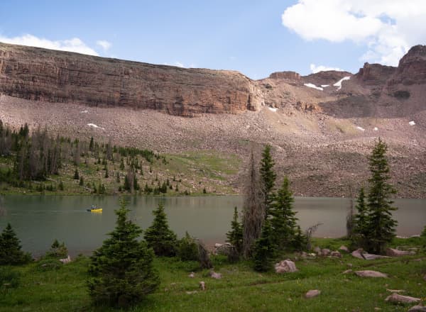
What you see, per the Forest Service: views of Mount Nebo, at 11,877 feet the tallest peak in the Wasatch Range, plus "flat bottomlands, high-alpine conifers, red rock formations, gray sandstone cliffs and salt flats all in the same day." The road climbs to about 9,000 feet. Devil's Kitchen has a half-mile round-trip trail and an observation deck over red sandstone hoodoos, and the Payson Lakes Recreation Area, 12 miles south of Payson, has paved trails, picnic areas, camping and fishing. FHWA designates it a National Scenic Byway. There is no drinking water listed along the byway.
Because it starts at the south end of Utah Valley and does not involve a canyon commute, it is the easiest of the five to do on a school-night summer evening. Our Nebo Loop guide covers every stop.
2. Alpine Loop (SR-92)
Start: Sundance end, about 16 miles and 27 minutes from Provo up Provo Canyon; or the American Fork Canyon mouth, about 19 miles and 31 minutes. Length: a "20-mile drive" linking American Fork Canyon and Provo Canyon, per Utah.com. Season: UDOT closes SR-92 through the winter, typically November through May or June. The Forest Service says it typically closes Nov. 1, and Utah.com gives the open season as roughly late May to late October. In 2026, UDOT reopened it on May 22, ahead of Memorial Day weekend. Fees: driving through is free. The Forest Service charges for stopping at developed sites: $10 for three days, $20 for seven, $60 for a year.
What you see, per the Forest Service: a climb from 5,000 feet at the mouth of American Fork Canyon to a crest at 8,000 feet, with views of Mount Timpanogos through aspen groves, Sundance Resort, and trailheads into the Mount Timpanogos and Lone Peak wilderness areas. The Forest Service calls it "easily the most popular scenic drive" on the forest, "a narrow, windy road famous for fall color," and notes it is paved but mostly without centerline markings, with steep grades and blind curves; pulling a trailer is prohibited.
"Avoid weekends and holidays" is the Forest Service's own advice. Our Alpine Loop guide covers the 30-foot vehicle limit, the camping ban and the stops.
3. Mirror Lake Highway (SR-150)
Start: Kamas, about 44 miles and an hour from Provo; Mirror Lake itself is about 77 miles and an hour 50 minutes. Length: 42 miles along SR-150 from Kamas to the Wyoming border, per Visit Utah. Season: UDOT closes SR-150 from east of Kamas to near the Wyoming border through the winter. Visit Utah says it is typically open mid-May to mid-fall. In 2026 it reopened May 22. Fees: the Mirror Lake Scenic Corridor Recreation Area charges standard amenity fees of $10 for three days, $20 for seven days and $60 for a year (Forest Service). America the Beautiful passes are honored. Visit Utah lists places in Kamas to buy a pass before you go up.
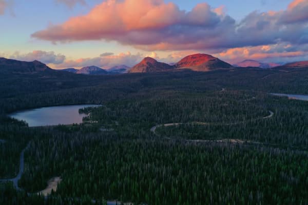
What you see: Visit Utah describes the road climbing into the Uinta Mountains to Bald Mountain Pass, at 10,715 feet, Utah's highest paved road, then descending past Hayden, Kletting and Holiday Park peaks. It notes the Uintas are one of the few North American ranges that run east to west. The Forest Service lists numerous access points into the High Uintas Wilderness. Short walks include a 1.5-mile loop around Mirror Lake with about 39 feet of elevation gain, per Visit Utah.
This is the byway where altitude matters most. Our Mirror Lake Highway guide covers the lakes, mosquitoes and the altitude.
4. The Energy Loop: Huntington and Eccles Canyons
Start: Fairview, about 51 miles and an hour 7 minutes from Provo, by US-6 and US-89. Length: The byway starts on SR-31 at Fairview and forks at the top of Fairview Canyon: SR-31 runs about 40 miles south and east to Huntington, and SR-264 and SR-96 run to Scofield and Colton on US-6, according to the byway's Recreation.gov page. Season: SR-31, SR-264 and SR-96 are not on UDOT's list of roads closed for winter. That means plowed, not easy; it still climbs high. Fees: none listed for the byway itself.
What you see: FHWA describes a route that "winds across the Manti-La Sal National Forest, rising up to 10,000 feet above sea level," and points travelers to "coal mining operations, historic mining towns, and coal-fired power plants." It is a National Scenic Byway, and the only one in this list whose official theme is industry: coal country on the Wasatch Plateau. FHWA also notes the nearby Sanpete Valley's well-preserved pioneer settlements.
Our Scofield, Electric Lake and Skyline Drive guide builds a full loop from Provo around this byway, with drive times for each leg.
5. Highway 12
Start: Torrey, at the northeast end, about 170 miles and three hours 20 minutes from Provo; Bryce Canyon City, near the southwest end, is about 223 miles and four hours. Length: 124 miles, per FHWA and Visit Utah. Season: not on UDOT's seasonal-closure list. Visit Utah warns of summer heat in the desert sections and notes elevations from 5,223 to 9,636 feet, so expect very different weather at the two ends on the same day. Fees: none for the road; the national parks at each end charge entrance fees.
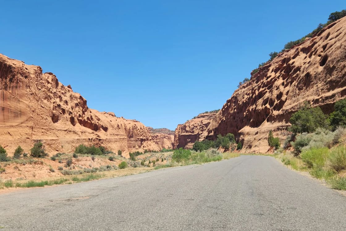
What you see: FHWA calls Scenic Byway 12 an All-American Road, a higher designation than National Scenic Byway, and describes "an isolated landscape of canyons, plateaus, and valleys ranging from 4,000 to 9,000 feet." Visit Utah lists two national parks along it (Bryce Canyon and Capitol Reef), the towns of Panguitch, Tropic, Cannonville, Henrieville, Escalante, Boulder and Torrey, Kodachrome Basin State Park as a detour, Anasazi State Park Museum, Calf Creek Falls and the Hogback, a narrow ridge between Escalante and Boulder with "sheer drops" on either side. It is also part of the U.S. Bicycle Route System.
From Provo, Highway 12 is a two-day trip at minimum. Our Capitol Reef, Bryce Canyon and Escalante slot canyons guides each cover one end or the middle.
Picking one, by the time you have
- An evening in summer: the Nebo Loop from Payson. It is the shortest drive to the start.
- A free half day, and you can avoid the weekend: the Alpine Loop, without stopping at fee sites, or with a pass if you want the trailheads.
- A full summer day with altitude: the Mirror Lake Highway, with a pass from Kamas.
- A full day any season, with a different story: the Energy Loop, which stays open when the other mountain byways are gated.
- A long weekend: Highway 12, with Capitol Reef or Bryce as your base.
Fall color, and the one thing to remember
The Forest Service highlights fall color on both the Alpine and Nebo loops, which is why October weekends are when they are most crowded. All three mountain loops close for winter: the City of Nephi says the Nebo Loop closes from late October, the Forest Service gives Nov. 1 as the Alpine Loop's usual closing, and UDOT's typical window for SR-92 and SR-150 starts in November. If you are reading this in late October, check UDOT's seasonal-roads page and the Forest Service before you drive. Our fall in Provo guide covers color timing closer to home, and our day trips from Provo list has more drives in every direction.
Frequently Asked Questions
Which scenic byway is closest to Provo?
How are these byways ranked?
Which Utah byways close in winter?
Do I have to pay to drive the Alpine Loop?
Does the Mirror Lake Highway charge a fee?
What is the highest paved road in Utah?
Is Highway 12 a day trip from Provo?
When is the best time to drive these byways?
Sources
The facts in this guide were checked against these sources. Hours, fees and rules change, so confirm anything time-sensitive with the source before you go. How we make Provo.com.
- Utah - Byways (National Scenic Byways and All-American Roads: Nebo Loop, Energy Loop, Scenic Byway 12), Federal Highway Administration, America's Byways. Checked October 19, 2026.
- Seasonal Roads, Utah Department of Transportation. Checked October 19, 2026.
- UDOT announces all seasonal roads now open (May 22, 2026), Utah Department of Transportation. Checked October 19, 2026.
- Nebo Loop National Scenic Byway, USDA Forest Service, Uinta-Wasatch-Cache National Forest. Checked October 19, 2026.
- Mount Nebo Scenic Loop, City of Nephi. Checked October 19, 2026.
- Alpine Scenic Loop Backway (closing, fees, trailer prohibition), USDA Forest Service, Uinta-Wasatch-Cache National Forest. Checked October 19, 2026.
- Mirror Lake Scenic Byway (fees, passes), USDA Forest Service, Uinta-Wasatch-Cache National Forest. Checked October 19, 2026.
- The Energy Loop: Huntington/Eccles Canyons Scenic Byway, Recreation.gov. Checked October 19, 2026.
- Alpine Loop Scenic Drive, Utah.com. Checked October 19, 2026.
- Mirror Lake Scenic Byway, Visit Utah (Utah Office of Tourism). Checked October 19, 2026.
- All American Road Scenic Byway 12, Visit Utah (Utah Office of Tourism). Checked October 19, 2026.
- OSRM route service (OpenStreetMap data), driving estimates from Center St & University Ave, Provo, Project OSRM. Checked October 19, 2026.