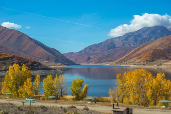
Utah Valley is made for aerial photos: the lake, the Y on the mountainside, the canyon mouths, the Alpine Loop in October. It is also a patchwork of land managers, and each one has a different answer to the question "can I fly here?" The answer near Provo ranges from a flat no at Utah Lake State Park to "usually yes, with conditions" on much of the Bureau of Land Management (BLM) ground farther south and west.
This guide walks through the rules of each agency in the order a Utah Valley pilot is likely to run into them: the Federal Aviation Administration (FAA) first, since it applies everywhere, then national parks and monuments, Utah State Parks, the Forest Service and the BLM. Everything below comes from the agencies' own pages, read on Nov. 6, 2026. Rules change, and several of these agencies leave the details to the local manager, so treat this as a map to the right official page rather than a replacement for it. If you are working on a photo list for the valley, our photography spots guide covers the locations and who owns the ground.
| Land manager | Short answer | Check before you go |
|---|---|---|
| National Park Service | Launching or landing generally prohibited | The park's compendium or superintendent |
| Utah State Parks | Written permission from the park manager; Utah Lake is a no-fly zone | The specific park page on stateparks.utah.gov |
| Forest Service | Prohibited in designated Wilderness, near active wildfires and for hunting | The ranger district and forest permits page |
| BLM | Launch and land on designated routes; not in designated wilderness | The local BLM field office |
| FAA (all land) | TRUST, registration at 250 grams or more, Remote ID, 400 feet in uncontrolled airspace | faa.gov/uas |
Start with the FAA, because it applies everywhere
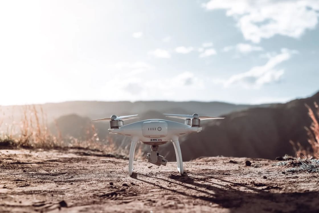
Whatever the land manager says, the FAA rules sit on top. The FAA treats a drone as an aircraft, and its recreational flyer page lays out what a hobbyist has to do.
Take TRUST. The FAA says recreational flyers are required by law to take The Recreational UAS Safety Test (TRUST) and carry proof when flying. The test is free and online.
Register if the drone is heavy enough. The FAA says you must register if your drone weighs 250 grams (0.55 pounds) or more. You also have to mark the drone on the outside with the registration number and carry proof of registration while flying.
Broadcast Remote ID if you are registered. The FAA says drones that are required to be registered, or are registered, must comply with the Remote ID rule. A drone can comply by being a Standard Remote ID drone, by carrying a Remote ID broadcast module, or by flying inside an FAA-Recognized Identification Area (FRIA). The FAA notes that a pilot using a broadcast module must be able to see the drone at all times during the flight.
Stay in sight, stay low, stay out of the way. The FAA's recreational rules say to keep the drone within visual line of sight, or use a visual observer who is next to you and in direct communication. Give way to other aircraft and do not interfere with them. In Class G (uncontrolled) airspace, fly at or below 400 feet. In controlled airspace, which the FAA lists as Class B, C, D and surface Class E designated for an airport, you may fly only with prior FAA authorization through LAANC or DroneZone, and only at or below the authorized altitudes. The FAA also notes that other aircraft can and do fly low, not just near airports.
Know when you have stopped being a hobbyist. This is the line that catches Utah Valley photographers, because so many people here shoot engagement sessions, listings and graduation photos on the side. The FAA says compensation, or the lack of it, is not the only thing that decides whether a flight is recreational. Its examples of non-recreational flights under 14 CFR Part 107 include taking photos to help sell a property or service and taking pictures of a high school football game for the school's website. Its advice: when in doubt, assume Part 107. That means a certificated remote pilot, which is a different process from TRUST. Our guide to Utah Valley photographers explains how the local market works if you are hiring rather than flying.
The FAA page is at faa.gov/uas/recreational_flyers, and the Remote ID rules are at faa.gov/uas/getting_started/remote_id. Check both before a first flight.
National parks and monuments: assume no
The National Park Service answer is the simplest and the strictest. The NPS unmanned aircraft page says launching or landing a UAS, including drone delivery, is prohibited in national parks. It adds that unauthorized operation "may result in a fine, confiscation, and/or other repercussions," with the consequences depending on the park.
The rule is written into federal regulation. The Timpanogos Cave National Monument compendium, the superintendent's list of local rules, cites 36 CFR 1.5(a)(2), which prohibits "launching, landing, or operating an uncrewed or remotely piloted aircraft" from or on lands and waters administered by the National Park Service within park boundaries, except as approved in writing by the superintendent. The same compendium points to 36 CFR 1.6(f), which lists launching or landing uncrewed aircraft among the activities that require a permit.
Three things follow for a Utah Valley visitor.
There is a way in, but it is not for hobbyists. The NPS says it uses drones itself for emergencies, wildland fire and search and rescue, structural assessments, scientific monitoring and contracted services such as aerial photography. Outside parties can request permission for scientific research and collecting permits, agreements that include drone missions, and special use permits, and those requests have to meet specific requirements. The NPS points to its Reference Manual 60, Chapter 12 and Appendix 8, for the permitting rules. None of that is a quick form for a family wanting a sunset clip.
Local superintendents can go further. The NPS page says superintendents "may adopt more protective measures to address park-specific concerns." Read the page for the unit you are visiting, and call the park if the compendium is unclear. For Timpanogos Cave, the monument's Laws and Policies page links the compendium and lists a phone number for questions.
Boundaries matter more than you think. The BLM notes in its Utah drone fact sheet that many BLM lands in Utah border other federal and state lands, and that pilots should learn the policy of the National Park Service, Forest Service or other agencies they may fly over before crossing a boundary. A drone that launches from a legal spot and drifts into a park can still be inside the boundary the NPS regulation describes. Plan a route that keeps you well clear, especially on trips south toward Arches, Canyonlands and Capitol Reef or Moab, where the national park units sit next to BLM ground that looks similar from the road.
Official pages: NPS unmanned aircraft overview and the Timpanogos Cave compendium.
Utah State Parks: written permission, and some parks say no
Utah State Parks takes a permission-based approach rather than a blanket ban. A June 2016 notice in the Utah State Bulletin for a rule amendment that adds a definition of "unmanned aircraft" to the state parks rules (Rule R651-601) says the rule requires that all state park visitors obtain written permission from the park manager prior to flying an unmanned aircraft. The notice listed July 22, 2016 as the date the rule could become effective. The practical meaning is that the park manager decides whether flying is allowed at that park, when, and on what terms.
Two park pages show how that plays out.
Utah Lake State Park: no-fly. The official park page says: "Due to its proximity to the Provo Airport, Utah Lake State Park is a no-fly zone for drones." For anyone from Provo, this is the entry that matters most, since the lake is the closest large open space and the obvious place to try a first flight. Our Utah Lake State Park guide covers what the park does offer, and the Utah Lake guide covers the other access points. The same page also says a special use permit is needed for any commercial activity inside the park, including "races, tournaments and professional photography (work for which you are being compensated)." So the commercial photographer is regulated too, in addition to the drone pilot.
Snow Canyon State Park: permission by form. The Snow Canyon permits page says personal, non-commercial drone use is allowed at the Snow Canyon Scenic Overlook with an advance permit. You submit the Personal Drone Use Flight Permission Form by email "a minimum of five days in advance of your preferred flight date." If the date is open, the park emails back a signed form and a rules attachment. Snow Canyon is a long drive from Provo, but it illustrates the general pattern: ask early, in writing, for a specific date.
The lesson for other state parks within a day trip of Utah Valley is not to guess from a different park's page. Each state park runs its own page and its own contact. If a park page says nothing about drones, the statewide rule still sends you to the park manager for written permission, so send the question rather than assuming silence means yes. This guide did not open the individual pages of every state park, and several of them post their own drone details that may differ from the two examples above.
A related caution: do not read the Utah Lake no-fly rule as limited to the park gate. The reason the park gives is the airport. The FAA's airspace rules for controlled airspace around an airport apply to the whole area regardless of who owns the shoreline, which is why an airspace check belongs in every plan. The FAA directs recreational flyers to use LAANC or DroneZone to request authorization in controlled airspace. Municipal shoreline and delta access points are under different managers than the state park, so check their rules and the airspace separately. Our Provo River Delta update describes the restored delta area on the lake.
Official pages: Utah Lake State Park, Snow Canyon permits and the 2016 rulemaking notice.
National forest land: open in places, closed in specific situations
Most of the high country above Provo is national forest, in forests such as the Uinta-Wasatch-Cache, and the Forest Service rules are narrower than the Park Service rules. The Uinta-Wasatch-Cache permits page lists situations where a drone is prohibited:
- Use in designated Wilderness
- Use in association with any hunting activities
- Use within an active wildland fire area
The same page addresses work and business flights. It says individuals and organizations wanting to fly an unmanned aircraft system on National Forest System lands for work or business must meet FAA requirements, including news media and film and video production companies. Meeting the listed criteria does not guarantee commercial drone permission, but submitting them with a film permit application can greatly increase the chances of approval. The items listed include a Small UAS Certificate of Registration from the FAA for the drone to be used, and a Remote Pilot license.
That means the Forest Service page treats a casual hobby flight and a paid shoot very differently, and it does not set out a simple "open" or "closed" status for each trailhead. Designated Wilderness is the line to know. Our photography guide notes that the Mount Timpanogos and Lone Peak areas fall in this category, which is a reason to check a Forest Service map, not just a trail app, before launching from a trailhead near a boundary. The BLM fact sheet gives the legal footing for wilderness restrictions: designated wilderness is protected by Section 4(c) of the 1964 Wilderness Act, and the public is prohibited from landing, taking off or operating a drone within wilderness unless such aircraft use is described in that wilderness area's enabling legislation.
Two practical notes for Utah Valley canyons. First, the roads and trailheads in American Fork Canyon and the Alpine Loop are popular and crowded on autumn weekends, and a drone over a busy trailhead or campground affects other visitors even where it is technically allowed. The BLM fact sheet makes the same point, telling pilots to consider how flying over developed recreation sites, campsites and trails might affect others' enjoyment. Second, the forest says nothing in the section above about specific canyon closures, so call the ranger district about local orders before a trip. Seasonal road gates are covered in our canyon conditions guide.
Official page: Uinta-Wasatch-Cache National Forest permits.
BLM land: the most permissive, with a catch on launching
BLM land is where Utah drone pilots have the most latitude, and the BLM's own Utah fact sheet is a useful, plain-language summary. It is written for the Grand Staircase-Escalante and Bears Ears national monuments, but it describes itself as tips for recreational drone users on BLM lands and refers to "BLM Utah lands" generally. It does not give a fee, an application or a blanket permit rule for hobby flights.
Its main points:
Know the agency policy where you fly. Many BLM lands in Utah border other federal and state lands, and drone policies may differ within BLM lands because of special designations, such as wilderness study areas or monuments.
Do not launch or land in designated wilderness. The fact sheet says the public is prohibited from landing, taking off or operating a drone within wilderness unless the area's enabling legislation describes such use. A BLM Arizona fact sheet makes the same point, saying drones are FAA-defined aircraft and cannot take off or land in BLM wilderness areas, citing 43 CFR 6302.20.
Leave wildlife and other visitors alone. The fact sheet says wildlife on public lands is protected by law and that it is illegal to harass animals with a drone. If an animal notices you or your drone, it says, you are too close.
Stay away from wildfires. When a drone is over or near a fire, fire managers may have to ground aerial firefighting resources until the airspace is clear. The fact sheet says it is illegal to operate a drone where a Temporary Flight Restriction (TFR) is in place, and points to the FAA's TFR list at tfr.faa.gov.
Launch and land on designated routes. This is the catch many pilots miss. The fact sheet says the FAA governs drones in the air, but the BLM regulates them while they are on or immediately over the ground. During any phase of take-off or landing, drone users must follow the Off-Highway Vehicle regulations in 43 CFR 8340, which the sheet says means launching and landing your drone on designated routes only. A pilot who drives a two-track that is not a designated route to reach a launch point is outside that rule.
Check the 400-foot line. The sheet says that if a flight will take place at 400 feet or higher, you may need to contact the FAA and obtain an authorization.
Researchers and commercial operators, the sheet adds, may be subject to additional rules, and it tells pilots to get in touch with land managers for the lands where they have planned a flight. The BLM's Utah pages list the right field office for a given parcel. The BLM document is posted at blm.gov, and the wilderness statement is on its Arizona permits and regulations page.
A short list of other places that matter around Provo
Several places that Utah Valley photographers want to fly are neither parks nor forest, and the pages above do not settle them. Use the same approach for each:
- Provo River Parkway and city parks. These are managed by cities and Utah County, not the agencies above. Neither the FAA page nor any page read for this guide gives a blanket answer. Ask the city or county parks office, and keep in mind the airport airspace question. The Provo River Parkway guide covers the route.
- Bridal Veil Falls. Utah County has closed the trail and park near the falls through the winter after an October rockslide. The Sheriff's Office warned of continued danger from falling rocks and posted deputies and volunteers to keep people out, so do not fly into the closed area. See our rockslide report for the current status.
- BYU and other campuses. Campus policies set separately from the agencies here. Our photography guide covers the personal-use versus promotional-use line on campus, and a drone flight is a further question to put to the university.
- Private land. The FAA rules do not give you a right to launch from private ground, and the agencies above do not either. Get the owner's permission.
What to check before you launch
A pre-flight routine that fits all of the rules above:
- Who owns the ground where you will launch and land? Park, monument, state park, forest, BLM, city or private. Each has a different answer.
- What does that manager's own page say today? Use the pages linked in this guide, not a blog or an app. If the page is silent on drones, email or call.
- Is the airspace controlled? Near the Provo airport, LAANC or DroneZone authorization is required in the controlled classes the FAA lists. Check before you arrive.
- Is the area wilderness, a monument, a wilderness study area or a fire area? If so, find the specific rule, and look for any TFR.
- Do you have TRUST, registration (if the drone is 250 grams or more) and Remote ID in order? Carry proof.
- Is this flight recreational? If money, a listing, a business account or a client is involved, treat it as a Part 107 flight and ask the land manager about commercial permits.
- Who else is there? Campers, climbers, hikers, birds and wildlife all come first.
Who should skip flying altogether
If your plan is a quick clip at a national park overlook, a state park with no posted permission or the Utah Lake shoreline, skip the drone and shoot from the ground. The penalties the NPS describes include confiscation, and the airport-based no-fly rule at the lake is stated plainly on the park's page. Photographers who want a high vantage point in Utah Valley have ground-level options, from the foothill trails to the overlooks described in the Provo Canyon photo spots guide, where you can get the elevation by walking rather than flying.
For a trip that is built around aerial footage, the BLM lands to the south and west and the national forest outside designated Wilderness are the most workable starting points, with the cautions above about launch routes, wildfire closures and the FAA's altitude and sight rules. For anything inside a park boundary, ask for written permission before buying the plane ticket or booking the campsite.
Sources and how to verify
The details above come from these official pages, read on Nov. 6, 2026:
- FAA, Recreational Flyers and Community-Based Organizations and Remote Identification of Drones
- National Park Service, Unmanned Aircraft Systems and the Timpanogos Cave National Monument compendium
- Utah State Parks, Utah Lake State Park and Snow Canyon permits, plus the Utah Division of Administrative Rules bulletin notice
- USDA Forest Service, Uinta-Wasatch-Cache National Forest permits
- Bureau of Land Management, Drones: Do and Don't and Arizona permits and regulations
Not confirmed for this guide: the current drone rules at individual state parks other than Utah Lake and Snow Canyon, any Utah County or city rules, and the full text of Utah State Parks' administrative rule as it now reads. Verify each agency's rule on its own official page before you fly.
Related on Provo.com
- Best photography spots in Provo and Utah Valley
- Provo Canyon photo spots
- Utah Lake State Park guide
- Timpanogos Cave National Monument guide
- American Fork Canyon guide
Frequently Asked Questions
Can I fly a drone in a national park or monument in Utah?
Can I fly a drone at Utah Lake State Park?
Do I need permission to fly a drone in other Utah state parks?
Are drones allowed on BLM land in Utah?
Can I fly a drone on national forest land near Provo?
Do I need to register my drone or take a test?
How high can I fly a recreational drone?
What if I am photographing for money, even a little?
Sources
The facts in this guide were checked against these sources. Hours, fees and rules change, so confirm anything time-sensitive with the source before you go. How we make Provo.com.
- Recreational Flyers & Community-Based Organizations, Federal Aviation Administration. Checked November 6, 2026.
- Remote Identification of Drones, Federal Aviation Administration. Checked November 6, 2026.
- Unmanned Aircraft Systems (UAS), National Park Service. Checked November 6, 2026.
- Superintendent's Compendium, Timpanogos Cave National Monument, National Park Service. Checked November 6, 2026.
- Utah Lake State Park, Utah State Parks. Checked November 6, 2026.
- Snow Canyon State Park Permits, Utah State Parks. Checked November 6, 2026.
- DAR File No. 40447 (Rule R651-601), Utah Division of Administrative Rules. Checked November 6, 2026.
- Uinta-Wasatch-Cache National Forest Permits, USDA Forest Service. Checked November 6, 2026.
- Grand Staircase-Escalante National Monument Drones: Do and Don't, Bureau of Land Management. Checked November 6, 2026.
- Permits and Regulations (Arizona), Bureau of Land Management. Checked November 6, 2026.