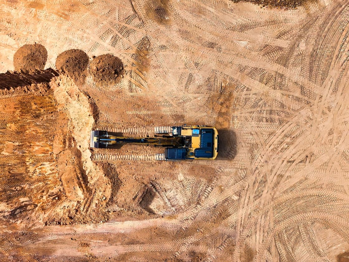

Drive north out of Utah Valley on I-15 and, just as the freeway climbs through the gap in the ridge, the land on your right opens into several hundred acres of nothing much. Graded dirt. New roadway. Utility trenching. A few pieces of heavy equipment.
For seventy years that ground held the Utah State Prison. It is now a major state-directed redevelopment project, and it has a name: The Point.
If you live in Provo, Orem, Lehi or anywhere between, this project will affect your commute, your housing market and your job market — and almost everything most people believe about it is slightly wrong, starting with which county it is in.
The fact that corrects most of the confusion
The Point is in Salt Lake County, not Utah County.
The old prison stood in Draper. Draper is Salt Lake County. The 600 acres being redeveloped sit on the Salt Lake side of the ridge, and the adjacent groundbreaking work has extended into Bluffdale, which is also Salt Lake County.
The confusion is understandable, because "Point of the Mountain" is a geographic name for the gap where Utah County and Salt Lake County meet, and a name that references neither county gets claimed by both. Ask around Lehi and you will hear the project described as local. Ask in Draper and it is obviously theirs.
Draper is right. This matters practically rather than pedantically: the property taxes, the municipal approvals and the direct fiscal benefit land on the north side of the line. What lands on the Utah County side is the traffic, the housing pressure and the labor-market pull.
So the accurate framing for anyone reading this from Utah Valley is not "our new development." It is "the enormous thing being built immediately over our northern boundary, which we will absorb the effects of without collecting the tax base."
Seven decades of what was there before
The Utah State Prison moved to the site in March 1951 and operated there for more than seventy years. For most Utahns of a certain age it was simply a fixed feature of the drive — the fenced compound and guard towers visible from the freeway, unremarkable through sheer familiarity.
It closed in July 2022, when the state opened a replacement facility in Salt Lake City. The incarcerated population, numbering in the low thousands, was transferred to the new prison.
After the move, the site was razed.
The one building that was spared
Everything came down except a chapel.
The prison chapel was built by incarcerated men, and it is the only structure left standing on the site.
It is a small decision against a project of this size, and it is the one most likely to still matter in fifty years. A district built on a cleared site has no history at all unless somebody deliberately keeps a piece of it, and the chapel is what somebody kept.
Why the prison moved at all
This is worth understanding because it explains why the project exists.
The old facility was aging and expensive to maintain, and the argument for replacing it was made on corrections grounds. But the decision was inseparable from real estate. The state owned 600 contiguous acres of flat, freeway-adjacent land in the middle of the fastest-growing tech corridor in the Mountain West, and it was using that land to house a prison.
Moving the prison converted an operational cost center into a major economic development opportunity. Whether the replacement facility's cost was justified is a live political question that has never fully settled. The land opportunity was never seriously disputed.
A landowner that is not a city
In 2018 the Utah Legislature created the Point of the Mountain State Land Authority to plan and oversee redevelopment of the site.
This is the structural oddity at the heart of the project, and it is why the thing behaves differently from ordinary development. Normally a private landowner proposes and a city approves. Here the state is the landowner, acting through a board that mixes state legislators with local elected officials and agency executives.
That arrangement draws a recurring objection — why is the state in the development business at all? — which the project's own backers have acknowledged and answered publicly. Their argument is that a single owner of 600 contiguous acres can plan coherently in a way that fragmented private ownership cannot, and that the public interest in a site this consequential justifies public control of the master plan.
The counterargument is that governments are not especially good at development, and that public ownership concentrates risk on taxpayers. Both positions are reasonable. Neither has been settled by results yet, because the results do not exist.
Ten thousand Utahns and a framework plan
Before any building was designed, the Land Authority ran a multi-year planning and public-input process. The resulting framework plan drew on broad public input.
That input deserves a caveat. Broad public input shapes goals — walkability, open space, transit, housing affordability — far more than it shapes buildings. The framework plan is a statement of intent. The actual district emerges from land deals, financing terms and construction economics negotiated years later, which is where plans usually change.
Read the framework plan as the promise. Judge the project against it later.
"15-minute city," decoded
The framework adopted the phrase 15-minute city, and it has followed the project through every subsequent news cycle.
Stripped of the branding, it means a simple thing: the district is designed so that daily needs sit within roughly a fifteen-minute walk of its center. Housing near jobs. Retail near housing. Transit near both. Parks people can reach without driving.
Two honest observations.
First, it is unusual to attempt this from scratch in an American suburb. Existing suburbs are hard to retrofit because the street network and parking requirements are already built. A blank 600 acres is the rare case where the geometry can be set deliberately.
Second, the phrase has picked up political baggage nationally that has nothing to do with what is being built here. It describes a walking distance, not a restriction on movement. If you encounter heated claims about the term, they are almost certainly not about this project.
What Phase 1 contains
Phase 1 is the first hundred acres or so, and it is the part with real agreements behind it.
The Land Authority's private-sector partner for the first phase is a group formed from Lincoln Property Company, Colmena Group and Wadsworth Development Group. Phase 1 covers about 100 acres.
The published components of Phase 1 include:
- Multi-family residential housing
- A walkable promenade as the district's main street
- A central green — the large public park at the district's heart
- Regional trail connections, including a corridor described as running "river to range"
- Office, retail and entertainment space, including a mid-sized event venue
- Transit-oriented development around planned transit service
Treat every number here as a planning figure. Phased developments revise unit counts and building mixes routinely between announcement and completion, and this one is expected to build out over decades.
Why a road was the headline
The moment that mattered was less photogenic than any rendering: the offsite infrastructure, roads and utilities.
The state broke ground on those offsite improvements in December 2024, and the rest of the district depends on them.
This is how large developments begin, and it is worth knowing because it gives you a reliable way to read progress. Renderings are cheap and can be published years before anything happens. Roads and buried utilities are expensive, are built by contractors under signed agreements, and are visible from the freeway. When you want to know whether a megaproject is real, watch the infrastructure, not the images.
The housing question, without the spin
The housing element is the part most relevant to anyone reading this from Utah Valley, and it deserves care.
Phase 1's residential component is planned as multi-family housing.
Three honest points.
It is a meaningful number and a small share of the problem. Several thousand units matter. Set against the Wasatch Front's housing shortfall, they are a contribution rather than a solution.
"Affordable" is a technical term. Income-restricted units are priced against area median income under program rules. They are not the same as cheap, and the qualifying thresholds decide who benefits.
New construction in a marquee district is rarely the bottom of the market. The realistic effect on Utah Valley is indirect: added regional supply eases pressure at the margin, and the district's jobs pull demand northward.
What it means for the northern edge of Utah Valley
For Utah County, The Point is best understood as an intensification of a corridor that was already intensifying.
The stretch of I-15 through the gap is among the most congested in the state at weekday peaks — heavy northbound in the morning, heavy southbound in the evening — because tens of thousands of people already live on one side of the ridge and work on the other. Our guide to Lehi and Provo as places to live covers that daily reality in more detail.
Adding a district planned for thousands of homes and tens of thousands of jobs pushes in two directions at once. More activity at the gap means more trips. But a district where housing sits beside employment generates fewer long commutes than the same growth scattered across distant subdivisions.
Which effect dominates depends almost entirely on whether transit and the internal street network arrive on the schedule the plan assumes. That is the thing to watch, and it is uncertain. Anyone telling you confidently that traffic will get better, or that it will become impossible, is guessing.
Proposal versus plan: a decoder
More nonsense circulates about this project than almost any other in the state, because a state-owned blank slate attracts proposals. Here is how to tell the categories apart.
Under construction means infrastructure is in the ground under a signed agreement. The offsite roads and utilities qualify.
Under agreement means a development contract exists with a named partner and a financing figure. Phase 1 qualifies.
Under study means someone was hired to assess feasibility. The Land Authority commissioned a study of advanced air mobility — vertiports, air taxis, drone delivery — which tells you the question was asked, not that any of it is coming.
Proposed by outside parties is the loosest category and generates the loudest coverage. A large "Statue of Responsibility" was floated for the site and drew strong reactions in both directions. Major-league sports have been mentioned by state officials in the general context of the area. None of that is a plan.
Apply this test to any Point headline and most of the confusion resolves itself.
The dates that happened
- 2018 — The Legislature creates the Point of the Mountain State Land Authority
- July 2022 — The prison closes; the population moves to the new Salt Lake City facility, and the site is then razed
- December 2024 — The state breaks ground on offsite improvements for Phase 1
- 2025 — Phase 1 public infrastructure district bonds and agreements move forward
How to follow it without relying on headlines
The Land Authority publishes board meeting materials, plan documents and solicitations on its own site, and its board meetings are public. That is the substantive record.
Utah's public notice system is the other route, and it is the one most people do not know exists — the state maintains a central register of public meeting notices and agendas for public bodies. Our guide to finding and following public meetings explains how to use it, and the same approach works for following Provo City Council on local matters.
The general principle, which applies to every big project: the agenda packet is more reliable than the press release, and both are more reliable than the rendering.
Is there anything to see?
Not really, and it is better to say so plainly than to send you on a pointless drive.
The site is earthworks and new roadway. There is no visitor center, no tour and nothing to walk. That will change as buildings go up, but it has not changed yet.
If you want a genuine reason to stop near the gap, the ridge above it is one of the best-known paragliding sites in the country, thanks to reliable thermals off the slope, and watching from the ground costs nothing. Our guide to paragliding at Point of the Mountain covers where to park and when the air is worth watching.
The honest summary
The Point is real, it is large, and it is early.
The infrastructure is under construction, the Phase 1 agreement is signed, and the money behind it is committed. It is not vaporware. Equally, it is a decades-long build in which almost every visible element still exists as a plan, and plans of this size change.
For Utah Valley the practical stance is neither excitement nor alarm. It is attention. Something consequential is being built immediately over the county line, its effects will cross that line freely, and its tax base will not. Knowing which parts are under construction, which are under agreement, and which are merely somebody's idea is most of what it takes to read the news about it accurately.
Related Guides
- Silicon Slopes, explained — the corridor The Point sits at the top of
- Companies founded in Utah Valley — who started here
- Lehi vs. Provo — the two ends of the corridor compared
- Things to do in Lehi — the nearest city with an actual downtown
- Paragliding at Point of the Mountain — the ridge itself
- How to follow public meetings — reading the record rather than the coverage
- Traverse Mountain, Lehi: The Area and the Subdivision
- Draper, Sandy and South Jordan From Utah County: The Near-North Day
- Master-Planned Communities of Utah County: What They Actually Are, and What You Give Up
Frequently Asked Questions
Is The Point in Utah County or Salt Lake County?
What was on the site before?
Who owns and controls The Point?
What is a 15-minute city, and is that what this is?
How many homes will be built there?
When will it be finished?
How will The Point affect traffic through the Point of the Mountain?
Can I visit or see the site?
Sources
The facts in this guide were checked against these sources. Hours, fees and rules change, so confirm anything time-sensitive with the source before you go. How we make Provo.com.
- Point of the Mountain Phase 1 PID No. 1, State Finance Review Commission materials (March 28, 2025), Utah State Treasurer. Checked October 12, 2026.
- Utah Department of Corrections: History, Utah Department of Corrections. Checked October 12, 2026.
- Development in Utah, Governor's Office of Economic Development. Checked October 12, 2026.
- Utah Code 11-59-201 Creation of Point of the Mountain State Land Authority, Utah Legislature. Checked October 12, 2026.