
There is a ridge at the top of Utah County where people from all over the world come to fly, and a great many Utah Valley residents have driven past it for years without registering what they were looking at.
If you have taken I-15 north from Provo toward Salt Lake, you have seen them: a scatter of bright wings hanging over the bench on the right-hand side just before the freeway climbs over the Point. That is not a local hobbyist scene. Flight Park State Recreation Area is recognized internationally as one of the best training sites for paragliding and hang gliding anywhere, and it is a twenty-minute drive from Lehi and under an hour from Provo.
This guide explains what the site is, why the geography makes it exceptional, how a first-time visitor experiences it, and what the rules are for anyone who wants to fly.
What the site is
Flight Park State Recreation Area is a Utah state park on the south side of Point of the Mountain, with a Lehi address, managed through Utah Lake State Park.
Two features of its governance are unusual and worth knowing.
First, it carries a Lehi address. Point of the Mountain gets talked about as a Salt Lake landmark, but the flight park is listed in Utah County's largest northern city.
Second, Utah State Parks partners with the Utah Hang Gliding and Paragliding Association to preserve it. A state park run in partnership with the user community is a rare arrangement, and it exists because the site was preserved through negotiation rather than simply designated. Pressure from development and expanding gravel operations threatened the south side in the years before 2006, and the park emerged from a multi-year effort involving landowners, the state and the county to consolidate the land under a single manager.
Just west of the parking area there is also a modelport for radio-controlled aircraft, which is its own small scene.
Why the flying is good here
The explanation is geological, and it is interesting rather than incidental.
Point of the Mountain is a bench formed along the southern shoreline of ancient Lake Bonneville, the vast prehistoric lake that covered much of western Utah. The mesa is compacted sand and gravel — which is also why the surrounding area supports large mining operations.
The bench sits in the narrow gap between the Salt Lake Valley and Utah Valley, at the place where the Jordan River, flowing north out of Utah Lake, cut through the ridge on its way to the Great Salt Lake.
Air moving between two large valleys has to pass through that gap, and when it meets the ridge it is forced upward. The result is reliable, consistent ridge lift along a long, smooth, open slope with a large landing area beneath it.
That combination — dependable lift, a forgiving launch, room to make mistakes — is precisely what a training site needs. Spectacular sites are common; spectacular sites that are also safe places to learn are not.
Morning or evening, and which side
This is the operational fact that separates people who know the site from people who do not.
The south side — the state park, in Utah County — is typically flown in the mornings.
The north side — a Salt Lake County park — is typically flown in the evenings.
That is not a scheduling arrangement. It follows the prevailing wind direction at each part of the day, and each slope works when the wind is coming at it. A visitor who drives out to the south side at seven in the evening expecting to see the sky full of wings may find an empty mesa and a spectacular view.
If you are booking a tandem flight, the operator handles this and will tell you where to meet. If you are going to watch, the south-side morning is the dependable choice, and it is the one that keeps you in Utah County.
A century of flying off this hill
The site's history is longer than most visitors assume.
Pilots have flown motorless craft here for generations: gliders first, then hang gliders, and then paragliders, which took hold here in the late twentieth century.
By the time the state park was created, the site had already become internationally known.
The area also carries a separate piece of Utah recreational history: the Widowmaker motorcycle hill climb, once a famous event on this same steep ground.
Going for a tandem flight
For almost everyone reading this, the realistic way to fly at Point of the Mountain is tandem — harnessed to a certified pilot who does the flying while you sit in front and look at the view.
Several schools operate at the site. Rather than recommending one, here is what to ask, because the differences matter more than the price:
What is the flight duration, and is that airtime or total appointment time?
What happens if weather cancels? Flights here are highly weather dependent, and a reschedule policy is the most important term in the arrangement. Do not book a tandem flight on the last afternoon of a visit to Utah.
What are the weight limits? These are real and set by equipment.
Are photos or video included, or an add-on?
Which side will we fly, and at what time? The answer tells you whether the operator is working with conditions or around them.
We are not printing prices. They vary by operator, duration and season, and a figure published today would misinform somebody next year. Call two schools.
Flying solo: the rules
Solo flight here is not a walk-up activity, and the requirements come from the pilot association rather than from a state park entrance booth.
UHGPGA has historically required that pilots flying the site be current members and hold a minimum USHPA rating, with students and lower-rated pilots required to be accompanied by an accredited instructor. Helmets are required. The site also has established separations — paragliders and hang gliders use different areas, and paraglider launch and landing is confined to specific zones.
There is one convention worth knowing even as a spectator: gliders flying with streamers attached are being flown by students. Give them room.
If you are a visiting pilot, the association's site guidance is essential reading rather than optional. Point of the Mountain carries a large volume of tandem, student and visiting traffic, and the association's own advice is to ask a local or an instructor how busy the air is before launching — traffic conditions here range from entirely manageable to inadvisable depending on the day.
Blow-back is the other named hazard. Winds stronger than anticipated can push a pilot back over the ridge toward towers, power lines and the steep drop-offs behind the site.
Learning to fly for real
For anyone who takes a tandem flight and finds they cannot stop thinking about it, the natural question is what learning involves.
The path in paragliding runs through instruction with a certified school and a progression of ratings issued by the national association. The early stages happen on gentle ground — the training hill at the bottom rather than the top of the mesa — where students learn to inflate and control the wing on the ground before ever leaving it. Ground handling is unglamorous and it is where most of the real skill is built.
Point of the Mountain's reputation as a training site rests on exactly this. Because the lift is dependable and the slope is long and smooth, a student can get repetitions here that would take much longer to accumulate at a site with fickle conditions. Pilots travel to Utah specifically to compress their early hours.
The realistic picture: this is a sport that takes a season rather than a weekend to enter, it requires equipment, and the ratings exist because the consequences of skipping steps are serious. Schools operating at the site can lay out the sequence and the cost. Talk to more than one.
The other route worth mentioning is the association itself. A local club is where a new pilot finds mentors, weather judgment and people who will tell them when not to fly, and that social layer matters as much as the instruction.
Seasons, and when the site is at its best
The park operates year round, and conditions change character across the year in ways worth planning around.
Spring and autumn are widely regarded as the best flying seasons at the Point, with moderate temperatures and workable wind patterns. Autumn in particular pairs good air with the valley's best visibility.
Summer brings heat to an exposed gravel mesa with no shade and stronger midday thermal activity. Early morning is the window, and it is also when a spectator visit is pleasant rather than punishing.
Winter does not close the site. Cold, clear days can fly well, and the view over two snow-covered valleys is arguably the best of the year. Access depends on conditions on the approach road, and dressing for standing still on an exposed ridge in January is a different exercise from dressing for a hike.
Inversion season is worth flagging for photographers. When Utah Valley sits under winter inversion, the ridge sometimes rises above the murk, which produces the striking images of wings above a sea of gray that circulate every year.
The gravel pits, and why the site nearly did not survive
The industrial landscape around the flight park is not incidental scenery, and understanding it explains why the park exists at all.
Point of the Mountain's compacted sand and gravel — the Lake Bonneville bench itself — is a valuable construction aggregate, and mining operations have worked the north side and the Traverse Mountains to the east for decades. In a region building as fast as this one, that material has a market.
Which means the same geology that produces world-class lift also makes the ground commercially valuable to remove. As the area grew, the pits expanded and development pressure arrived from the other direction. The south side was at risk.
The resolution took years of negotiation, consolidating the south side under single management and designating it a state park.
It is a useful thing to know while standing there. The view includes active extraction, and the reason the mesa under your feet is still a mesa is that a community of pilots organized to keep it.
Etiquette, for visitors and pilots
A short list that covers most of what goes wrong.
Park where people park. Improvised parking blocks vehicles that are hauling equipment.
Do not walk across the launch or the landing zone. These look like open ground and are working areas.
Watch your dog. Leashed is the rule, and a loose dog in a landing zone is a genuine hazard to a pilot committed to an approach.
Ask before photographing people closely, and remember that paid photography needs a permit.
Do not offer to help launch unless you are asked and know what you are doing.
If you are a visiting pilot, talk to locals first. The association's own guidance says this plainly, and the honest answer about traffic on a given day may be that it is a bad idea.
Take your rubbish. Facilities are minimal, which means there is no one cleaning up behind you.
Visiting without flying
This is the underrated option, and it is the one most Utah Valley families should take first.
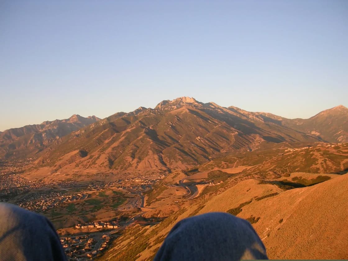
Utah's tourism listing shows no entrance fee, though it links to a day-use fee payment, and camping at the site costs $15 a night. The view takes in both the Salt Lake and Utah valleys from a single vantage point, which almost nowhere else in the region offers. And watching experienced pilots work a ridge — carving back and forth along the slope, gaining height without an engine — is absorbing in a way that photographs do not convey.
Practical notes. Facilities are minimal: expect a gravel parking area and signage rather than restrooms and drinking water, and bring what you need. Pets are allowed but must be leashed. Mornings are when the south side is active. And a special use permit is required for commercial activity at the park, which specifically includes professional photography you are being paid for — relevant to anyone thinking about engagement or family photos at golden hour on the mesa.
On camping, sources conflict: some describe overnight camping as permitted at the south-side park, others state that no camping is available. We are not going to resolve that from here. Utah State Parks publishes the current rules, and if camping is part of your plan, confirm it before driving out.
Fitting it into a Utah Valley day
The site sits at the far north end of the county, off I-15 at exit 288, which puts it close to a cluster of other things.
From Provo it is a straightforward drive north up the interstate, under an hour outside peak traffic. From Lehi it is a few minutes. Thanksgiving Point is nearby, which makes a morning at the flight park and an afternoon in the gardens or museums a reasonable family day.
Because the south side flies in the morning, this works better as a start-of-day trip than an afternoon one — which is also when summer temperatures on an exposed gravel mesa are tolerable.
The short version
Flight Park State Recreation Area is a Utah state park on the south side of Point of the Mountain, just north of Lehi, managed by Utah State Parks and the state's hang gliding and paragliding association. A Lake Bonneville bench in the gap between two valleys produces some of the most reliable ridge lift in North America, which is why pilots come here from around the world to learn. Fly the south side in the morning and the north side in the evening. Book tandem with a school and ask about their weather policy first. And if you only want to watch, go early, bring water, stay out of the landing zone, and give the streamers room.
Related Guides
- Things to Do in Draper, Utah, From Provo
- Things to Do in Lehi, Utah (2026)
- The Murdock Canal Trail
- Living in Lehi, Utah (2026)
- The Complete Provo Hiking Guide (2026)
- Summer Activities in Provo & Utah Valley (2026)
- I-15 Through Utah County: Exits and Express Lanes
- The Point development — what is happening on the ground below the ridge
- Loveland Living Planet Aquarium from Provo: The Drive, the Tickets, the Exhibits, and a Plan for the Day
Frequently Asked Questions
Where is the Point of the Mountain flight park?
Do you need experience to paraglide at Point of the Mountain?
What time of day should you go to Point of the Mountain?
How much does a tandem paragliding flight cost in Utah?
Is Flight Park free to visit?
Why is Point of the Mountain such a good flying site?
Can you camp at Flight Park State Recreation Area?
Is Point of the Mountain safe for spectators?
Sources
The facts in this guide were checked against these sources. Hours, fees and rules change, so confirm anything time-sensitive with the source before you go. How we make Provo.com.
- Flight Park State Recreation Area, Utah State Parks. Checked October 12, 2026.
- Flight Park State Park, Visit Utah (utah.com). Checked October 12, 2026.