More on Lehi: every guide we have published there, in one place.
Traverse Mountain is the most misunderstood address in north Utah County, and the misunderstanding is structural rather than careless: the name refers to two different things at once.
There is Traverse Mountain the area — a large swathe of north Lehi climbing the slopes below Traverse Ridge, containing many subdivisions, a retail district, schools, offices and several thousand homes.
And there is Traverse Mountain the subdivision — a specific HOA-governed community inside that area, with a clubhouse, a pool, and monthly dues.
Buy a house in the first without checking whether it is in the second, and you will find out the difference the first time you try to use the pool.
Where it is
Traverse Ridge is the high ground that separates Utah Valley from the Salt Lake Valley. It is the reason the two valleys feel like separate worlds despite being a short drive apart, and it is the reason I-15 pinches where it does at the Point of the Mountain.
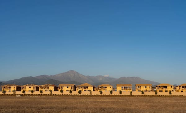
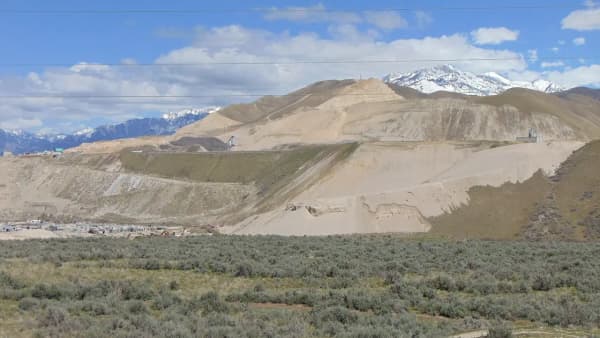
Traverse Mountain occupies the Utah County side of that ridge — the south-facing slopes above Lehi, looking out across the valley toward Utah Lake and Mount Timpanogos. The elevation is the whole point. Homes up there have views that homes on the valley floor simply cannot have, and the higher you go the more you pay for them.
The practical geography: I-15 runs along the bottom, the Timpanogos Highway (SR-92) interchange is the main gateway, and the residential streets climb from there. Everything above the interchange is uphill, which matters more in January than the brochures suggest.
The area-versus-subdivision problem, in detail
This deserves its own section because it costs people real money.
An HOA is a legal entity attached to specific platted lots. "Traverse Mountain" as a place name has no legal boundary at all — it is a marketing and colloquial term that developers, agents and residents all use loosely.
So within the broad Traverse Mountain area you will find:
- Homes inside the Traverse Mountain HOA proper, paying dues and holding clubhouse and pool rights
- Homes in other, separate associations with their own dues and their own (often different) amenities
- Homes with no association at all
All of them will be described as "Traverse Mountain" in conversation, and many will be described that way in listings.
What to do about it. Before making an offer, ask for the name of the specific association, not the area. Ask what the dues cover — the Traverse Mountain subdivision's dues have historically covered clubhouse and pool access and shared community areas, but not landscaping, water or other utilities, which is a narrower package than buyers sometimes assume. And ask for the association's current fee schedule in writing rather than accepting a number from a listing or a video, because dues are reset by boards and stale figures circulate for years.
Our guide to HOAs in Utah Valley covers how to read the governing documents once you have them.
The trails, which are the real amenity
If there is one thing that distinguishes living up here, it is the open space.
Lehi City's own trails master plan states that the city owns more than 900 acres of open space in the Traverse Mountain area. That is a substantial public landholding for a single city, and the plan exists to lay out a strategy for turning it into a connected, sustainable trail system rather than a scatter of disconnected paths.
The plan is worth understanding in outline because it tells you what to expect over time. It commits the city to building trails to recognized standards, specifically citing the International Mountain Bicycling Association and the Bureau of Land Management. It notes that implementation must be phased over multiple years, with the pace depending on funding, property-owner permissions, and how private development proceeds. And it identifies priority trails for the city to consider first.
Two honest implications follow. First, the trail network up here is genuinely good and getting better, and that is a documented city commitment rather than a sales pitch. Second, a trail shown on a plan is not a trail on the ground. If a specific connection matters to you, walk it before you buy rather than trusting a map.
The plan also touches something few residents ever think about: Lehi notes that it holds statutory immunity under Utah Code 63G-7-201(4)(n) for certain trails along ditches, canals, streams and rivers. That provision is part of why Utah cities are willing to open canal-side corridors to the public at all — the liability framework makes it possible. The Murdock Canal Trail further south exists for related reasons.
The outlets, and what they do to the interchange
The Outlets at Traverse Mountain sit at the base of the hill by the freeway, and they anchor the commercial district.
For residents this is a convenience that most Utah County suburbs do not have — a substantial retail center within a few minutes of the front door, alongside the restaurants and services that have grown up around it.
For the road network it is a complication. The outlets draw shoppers from well beyond Lehi, and they share an interchange with commuters, with traffic bound for Thanksgiving Point, and with everyone heading for the Point of the Mountain. Saturday afternoon at that junction is not a local traffic pattern; it is a regional one.
If you are house-hunting up here, drive the interchange on a Saturday as well as a Tuesday. It is a different road.
The employment picture, which is the reason any of this exists
Traverse Mountain did not fill up because of the views alone. It filled up because of where it sits relative to jobs.
North Lehi is the heart of what everyone now calls Silicon Slopes, and the tech campuses along the corridor — Adobe's among the most visible from the freeway — are minutes from the residential streets. Lehi's growth through the 2010s was driven substantially by high-paying technology employment, and Traverse Mountain is where a lot of that payroll bought houses.
That produces a specific housing profile: newer construction, larger floor plans, executive and custom homes toward the upper slopes, and a resale market that behaves differently from older Utah County stock. Our guides to Silicon Slopes and tech jobs in Utah Valley cover the employment side properly.
It also produces a dependency worth naming. A neighborhood built on one industry's payroll is exposed to that industry's cycles in a way a mixed neighborhood is not. That is not a prediction, just a structural fact about the place.
Schools, and a change that is coming
Traverse Mountain has been served by Alpine School District, and Lehi's high schools — Lehi, Skyridge and Westlake — have absorbed the city's growth with repeated boundary adjustments.
Two things make school questions unusually unstable here.
The first is growth. Boundaries in north Lehi have shifted more than once as new subdivisions came online, and a boundary that held for a family who bought in 2019 may not hold for a family buying now.
The second is bigger. Alpine School District splits into three separate districts effective July 1, 2027 — Aspen Peaks, Lake Mountain and Timpanogos. That is a genuine structural change to how schools in this part of the county are governed and funded, not a routine rezoning.
The practical advice is unusually firm: verify the assignment for the specific address with the district, and ask what the split means for it. Do not take a school assignment from a listing, a neighbor, or this page. Our Alpine School District guide and school boundaries guide go into the change in more detail.
The commute, honestly
The location is excellent and constrained, and which one dominates depends entirely on which direction you travel.
Heading south into Utah County — Lehi proper, American Fork, Orem, Provo — the run is straightforward and mostly uncongested outside rush hour.
Heading north into the Salt Lake Valley — you are entering I-15 at the approach to the Point of the Mountain, which is among the most reliably congested stretches of freeway in Utah. Living at Traverse Mountain means you are first in the queue rather than stuck behind twenty miles of it, which helps, but the pinch is still the pinch.
There is no FrontRunner station on the hill. The nearest rail options are down in the valley, and reaching them means driving. Anyone hoping to live car-light should look closely at that before committing; our FrontRunner commuting guide covers what the service does.
Winter adds the last variable. These are hillside streets at elevation, and the city plows them, but a steep driveway facing the wrong way is a different daily experience from a flat one in Orem. Our notes on winter tires and canyon driving apply here more than most Utah County addresses.
The Draper question
People ask constantly whether Traverse Mountain is in Draper. It is not.
Draper is in Salt Lake County, over the ridge. The county line runs along the high ground above the neighborhoods. Traverse Mountain addresses are Lehi, Utah County — Utah County property tax, Lehi city services, Utah County elections.
The confusion has real roots, though. The two communities share the same ridge and the same skyline, some development documents for parcels near the top reference land extending toward Draper, and from the freeway the hillside reads as one continuous slope of houses. It looks like one place. It is two counties.
This matters practically for property tax, for which courts and clerk's office you use, and for every service that is organized by county rather than city.
Who it suits
It suits buyers who want newer, larger housing with views and immediate trail access, who work in the north-county tech corridor, and who are comfortable paying a premium — in price and often in dues — for a hillside address.
It suits less well anyone who wants walkable urbanism, anyone who commutes north daily and hates traffic more than they love views, anyone who wants an older home with character, and anyone whose budget is tight enough that HOA dues and a longer winter driveway matter.
It is a poor fit for someone who wants to be near BYU or downtown Provo. Traverse Mountain is at the far north end of Utah County. Provo is a real drive, not a hop, and if your life is centered on campus you are living in the wrong end of the valley. Our Lehi versus Provo comparison sets the two side by side.
The one thing to verify before you sign
If you take a single action from this page, make it this: get the name of the specific homeowners association attached to the specific lot, in writing, along with its current dues and what they cover.
Everything else here — the trails, the outlets, the commute, the schools — is knowable from a couple of visits at different times of day. The HOA question is the one that hides inside a place name that two different entities both legitimately use, and it is the one that surprises people after closing rather than before.
The ridge itself, and why it runs the wrong way
Most mountain ranges in this part of the world run north to south. The Wasatch does. The Oquirrhs do. Basin and Range topography is a series of long parallel north–south ridges with valleys between them, and Utah's whole settlement pattern follows those grooves.
Traverse Ridge runs east to west, cutting across the grain, and that single geological accident is responsible for a startling amount of daily life in northern Utah County.
It is why Utah Valley and the Salt Lake Valley are two distinct valleys rather than one long one. It is why the two have separate weather, separate lakes, separate counties and — for most of their history — separate economies. It is why every road, rail line and pipeline between Salt Lake City and Provo has to funnel through one narrow gap, which is the Point of the Mountain. And it is why that gap is congested: there is no alternative route, because a ridge crossing the valley leaves exactly one convenient low spot.
The ridge also generates the wind that made Point of the Mountain internationally known among paragliders. Air moving across the valley floor is forced up the slope, producing reliable lift on both the north and south sides depending on conditions. Residents on the hill see the canopies most afternoons in season; our paragliding guide covers the flying itself.
There is one more layer written into the hillside. The horizontal benches you can see cut across these slopes — and across the Wasatch front generally — are old shorelines of Lake Bonneville, the Ice Age lake that covered much of western Utah. A great deal of Utah Valley's most desirable housing sits on those benches, for the same reason it always has: the ground is well drained, the views are long, and the gravel is easy to build on. Traverse Mountain is a bench neighborhood in the oldest sense of the term.
Living above the inversion
This is the advantage of elevation that nobody puts in a listing, and it is worth understanding properly because it is frequently overstated.
In winter, Utah Valley experiences temperature inversions — cold, dense air settles on the valley floor with a layer of warmer air above it, the lid stops the cold air mixing, and pollutants accumulate underneath. It is a seasonal fact of life along the whole Wasatch Front and it is why the valley's worst air-quality days cluster in December and January.
The relevant point for a hillside neighborhood is that an inversion has a top. Homes above the inversion layer can sit in clear air and sunshine while the valley floor below is under gray murk. On the right January morning, the difference between Traverse Mountain and central Lehi is dramatic, and long-time bench residents across Utah Valley will all tell you the same story.
Three honest caveats, because this gets oversold by people selling hillside houses.
The inversion's top varies. It is not a fixed altitude, and it moves with the weather system. A neighborhood that is above the lid in one storm cycle is inside it in the next, and the lower slopes of Traverse Mountain are inside it far more often than the upper ones.
Being above it does not exempt you from it. You still drive down into the valley for work, school and shopping, and you breathe it while you are there.
And elevation cuts both ways across the year. The same height that lifts you out of the winter murk gives you more snow, colder nights and steeper approach roads, which is a real trade rather than a free upgrade. Our guide to Provo's elevation and altitude covers what living high does, and Provo weather covers the seasonal pattern.
Related Guides
- Living in Lehi, Utah: The Complete Guide
- Lehi vs Provo: Which Should You Choose?
- Silicon Slopes Explained
- The Point of the Mountain Development
- HOAs in Utah Valley: What to Know Before You Buy
- The Murdock Canal Trail
- Alpine School District: The 2027 Split Explained
- Things to Do in Lehi, Utah
Frequently Asked Questions
Is Traverse Mountain a city?
Do all Traverse Mountain homes pay HOA dues?
How much are Traverse Mountain HOA dues?
Are there trails at Traverse Mountain?
What is at the Outlets at Traverse Mountain?
Is Traverse Mountain in Alpine School District?
How long is the commute from Traverse Mountain to Salt Lake City?
Is Traverse Mountain part of Draper?
Sources
The facts in this guide were checked against these sources. Hours, fees and rules change, so confirm anything time-sensitive with the source before you go. How we make Provo.com.
- Traverse Mountain Trails Master Plan (narrative), Lehi City. Checked October 12, 2026.
- Studies and Master Plans, Lehi City. Checked October 12, 2026.
- Update: Commissioners vote on Alpine School District boundary maps, Utah County. Checked October 12, 2026.