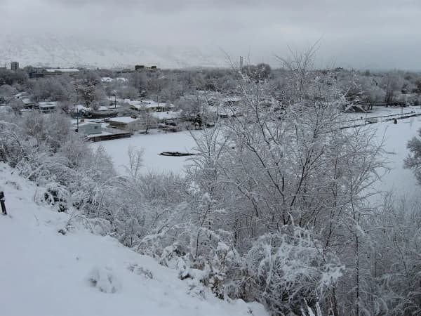
Provo gets 44.9 inches of snow in a normal year, according to the National Oceanic and Atmospheric Administration's official 1991-2020 climate normals for the Provo BYU weather station. January is the snowiest month (12.5 inches), and December through February bring nearly three-quarters of the total. Recent winters have been lighter: the last 10 seasons averaged 29.2 inches, and 2025-26 brought only 3.9.
Monthly normals below are from NOAA's National Centers for Environmental Information (NCEI) 1991-2020 monthly normals. Season totals, first- and last-snow dates and the biggest storms are our tally of NCEI's daily records for the same station, downloaded Nov. 9, 2026. The station sits at about 4,570 feet on the BYU campus; our Provo weather by month guide has temperatures and rain.
Provo snowfall by month
| Month | Normal snowfall | Days with 1"+ of new snow | Days with 1"+ on the ground |
|---|---|---|---|
| October | 0.6" | 0.3 | 0.1 |
| November | 4.6" | 1.8 | 3.0 |
| December | 11.2" | 4.0 | 12.1 |
| January | 12.5" | 4.3 | 16.6 |
| February | 8.7" | 3.1 | 7.4 |
| March | 4.0" | 1.6 | 1.1 |
| April | 3.1" | 1.2 | 0.3 |
| May | 0.2" | 0.1 | 0.0 |
| June to September | 0.0" | 0 | 0 |
| Year | 44.9" | 16.4 |
Read the last column as the snow you'll live with: in an average January, about 17 days have at least an inch on the ground at the station. By March that drops to about a day, which is why Provo's spring snowstorms tend to melt off the streets within a day or two.
When the first and last snow come
In the 27 complete seasons from 1991 to 2020, Provo's first measurable snow (a tenth of an inch or more) came on a median date of Nov. 8, and the last came around April 7.
- Earliest first snow: Oct. 12, 1997.
- Latest last snow: May 24, 2010.
- This season: through Nov. 6, 2026, the station had recorded no snow yet.
Every recent winter in Provo
Totals are July through June, from NCEI's daily records. A few seasons have missing days, marked with an asterisk, and may run slightly low.
| Season | Snowfall | First snow | Last snow |
|---|---|---|---|
| 2025-26 | 3.9" | Nov. 30 | Feb. 20 |
| 2024-25 | 16.1" | Dec. 13 | April 1 |
| 2023-24 | 19.8" | Nov. 24 | March 25 |
| 2022-23 | 67.8" | Oct. 24 | April 5 |
| 2021-22 | 30.0" | Dec. 9 | April 13 |
| 2020-21 | 19.6" | Nov. 8 | March 21 |
| 2019-20 | 22.6" | Nov. 28 | April 2 |
| 2018-19 | 29.1" | Dec. 1 | March 13 |
| 2017-18 | 31.4" | Dec. 4 | April 17 |
| 2016-17 | 51.4" | Nov. 17 | Feb. 27 |
| 2015-16 | 27.2" | Nov. 16 | Feb. 14 |
| 2014-15 | 10.1" | Nov. 13 | Dec. 29 |
| 2013-14* | 32.8" | Sept. 26 | March 11 |
| 2012-13* | 55.9" | Oct. 25 | April 16 |
| 2011-12 | 21.1" | Nov. 6 | April 6 |
| 2010-11* | 61.4" | Oct. 27 | April 30 |
Two things stand out. Only two of the last 10 winters, 2016-17 and 2022-23, beat the 44.9-inch normal. And 2025-26 was the lowest complete season in the station's daily record, which runs back to 1915. It matched what happened up the valley: Salt Lake City recorded 3.7 inches for the season, shattering its 1933-34 record low, KSL reported, and the National Weather Service said Salt Lake City had its warmest winter since records began in 1874, averaging 40.7 degrees.
The big winters
Among complete seasons in the record, the snowiest was 1983-84, at 127.6 inches, followed by 1988-89 (93.5), 1992-93 (92.0) and 1984-85 (90.6). The biggest single-day snowfall was 16 inches on Jan. 12, 1918; the biggest in recent decades was 13 inches on Feb. 3, 1989, and 11 inches on Dec. 21, 2010.
How the rest of Utah County compares
Snow in Utah County depends mostly on where you sit against the mountains. NOAA's 1991-2020 normals for the county's weather stations with snowfall records:
| Station | Area | Elevation | Snow per year | Snowiest month |
|---|---|---|---|---|
| Alpine | North county bench | 5,100 ft | 74.4" | Dec. (17.5") |
| Spanish Fork Power House | Mouth of Spanish Fork Canyon | 4,720 ft | 66.0" | Jan. (17.3") |
| Santaquin | South county bench | 5,160 ft | 55.1" | Jan. (13.4") |
| Provo BYU | Provo east side | 4,570 ft | 44.9" | Jan. (12.5") |
| Pleasant Grove | North county | 4,690 ft | 41.4" | Jan. (11.5") |
| Fairfield | West county | 4,880 ft | 33.6" | Jan. (10.7") |
| Utah Lake Lehi | Lakeshore, Lehi | 4,500 ft | 26.3" | Dec. (8.2") |
The pattern holds across the valley: bench neighborhoods and canyon mouths (Alpine, Highland, north Orem, east Provo, Mapleton, Spanish Fork's canyon side) get noticeably more snow than lakeshore neighborhoods (west Provo, Vineyard, Saratoga Springs, the Lehi lakeshore). The canyons above get far more: ski areas such as Sundance top out near 8,250 feet, more than 3,600 feet above the Provo station.
Living with Provo snow
- Snow tires or all-weather tires matter more for the canyon than for city streets. See winter tires and canyon driving and Utah's traction law and chains.
- Inversions, not snow, are the bigger midwinter problem. Cold air trapped under warm air on calm days after a storm brings Utah County's worst air of the year; our Provo weather guide explains.
- For students: BYU's and UVU's winter semesters start in early January, right as the snowiest month begins. Our BYU winter 2027 semester dates guide has the calendar.
- Plan for winter fun: winter activities in Provo and learning to ski near Provo.
Related guides
- Provo weather by month
- Provo sunrise, sunset and daylight by month
- Winter activities in Provo
- Winter tires and canyon driving
- Sundance Resort guide
- Provo Canyon in winter 2026-27
- Elevation of every Utah County city
- Inversion season and air quality in Utah County
Frequently Asked Questions
How much snow does Provo get a year?
What is the snowiest month in Provo?
When does it usually first snow in Provo?
When is the last snow of the season in Provo?
How much snow did Provo get last winter?
Does Orem or Spanish Fork get more snow than Provo?
Do Provo streets stay snowy all winter?
Sources
The facts in this guide were checked against these sources. Hours, fees and rules change, so confirm anything time-sensitive with the source before you go. How we make Provo.com.
- It is official: Salt Lake City shatters previous record-low snow collection total, KSL.com. Checked November 9, 2026.
- Salt Lake City sets record for warmest winter in more than 150 years, KJZZ. Checked November 9, 2026.
- U.S. Climate Normals 1991-2020, monthly: PROVO BYU, UT (USC00427064) and other Utah County stations, NOAA National Centers for Environmental Information. Checked November 9, 2026.
- Global Historical Climatology Network daily: PROVO BYU, UT (USC00427064), NOAA National Centers for Environmental Information. Checked November 9, 2026.
- U.S. Climate Normals 1991-2020, monthly: ALPINE, UT (USC00420061), NOAA National Centers for Environmental Information. Checked November 9, 2026.