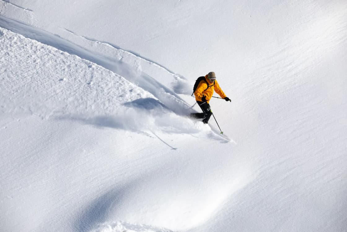
Anyone who skis in Utah, buys a ski license plate or watches a resort ad eventually runs into the phrase "The Greatest Snow on Earth." It is a slogan, a registered trademark and, according to the scientists who study it, a claim with some real physics behind it, though not quite the physics most people repeat. The popular version credits the Great Salt Lake. The research coming out of the University of Utah's atmospheric sciences department says the lake matters, but much less than the legend suggests, and that the bigger reasons are dry air, storm size and the order in which snow falls.
This explainer walks through what researchers and the National Weather Service have published about Utah snow: what a snow-to-liquid ratio is, why the 10-to-1 rule taught in school does not fit the Wasatch, how lake-effect storms form and how much snow they contribute, where the slogan came from, and what all of it means for a Provo skier heading to Sundance or the Cottonwood Canyons. It is a companion to our guide to Utah's national parks from Provo, ranked, which covers the rest of the state's scenery; this one stays in the mountains above Utah Valley.
All details below were checked on Nov. 20, 2026, against the sources named in each section. Forecasts, road rules and resort figures change, so look again before you go.
Utah snow quick facts
| Topic | What sources say | Source |
|---|---|---|
| Average water content, Utah snow | About 8.5 percent | Jim Steenburgh, via The Salt Lake Tribune; Ski Utah |
| Average water content, Sierra Nevada | Roughly 12 percent | Steenburgh, via The Salt Lake Tribune |
| Machine-made snow | About 24 to 28 percent moisture | Ski Utah |
| Snow-to-liquid range | About 2 to 1 (slush) up to about 100 to 1 | University of Utah |
| Lake-effect share, Cottonwood Canyons | About 6 percent of total snowfall | Steenburgh, via the Deseret News |
| Lake-effect storms per winter | 3 to 20 since 1998, about a dozen on average | University of Utah (2013) |
| Alta average snowfall | 547 inches, per Alta's website | The Salt Lake Tribune |
| Sundance average snowfall | Around 250 inches | Sundance Mountain Resort |
| Slogan first in print | Dec. 4, 1960, Salt Lake Tribune Home Magazine | Ski Utah |
| State trademark | 1975 | Ski Utah |
| Drive from Provo to Sundance | About 16 miles, roughly 30 minutes | OSRM routing |
Who this explainer is for
This page is for anyone who has heard the slogan and wondered how much of it is marketing: new BYU and UVU students skiing their first Utah winter, families deciding whether to buy passes, people who moved here from the Midwest or the East and want to know why the forecast talks about "density," and drivers who want to understand why a light-snow day can still mean a traction-law day on the canyon roads.
If you just want to know how much snow lands in town, our Provo snowfall by month guide covers the valley numbers. If you are planning a day on the mountain, the Sundance resort guide and Skiing Near Provo cover tickets, lifts and logistics. This page explains the snow itself.
What "light" snow means: the snow-to-liquid ratio
Meteorologists describe how light or heavy snow is with a number called the snow-to-liquid ratio, or SLR. It answers a simple question: how many inches of fresh snow does it take to make one inch of water once it melts? A related measure, density, expresses the same thing as a percentage of water.
A University of Utah article published Nov. 20, 2025, on research led by research assistant professor Peter Veals and professor Jim Steenburgh lays out the range. It says ratios "can be as low as 2-to-1, or two inches of snow equals an inch of liquid water, typical of slush," and that ultralight powder can reach about 100 to 1.
Most people learned that 10 inches of snow equals an inch of rain. The same article says that rule of thumb "was a product of Eastern weather forecasting," and that Steenburgh described it as easy to use, since you just multiply by 10, but of little relevance to the West.
When Steenburgh says Utah snow averages about 8.5 percent water, as he told The Salt Lake Tribune in 2021, that translates to a ratio of roughly 12 inches of snow per inch of water. The Tribune reported his comparison figure for the Sierra Nevada at about 12 percent water, which works out to a little over 8 to 1. That is in line with a National Weather Service technical attachment by Darren Van Cleave of the NWS office in Sacramento, which found that snow-to-liquid ratios on the west slopes of the northern Sierra "average around 9." Ski Utah's own history page uses the same 8.5 percent figure for Utah and about 12 percent for storms in the Cascades and Sierra, and puts machine-made snow at about 24 to 28 percent moisture.
The difference sounds small on paper. On a ski slope, it is the difference between snow you float through and snow you push.
Why the ratio changes from storm to storm
No single number describes every storm. The 2025 University of Utah research found that the amount of water in a storm, called snow-water equivalent, is the single most important predictor of the ratio. As Veals put it in the university's article, "the more SWE you have, the more the storm's snow weighs and it densifies itself." Elevation, temperature and wind speed also matter.
Temperature works through the shape of the ice crystals. The NWS Sacramento paper, citing a 1999 crystal-growth chart by Libbrecht, says dendrites, the classic branching six-armed snowflakes, support higher ratios because they are less dense, and that dendrite growth is favored at about minus 12 to minus 18 degrees Celsius inside the cloud. Colder or warmer than that band, crystals tend toward columns and needles that pack more tightly. The same paper notes that strong winds can break dendrites apart, and it cites earlier work by Trevor Alcott and Steenburgh that tied temperatures aloft and wind to snow-to-liquid ratios at a ski area near Salt Lake City.
The research measured snow in Provo Canyon
Utah County is part of this research. The University of Utah team gathered hand-measured snow data from 14 mountain sites across the West, and three of them are in Utah: Alta in Little Cottonwood Canyon, the Spruces campground in Big Cottonwood Canyon, and Aspen Grove in Provo Canyon, near Sundance. Observers recorded snow height and water content during every storm cycle, daily or twice daily. The university says the team relied on manual measurements because automated gauges "can't always accurately record snowfall in windy conditions."
The resulting study, "Predicting Snow-to-Liquid Ratio in the Mountains of the Western United States," appeared in the American Meteorological Society journal Weather and Forecasting, and was funded by the National Oceanic and Atmospheric Administration. A machine-learning model the team trained explained nearly half of the variability in snow density, according to the university, while current operational models explained less than a quarter. The practical payoff is better snowfall forecasts, since a forecast that gets the water right but the ratio wrong will still miss the snow depth.
Why Utah snow is light: the three reasons
In the 2021 Tribune piece, Steenburgh credited Utah's snow quality to three factors, and the paper noted that none of them depends on the Great Salt Lake.
Storm size. Utah gets many storms that are, in the Tribune's paraphrase of Steenburgh, "neither too big nor too small." Very large storms carry a lot of water, and the University of Utah research says heavy water loads compress the snow. Frequent moderate storms keep refreshing the surface with lighter snow.
Low moisture. By Steenburgh's numbers, Utah gets snow that averages about 8.5 percent water rather than the 12 percent typical of the Sierra.
Right-side-up layering. Many Utah storms start warmer and finish colder. The Tribune described it this way: early snow falls in warmer air and packs a denser base, and as temperatures drop, lighter powder lands on top. Skiers and forecasters call this a "right-side-up" snowfall. In a December 2025 Deseret News story published on KSL.com, Steenburgh said Utah's frequent "Goldilocks" storms "produce what are called right-side-up snowfalls."
That last point is the one skiers feel most. A heavy base supports your skis, and a light top layer gives the floating sensation that powder skiers chase. Ski Utah's history page quotes avalanche scientist Ed LaChapelle, writing in 1962, making the same argument: "The best deep powder skiing is not found in the lightest snow."
Utah does not have the driest snow
This is where the slogan and the science part ways a little. Steenburgh told the Deseret News, "We don't have the driest snow on Earth, but that's a good thing in many ways," and the paper reported his view that mountains in Montana, Idaho and western Colorado have snow with lower water content. Ski Utah's own history page concedes that Utah does not have the driest snow (it names New Mexico) or the highest average snowfall (it names Mt. Baker in Washington).
Steenburgh's framing, as quoted by the Deseret News: "I call Japan the greatest snow climate on Earth, and I say Utah has the greatest snow on Earth." He added, "What I usually tell people is the greatest snow on Earth is in the eye of the beholder," and said Utah's powder reputation "is based strongly on the Cottonwoods."
The argument for Utah, as the sources lay it out, is the combination: a lot of snow (the Deseret News reported that Utah's mountains typically receive more than 500 inches above 8,500 feet), snow that is light enough to ski well, layered in a way that skis well, and big mountains close to a major airport and city.
The Great Salt Lake effect: real, but smaller than its reputation
The lake effect is the most repeated explanation for Utah powder, and it is a real phenomenon. A 2013 University of Utah news release, describing a study by Trevor Alcott and Steenburgh in the journal Monthly Weather Review, explains the basic setup: "The lake effect occurs when a cold mass of air moves over a large body of warmer water." The air picks up heat and moisture, rises, cools and drops snow downwind.
The National Weather Service office in Salt Lake City takes these storms seriously. A 2005 NWS Western Region case study by Mark Jackson of the Salt Lake City forecast office says local meteorologists coined the phrase "Dreaded Lake Effect," or "DLE," for them, because they are hard to predict and can drop heavy snow over a small area. The study lists favorable conditions including a temperature difference of at least 16 degrees Celsius between the lake surface and the 700-millibar level aloft, and no capping stable layer near the surface.
Why the lake keeps working all winter
The lake's salt plays two roles, according to the same NWS paper. Because of its high salinity, the Great Salt Lake "typically stays unfrozen, only freezing near its very few fresh water inlets," so it can keep feeding storms through the winter. But salty water also gives off less moisture than fresh water. The paper cites research by Onton and Steenburgh estimating that the lake's hypersaline composition results in a 17 percent reduction in snowfall compared with a freshwater lake of the same size.
How much snow it adds
Here the numbers get modest. The 2013 University of Utah release says that since 1998, the lake "has helped generate from three to 20 lake-effect snowstorms each winter," about a dozen on average, and that these storms "account for about 5 percent to 8 percent of the precipitation south and east of the Great Salt Lake" from mid-September to mid-May.
Steenburgh told The Salt Lake Tribune in 2021, "The Great Salt Lake effect is not as important as many people think." He estimated that the lake provides about 6 percent of the annual snowfall at the Cottonwood Canyons resorts, with the most in October and November. The Tribune applied that to Alta: against the 547-inch average on Alta's website, Steenburgh's 10-year survey attributes only about 30 to 40 inches a year to the lake. He said skiing "will survive without it," but that the lake "can be helpful for building the early season snowpack, provide some nice dry powder at the end of storms."
So the lake contributes a few storms a year, a handful of percent of the total, and some light snow on the back end of systems. It does not explain why Utah snow is light in general.
The mountains matter as much as the lake
The 2013 study added a twist. Simulating an Oct. 26-27, 2010, storm that dropped 13 inches at Alta, Alcott and Steenburgh found that a version with the lake removed produced about 90 percent less snow, and a version with the lake but flat terrain produced about 94 percent less. Mountains upstream and around the lake, the release says, help channel cold air so it converges over the water, and the Wasatch and Oquirrh ranges funnel air into the valley. The conclusion in the release's headline: lake-effect snow sometimes needs mountains.
Wind direction then decides where the bands land. The NWS case study of an Oct. 31, 2004, lake-effect storm reported 4 to 6 inches across the Salt Lake Valley and up to 18 inches at Alta. For Utah Valley, none of the sources checked for this guide measured how often lake bands reach Provo or Sundance, which sit well south of the lake. If a forecast mentions lake effect, the Salt Lake City NWS forecast discussion is the place to see where the forecasters expect it.
Where the slogan came from
The phrase is older than most people guess. According to Ski Utah's history page, Tom Korologos, skiing editor of The Salt Lake Tribune in the 1960s, wrote it, and it first appeared in the Tribune's Home Magazine insert dated Dec. 4, 1960. Starting in 1962, Ski Utah says, the Utah Travel Council and many of the state's ski resorts used it in promotional materials.
The origin was lost for decades. Ski Utah says Steenburgh rediscovered it while researching his book, Secrets of the Greatest Snow on Earth, and that Korologos's brother Mike confirmed it.
The legal history, as Ski Utah tells it:
- Utah registered the phrase as a state trademark in 1975.
- The phrase was added to Utah license plates in the mid-1980s.
- Utah applied for a federal trademark in 1988, and the U.S. Trademark Trial and Appeal Board approved it in 1995.
- Ringling Bros. and Barnum and Bailey, which had used "The Greatest Show on Earth" since P.T. Barnum's era, sued the Utah Division of Travel Development in January 1996, arguing that Utah's slogan diluted its trademark. Ski Utah says the circus "failed to prove that consumers were confused" and could not stop Utah from using the phrase. Ski Utah's page cites a 1997 federal court decision from the Eastern District of Virginia.
For more on the people and places behind Utah skiing, see our history of skiing in Utah.
What this means for Utah County skiers
Sundance Mountain Resort, up Provo Canyon below Mount Timpanogos, is the closest resort to Provo. Its FAQ page says the mountain gets "around 250 inches of Utah's famously light, dry powder each season," and lists 2,150 feet of vertical and about 608 skiable acres served by 10 lifts. Its skiing page lists the summit at 8,250 feet. Other websites publish different snowfall averages for Sundance, some lower and some higher, so treat any single number as approximate.
That puts Sundance's reported average well under the 547 inches The Salt Lake Tribune cited for Alta. Steenburgh's comment that Utah's powder reputation is "based strongly on the Cottonwoods" is a useful reminder: the snow statistics most often quoted for Utah come from the high resorts of Little and Big Cottonwood Canyons, not from every mountain in the state.
What carries over to Sundance is the physics. The same inland storms reach Provo Canyon, and the University of Utah team chose Aspen Grove, just up the road from the resort, as one of its three Utah measurement sites. The research gives no separate average ratio for Aspen Grove, so it is not possible to say from these sources whether Sundance snow runs lighter or heavier than Alta's.
Practical points the sources support:
- Early season. Steenburgh told the Tribune the lake's contribution peaks in October and November, which helps the early-season snowpack at the Cottonwood resorts. Sundance's skiing page says opening day "typically arrives in early December," while its FAQ says late November, so check the resort's site for the current date.
- Storm timing. A right-side-up storm, warmer first and colder later, tends to give the best skiing at the end of the storm, according to the Tribune's description of layering. A storm that starts cold and turns warm does the opposite.
- Climate trends. In the Deseret News story, Steenburgh said Utah snow is "shifting to high density, which means snowfall is getting a little heavier," and that the effect of climate change in the upper elevations and on north-facing slopes is "almost zero" right now. "But it's coming," he said.
If you're comparing resorts, our Alta from Utah Valley guide covers the drive and parking rules for the resort with the biggest snowfall number in this story.
Getting there from Provo
Sundance is close. OpenStreetMap routing (OSRM) puts the resort about 16 miles and roughly half an hour from Center Street and University Avenue in Provo without traffic, by way of University Avenue north to US-189 up Provo Canyon, then SR-92 to the resort. Alta, by the same routing, is about 44 miles and roughly an hour away via I-15 and Little Cottonwood Canyon, before storm traffic.
Sundance's website shows a status panel for SR-92, Highway 189, UTA bus service, the Park N Ride shuttle and parking lots. Check it the morning you go rather than relying on an earlier look.
For more on the canyon in winter, see Provo Canyon in winter.
Light snow and the roads
Light powder is great for skiing, but none of the sources checked suggest it makes driving easier. Light snow still covers the road, and storms that produce it are often cold, windy and long.
UDOT's current traction law poster lists SR-92 "To Sundance and in American Fork Canyon" among the ski-area highways where traction rules can apply during severe winter weather. UDOT's requirements page, under Utah Administrative Code R920-6, says:
- Two-wheel-drive passenger cars and light trucks need tires with the three-peak mountain snowflake (3PMSF) rating on all wheels, or traction devices on all drive tires.
- All-wheel and four-wheel-drive vehicles need M+S or 3PMSF tires, or traction devices on at least two drive tires.
- Traction devices include chains, cables, snow socks or studs.
- UDOT says drivers may need to comply up to 24 hours before a storm, and that travelers are notified "via road signs, message boards, the UDOT traffic app, and UDOT social media."
Big and Little Cottonwood Canyons are stricter. UDOT's Cottonwood Canyons page says both carry a "Class 3" designation, with a minimum 5/32-inch tread depth for vehicles relying on tires, and that police may cite drivers who do not comply. Our Utah winter driving and traction law guide goes through the rules road by road.
What to bring
The science suggests a few things worth packing for a powder day in the Wasatch:
- Skis or a board suited to soft snow. A rental shop can advise; our Provo and Orem ski rental guide lists options.
- Goggles and face cover. Light snow blows easily, and the same cold, dry storms that make powder make for wind-driven snow.
- Layers. The storms that leave the lightest snow on top are the ones that turned colder as they went.
- Traction equipment or the right tires for the drive, per UDOT's rules above.
Who should skip a powder day
Deep, light snow is not ideal for everyone:
- First-time skiers and riders may prefer to wait for groomed or packed conditions; ask the resort what is groomed that day.
- Drivers without traction-compliant tires or chains should wait until the roads are clear, or use transit. UDOT may put the rules in place before the snow starts.
- Anyone headed past the resort boundary without avalanche training. Light new snow on top of a weaker layer is a classic avalanche setup. Light snow is not the same as stable snow.
Safety and conditions
The resorts manage avalanche risk inside their boundaries. Outside them, you are on your own. The Utah Avalanche Center publishes forecasts for the Provo Area Mountains, which cover Mount Timpanogos and the Cascade ridgeline. Its website could not be loaded for this guide on Nov. 20, so check utahavalanchecenter.org directly for the current danger rating before any backcountry trip. Our avalanche safety guide for Utah Valley and Backcountry Skiing 101 cover training and terrain.
On the day this guide was checked, the NWS Salt Lake City homepage said snow would continue through early Saturday across Utah's mountains, with up to two feet possible in the Wasatch. Storms like that are when both powder and canyon delays are most likely.
What to check before you go
- NWS Salt Lake City (weather.gov/slc). The office's homepage links to its forecast discussion, a probabilistic snow forecast, a snow and avalanche weather page, and the Utah Avalanche Center. The forecast discussion is where meteorologists explain whether a storm will start warm and end cold, and whether lake effect is in play.
- The Utah Avalanche Center forecast for the Provo Area Mountains, if you are leaving resort terrain.
- UDOT traffic and traction status for US-189 and SR-92, or for Little and Big Cottonwood Canyons if you are heading north.
- The resort's own site for lift status, parking and opening dates. Sundance's site shows live status for SR-92, Highway 189, transit and parking.
Sources
- University of Utah, "Improving snowfall forecasts in the Mountain West," Nov. 20, 2025.
- University of Utah, 2013 news release on Alcott and Steenburgh's lake-effect study, via ScienceDaily.
- The Salt Lake Tribune, Aug. 4, 2021, article on Steenburgh, the Great Salt Lake and Utah snow.
- Deseret News via KSL.com, "Does Utah really have the 'greatest snow on Earth'?" Dec. 7, 2025.
- Ski Utah, "The History of 'The Greatest Snow on Earth.'"
- National Weather Service, Van Cleave, "Snow-to-Liquid Ratios over the Northern Sierra Nevada," Western Region technical attachment.
- National Weather Service, Jackson, "Forecasting the 31 October 2004 Lake-Effect Snowstorm of the Great Salt Lake," Western Region technical attachment.
- National Weather Service Salt Lake City homepage, checked Nov. 20, 2026.
- Utah Department of Transportation, traction law requirements, Cottonwood Canyons traction law page and statewide traction law poster.
- Sundance Mountain Resort, FAQ and skiing pages.
Related on Provo.com
- Utah National Parks From Provo, Ranked
- How Much Snow Does Provo Get? Snowfall by Month
- Sundance Mountain Resort Guide
- Skiing Near Provo: Beyond Sundance
- The History of Skiing in Utah
- Utah Winter Driving: The Traction Law, Chains and Canyon Rules
- Avalanche Safety in Utah Valley
- Provo Canyon in Winter
- Provo Weather by Month
Frequently Asked Questions
Is Utah snow really lighter than snow elsewhere?
What is a snow-to-liquid ratio?
How much of Utah's snow comes from the Great Salt Lake?
Does lake-effect snow reach Provo and Sundance?
Who came up with 'The Greatest Snow on Earth'?
Is 'The Greatest Snow on Earth' trademarked?
How much snow does Sundance get?
Does light, dry snow make canyon driving easier?
Sources
The facts in this guide were checked against these sources. Hours, fees and rules change, so confirm anything time-sensitive with the source before you go. How we make Provo.com.
- Snow-to-Liquid Ratios over the Northern Sierra Nevada: Climatology and a Predictive Methodology, National Weather Service. Checked November 20, 2026.
- Forecasting the 31 October 2004 Lake-Effect Snowstorm of the Great Salt Lake, National Weather Service. Checked November 20, 2026.
- National Weather Service Salt Lake City, National Weather Service. Checked November 20, 2026.
- Snow Tire, Chain and Traction Device Requirements, Utah Department of Transportation. Checked November 20, 2026.
- UDOT Traction Law (Cottonwood Canyons), Utah Department of Transportation. Checked November 20, 2026.
- Traction Law Poster (statewide routes), Utah Department of Transportation. Checked November 20, 2026.
- Improving snowfall forecasts in the Mountain West, University of Utah. Checked November 20, 2026.
- Lake-effect snow sometimes needs mountains (University of Utah release), ScienceDaily. Checked November 20, 2026.
- The History of "The Greatest Snow on Earth", Ski Utah. Checked November 20, 2026.
- Frequently Asked Questions, Sundance Mountain Resort. Checked November 20, 2026.
- Skiing and Riding at Sundance Mountain Resort, Sundance Mountain Resort. Checked November 20, 2026.
- Will Utah's snow shrink?, The Salt Lake Tribune. Checked November 20, 2026.
- Does Utah really have the 'greatest snow on Earth'?, Deseret News via KSL.com. Checked November 20, 2026.