
Battle Creek Falls is the hike Utah Valley sends people on when they have ninety minutes, a couple of kids, no gear and no plan. It is short, it is free, it ends at a fifty-foot waterfall you can walk right up to, and the trailhead sits inside Pleasant Grove city limits rather than up some canyon road. That combination is rare enough that on a July Saturday the parking lot behaves like a mall at Christmas.
It is also the most inconsistently described trail in the county, and the reason is more interesting than sloppy blogging.
The trail has two difficulty ratings and both are correct
Look this hike up and you will find it called easy, family-friendly, and about 1.2 miles round trip. Look it up somewhere else and you will find it rated double black diamond, physical rating extreme, average grade 18 percent.
Those are the same trail. They are not the same hike.
The Forest Service knows it as Battle Creek Trail #050, and #050 runs 2.4 miles one way. It climbs from Pleasant Grove up the west face of Mount Timpanogos, meets the Curly Springs Trail #051 at 1.3 miles, and then climbs another 1.1 miles to join the Dry Canyon Trail #049. It is open to hikers, horses and mountain bikes, and the mountain bikers rating it extreme are rating the whole climb.
The waterfall sits roughly half a mile up that trail. Almost everyone walks to the falls and turns around. So when a family blog says 1.2 miles easy and a bike database says extreme, nobody is lying — one is describing the first quarter of the trail and the other is describing all of it.
This also explains the round-trip spread. Published distances run 1.2, 1.3, 1.4 and 1.6 miles, and the variable is simply where you stop: the base of the falls, the top of the falls, or the overlook just past them. Elevation gain to the falls is generally given as about 450 feet.
The practical version: budget an hour if it is just you, two hours with small kids, and treat everything past the falls as a different outing with different shoes.
What the walk looks like
The first stretch out of the trailhead is a wide gravel service road with an easy grade, running alongside the creek. Water pipes follow the canyon here — this drainage feeds part of Pleasant Grove's culinary water — and you will pass the Battle Creek debris basin, a small engineered catchment that most people read as a pond and stop at to throw rocks.
Past that the road narrows to trail. You cross a bridge, and shortly after there is a hole in the rock on the canyon wall that every family in this valley photographs their children standing inside and calls the cave. It is not a cave. It is a very good photo.
Then the trail gets down to business. The last pitch to the falls is short, steep and loose with shale, and it is the only part of this hike that produces incidents. Hikers describe reinforced matting and cable laid into the steepest sections to hold footing, which helps and does not eliminate the problem. This is where you put a hand on a small child rather than trusting them to manage it.
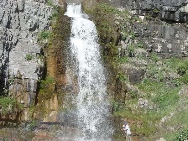
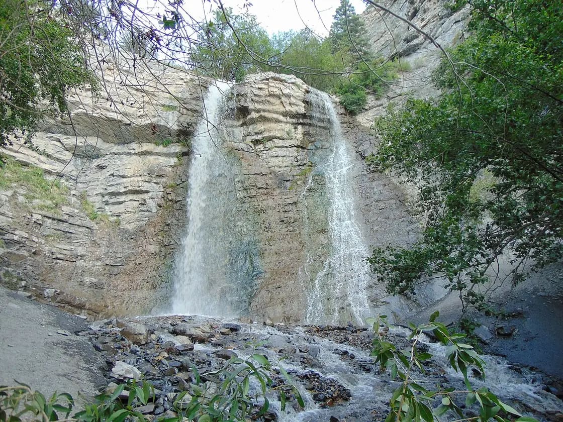
The falls arrive suddenly. Water comes over a rock shelf and lands on rock rather than into any real plunge pool, and the canyon is narrow enough at that point that on a hot day you feel the spray well before you reach it.
The parking lot is mid-project, and that is worth checking before you drive
Through 2026 Pleasant Grove has been rebuilding the trailhead parking area. Winter and spring visitors were routed to a temporary lot lower down near the water tanks, which added uphill distance to the walk. Check the city's current notices for where to park before you go.
The new lot may well be open by the time you read this. Layout, entry and capacity may all differ from whatever a two-year-old blog post described, and a project that slips a few weeks is unremarkable. Pull up the trailhead before you leave and expect the possibility of a changed approach.
What has not changed: the road is 200 South, also signed Battle Creek Drive, and you follow it east until it ends. The trailhead shares its lot with the trail up to the "G" on the foothills above town, which is a separate hike entirely — the G trail picks up on the far side of the Kiwanis Park pavilion, and the canyon trail stays right and heads up the gravel road. On a clear afternoon you may see paragliders launching from the slope below the G.
What the Forest Service says that the trail blogs leave out
Three things appear on the official trail listing and almost nowhere else, and all three matter more than the parts everyone repeats.
There is poison ivy in Battle Creek, and stinging nettle. This is the single most useful sentence on the Forest Service page and it is missing from essentially every family write-up of this hike. On a narrow trail, in shorts, with a dog and a toddler wandering off the tread, that is worth knowing before rather than after.
The tread above and below the falls is exposed and narrow. The Forest Service flags this specifically. There are no handrails and no benches up there. The steep-walled section of canyon just past the falls is beautiful and is not a place to let a group spread out unsupervised.
Expect every user group on any given day. The trail is open to horses and mountain bikes as well as hikers, and the Forest Service notes the high volume directly. Bikes descending the upper trail arrive faster than people expect.
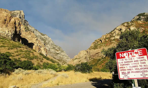
Bear awareness applies here as it does across the Uinta-Wasatch-Cache. And in a dry summer, fire restrictions on the forest change through the season — no fires are permitted along this trail or at the falls regardless, but check current forest restrictions before you assume anything about the wider area.
About standing under the waterfall
Standing in the spray at the base is the whole reason half of Utah Valley does this hike in July, and it is wonderful. It is also worth reading the one warning that experienced trail users repeat and casual guides do not: the rock in this canyon flakes off, and material comes down at the base of the falls.
That is not a reason to skip it. It is a reason not to park a group directly underneath for twenty minutes while everyone takes turns with the camera. Enjoy it, keep it brief, and pay attention to what is above you.
The creek runs shallow through most of the summer and children do wade at the base. Flow varies enormously by season — heavy in spring melt, a trickle by late summer — so what you find depends on when you go and what kind of winter preceded it.
Winter is the version most people never see
This is one of the few waterfall hikes in the valley that improves in January.
The elevation is low, the canyon is short, and snow rarely piles deep enough on the lower trail to stop a determined family. The falls freeze into a huge hollow cone of ice that locals call an ice volcano, with columns and icicles layering across the rock beside it. Groups run guided winter trips and ice rappels here.
Two practical points. Microspikes are the difference between a nice outing and a bad one — the last hundred yards glaze hard, and the ground you would land on is not forgiving. And do not climb inside the hollow ice formation at the base. People who guide trips there put it plainly: getting stuck inside one can kill you. Admire it from beside it.
The winter approach is otherwise the same trail, and the crowd thins to almost nothing on a weekday. What you get in exchange for the traction gear is the canyon quiet, the creek running under ice, and a waterfall that looks structurally different every few weeks depending on how cold the run of nights has been. Regulars come back three or four times a winter for exactly that reason.
One access note that catches people out: both of the valley's other marquee options go away in the cold months. The Alpine Loop road closes seasonally, which ends the Aspen Grove approach to Stewart Falls entirely, and the Sundance chairlift that offers the alternative is a warm-months operation. Timpanogos Cave runs a seasonal schedule set by snow rather than by the calendar. Battle Creek stays walkable when the higher options do not, which is a large part of why it carries so much traffic in winter. For the wider seasonal picture, our guide to winter activities in Provo covers what else is running once the canyons close.
Where the name comes from
Most people hike this canyon without ever asking why a creek in a town called Pleasant Grove is named Battle Creek. The answer is the founding event of Utah Valley's settlement, and it is not a comfortable one.
In early March 1849, a militia party sent south from Salt Lake City under Captain John Scott surrounded a Timpanogos encampment near the mouth of this canyon before dawn and opened fire. The stated cause was reported theft of settlers' cattle, and two men, recorded as Roman Nose and Blue Shirt, had been named as the targets. It was the first violent engagement between Latter-day Saint settlers and the Timpanogos in this valley, and historians generally treat it as the opening of a long deterioration between the two.
The accounts do not agree on the scale, and this page is not going to resolve them. Most say four men were killed. At least one public history project puts the number at seventeen — a figure that appears elsewhere as the size of the encampment, men, women and children together, rather than the death toll. Sources also disagree about what to call the event at all: the Forest Service's own trail page calls it a battle with settlers, other accounts call it a skirmish, and the standard encyclopedia entry titles it a massacre. Those are three different framings of one morning, and readers can weigh them.
One detail is worth carrying up the trail. A boy who survived that morning is identified in historical accounts as Antonga Black Hawk, who would later lead the Ute side of the Black Hawk War of 1865 to 1872. The consequences of that pre-dawn hour ran for another quarter century.
The settlement that grew at the canyon mouth was called Battle Creek for its first years, before residents chose the gentler name of the grove of trees they had camped in. The Timpanogos had their own name for the place, recorded as Mepha, or Little Waters.
For more on how the town developed from there, see our guide to living in Pleasant Grove.
Other waterfalls in the county
Battle Creek is the easiest real hike to a waterfall here, but there are several others. See waterfalls in Utah Valley for the full set sorted by effort.
Going further than the falls
If the falls are a warm-up rather than a destination, the trail keeps climbing and gets serious quickly.
At 1.3 miles you reach the junction with Curly Springs Trail #051. Another 1.1 miles of climbing brings you to the Dry Canyon Trail #049, which is the end of #050 proper. Above the falls the canyon opens into steep, rocky, exposed walking and eventually a meadow with real Timpanogos views.
The classic big day here is the Grove Creek and Battle Creek loop, linking this canyon with Grove Creek Canyon to the north. Published figures put it around eight miles with well over two thousand feet of gain, and it is a half-day undertaking rather than an afternoon. Most people run it as a descent of Battle Creek after climbing Grove Creek, because coming down the loose upper section is easier than going up it.
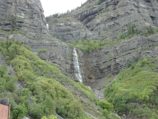
If you are working through the valley's waterfalls, Bridal Veil Falls in Provo Canyon is the drive-up option and Stewart Falls on the back of Timpanogos is the next step up in commitment. The Mount Timpanogos summit hike is a different category of day altogether. Our complete Utah Valley hiking guide puts all of them in order.
The practical block
Getting there: Take I-15 to exit 275 and head east through Pleasant Grove to 100 East, then east on 200 South, also signed Battle Creek Drive, until the road ends at the Kiwanis Park trailhead. The Forest Service GPS reference for the start of the trail is roughly N 40 degrees 21.7 minutes, W 111 degrees 42.1 minutes.
Fees and permits: None. Free parking.
Facilities: Kiwanis Park at the trailhead has a pavilion, picnic tables and restroom facilities, and the pavilion can be reserved through Pleasant Grove City. There is nothing at the falls.
Dogs: Allowed, and this is one of the more dog-heavy trails in the county. Leash them — the tread is narrow past the halfway point and you are sharing it with horses and bikes.
When to go: Early. This trail draws families, BYU and UVU students and out-of-town visitors, and the trailhead fills on summer evenings and weekends. A weekday morning is a completely different trail from a Saturday afternoon. Fall brings color to the canyon, spring brings the strongest flow, and winter brings the ice.
What to bring: Real shoes rather than sandals, water, and microspikes from roughly November through March. Phone coverage is generally available on the lower trail.
Battle Creek does not ask much of you. That is the whole point of it, and it is why more people in this valley have stood at the bottom of these falls than at the bottom of any other. Just know which of the two trails you signed up for before you leave the parking lot.
For more ideas nearby, see our guide to things to do in Pleasant Grove, and check the Provo.com events calendar for what is happening in the north county while you are up there.
Related Guides
- Provo Peak: The Mountain Behind the Y, and Why the Road Is the Hard Part
- Bonneville Shoreline Trail: The Provo & Orem Guide (2026)
- Kyhv Peak (Formerly Squaw Peak): The Complete Guide (2026)
- Lesser-Known Hikes Near Provo: Six Trails Past the Famous Five (2026)
- Y Mountain Trail: The Complete Hiking Guide (2026)
- Utah Valley Hike Finder — filter every trail by difficulty, length, season, dogs and fees
- Hikes for Kids Under 8 Near Provo, and the Stroller Test
Frequently Asked Questions
How long is the Battle Creek Falls hike?
How hard is the Battle Creek Falls trail?
Is there a fee to hike Battle Creek Falls?
Can you hike Battle Creek Falls in winter?
Why is it called Battle Creek?
Sources
The facts in this guide were checked against these sources. Hours, fees and rules change, so confirm anything time-sensitive with the source before you go. How we make Provo.com.
- Battle Creek Trail #050, USDA Forest Service, Uinta-Wasatch-Cache National Forest. Checked October 12, 2026.
- Curly Springs Trail #051, USDA Forest Service, Uinta-Wasatch-Cache National Forest. Checked October 12, 2026.
- Pleasant Grove City: History, Pleasant Grove City. Checked October 12, 2026.
- Pleasant Grove (Utah History Encyclopedia), Utah Education Network / Utah State Historical Society. Checked October 12, 2026.
- Battle Creek Falls Trail, AllTrails. Checked October 12, 2026.