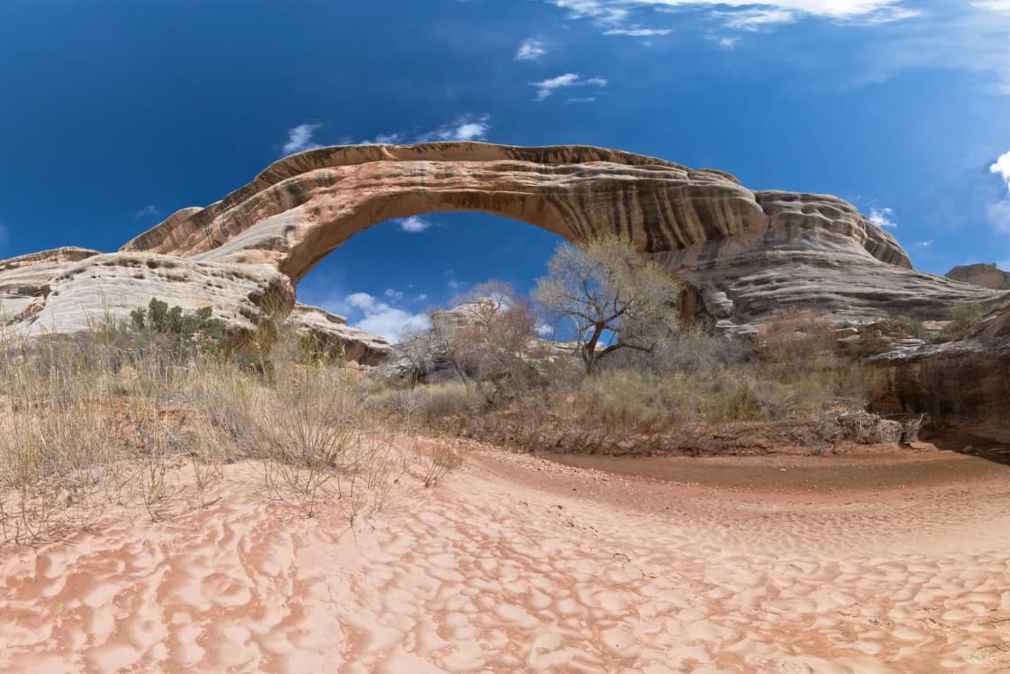
Natural Bridges National Monument is a small place at the end of a long road. It sits in San Juan County in southeastern Utah, roughly 282 miles from downtown Provo by a routing estimate, and it protects three natural stone bridges cut by White Canyon and its tributary. It also holds a distinction that still draws people with tripods: the Park Service says it was designated the world's first International Dark Sky Park, in 2007.
This guide is written for Utah Valley travelers who are deciding whether the monument earns its drive. It covers how to get there, what the Park Service says about fees and hours, how the nine-mile loop drive and the bridge trails work, and what to know about the dark-sky designation. Where the Park Service's pages did not give a number or a rule, this guide says so and tells you where to check.
Quick facts
| Item | What the Park Service says | Where to confirm |
|---|---|---|
| Location | End of Utah 275, off Utah 95, San Juan County | nps.gov/nabr |
| From Provo | About 282 mi, 5 hr 48 min (OSRM estimate) | Your own map app on the day |
| Loop drive | Bridge View Drive, 9 miles, paved, one-way | Visitor center |
| Suggested visit | Two to three hours | nps.gov/nabr |
| Vehicle entrance | $20, valid 7 days | nps.gov/nabr fees page |
| Main road and trails | Open 24 hours a day | Park conditions page |
| Visitor center | 9 a.m. to 4 p.m. daily in summer | Phone 435-241-3951 |
| Camping | $16 per night, reservations through Recreation.gov | Recreation.gov |
Who this trip is for
Natural Bridges suits people who like a compact, well-organized stop with a clear payoff. You can see all three bridges in a few hours from a paved road and short walks, which makes it one of the more manageable stops in this part of Utah. It also suits anyone building a longer southeastern Utah loop, since it sits on the way between Capitol Reef country and the Bears Ears region. Our guide to how many days the Utah Mighty 5 need is a good place to see how the monument fits into a larger itinerary, and the Bears Ears etiquette guide covers the surrounding landscape.
It is especially good for stargazers. The monument is open around the clock on its main road and trails according to the Park Service, it offers a campground, and the skies are the point. If you care about the night sky more than the bridges, pair this guide with our ranking of International Dark Sky places in Utah by access from Provo, where Natural Bridges ranks number 17 by drive time.
The Park Service's own tone is plain about the visit length. It suggests two to three hours. That is a short stay for a trip this long, so most Provo-based travelers will want to build in a night nearby, a second stop, or both.
Getting there from Provo
By an OpenStreetMap (OSRM) driving estimate from downtown Provo with no traffic, the monument is about 282 miles and 5 hours 48 minutes away. We use the same method in our national parks comparison, and the figure matches the one in our dark-sky ranking. It is an estimate. It does not account for road work, weather, a stop for fuel, or the slower pace of a two-lane highway behind a truck.
The Park Service gives directions only from the south side of the approach. From Blanding, it says to drive just south of town on US 191 to Utah 95, then about 35 miles west on Utah 95 to Utah 275. The monument entrance is at the end of Utah 275. The Park Service says the drive from Blanding takes roughly 45 minutes. The Park Service page says there is no public transportation at the monument, so this is a trip you make in your own vehicle.
The Park Service directions page does not lay out a Provo route, and we did not verify which road the routing estimate follows. Two broad approaches exist in southeastern Utah: a route that reaches US 191 and runs south toward Blanding, and a route that approaches Utah 95 from the west. Before you leave, put the monument's address into a current map app, look at the route it picks, and check road conditions for every highway on it. UDOT's travel information and the Park Service conditions page are the places to look.
Two planning notes follow from what the Park Service does say. First, the page lists nothing about fuel or services inside the monument, so fill your tank and bring food and water before the final stretch. Second, the monument's mailing address is HC-60 Box 1, Lake Powell, UT 84533-0001, which tells you something about how remote the area is. Phone 435-241-3951 reaches the park.
If your trip runs in colder months, read our Utah winter driving, traction law and chains guide before you commit to mountain passes between Utah Valley and the southeast.
Fees and passes
The Park Service fee page, checked November 10, 2026, lists these entrance fees:
- Private vehicle: $20, covering the driver and passengers, valid 7 days.
- Motorcycle: $15, valid 7 days, admitting up to 2 motorcycles with up to 4 total passengers.
- Per person without a vehicle: $10, for people on bicycles or on foot. Ages 15 and under are free. Valid 7 days.
- Camping: $16 per night. Interagency Senior Pass or Access Pass holders pay $8 per night.
The annual pass for this part of Utah costs $55. It is valid for one year through the month of purchase and admits one private, non-commercial vehicle to Arches, Canyonlands, Natural Bridges and Hovenweep. It is available to U.S. residents only, and the Park Service says purchase is credit or debit only. If you are also visiting Arches or Canyonlands, as many people do from Moab, that pass can pay for itself quickly.
The America the Beautiful annual pass is $80 for U.S. residents and $250 for non-residents. A senior annual pass is $20 for U.S. citizens and residents ages 62 and older, and a senior lifetime pass is $80. Military, Access, 4th Grade and Volunteer passes are free for those who qualify. Passes are non-refundable and non-transferable, and holders must show photo ID.
One practical detail matters more than the prices. The Park Service says the monument now accepts only mobile or electronic payments for entrance and camping fees, and that in person only debit or credit cards are accepted. Do not count on cash. Passes can also be bought through Recreation.gov or by calling 1-877-444-6777.
The Park Service lists 2026 fee-free days at fee-charging sites for U.S. citizens and residents. The list includes November 11, which is tomorrow as of this writing. Other fees, such as camping, may still apply.
Hours and winter conditions
Per the Park Service, the main road and trails are open 24 hours a day, and the monument is open year-round. The Park Service's main page lists the visitor center as open 9 a.m. to 4 p.m. daily in summer. Its hours page says visitor center hours vary by season but gives no winter times, and that page's hours table did not display when we checked. That means we cannot tell you the visitor center's winter schedule. Call 435-241-3951 or check nps.gov/nabr.
On the seasons, the Park Service says spring and fall are the busiest, with mild temperatures. Summer is hot and dry, often in the high 90s Fahrenheit and sometimes above 100. In winter, the Park Service says services are reduced and warns that conditions can change rapidly, so you should be prepared for all kinds of weather.
Floods also matter. The Park Service's nature page notes that a thunderstorm may send a flood down White Canyon. If you plan to walk into a canyon bottom, check the forecast first and ask rangers about conditions.
The campground is open all year, according to the Park Service, with reservations made through Recreation.gov. The Park Service's conditions page says camping is by reservation only. Another park page describes the sites as offering seclusion with lots of tree cover and good dark night skies. We did not find site counts, RV length limits or water details on the pages we could open, so confirm those with the park before you bring a trailer. The Park Service does say that if you are towing a trailer, you should unhook it and leave it in the visitor center parking lot, because each overlook and trailhead has limited parking. For a broader look at how reservations and first-come camping work around Utah, see our Utah camping reservations guide.
The three bridges
The Park Service names the three bridges Kachina, Owachomo and Sipapu, in honor of the Ancestral Puebloans who once lived in the area. The history page gives the story behind each name.
Sipapu is a Hopi word meaning "the place of emergence," the entryway through which the Hopi believe their ancestors entered this world. The name is not decorative. If you visit, treat it as a place with meaning to living people.
Kachina is named for rock art on the bridge that resembles symbols used on kachina dolls.
Owachomo means "rock mound," a reference to a feature on top of the bridge's east abutment. The Park Service's nature page notes that Owachomo may not last forever, and it adds that the same processes that formed this landscape are still at work. The pages we opened did not give measurements for the bridges, so for spans and heights, ask at the visitor center or read the park's own materials rather than relying on a number from a third party.
The history behind the names is a useful piece of context. According to the Park Service, prospector Cass Hite found the three bridges in 1883 while searching for gold up White Canyon from a base camp on the Colorado River. He called them "President," "Senator" and "Congressman." Later explorers renamed them "Augusta," "Caroline" and "Edwin." The General Land Office assigned the Hopi names in 1909. National Geographic publicized the bridges in 1904, and in 1908 President Theodore Roosevelt established the monument, which the Park Service describes as Utah's first National Park Service area.
People were here long before any of that. The Park Service says people occupied the area repeatedly beginning in the Archaic period, which it dates from 7000 BCE to 500 CE. Ancestral Puebloan farmers moved onto the mesa tops around 700 CE and returned about 300 years later, building sandstone or mud-and-stick homes on the mesas and in cliff alcoves. Their masonry and pottery styles relate to the Mesa Verde region, with influences from the Kayenta and Fremont cultures. The Park Service says they left the area for the last time around A.D. 1270, and that Hopi ancestors, the Hisatsinom, once lived in the Natural Bridges area.
The loop drive and the trails
The Park Service calls the road Bridge View Drive in its materials, and describes it as a 9-mile (14.5 km) paved, one-way loop with overlooks of all three bridges. Its things-to-do page makes an important point: the bridges are not visible from the drive itself. Short walks lead to a viewpoint for each bridge and for Horse Collar Ruin. Plan to park, walk, and return to the car at each stop.
Because the road is one-way, you follow the loop in a single direction. Each overlook and trailhead has limited parking, so a busy spring or fall day may mean waiting for a space. A picnic area with covered tables sits along the loop, including an accessible site, according to the Park Service.
Ranger-led programs, according to the Park Service, are offered spring through fall. They include guided walks, overlook talks along the loop drive, patio talks at the visitor center, and astronomy talks with telescope viewings. The page says times and topics vary and schedules may change, so check with the park or the bulletin boards for current listings. Because we are writing in November, assume the schedule is reduced and confirm before you plan around a program.
For more than a viewpoint, the Park Service describes trails that let you get close to the bridges and walk through them. Its hiking page lists three longer loops, all described as "primitive and strenuous," and none allowing pets other than service animals:
| Loop | Length | Bridges passed |
|---|---|---|
| Full loop | 12 miles (19.3 km) | All three |
| Sipapu-Kachina loop | 5.7 miles (9.2 km) | Sipapu and Kachina |
| Kachina-Owachomo loop | 6.5 miles (10.5 km) | Kachina and Owachomo |
These loops pass through canyons and over the mesa top. The Park Service's advice is to stop at the visitor center for updated conditions and detailed directions before any loop, and to bring water, appropriate clothing and a map. The hiking page we could open did not load its short and moderate hike sections, so we are not listing those trail lengths or elevation changes. The park's visitor guide PDF is the Park Service's pointer for more trail information. Pick it up at the visitor center or find it on nps.gov/nabr.
A sensible first-visit plan, based on the Park Service's two-to-three-hour suggestion, is to drive the loop once, stop at each overlook, and take the short walk to whichever bridges interest you most. If you have a full day and the weather cooperates, ask a ranger whether one of the shorter loops makes sense for your group.
The dark-sky designation
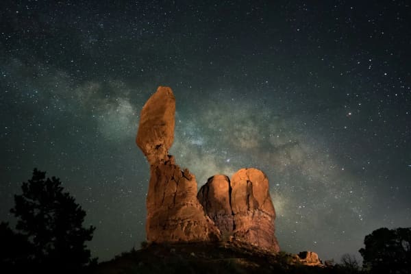
The Park Service says Natural Bridges was designated the world's first International Dark Sky Park, in 2007, and that it has some of the darkest skies in the country. Those two statements are what the Park Service pages we opened say. The designation program was created by the International Dark-Sky Association, now known as DarkSky International. We were not able to open the association's page on the monument today, so we are not repeating details of the original application, the lighting work or the sky-quality measurements. If that history matters to you, the DarkSky International listing for the monument and the park's own staff are the right sources.
What the designation means in practice, per the Park Service, is an invitation. The things-to-do page describes stargazing as a main activity and says astronomy talks with telescope viewings are offered. The main road and trails are open around the clock, which means a visit does not have to end at sunset. The campground, described as having good dark night skies, gives you a place to stay.
Utah's other national parks and monuments followed. Our dark-sky ranking notes that the Park Service pages we checked confirm designations for Arches (2019), Bryce Canyon (2019), Canyonlands (2015, Gold Tier) and Capitol Reef (2015, Gold Tier), and that Hovenweep (2014) and Cedar Breaks (2017) hold the designation too. Natural Bridges (2007) is the earliest in that list. Our Capitol Reef guide covers one of the other Gold Tier parks, which makes a natural pairing if you are driving through that part of the state.
Plan for the night sky the way you would for any remote stargazing. Moon phase matters more than almost anything else, since a bright moon washes out the Milky Way. Check a moon calendar before you choose a date. Clouds matter too, and so does temperature. Desert nights cool quickly, and in late fall and winter they can be cold. Your eyes also need time. Give them a while away from phone screens and headlights, and use a red light if you need one.
What to bring
The Park Service's own list is short: water, appropriate clothing and a map. Beyond that, the logic of a remote monument applies.
- A full tank of fuel and a spare plan for food and water. The Park Service pages we opened did not list services at the monument.
- A debit or credit card, since the Park Service says the monument takes only electronic payments.
- A printed or downloaded map. Cell service is not covered on the Park Service pages we opened, so do not assume you will have it.
- Sun protection for summer, and layers for any season. The Park Service notes a wide range of weather.
- Water for every person on any walk below the rim.
- A red flashlight or headlamp, a warm layer and a chair if you plan to watch the sky.
- Your camping reservation confirmation if you are staying in the campground.
Who should skip it
Skip this trip if you want a day trip. At about 5 hours 48 minutes each way by estimate, it does not work as a same-day outing from Provo. Skip it, or shorten your plans, if you are not comfortable on long rural drives or if you are traveling in poor weather. If your group wants a big ticket landscape with long views, other Utah parks offer more variety per mile, and our ranking of Utah's national parks from Provo can help you compare. If you want to hike with a dog, note that the Park Service does not allow pets on its long loop trails. And if the visit window is only two or three hours, the drive-to-stay ratio will not suit every traveler.
Safety
Most of the risks here are ordinary desert risks. Heat is the first. The Park Service says summer temperatures are often in the high 90s and sometimes above 100, so carry water and avoid long walks at midday. Floods are the second. A storm can send water down White Canyon, so check the forecast and ask rangers before entering a canyon. Remote driving is the third. Services are thin, so keep your tank full and tell someone your route and return time.
On the long loops, follow the Park Service's advice to check in at the visitor center first, since the trails are described as primitive and strenuous. Stay on marked routes. Treat archaeological sites and rock art with respect, and leave them undisturbed. When you stargaze at night, be careful on trails and near edges, and do not hike in the dark unless you know the route.
What to check before you go
- The Park Service conditions page and the park's alerts at nps.gov/nabr. The conditions page did not display live alerts when we opened it, so call 435-241-3951 if you have any doubt.
- Visitor center hours for your travel date. We could confirm only the summer hours.
- Road conditions on every highway in your route, especially in winter.
- The fee page, in case amounts change. Bring a card, not cash.
- Campground reservations through Recreation.gov.
- The weather forecast, including the chance of storms and flash floods.
- The moon phase, if stargazing is the goal.
- Ranger program schedules, which vary by season.
Putting it together
Natural Bridges rewards planning more than most Utah stops. The loop drive is short, the bridges are clear goals, and the dark-sky history gives the visit a second reason to exist after sunset. The drive from Provo is the cost, and it is a real one. Treat it as part of a longer southeastern Utah trip, confirm the details the Park Service leaves open, and bring a card, water, a map and a warm layer.
Sources: National Park Service Natural Bridges National Monument pages on basic information, fees, hours, hiking, things to do, history and culture, directions, camping and nature, checked November 10, 2026. Drive times are OpenStreetMap (OSRM) estimates from downtown Provo.
Frequently Asked Questions
Was Natural Bridges really the world's first International Dark Sky Park?
How far is Natural Bridges from Provo?
How much does it cost to enter Natural Bridges?
Can I pay the entrance fee with cash?
How long should I plan for the loop drive?
Can I bring my dog on the trails?
Is Natural Bridges open in winter?
Do I need an annual pass?
Sources
The facts in this guide were checked against these sources. Hours, fees and rules change, so confirm anything time-sensitive with the source before you go. How we make Provo.com.
- Natural Bridges: Fees and Passes, National Park Service. Checked November 10, 2026.
- Natural Bridges: Operating Hours and Seasons, National Park Service. Checked November 10, 2026.
- Natural Bridges: Hiking, National Park Service. Checked November 10, 2026.
- Natural Bridges: Directions, National Park Service. Checked November 10, 2026.
- Natural Bridges: History and Culture, National Park Service. Checked November 10, 2026.