
More on The South Valley: every guide we have published there, in one place.
Utah County is dominated by its big numbers — Provo at about 115,000, Lehi past 90,000, Orem not far behind. What gets lost is that the same county contains incorporated communities so small that a single Provo apartment complex could outnumber them, and that these places have almost nothing in common with each other beyond being small.
This guide covers the four at the southern end of the county. Two of them — Elk Ridge and Woodland Hills — are mountain-bench subdivisions that did not exist before 1970. Two of them — Genola and Goshen — are farm towns, one of which predates Utah's statehood by nearly four decades. Together they make a useful cross-section of how this county got built.
One correction before we start, because it is made constantly. Goshen is frequently described as the smallest town in Utah County. It is not. Goshen is the smallest of the four covered here, but the county's two smallest incorporated communities are over the ridge to the west in the Cedar Valley: Fairfield, at 160 people, and Cedar Fort, at 427. Goshen is roughly six times the size of Fairfield. We cover those two separately in the guide to Cedar Fort and Fairfield, because their story is a different one — an army post, a vanished county, and a boom that emptied out.
Elk Ridge and Woodland Hills: the benches
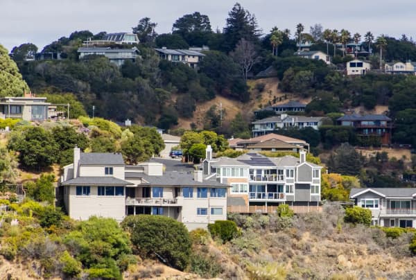
Both cities occupy the slopes rising south-east of Salem and Payson, and both began as private land development rather than settlement.
Elk Ridge sits at the foot of Mount Loafer, across roughly 2.9 square miles. The land was part of the historic Goosenest Ranch. After part of the ranch sold in the late 1960s, the development that followed was called Salem Hills, and Utah County approved it in 1971 on condition that it incorporate if it passed 100 permanent residents. When the population reached 100, county rules required incorporation, and Salem Hills Town was incorporated on 22 December 1976. The name was changed to Elk Ridge in 1978, after the elk often seen on the hillsides and to avoid confusion with nearby Salem. It later became a city. The 2020 census counted 4,687 residents; the Census Bureau's 2025 estimate is about 4,970.
Woodland Hills is the smaller and higher neighbor: roughly 2.6 square miles and 1,521 residents at the 2020 census. It began as a private development around the same time and later became a city.
What defines both is what they don't have. There is no commercial core in either. There is no through-route in Elk Ridge — the road network dead-ends into the mountain, so nobody drives through on the way to somewhere else. Housing is almost entirely single-family, much of it on view lots, and prices on both benches run well above the valley floor beneath them.
The trade-off is the one every bench community in Utah makes: quiet, views, trail access and steep terrain, in exchange for driving down the hill for absolutely everything. Groceries, fuel, restaurants and errands all happen in Salem, Payson or Spanish Fork.
What the elevation costs you
The bench premium is not only financial, and it is worth being specific because the brochures are not.
Both cities sit several hundred feet above the valley floor on steep, wooded ground on the flank of Mount Loafer. That means real snow — meaningfully more than Payson gets, and on grades where getting a two-wheel-drive car up your own street in February is a genuine question rather than a rhetorical one. It means wildfire exposure on the mountain side, and the defensible-space and insurance considerations that come with it. It means longer utility runs and, in places, wells and septic where the valley floor has municipal service.
It also means the thing people move there for: you can be on a trail in the Wasatch in the time it takes most Utah Valley residents to find parking. Whether that trade is worth it comes down to a question worth asking before buying — will this household use the mountain, or just look at it? If the answer is the latter, the bench is a premium and a driving penalty paid for a view that is also visible, for free, from Payson.
Genola and Goshen: the Goshen Valley
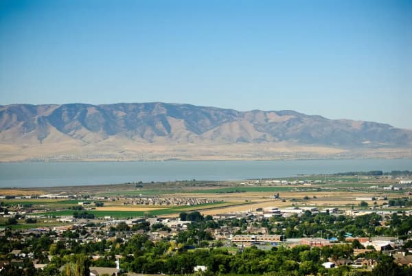
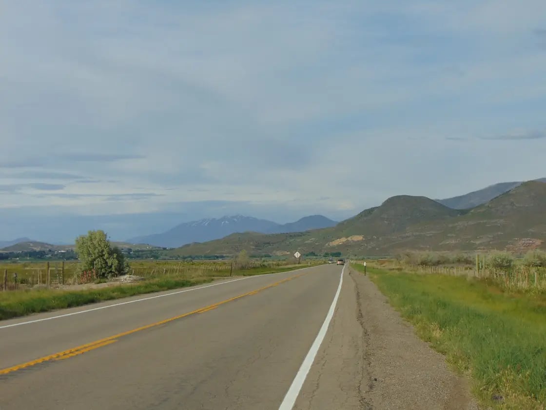
Drop south-west out of Santaquin and the landscape opens into the Goshen Valley, which is farm country and looks it.
Goshen is the oldest of the four by a wide margin. Goshen Valley was settled by Mormon pioneers in the 1850s. Goshen is also the smallest of this group: 978 residents at the 2020 census, on 0.83 square miles — an area so compact that the town is essentially a grid of a few streets around the intersection of Main and Center. U.S. Route 6 runs straight through as Main Street, which means most people who have been to Goshen went through it on the way to Delta or Nephi without registering that they had. The town has its own elementary school, a town office and a fire station.
Genola is stranger, statistically. It was incorporated on 30 December 1935, and had 1,548 residents at the 2020 census — but it spreads across roughly 14 square miles, most of it farmland. That gives it about seventeen times Goshen's land area and only about 58% more people. It sits in the north-east of the Goshen Valley, immediately adjacent to Santaquin, and shares Santaquin's ZIP code. The former settlement of Townsend lies within its south-eastern corner.
Neither town has commercial development in any real sense. Both are agricultural, both are quiet, and both are close enough to Santaquin and Payson that the practical daily radius includes them.
The concrete castle on the hill
Drive between Goshen and Genola and you will see it long before you can identify it: a huge, terraced concrete structure built into the west slope of Warm Springs Mountain, stepping down the hillside like a fortress, covered in decades of spray paint. Almost everyone who passes wonders what it is. Almost nobody stops to find out, and — importantly — nobody legally should.
It is the Tintic Standard Reduction Mill, also called the Tintic Mill or the Harold Mill, after the small company town that grew up beside it. It was built by the Tintic Standard Mining Company under Emil John Raddatz, and designed by W.C. Madge, a Salt Lake mechanical and metallurgical engineer.
The point of it was transport economics. The Tintic Mining District around Eureka, west of here, was producing enormous quantities of gold, silver, lead and copper, and shipping raw ore to distant smelters was expensive. Concentrating the metal content locally made the freight bill smaller. The mill was cut into a hillside deliberately, so that gravity did the work of moving material down through crushing bins, roasters, leaching pools and drain boxes.
Construction dates are contested and we are not going to pick one. Published sources variously place the build between 1918 and 1921 — one scholarly architectural source says designed and built 1918–1919, another account says construction began in 1921, and the National Register listing gives a build date that does not match its own narrative sources. What matters is the operating window: the mill ran only briefly in the early 1920s and then stopped.
It stopped because the technology was wrong on arrival. The mill used an acid-brine chloridizing and leaching method — the Augustin Process — which almost no other American plant of the era was using, and which was superseded by better methods essentially while the concrete was curing. A structure built to last a century was obsolete inside four years.
Two warnings, because this site is photographed far more often than it is explained. First, it is closed. No-trespassing signage is posted; the striking interior shots circulating online largely predate that, and reproducing them now means trespassing. Second, the Goshen Warm Springs water below the mill carries heavy-metal contamination from the milling process. It looks inviting and it is not. Photograph the mill from the public road, which is where the best view of it is anyway, and leave it there.
The towns that are not towns
One of the most confusing things about this end of the county is that several places with names, signs, ZIP codes and strong local identities are not municipalities at all.
Benjamin, Elberta, Lake Shore, Palmyra, Spring Lake and West Mountain are unincorporated. They have no mayor, no town council, no municipal budget and no city limits in the legal sense. They are administered directly by Utah County, and their boundaries are a matter of local usage and census geography rather than law.
This matters more than it sounds, and in practical ways:
- Services come from the county, not a city. Road maintenance, land-use decisions and code enforcement run through county offices in Provo rather than a local town hall.
- You cannot vote in a municipal election you do not have. Residents vote in county and school-district races; there is no mayor's race.
- Addresses confuse databases. Insurance quotes, delivery estimates and online forms frequently do not recognize these place names, and will substitute the nearest incorporated city, sometimes changing the answer.
- Some are smaller than the incorporated towns. Elberta in particular is smaller than Goshen and smaller than Cedar Fort, which is part of why "smallest town in Utah County" lists disagree with each other so often — some are counting incorporated municipalities and some are counting anywhere with a name.
If you are house-hunting in the south county, establishing which category a given address falls into is a five-minute job that prevents a lot of later surprise.
The practical picture
Schools. All four are in the Nebo School District — worth stating clearly, because the county's big school story right now is the Alpine School District split, and Alpine's division into three new districts on 1 July 2027 does not affect Nebo at all. On the benches, secondary students attend Salem Hills High School, which opened in 2008 and serves Salem, Elk Ridge, Woodland Hills and part of Payson — meaning Elk Ridge's teenagers go to a school named after the town's own original name. In the Goshen Valley, Goshen has its own elementary; older students travel.
Addresses and ZIP codes. None of the four has a distinct postal identity of its own. Genola uses Santaquin's ZIP code; the bench cities share codes with Salem and Payson, and published sources disagree about which one applies to Elk Ridge. If you are dealing with anything where the ZIP code matters — insurance quotes, delivery zones, voter registration — confirm it directly rather than trusting a listing.
Commuting. All four are at the southern end of the county, which means a Silicon Slopes commute is a serious daily drive, not a short one. Provo is manageable. Lehi and Draper are not, for most people, on a five-day-a-week basis. This is the single factor that most often decides whether these towns work for a household, and the only reliable way to evaluate it is to drive it at 7:30am on a weekday rather than at noon on a Saturday.
Emergency and municipal services in communities this small are typically shared, contracted or volunteer-supported. That is normal and it works, but it is worth understanding before you assume city-scale response times. Ask specifically about fire and ambulance response, since those are the two where minutes are the unit of measurement, and where a bench address on a steep road in winter differs materially from a valley-floor one.
Water. In agricultural towns, culinary water and secondary irrigation water are separate systems with separate shares, separate bills and separate rules, and irrigation shares can be attached to a property. On the benches, some properties run on wells. None of this is exotic and all of it is worth asking about explicitly, because it is the single most common thing buyers moving from a city assume is uniform and is not.
Who these towns are for
The benches and the valley towns attract different people for opposite reasons, and it's worth being clear about which is which.
Elk Ridge and Woodland Hills suit households that want space, elevation and immediate access to the mountains, and that have either a Provo-or-south commute or no commute at all. The case for them rests heavily on schools, quiet, and using the canyon and trail access on the doorstep.
Genola and Goshen suit people who want land, and who mean it. These are agricultural communities, not rural-flavored subdivisions, and the acreage-to-population ratio in Genola in particular reflects genuine farming rather than large lots. The nearest full-service town is a short drive; the nearest city is not.
What all four share is a scale that is unusual in a county growing as fast as this one. Utah County added tens of thousands of residents in the last few years, and these four communities have collectively stayed under nine thousand people. In a valley where the conversation is almost always about growth, that is its own kind of statement — and out west in the Cedar Valley, Cedar Fort and Fairfield have taken it considerably further.
For the larger neighbors, see our city guides to Payson, Salem and Santaquin. The county's two smallest incorporated towns are covered in Cedar Fort and Fairfield. If you're weighing up the valley more broadly, the moving to Provo guide covers the fundamentals, and the Nebo Loop Scenic Byway runs into the mountains directly above this corner of the county.
"Town" is a legal classification, and three of these four are not towns
This guide has been using town the way everyone here uses it, to mean a small place. Utah law uses the word much more narrowly, and once you know the definition, the census figures above stop being trivia and start telling you something about how each of these places is governed.
The six classes, and where the lines fall
Utah Code Section 10-2-301 sorts every municipality in the state by population into six categories:
| Class | Population |
|---|---|
| City of the first class | 100,000 or more |
| City of the second class | 65,000 to 99,999 |
| City of the third class | 30,000 to 64,999 |
| City of the fourth class | 10,000 to 29,999 |
| City of the fifth class | 1,000 to 9,999 |
| Town | under 1,000 |
So town is not a synonym for small. It is the bottom rung, and the cutoff is 1,000 people. Applied to the 2020 census counts cited earlier in this guide, the four communities covered here sit either side of that line: Goshen at 978 falls below it, while Genola at 1,548, Woodland Hills at 1,521 and Elk Ridge at 4,687 all sit above it, in fifth-class-city territory. Out in the Cedar Valley, Fairfield at 160 and Cedar Fort at 427 are well below.
But population alone does not change anything
Here is the part that is counterintuitive, and it is the reason this section does not simply announce what class each place is in.
Section 10-2-302(1) provides that a municipality retains its classification until it is changed either under that section or under Subsection 67-1a-2(3). And Section 10-2-302(3) provides that a change in class takes effect on the date of the lieutenant governor's certificate — not on census day, and not on the day a community's population crosses a threshold.
The mechanism runs in two different directions depending on which way the population moved:
- Growing past a threshold. Under Section 67-1a-2(3)(c) and (d), the lieutenant governor monitors each municipality's population and, if the figure shows a city has grown beyond the limit for its current class, shall prepare a certificate indicating the new class and deliver a copy to the city's legislative body within 10 days. The city does not have to ask.
- Shrinking below a threshold. Under Section 10-2-302(2), if the figure shows the population has dropped below the limit for the current class, the city's legislative body may petition the lieutenant governor for a certificate. It is optional, and the state does not initiate it.
The practical result is a mild ratchet. Growth gets recognized automatically; decline gets recognized only if the municipality asks. A place that has slipped below a line may be carrying a classification that its current population no longer supports, entirely lawfully.
Which population figure, and who produces it
Not the one you would guess. Section 67-1a-2(3)(c) directs the lieutenant governor to use the estimate of the Utah Population Committee, created in Section 63C-20-103 — and to fall back on the census or a Census Bureau estimate only if the committee's estimate is not available. For a new city, Section 67-1a-2(3)(a) has the classification set at incorporation using the committee's estimate.
That matters in a fast-growing county, because a decennial census figure can be five or eight years stale while a state estimate is current. If you want to know what class a Utah municipality is, the answer is on a certificate in the lieutenant governor's office, not in a census table.
What changes when the class changes
Less than people expect, which is reassuring. Section 10-2-303 provides that on a change of class: all property and property rights stay vested in the municipality; no contract, claim, right, demand or liability is altered; every ordinance, order and resolution in force stays in force until repealed or amended, so long as it is not inconsistent with law; the identity of the municipality is not affected; every officer in office stays in office until the term expires and a successor is elected and qualified; and — the one most likely to matter — the municipality keeps the same form of government it had immediately before the change (Section 10-2-303(1)(f)).
Pending litigation and municipal business continue as if nothing happened (Section 10-2-303(2)(a)), though if the law applicable under the new class offers a different remedy for a right the municipality already held, that remedy is cumulative rather than a replacement (Section 10-2-303(2)(b)).
And Section 10-2-306 provides that all courts in Utah take judicial notice of the existence and classification of any municipality — nobody has to prove in court that Goshen is Goshen.
Why any of this is worth a resident's time
Class determines which provisions of the Municipal Code apply, and several statutes elsewhere in Utah law switch on it. If you are trying to work out whether a rule you read about applies to Elk Ridge or only to Provo, class is usually the hinge. It is also the reason a place with 1,548 residents can be a city in the statute and a village in every conversation about it, with both descriptions correct.
Population estimates and certificates change. Confirm a municipality's current classification with the municipality itself or the lieutenant governor's office rather than inferring it from a census table.
Related Guides
- Living in Cedar Hills, Utah (2026): The Complete Guide
- Living in Lehi, Utah (2026): The Complete Guide
- Living in Lindon, Utah (2026): The Complete Guide
- Nebo School District: The Parent's Guide to South Utah County Schools
- Which School District Am I In? Utah County Before and After the Alpine Split
- Who Decides What in Utah Valley — why Goshen registers exactly one body and Elk Ridge two
- Eureka and the Tintic Ghost Towns
- Public Libraries in Utah County: Cards, Fees and Reciprocal Borrowing
- Spanish Fork vs. Springville — the larger south-valley pair, compared
Frequently Asked Questions
What are the smallest towns in Utah County?
Is Goshen the smallest town in Utah County?
What is the difference between Elk Ridge and Woodland Hills?
Why is Elk Ridge called Elk Ridge?
How old are Genola and Goshen?
Do these towns have their own schools and shops?
Can you visit the Tintic Standard Reduction Mill near Goshen?
Are these towns a realistic commute to Silicon Slopes?
Sources
The facts in this guide were checked against these sources. Hours, fees and rules change, so confirm anything time-sensitive with the source before you go. How we make Provo.com.
- Utah Division of State History (History to Go): Elk Ridge, Utah Division of State History (History to Go). Checked October 12, 2026.
- Elk Ridge City General Plan 2023, Elk Ridge City. Checked October 12, 2026.
- Genola incorporation record, Utah State Archives. Checked October 12, 2026.
- Town of Genola: About Us, Town of Genola. Checked October 12, 2026.
- Tintic Standard Reduction Mill (HAER UT-116), Library of Congress / Historic American Engineering Record. Checked October 12, 2026.
- Decennial Census 2020 PL 94-171 (P1_001N), U.S. Census Bureau. Checked October 12, 2026.
- City and Town Population Totals (SUB-EST2025), U.S. Census Bureau. Checked October 12, 2026.
- 2024 Gazetteer Files, Places, Utah, U.S. Census Bureau. Checked October 12, 2026.