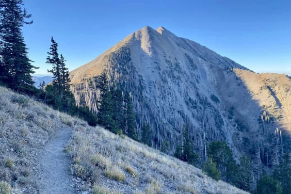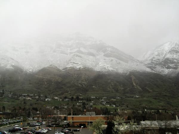
The Bonneville Shoreline Trail is the long foothill path that follows the old beach of Lake Bonneville along the Wasatch Front. In Utah County it is less a single trail than a chain of pieces, some finished and signed, some unofficial, some only lines on a city plan. The best count available, the Bonneville Shoreline Trail Committee's 2023 annual report, put the county at 41 miles completed out of a potential 90 to 125. That report is the most recent the Committee has published, so treat every number below as a 2023 snapshot.
This page walks the whole county segment from north to south. For the Provo and Orem stretches in detail (footing, winter rules, what the walking is like), our Provo and Orem BST guide goes deeper.
The county at a glance
The Committee divides Utah County into eleven segments. Its 2023 figures:
| Segment | From and to | Completed (2023) |
|---|---|---|
| 1. Traverse Mountain South | Point of the Mountain to Alpine's Dry Canyon | 11 of 20 miles |
| 2. Box Elder Peak | Dry Canyon to American Fork Canyon | 0 of 4 miles |
| 3. Mahogany Mountain | American Fork Canyon to Grove Creek | 4.8 of 5.3 miles |
| 4. Timpanogos | Grove Creek to Bridal Veil Falls | 9.0 of 10.6 miles |
| 5. Kyhv | Bridal Veil Falls to Rock Canyon | 5.8 of 8.1 miles |
| 6. Provo | Rock Canyon to north Springville trailhead | 6.7 of 6.7 miles |
| 7. Springville | North Springville trailhead to Hobble Creek Canyon | 3.8 of 5.5 miles |
| 8. Maple Mountain | Hobble Creek Canyon to Spanish Fork Canyon | 0 miles |
| 9. Loafer Mountain | Spanish Fork Canyon to Loafer Canyon | 0 miles |
| 10. Payson | Loafer Canyon to Picayune Canyon | 0 miles |
| 11. Dry Mountain | Picayune Canyon to the county line | Being planned by Santaquin |
Read down the right-hand column and the shape of the trail is obvious: mostly built from Lehi to Springville, with a hole above Alpine, and almost nothing official south of Hobble Creek.
North: Lehi, Draper and the Traverse Mountains
At the Point of the Mountain, the BST crosses the county line through the Traverse Mountains. The State of the BST project, a trail-by-trail survey led by Brandon Plewe that walked the whole route, reported in 2022 that Lehi had been buying the unbuildable highlands from developers and, with Draper, had created a permanently conserved area of at least 7 square miles. Working with the Traverse Mountain Trails Association, Lehi built a mountain-bike-designed network there.
For now, the link over the ridge is a chain of those trails: Sensei (finished 2018), Mo-mentum (2020), Tráverse Travérse (2021) and Ann's Trail on the Draper side. The trip report describes gentle grades but a very roundabout route on the Lehi side, and a steeper climb of about 1,000 feet on the Draper side to the Oak Hollow trailhead. The 2023 report adds that Lehi and Draper built a pair of trails between the Sensei trailhead and Draper's Brookside trailhead in 2022. AllTrails lists the Sensei and Lolo loop at 4.4 miles with 649 feet of gain.
Over the county line, the BST continues into Draper's Corner Canyon. The Committee's report counts a 20.2-mile continuous stretch from Rocky Mouth in Sandy to Canyon Hills in Lehi. If you ride, our Corner Canyon guide covers Draper's one-way trails, its Class 1 e-bike rule and its dog rules.
Alpine and the Box Elder Peak gap
East of Lehi the trail reaches Alpine, and then stops being official. The 2023 report says Alpine received a state grant for a paved path along Grove Drive from the Lambert Park area, after which existing trails over a ridge into Fort Canyon could be designated as BST.
The Box Elder Peak segment, from Alpine's Dry Canyon to American Fork Canyon, had zero completed miles. The fix is a federal one. The Committee explains that the Bonneville Shoreline Trail Advancement Act, passed as part of the December 2022 spending law, moved about 300 acres out of wilderness areas, where mountain bikes are prohibited, so the BST could be multi-use. In Alpine, that lets a roughly 3-mile social trail known locally as the "LPW" (for Lone Peak Wilderness) become official BST once the Forest Service finishes its environmental review.
Mahogany Mountain and the Timpanogos foothills
From American Fork Canyon south, the trail is mostly real again.
Mahogany Mountain (4.8 of 5.3 miles). The State of the BST's 2021 report describes the newest Utah County piece at the time: about 2.5 miles from the Grove Creek trailhead to the Cedar Hills city limit, part of roughly 20 miles of existing social trails that the Utah Valley Trails Alliance and the Forest Service legalized in 2019. Through southern Cedar Hills the route follows the Salt Lake Aqueduct pipeline road, level and plain, and ends on Cedar Hills' paved path system.
Timpanogos (9.0 of 10.6 miles). The same project's July 2021 report calls most of the route from the Orem firing range trailhead north to Pleasant Grove officially designated BST, through Orem City land, the Timpanogos State Wildlife Management Area and the national forest. The first stretch climbs from the shoreline at about 5,100 feet to nearly 5,700 feet, and much of it was built by volunteers around 2000. The Dry Canyon area above Lindon, once an off-road vehicle area, became a mountain bike hub after the Forest Service banned motor vehicles there, and the Trails Alliance legalized the best of the riders' trails in 2019 and 2020. A short detour reaches Battle Creek Falls. The last mile below the Pleasant Grove "G" runs on old roads through private property. The Deseret News reported in 2025 that new land had been acquired for the trail in Pleasant Grove near the Battle Creek Trail.
AllTrails lists the Orem East section at 3.9 miles out and back with 416 feet of gain, rated easy.
Provo Canyon to Rock Canyon: the Kyhv segment
Kyhv (5.8 of 8.1 miles) runs from Bridal Veil Falls in Provo Canyon to Rock Canyon, under the peak our Kyhv Peak guide covers. AllTrails' Provo Canyon section is 10.8 miles out and back with 1,417 feet of gain, rated hard; its shorter Bridal Veil Falls via the BST route is 2.4 miles with 561 feet.
The gap is just north of Rock Canyon. The State of the BST's 2021 report found the official trail ending at the edge of Provo City property, a heavily used mile of utility road through private land beyond it, and then a further mile through fenced, posted property. Provo City, it said, had made closing that 3.5-mile gap a top priority. The 2023 report adds that Provo improved a trail access point at Little Rock Canyon and worked with the Forest Service on a new 1.5-mile segment from there to the existing trail to the north, with federal approval expected in 2024. We could not confirm whether that piece has been built.
Provo: the finished one
Provo (6.7 of 6.7 miles), from Rock Canyon south to the north Springville trailhead, is the only fully complete segment in the county. The 2021 trip report contrasts its two halves: south of the Y Trail, mostly level with one gradual climb out of Slate Canyon; north of it, converted firebreak and utility roads that go "continually up and down steep hills." BYU acquired the Y Mountain trail area from the Forest Service in 2014 and built a short new BST section to bypass the busy Y parking lot.
AllTrails figures for the Provo pieces:
| Section | Out and back | Gain | Rating |
|---|---|---|---|
| Y Mountain to Rock Canyon | 5.1 mi | 652 ft | Moderate |
| Y Mountain to Springville | 15.4 mi | 2,135 ft | Hard |
The Committee lists Rock Canyon to Spring Canyon in Springville, about 10 miles, as one of the six longest continuous stretches of BST anywhere. It is the best long walk or run on the trail in Utah County. The Rock Canyon and Y Mountain trailheads are the usual starts; our Big Baldy and Y-to-Rock-Canyon guide covers the short Provo bench walk between them.
Springville and Hobble Creek
Springville (3.8 of 5.5 miles). The State of the BST called the stretch from Spring Canyon to Slate Canyon its first fully official, signed and maintained piece of BST, mostly singletrack and firebreak road on a south-facing slope with almost no shade. In places it crosses private land whose owners granted the public an easement. The 2023 report says Springville built the first phase of a trail network in lower Spring Canyon, including a BST route across the canyon, set to open in spring 2024, and that the Hobble Creek Bicycle Association and the city were working on a permanent route east of Spring Canyon.
East of Spring Canyon toward Hobble Creek Canyon, the 2021 trip report found a heavily used trail that most people assume is official but is not: part runs through the state's Hobble Creek Wildlife Management Area, and the last stretch crosses private land with locked gates and walk-through gaps too narrow for bikes.
South of Hobble Creek: the unbuilt half
Maple Mountain (0 miles). Mapleton finished a trails master plan in 2023 that includes a new BST route above the bench to avoid private property it cannot cross. The State of the BST's 2021 trip found more than 4 unbroken miles across the face of Spanish Fork Peak, mostly city-owned thanks to Mapleton's transfer-of-development-rights program, but blocked at the Spanish Fork Canyon end by a fenced development parcel. North of Maple Canyon, a rough unofficial trail was bulldozed as a firebreak during the 2020 Ether Fire and ends at a ranch fence; Mapleton's plan routes the BST along city paths instead.
Loafer Mountain (0 miles). Above Spanish Fork, the 2021 report describes foothill trails on city and state land around the Spanish Oaks area, a gun club that occupies the whole shoreline bench, and a federal parcel with an old road on a wide undeveloped bench. The trail ends at the mouth of Spanish Fork Canyon, where the highway, a railroad, a pipeline and power lines would all have to be crossed.
Payson (0 miles). The 2021 report found promising bench trails and a gas line road around Payson, from Picayune Canyon to P Hill, but steep, unsustainable climbs, a difficult crossing of Payson Canyon and short strips of private land at every entrance to the public land on P Hill. City and county plans, it noted, show the route as a paved path along the Strawberry Highline Canal, which is posted no trespassing today.
Dry Mountain. Santaquin is planning a foothill network that includes a BST route, much of it through private land and the Santaquin State Wildlife Management Area.
Planning a walk on it
- For a long day: Rock Canyon to Spring Canyon, about 10 continuous miles.
- For an easy hour: the Orem East section or the Bridal Veil approach in Provo Canyon.
- For a ride: Lehi's Traverse Mountain network into Draper's Corner Canyon.
- For the gaps: respect fences and posted land. Several of the most-used "BST" pieces in the south are unofficial and cross private property.
If you want to help close the gaps, the Committee's report points to the Utah Valley Trails Alliance and the Traverse Mountain Trails Association in Utah County, and our trail volunteering guide lists ways to start.
Segment figures are from the Bonneville Shoreline Trail Committee's 2023 annual report, the latest published. Descriptions of unofficial stretches come from the State of the BST trip reports of 2021 and 2022 and may have changed. Trail lengths are from AllTrails.
Frequently Asked Questions
Can you walk the Bonneville Shoreline Trail from the Point of the Mountain to Payson?
What is the longest continuous stretch of the BST in Utah County?
Is the Provo section of the BST complete?
Is there a BST in Mapleton, Spanish Fork or Payson?
Can I ride a mountain bike on the BST in Utah County?
Where are the main trailheads?
How long would it take to walk all of the Utah County BST?
Is the BST dog-friendly?
Sources
The facts in this guide were checked against these sources. Hours, fees and rules change, so confirm anything time-sensitive with the source before you go. How we make Provo.com.
- Rules & Trail Etiquette, Draper City. Checked October 20, 2026.
- State of the Bonneville Shoreline Trail: 2023 annual report, Bonneville Shoreline Trail Committee / State of the BST. Checked October 20, 2026.
- BST news: Bonneville Shoreline Trail Advancement Act passes; 2023 Outdoor Recreation Grants, State of the BST. Checked October 20, 2026.
- Trip report 9: Traversing the Traverse, State of the BST (Brandon Plewe). Checked October 20, 2026.
- Trip report 7a: A smoky Cedar Hills, State of the BST (Brandon Plewe). Checked October 20, 2026.
- Trip report: Timpanogos foothills, State of the BST (Brandon Plewe). Checked October 20, 2026.
- Trip report: Provo, Rock Canyon, State of the BST (Brandon Plewe). Checked October 20, 2026.
- Trip report: Springville in the spring, State of the BST (Brandon Plewe). Checked October 20, 2026.
- Trip report: Hobble Creek, our first rainy day, State of the BST (Brandon Plewe). Checked October 20, 2026.
- Trip report: Mapleton, perfect but..., State of the BST (Brandon Plewe). Checked October 20, 2026.
- Trip report: Mapleton North, an unfortunate mess, State of the BST (Brandon Plewe). Checked October 20, 2026.
- Trip report: Spanish Fork, coming home, State of the BST (Brandon Plewe). Checked October 20, 2026.
- Trip report: Payson, potential and obstacles, State of the BST (Brandon Plewe). Checked October 20, 2026.
- Bonneville Shoreline Trail: Orem East, AllTrails. Checked October 20, 2026.
- Bonneville Shoreline Trail: Provo Canyon Section, AllTrails. Checked October 20, 2026.
- Bridal Veil Falls via Bonneville Shoreline Trail, AllTrails. Checked October 20, 2026.
- Bonneville Shoreline Trail: Y Mountain-Rock Canyon, AllTrails. Checked October 20, 2026.
- Bonneville Shoreline Trail: Y Mountain-Springville, AllTrails. Checked October 20, 2026.
- Sensei and Lolo Trail Loop, AllTrails. Checked October 20, 2026.
- Bonneville Shoreline Trail: what it looks like today, Deseret News. Checked October 20, 2026.