
If you grew up in Utah Valley, there is a mountain east of Provo that you have called one thing your whole life and that every official map now calls something else. And if you have tried to look it up recently, you have probably run into the more annoying half of the problem: the old name pointed at four different places, the rename did not reach all four at the same speed, and trail apps are still arguing about it.
This guide sorts that out first, because almost everything confusing about this mountain comes from the naming rather than the terrain.
What changed, and when
In September 2022 the U.S. Board on Geographic Names renamed roughly 650 federal place names that contained the word "squaw," a term long used as a slur against Native American women. About 50 of those were in Utah. The most visible was the peak above Provo, which became Kyhv Peak.
The name was not picked by one office in Washington. The new names were selected by a task force that included several government agencies and nearly 70 tribal governments.
Because the peak sits on federal land, the change came from the Board on Geographic Names rather than from Provo.
Four places, one old name
This is the part worth reading slowly, because it explains why two people can both say "I was at Squaw Peak yesterday" and mean completely different outings.
1. Kyhv Peak — the summit
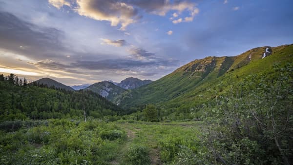
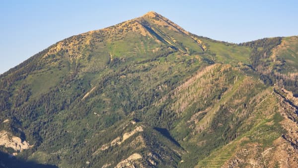
The mountain itself, a prominent bump on the skyline visible from most of Provo, including from BYU and LaVell Edwards Stadium. It sits in the Uinta-Wasatch-Cache National Forest.
Its elevation is published inconsistently. You will most often see about 7,865 feet, but roughly 7,880 also circulates. The gap is small enough not to matter on the ground and large enough that we are not going to pick one and pretend it is settled.
Reaching the summit is a real hike. Most people who say they have been to "Squaw Peak" have not been here.
2. Kyhv Peak Road — the canyon road
Formerly Squaw Peak Road. This is the winding route that leaves US-189 roughly two miles up Provo Canyon and climbs the mountainside in switchbacks. It is paved at the bottom and turns to dirt and gravel as it continues, eventually running a long way south toward Hobble Creek Canyon.
Its length depends entirely on which piece you mean, which is why published figures disagree so wildly. Trail databases that map only the paved lower section give something around 4.4 miles. Hikers describing the drive to the Rock Canyon Campground turnoff measure roughly 9.5 miles. Our own lesser-known hikes guide measures roughly 13.5 miles from Provo Canyon to the west ridge trailhead. Regional tourism listings describing the full through-route to Hobble Creek quote something closer to 28 miles. None of those is wrong. They are measuring different roads.
Name the segment you mean, and the numbers stop fighting.
3. Kyhv Peak Overlook — the viewpoint
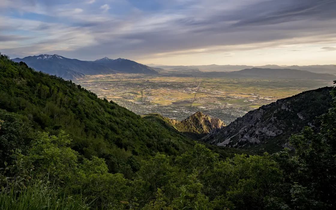
Formerly Squaw Peak Overlook. A developed pullout on the paved section with a parking area and a railing, looking out over Utah Valley and Utah Lake.
This is what most people mean. It is a drive, not a hike. It is where high schoolers go at night, where people take engagement photos, and where visitors get the valley shot. Conflating it with the summit is the single most common error in local directions, and it has sent more than one under-prepared group up a mountain they did not intend to climb.
4. Squaw Benchmark — the ridge
Kyhv Peak sits on a north-to-south ridge that reference sources still identify as the Squaw Benchmark ridge. The rename did not sweep every associated feature, so you will continue to encounter the old word in some technical and mapping contexts even where the peak itself is correctly labeled.
Hiking to the summit
There is no single Kyhv Peak hike. There are approaches, and they differ enormously in effort — the same structural situation as Provo Peak, which is either a short scramble or an enormous day depending on where you start.
From the Rock Canyon Campground area (the campground itself is closed until about May 2027), reached by driving up the canyon road, AllTrails' crowd-measured route puts the round trip at about 6.8 miles with roughly 2,500 feet of gain, out and back and rated hard. That is user-recorded data rather than an agency figure, so treat it as a good indication rather than a specification.
From the valley floor via Rock Canyon is the longer, harder version, and it is the one that turns a summit day into a genuine undertaking.
Riders have their own version. Our mountain biking guide lists a Kyhv Peak ride at roughly 10 miles with something like 4,400 feet of climbing, which is a different route again from either walking approach.
What all of them share: this is exposed, dry, steep country with very little shade and no water. It faces west, which means afternoon sun on the way down in summer. Start early, carry more water than the distance suggests, and treat the descent as the part where people get hurt.
Driving the road
For a lot of visitors, the road is the destination, and there is no shame in that — the views from the paved switchbacks are among the best in the county for the effort involved.
The turnoff is about two miles up Provo Canyon on US-189, on the right. It is signed, though you may still see the old name on signage, maps and navigation apps; app databases have updated unevenly and some still index the road under its former name.
The seasonal gate is the thing to plan around. The road closes seasonally, typically from about mid-October to mid-May. Both ends of that window move with the weather — it can close earlier and reopen considerably later after a big winter. Those are not published deadlines, and treating them as guarantees is how people end up at a locked gate. Check current status with the Uinta-Wasatch-Cache National Forest.
Surface changes as you climb. The lower stretch is paved. Beyond that it becomes dirt and gravel, and while high-clearance vehicles are comfortable the whole way in dry conditions, there are sections where a low car would struggle. Some trail databases label the whole thing a paved path, which is true only of the first part.
Check motorized access before you ride. The Forest Service sets the rules for off-highway vehicles on the road, so confirm them with the district rather than inferring them from where you happened to park.
What else is up there
The road is a corridor, not just a viewpoint, and several other outings hang off it. This is the part locals know and visitors usually miss.
Buffalo Peak. From a T intersection on the upper road, a dirt spur leads toward the Buffalo Peak trail — a second summit option that gets a fraction of the attention and is often described as the gentler of the two. Our Buffalo Peak guide covers the drive and the short walk to the top. If you turn the other way at that same intersection you end up at the overlook, which is why directions to these two places sound almost identical and land in different places.
Rock Canyon Campground. The campground is closed for the 2026 season and, per Recreation.gov, expected to reopen around May 21, 2027. There is a campground up here, reached by continuing past the paved section, and it doubles as the launching point for the shorter summit approach. Note that there are gates on both the main road and the campground road. Park clear of them — blocking a Forest Service gate is the fastest way to ruin someone else's day and possibly your own.
Dispersed camping. Much of the surrounding national forest land permits dispersed camping, and the road is one of the better-known corridors for it near Provo, with sites that trade amenities for a valley view. Our camping guide covers the rules and the other options in the area; the short version is that dispersed camping is a privilege that survives on people packing out what they bring.
Stargazing. Elevation plus a ridge between you and the valley lights makes this one of the closest usable night-sky spots to Provo — not dark by rural Utah standards, but a real improvement over anywhere on the valley floor for twenty minutes of driving. See our stargazing guide for how it compares to the darker sites further out.
Fall color. The slopes here turn early — this is frequently among the first places in the county to change, which makes late September through early October the busiest stretch of the year on the paved switchbacks. Our fall guide covers the timing across the valley.
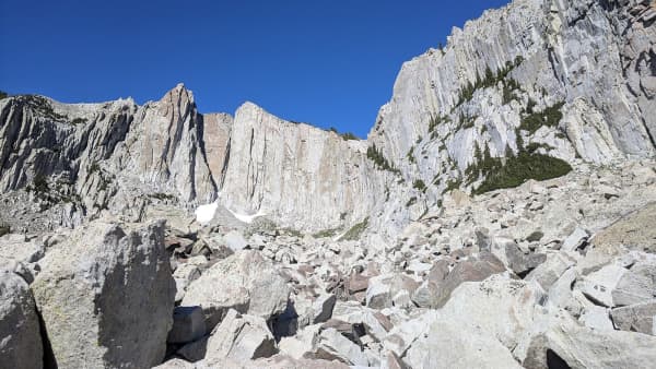
Climbing. Rock Canyon, below and west of the summit, is one of Utah Valley's major climbing areas, with sport, trad and bouldering routes. It draws serious traffic, and the wear on the approach trails shows it.
Photography. The overlook is the valley's default panoramic shot and appears in our photography spots guide for exactly that reason. It is also, predictably, busy at sunset.
Where the name came from
The old name traces to an account of the 1850 conflict at Fort Utah, sometimes called the Battle of Provo River, between Latter-day Saint settlers and Timpanogos Utes. In the version that appeared on an interpretive plaque in Provo, the wife of the Ute leader Old Elk fell from the peak and died as Ute families retreated toward Rock Canyon, and the name followed from that.
That account has never been historically verified. Multiple versions circulate, and what they share is a dead Native woman rather than an agreed set of facts. That is a large part of the argument for renaming: the name commemorated a story nobody could confirm, in a word that had become a slur, attached to the most visible mountain over a city.
It is worth knowing if you live here. The peak is on the horizon from most of Provo, and the reason it changed names is a more specific piece of local history than "a federal order in 2022."
The practical block
Getting there: The road turnoff is about two miles up Provo Canyon on US-189, on the right. Summit approaches leave from higher on the road or, for the long version, from Rock Canyon on the valley floor.
Season — road: Roughly May to November, weather dependent at both ends. Closed for snow in winter.
Season — summit: Late spring through early fall for most hikers. Snow lingers on the upper slopes well past the point where the valley is warm.
Fees: None reported at the road or the standard trailheads. Fee structures on national forest land do change, so check current signage.
Dogs: Allowed. Water is the constraint, not the rules — there is essentially none on the route.
Shade: Very little. Plan around the sun rather than the mileage.
Bikes and OHVs: The road is popular with riders. Confirm the motorized rules with the Forest Service, as above.
Facilities: The overlook has parking. Beyond that, assume nothing.
Which one do you want?
If you want the view with a fifteen-minute drive and a railing, you want the overlook. If you want a scenic drive and a place to watch the valley turn gold in late September, you want the road. If you want a steep, dry, quiet summit day with a genuine payoff at the top and no crowds, you want the peak.
They are three different days out, and the only reason anyone confuses them is that for a century and a half they all answered to the same name.
Who manages the ground, and why it differs from the Y
Provo's two signature front-range hikes sit about three miles apart and are governed by opposite arrangements, which is worth knowing before you carry an assumption from one to the other.
Kyhv Peak is on national forest land, inside the Uinta-Wasatch-Cache National Forest. It is federal public land, managed by the Forest Service through its district office, and the rules that apply are the agency's and the district's: seasonal and emergency closures, fire restrictions, motorized use on the road, dispersed camping limits, group-size thresholds and commercial-use permitting.
Y Mountain is not, because the trail corridor and the ground under the letter belong to BYU. That trail is private property kept open by its owner, and the owner sets the terms.
The practical version: two trails a few minutes apart, two different rulebooks, and two different places to check. Whether you can bring a dog, fly a drone, camp partway up, bring a large group, or shoot commercially can have different answers on each, and the answer on one is no guide at all to the answer on the other. For the peak, check the Forest Service district covering the Wasatch front here. For the Y, check BYU's posted rules — our Y Mountain trail guide covers how that ownership came about and what it means for access.
It also explains a difference hikers notice without being able to name it: the Y trail is heavily engineered, signed and maintained by an owner with a reason to invest in it, while the route up Kyhv is a national forest trail maintained to national forest standards. Neither is better. They are funded and governed by different bodies with different mandates.
For where this sits among everything else in the county, our complete Utah Valley hiking guide ranks the area's trails, and the lesser-known hikes guide covers the other trails locals use when the popular ones fill up.
Related Guides
- Provo Peak: The Mountain Behind the Y, and Why the Road Is the Hard Part
- Battle Creek Falls: The Complete Hike Guide (2026)
- Bonneville Shoreline Trail: The Provo & Orem Guide (2026)
- Y Mountain Trail: The Complete Hiking Guide (2026)
- Utah Valley Hike Finder — filter every trail by difficulty, length, season, dogs and fees
- Canyon & commute conditions — the road up is a first-wave closure, which surprises people who can see it from town
Frequently Asked Questions
What is Kyhv Peak and why was it renamed?
Who chose the name Kyhv?
Is Kyhv Peak the same thing as the Squaw Peak Overlook?
Is Kyhv Peak Road open year-round?
Can you ride an OHV on Kyhv Peak Road?
Is Kyhv Peak on public land?
Do the same rules apply on Kyhv Peak and Y Mountain?
Who do I contact about trail conditions or closures on Kyhv Peak?
Sources
The facts in this guide were checked against these sources. Hours, fees and rules change, so confirm anything time-sensitive with the source before you go. How we make Provo.com.
- Hope Campground, USDA Forest Service, Uinta-Wasatch-Cache National Forest. Checked October 12, 2026.
- Kyhv Peak from Rock Canyon Campground, AllTrails. Checked October 12, 2026.
- Kyhv Peak Trail, AllTrails. Checked October 12, 2026.
- Provo's Squaw Peak renamed to Kyhv Peak, Daily Herald. Checked October 12, 2026.