
There is a seventeen-mile paved path along the Wasatch bench with no hills on it. In a county where nearly every trail is either a canyon grind or a lakeside gravel loop, that is an unusual asset, and it exists for a reason that has nothing to do with recreation.
The Murdock Canal Trail runs from Orem to Lehi on top of a buried water main. It is flat, wide, entirely paved and connects seven cities. It is also the lid on a canal that killed at least twenty-two people, and the trail is essentially a by-product of the engineering project that closed the canal for good.
This guide covers the practical business of using it — trailheads, parking, seasons, what it is actually like — plus the two questions the listings never answer: why nobody agrees on how long it is, and what is underneath your wheels.
Nobody agrees on the length, and there is a reason
Search for this trail and you will be told it is 17 miles, 18 miles, 18.3 miles, 20 miles and 20.8 miles, sometimes by sources of comparable authority. It is worth understanding the disagreement rather than trusting whichever number you saw first.
Seventeen is the figure that traces back to transport planning and to the water district. The Mountainland Association of Governments describes 17 miles from 800 North in Orem to Timpanogos Highway in Lehi. Regional trail listings that measure the paved surface on top of the pipeline land in the same place.
The larger numbers are measuring something slightly different. The pipeline underneath — the Provo River Aqueduct — runs roughly 21 to 21.5 miles from the Murdock Diversion at the mouth of Provo Canyon all the way to the Point of the Mountain at the Salt Lake County line. The trail does not go that far. It stops in Lehi. Counts of 20 miles and up are generally measuring an end-to-end route that includes connector segments at one or both ends, most often the link north into the Jordan River Parkway system. Counts around 18 usually come from GPS traces, which pick up curve and are almost always slightly long.
So: about 17 miles of Murdock Canal Trail proper, inside a pipeline corridor that runs about 21. Both figures are correct about the thing they are describing, and picking one and calling the others wrong would be the actual error. What matters for planning is that a true out-and-back on the trail itself is a thirty-four-mile day, and that is a serious ride for most people.
The trail exists because the canal kept killing people
This is the part no trail listing carries, and it comes from the water district's own annual report rather than from anywhere secondhand.
The open canal ran along the bench for a century. It was fast, deep, steep-sided and, crucially, fitted with four inverted siphons — structures that pull water down into an enclosed pipe under an obstacle and shoot it back out the other side. Anything that went into a siphon did not come back out under its own power. Over the years people fell in, waded in, and in a handful of grim cases went in deliberately: a paraglider came down in the water in 1999 and was pulled into a siphon by a waterlogged canopy, and in 2003 two brothers died attempting to scuba through one.
In the Provo River Water Users Association's 2022 annual report, the retiring general manager set out the toll in plain numbers. In his first fourteen years with the Association there were five fatalities in the canal, and seventeen more before that. Twenty-two deaths. He then wrote the sentence that is the whole point of this trail: there have been no fatalities in the fourteen years since.
The enclosure project ran fourteen years from initial studies to completion and required more than forty agreements with eighteen partners — water districts, cities, a county, and federal, state and local agencies. Cost estimates published at different stages of that process ranged from roughly $115 million to $150 million. The canal was buried inside a welded steel pipe between 2010 and 2012 and renamed the Provo River Aqueduct.
Only after the pipe was in the ground did the trail become possible, and it was funded separately: about $12 million from the Federal Highway Administration, managed locally through UDOT. The trail opened in spring 2013.
The portable version of this, for anyone who likes knowing why places are shaped the way they are: the flattest, straightest, most family-friendly path in Utah County is flat and straight because water needs a constant gentle grade, and it is public because burying the water was cheaper than continuing to fence it.
What is actually under the trail
The corridor's history is more interesting than the average utility easement.
The Provo Reservoir Canal — Murdock Canal to everyone who lives near it — was built by the Provo Reservoir Company in the early 1900s with a capacity of about 180 cubic feet per second. In the 1940s the Bureau of Reclamation bought the canal and its right-of-way as part of the Provo River Project and enlarged it to 550 cfs. The Murdock Diversion Dam at the mouth of Provo Canyon, about nine miles below Deer Creek Dam, was completed in 1950 to feed it.
The enclosure replaced all of that with a 126-inch welded steel pipe — ten and a half feet in diameter, big enough to stand up in — running 21 miles by gravity, with no pumping. Sections vary where the geology demanded it, down to 84 inches and up to 133.
Two footnotes worth having, because they show how even careful organizations disagree with themselves. The Association's own website gives the enclosed aqueduct a capacity of 612 cfs; the general manager's message in its own annual report says 626 cfs. And the enclosure was projected to save roughly 8,000 acre-feet a year previously lost to seepage and evaporation — water that now stays in the Provo River, where it benefits the June sucker, the endemic fish whose recovery has driven a great deal of river policy in this valley.
The seven trailheads, south to north
The trail touches Orem, Lindon, Pleasant Grove, Cedar Hills, American Fork, Highland and Lehi. Access is genuinely easy; the catch is that the southern end is the awkward one.
Orem — 1100 East 800 North. The southern terminus, and there is no parking at the trailhead itself. The standard workaround is the Provo River Parkway trailhead lot a few blocks east, then a short ride or walk over. If you are coming from Provo, this is your on-ramp and it is worth knowing about the parking before you arrive rather than after.
Lindon — 300 North 780 East. Straightforward, with a connection to the Lindon Heritage Trail crossing the city east to west.
Pleasant Grove — two access points, one at 1100 North 600 East and one where Canyon Road (SR-146) meets Canyon Heights Drive. Pleasant Grove's stretch is among the busiest on the whole trail; a 2020-era count put annual users through this city alone in the region of 257,000.
Highland — Highland Glen Park, entered from Alpine Highway (SR-74) at Park Road, and Mitchell Hollow Park further west. Highland Glen is the easiest trailhead in the whole corridor for a first visit: real parking, restrooms nearby, a pond, and a park to leave people at if not everyone in the group is riding.
Lehi — the Bull River Road trailhead at Timpanogos Highway (SR-92) and 1200 West, at the north end.
Between the marked trailheads there are numerous street-level access points, which is the practical reason locals treat this as a neighborhood amenity rather than a destination trail. Most people who use it heavily got on it three blocks from home.
What it is like to ride, run or walk
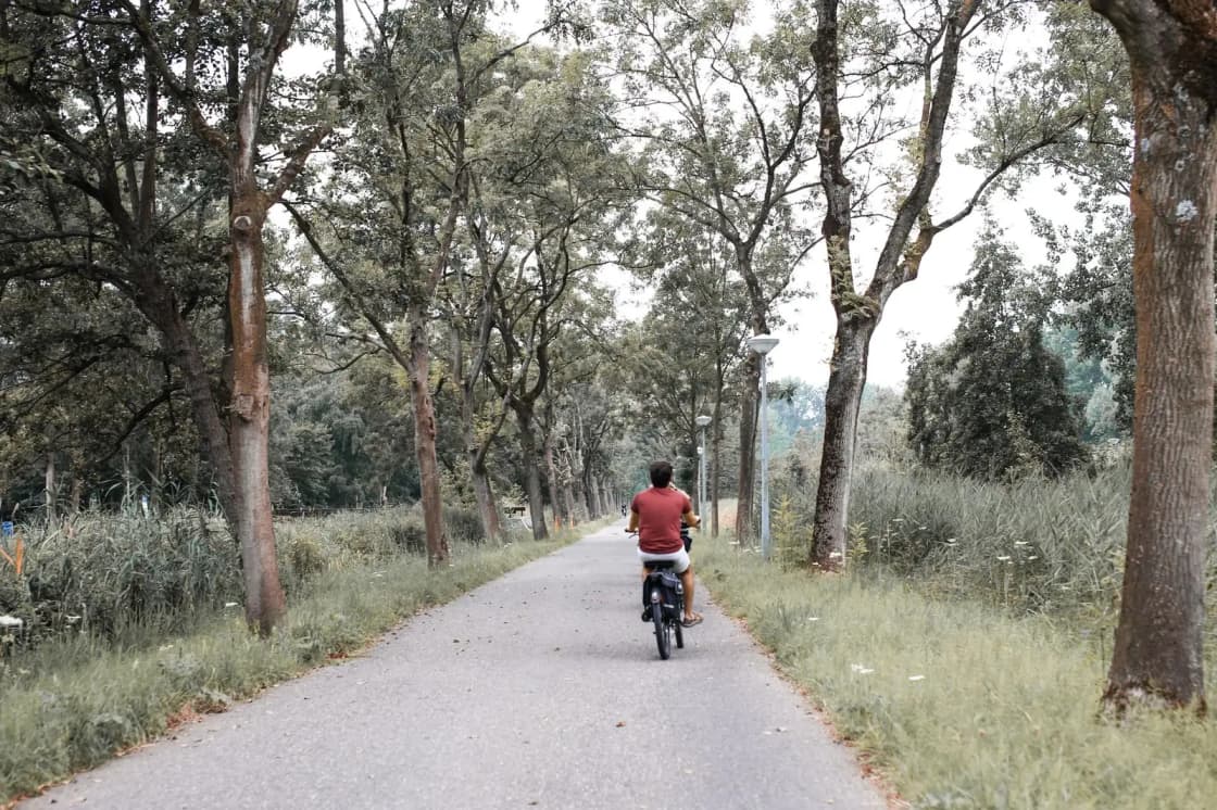
Flat, fast, exposed, and busier than you expect. Those four words cover most of it.
The surface is asphalt and concrete, in consistently good condition, with quarter-mile markers the entire way. The markers sound trivial and are not: on a path with few landmarks, they are how you negotiate a turnaround with a child, pace an interval session, or work out how far back the car is.
The exposure is the real planning constraint. There is very little mature shade. From late June through August the trail is a genuinely hot place by ten in the morning, and there is nowhere to hide. Ride early, ride in the evening, or accept that you are making a heat decision. The upside of the same feature is that it dries and clears quickly, so it is usable earlier in spring and later in autumn than the canyon trails.
The scenery is uneven, and honest guides should say so. The middle sections along the bench — Lindon through Highland — are the good part, with Timpanogos filling the eastern skyline and the valley falling away west. The westernmost few miles in Lehi run alongside a busy road and are the least pleasant stretch on the trail. If you have one hour and want the best of it, start at Highland Glen or Pleasant Grove and ride east, not west.
Weekend mornings are crowded. This is a shared path carrying cyclists at twenty miles an hour and toddlers on balance bikes at two, and the etiquette matters more here than on a canyon singletrack. Announce passes, keep dogs on short leads, and do not ride three abreast.
For a different kind of local outing there is the Provo River Parkway at the south end, which is shadier, prettier and more crowded, and the foothill routes covered in our running routes guide. Riders looking for dirt should read the mountain biking guide instead — the Murdock is not that.
The connections: this is one link in a hundred-mile chain
The trail's real significance is as a segment of something much larger.
At the south end in Orem, a widened sidewalk connector on 800 North (UT-52) links to the Provo River Parkway, which runs up into Provo Canyon.
At the north end in Lehi, the trail meets the Jordan River Parkway Trail, which continues north through Salt Lake County. Lehi also carries the Historic Utah Southern Rail Trail, roughly three miles toward downtown.
Together these form part of the Golden Spoke network — a chain of connected paved trails linking Provo, Salt Lake City and Ogden, and named as a play on the 1869 Golden Spike ceremony at Promontory. It was celebrated as complete in June 2018, with a final connection in Salt Lake City; some accounts date full completion to 2019 with a last segment in West Haven. Its length is variously given as 100, 103, 104 and 106 miles, and UDOT's own active transportation program now describes the network as more than 170 miles as it has continued to grow. It is routinely described as the longest continuous paved multi-use network west of the Mississippi.
Practical consequence: you can ride from Provo Canyon to Ogden Canyon almost entirely off-road. People do it as a single day.
One live caveat. Organizers of the 2026 Golden Spoke Ride flagged a marked detour on the Murdock Canal Trail in Lehi, where a section of paved trail had been removed for utility work. That kind of thing gets repaired, and it may well be finished by the time you read this, but if you are planning an end-to-end ride rather than a local loop, check current conditions before committing to a route.
Seasons, and the winter question
Spring and autumn are the best of it. April through early June and September through October give you the temperatures the trail was made for, and the bench position means you get the Timpanogos snowline at eye level for much of the year.
Summer is early-morning-only for most people, for the shade reasons above.
Winter is the underrated one. The trail is not consistently plowed along its entire length, and conditions vary city by city, but the corridor is used year-round by walkers and runners, and on a clear cold day the views up to the Wasatch are better than in summer haze. Check conditions locally rather than assuming, and be aware that shaded spots hold ice long after the open stretches have dried.
If the valley is under inversion — which it will be for stretches of January — the bench sits slightly above the worst of it in places, but not reliably. Air quality is a real consideration for hard efforts in midwinter here.
How to plan a first visit
If you have an hour: park at Highland Glen Park, ride or run east toward Pleasant Grove, turn around whenever you like. Best scenery, easiest parking, least road noise.
If you have a morning and a bike: start in Orem, ride north to Lehi, turn around. That is the full 34-mile out-and-back and it is flat the whole way, which means it is achievable by a much wider range of riders than the distance suggests.
If you want a one-way: two cars, or plan around the fact that this corridor is well served by street access, so a shorter point-to-point with a pickup is easy to arrange.
Bring water. Facilities vary trailhead to trailhead — some sit inside city parks with restrooms and water, others are a gate and a sign — so there is no dependable supply along the corridor itself. Combined with the shade situation, that matters more than it sounds.
The trail itself costs nothing. No pass, no parking fee, no permit. That is worth stating plainly because the canyons a few miles east work differently — American Fork Canyon is a designated Forest Service fee area where a parked vehicle needs a valid pass regardless of what you are doing. On the Murdock, you just turn up.
The short version
A seventeen-mile paved, flat, shadeless trail from Orem to Lehi, built on top of a ten-and-a-half-foot steel pipe that replaced a canal responsible for twenty-two deaths in a century. It is one of the best family cycling assets in Utah County, one of the few places to run long and flat, and a link in a network that reaches Ogden.
Start at Highland Glen, ride east, go early in summer, and take more water than you think you need.
Related Guides
- Horseback Riding in Utah Valley: Where to Ride, What It's Actually Like, and Who Takes Beginners
- Disc Golf in Utah Valley: Every Course, Ranked Honestly
- Hobble Creek Canyon: The Name Springville Gave Away
- Hiking Mount Nebo: The Highest Peak in the Wasatch, and Nobody Agrees How High
- Best Photography Spots in Provo & Utah Valley (2026)
- Provo Canyon: The Complete Guide to US-189, the Stops, and the Seasons
- RV Parks & Hookups Around Provo: How Camping With a Rig Actually Works Here
- Slate Canyon: South Provo's Quiet Canyon, and the Fight Over Its Mouth
- Provo River Delta keeps getting better: new fishing platforms, boat ramps, and fresh trout
- Utah Valley Hike Finder — filter every trail by difficulty, length, season, dogs and fees
- Paragliding at Point of the Mountain
- Irrigation Canal Safety — the canals that are still open
- Every Paved Trail in Utah Valley: Provo River Parkway to Murdock to the Jordan River, and How They Connect
Frequently Asked Questions
How long is the Murdock Canal Trail?
Where does the Murdock Canal Trail start and end?
Is there parking at the Murdock Canal Trail trailheads?
Is the Murdock Canal Trail flat?
Is there shade on the Murdock Canal Trail?
Can you bike the Murdock Canal Trail with kids?
Why is it called the Murdock Canal Trail if there is no canal?
Do you need a pass or permit to use the trail?