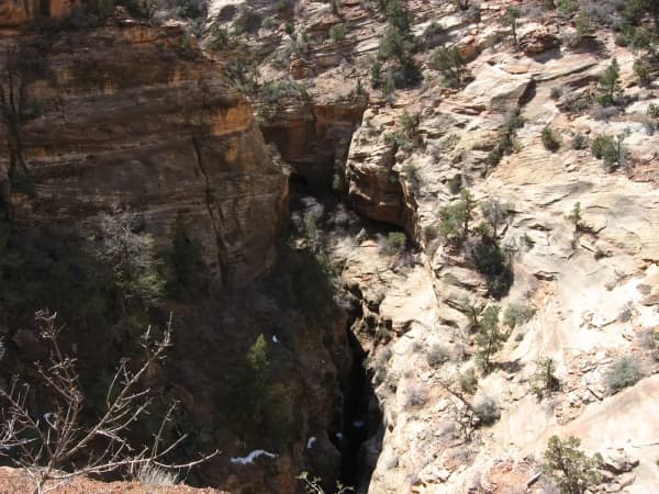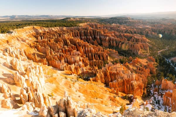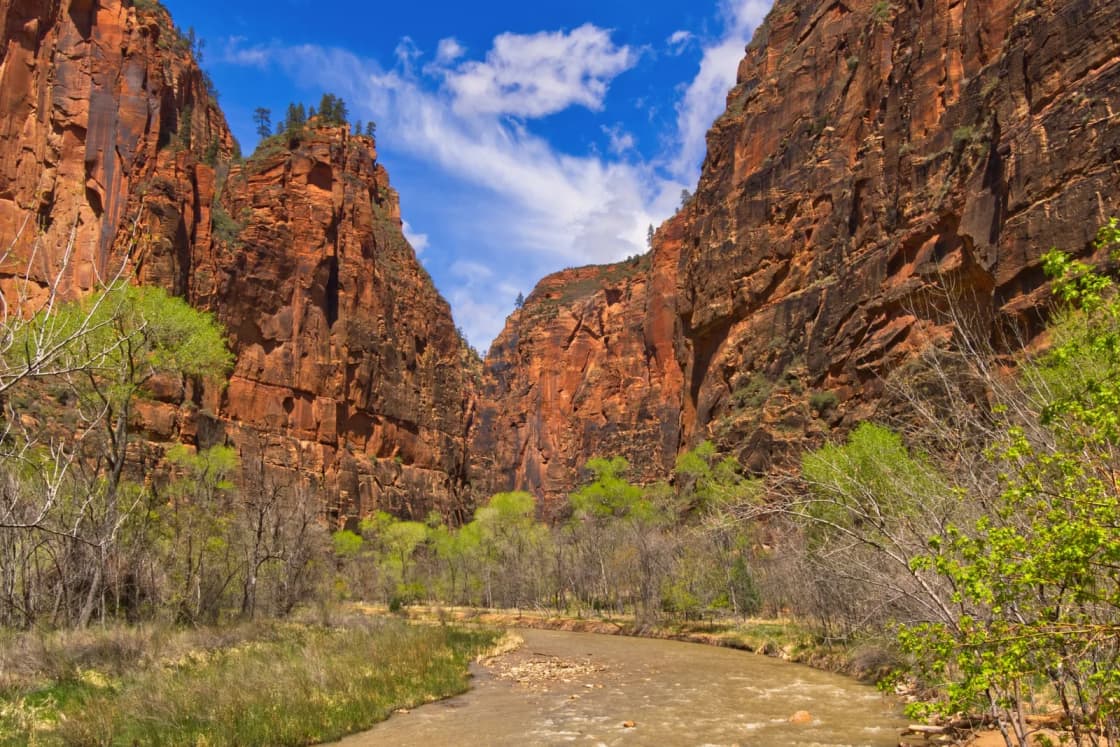
Zion and Bryce Canyon are two of the best-known parks in Utah, and from Provo they are also two of the longest drives. They are far enough from each other to feel like separate trips and close enough to combine. This is a three-day plan that does it by the numbers: one full day in Zion Canyon, one scenic crossing through the park's east side, and a morning at Bryce Canyon before the long drive home. It is built from National Park Service pages and UDOT checked on Nov. 8, 2026, plus the park guides we have already published.
| Question | Short answer | Where it comes from |
|---|---|---|
| Length | Three days, two nights | This plan |
| Drive, Provo to Springdale | About 4.5 hours, roughly 263 miles | Our Zion winter guide |
| Drive, Zion to Bryce | About 87 miles by Zion-Mt. Carmel Highway, roughly 1 hour 45 minutes (derived) | NPS Zion directions |
| Drive, Provo to Bryce | Roughly 4 hours | Our Bryce shuttle guide |
| Entry | $35 per vehicle at each park | NPS fee pages |
| Zion shuttle (Nov. 8) | Running, last bus out of the canyon 6:15 p.m. | NPS shuttle page |
| Bryce shuttle (Nov. 8) | Not running; 2026 season ended Oct. 18 | NPS shuttle page |
Who this trip is for
This plan suits a couple or a group of adults who can take a Friday or a Monday off, are comfortable spending a lot of the trip in a car, and want to see the headline views of both parks without a heavy backpacking agenda. It also works for families with older kids who handle long drives well.
It is not a hiking-depth trip. One day in Zion Canyon covers one or two hikes. One morning in Bryce covers the rim and one trail. If you want the Narrows, Angels Landing and Bryce's southern viewpoints all in the same trip, you need more days than a long weekend gives you.
Who should skip it
Skip this itinerary, or shrink it to one park, if any of these describe your group:
- You get carsick or tired on long drives. The two driving days add up to roughly eight or more hours behind the wheel by our guides' figures, before any in-park driving.
- You can only be gone two days. A Saturday in Zion and a Sunday drive home is covered in our Zion and St. George guide, and it is a better trip than a rushed version of this one.
- You are counting on Angels Landing. Past Scout Lookout the hike needs a permit from a lottery, and a long weekend is a poor reason to depend on winning it. Our Angels Landing permit guide explains how the two lotteries work and what a good Plan B looks like.
- Your plans are fixed in deep winter and you have no flexibility. Bryce Canyon sits at high elevation and its roads can close during and after snowstorms. If you cannot move your dates, choose a lower-elevation trip.
- You need hotel flexibility. Zion and Bryce both have limited lodging close to the parks. Book early and plan to pay for it.
How to get there from Provo
The route is I-15 south almost the entire way. Our Zion guide describes the sequence: south past Nephi, Scipio, Fillmore, Beaver and Cedar City, then off the freeway near Hurricane for the last stretch on state routes through La Verkin, Virgin and Rockville into Springdale. Our winter guide puts the total at about 4.5 hours and roughly 263 miles. St. George is closer, at about 3.5 hours per our guide, and is the usual base for people who want cheaper rooms and a grocery store.
For Bryce, the National Park Service lists the route from Zion and St. George as I-15 north to UT-9 (exit 16), east through Zion National Park to US-89, north on US-89 to UT-12, east on UT-12 to UT-63, then south on UT-63 into the park. The NPS page uses "UT" numbering where many Utah maps use "SR" or "Highway." They are the same roads. The park also lists a more northern approach from I-15 at UT-20 (exit 95), east to US-89, south to UT-12 and UT-63. That is the natural route home, or the natural route down, if you want to reach Bryce without passing through Zion.
The Zion directions page gives a useful number for the east-side leg. For vehicles that cannot use the Zion-Mt. Carmel Highway, the alternate route via Highway 20 is about 150 miles and 2.5 hours, which the page says is 63 miles longer and adds only about 42 minutes. Working backward, the Zion-Mt. Carmel route from Zion to Bryce is roughly 87 miles and about an hour and 48 minutes. That is our arithmetic from the park's figures, not a number the park prints, so treat it as a planning estimate.
Large vehicles are not permitted on the Zion-Mt. Carmel Highway between Canyon Junction and the East Entrance, per the NPS directions page. If you are towing a trailer or driving an RV, read the park's large-vehicle page before you commit to this route. The same page notes the highway usually carries speeds under 30 mph, so do not assume the road is quick.
The Bryce Canyon page lists the visitor center elevation at 7,894 feet. Provo is a mile high and the drive south crosses long, open stretches of I-15 that get weather. Our winter driving guide covers the traction law, chains and canyon rules if your dates fall in the cold months.
The three-day plan
Day 1: Provo to Zion
Leave Provo as early as you can. A midday departure puts you in Springdale around dinner, which leaves no time in the park but is enough to settle in. If you leave on a Friday after work, plan on a late arrival and use Day 2 for everything.
Two stops are useful on the way down. Kolob Canyons is a separate section of Zion directly off I-15 at Exit 40, which our Zion guide puts about 40 miles north of Zion Canyon, so you reach it before the Springdale turnoff. Per the NPS hours page, the Kolob Canyons Visitor Center is open 8 a.m. to noon and 1 to 5 p.m. as of Nov. 8, and the park says the Kolob Canyons Scenic Drive is open to personal vehicles year-round. If you arrive before 5 p.m., a short visit gets you into the park without a shuttle. If you arrive after dark, skip it and save it for the drive home.
Eat in Springdale or Hurricane, check in, and set an alarm for the first bus.
Day 2: Zion Canyon, then east to Bryce
This is the full Zion day. The structure depends on the shuttle.
If the shuttle is running (as of Nov. 8 it is, through Nov. 28), the Zion Canyon Scenic Drive is closed to private vehicles, including before the first shuttle and after the last one. The NPS schedule lists, for Oct. 25 to Nov. 28, a first Zion Canyon Line shuttle at 7:00 a.m. from the Visitor Center, a last shuttle from the Visitor Center at 5:00 p.m., and a last shuttle out of the canyon from the Temple of Sinawava at 6:15 p.m. The Springdale Line runs from 8:00 a.m. to 6:00 p.m. in the same period. Earlier in the fall, from Sept. 13 to Oct. 24, the last Zion Canyon shuttle left the Visitor Center at 6:00 p.m. and the last out of the canyon was at 7:15 p.m.
The shuttle is free, needs no reservation and carries no permit, but you still pay the park fee. The same page says visitors have to walk back if they miss the last bus, so build the afternoon around it.
For a first visit, pick one marquee trail and one easy extra. The shuttle page lists the stops in order, and our Angels Landing guide gives the full list. Scout Lookout, the turnaround before the permit section of Angels Landing, is reached without a permit and is described in that guide as most of the climb and most of the view. The Narrows requires no permit for the bottom-up route, per our Zion guide, though it needs a weather check for flash floods and, in cold months, rented gear from Springdale outfitters. We have not hiked these ourselves for this plan, so read the permit and conditions pages for the trail you choose before you commit.
If the shuttle is not running (Nov. 29 to Dec. 25 per the schedule, and most of December through February generally), private vehicles can usually drive the scenic drive and you park near trailheads on pavement. The shuttle page says this non-shuttle period is usually December through February. In that case you do not need the 7 a.m. start, but you do need to account for shorter days, and our Zion in winter guide covers what is open and what ice does to the upper trails.
Leave Zion Canyon by about mid-afternoon. Drive through Springdale and up the Zion-Mt. Carmel Highway, past the east entrance, to US-89, then north to UT-12 and UT-63 into Bryce. Our Zion guide describes the east side as having slickrock, Checkerboard Mesa and the short Canyon Overlook Trail just past the tunnel's east portal, a good stop if you have time and light. Our guide notes parking at that trailhead is scarce.
Sleep near Bryce. The shuttle page's stop list includes Best Western Plus Grand Hotel, Best Western Plus Ruby's Inn and Ruby's Campground, so there are in-area options. Reserve ahead.
Day 3: Bryce Canyon, then home
Bryce is a morning park. The park is open 24 hours a day year-round, per the NPS hours page, and the sunrise view from the rim is the reason to sleep nearby. Sunrise Point is one of the four main amphitheater stops, and our Bryce shuttle and Sunrise Point guide covers how to park for it. The short version: the first shuttle in season runs at 8:00 a.m., which is after sunrise, so for a daybreak view you drive and park in the rim lots whatever the season.
After sunrise, walk the rim and then go below it. Our Navajo Loop and Queen's Garden hike guide describes the most common descent into the hoodoos. If the shuttle is running (April to October), the park recommends parking at the Shuttle Station in Bryce Canyon City, which has free all-day parking, rather than circling the viewpoint lots. The park says vehicles 23 feet or longer cannot park at several viewpoints and the Visitor Center lot during shuttle hours.
Aim to leave the park by late morning or midday. Provo is roughly four hours away per our Bryce guide, and the route north is the UT-12, US-89 and I-15 reverse of the way you came, or the UT-20 shortcut. Use UDOT Traffic before you go, especially in shoulder seasons. A sunset at Bryce is lovely but turns this into a very late arrival home, and we do not recommend it on a Sunday night before work.
Costs
The fees below come from the NPS fee pages for Zion and Bryce Canyon, checked Nov. 8, 2026. Both pages are marked as showing 2026 amounts, and the Zion page lists no fee changes, but confirm before you travel.
| Pass | Zion | Bryce Canyon |
|---|---|---|
| Private vehicle | $35 | $35 |
| Motorcycle | $30 | $30 |
| Per person, on foot or bicycle | $20 (15 and under free) | $20 (15 and under free) |
| Park-only annual pass (U.S. residents) | $70 | $70 |
| America the Beautiful resident annual | Not listed on Zion's page | $80 |
Two vehicle fees come to $70 for the weekend. An $80 America the Beautiful pass costs $10 more than that, so it pays off if you plan a third paid federal-site visit during the year. Zion's page says the vehicle pass is valid for 1 to 7 days and the motorcycle pass for 7 days. Bryce's page gives 7 days for motorcycles and does not state a validity period for vehicles. Non-U.S. residents age 16 and older pay an extra $100 per person at both parks unless they hold an annual or America the Beautiful pass. Bryce's page says it accepts credit and debit cards only, not cash, at fee stations and for digital pass purchases.
Other costs are yours to price: fuel for the round trip, two nights of lodging, meals, and any hiking-gear rentals for the Narrows. We have not priced lodging or fuel for this article, so check current rates when you book.
When to go
The shuttle calendar and the weather are the two big variables.
At Zion, the Zion Canyon Line shuttle schedule lists seasonal blocks: Sept. 13 to Oct. 24, Oct. 25 to Nov. 28, no service Nov. 29 to Dec. 25, and a holiday run Dec. 26 to Jan. 2. The page lists no start or end dates for the March-to-September part of the season, and notes the schedule can change. Our Zion guide gives March through late November as the 2026 season.
At Bryce, the 2026 shuttle ran April 3 to October 18, with 8 a.m. to 8 p.m. service from May 9 to Sept. 20 and 8 a.m. to 6 p.m. in spring and fall, per the NPS shuttle page.
On temperatures, the Bryce weather page lists monthly average highs of 36 to 38 degrees Fahrenheit and lows of 15 to 17 in winter, 45 to 64 highs in spring, 75 to 80 in summer and 45 to 70 in autumn, with autumn lows of 23 to 42. Normal snowfall is about 14 inches in December, 17 in January and 18 in February. The page says temperatures drop below freezing nearly every night from October through May and that October snowstorms are not unusual. It also says March and April storms can still bring heavy snow that affects travel. For thunderstorms, the page says they are most frequent in July and August and that visitors should go indoors when they hear thunder.
So for a first trip, late spring through early fall gives the most open services at Bryce and the most crowds. A late-fall trip like one this month has an operating Zion shuttle but no Bryce shuttle, and cold mornings at the Bryce rim.
What to bring
- Layers, even if Zion is warm. Bryce's rim is at 7,894 feet and its nights are cold for much of the year.
- A full tank and a charged phone before you leave I-15. Parts of the route east of Zion and around Bryce are far from services. We did not source specific station spacing, so check your route.
- A photo ID and a card. Bryce says cash is not accepted at its fee stations. Zion's page does not say either way, so bring a card to both.
- Water and food for the trail. We did not source dining hours inside either park, so pack your own for the trailhead.
- Traction gear for cold months. See our winter driving guide for the traction law and chain rules on Utah roads.
- Walking shoes with grip. Our Zion winter guide notes that the park describes ice on shaded trails as a possibility in winter.
- A paper or offline copy of your route. Cell coverage can drop in canyons. We did not source coverage details, so do not rely on a live map in the park.
Safety and conditions
Four things matter on a trip like this.
Road conditions. UDOT's road-conditions page directs travelers to UDOT Traffic, available as a website and an app for iPhone and Android. UDOT says it draws on more than 1,200 cameras, 200 message boards and in-road and roadside sensors, and that its Traffic Operations Center is staffed 24 hours a day. It notes that construction, crashes, congestion, fires and weather all change conditions. Check I-15, UT-9, US-89, UT-12 and UT-63 for your dates. UDOT's Zion-area page was returning a service error when we checked it, so we cannot report current SR-9 status.
Winter closures at Bryce. The park says temporary road closures may occur during and after winter snowstorms, with roads closed until plowing is finished and conditions are safe. It also says some trails, such as the Rim Trail section between Bryce Point and Inspiration Point, close in winter.
The last shuttle in Zion. If you miss the last bus out of Zion Canyon, you may be walking. The schedule lists the last departure from the Temple of Sinawava at 6:15 p.m. from Oct. 25 to Nov. 28.
Altitude and cold at Bryce. The park describes the weather as highly variable in autumn, winter and spring. Dress for the lowest forecast overnight temperature, not the average.
What to check before you go
- UDOT Traffic for I-15, UT-9, US-89, UT-12 and UT-63.
- The Zion shuttle schedule page for your exact dates. The page notes the schedule is subject to change and was last updated Oct. 4, 2026.
- The Bryce Canyon current conditions page for road and trail closures, which the park's weather page points to.
- The Zion Canyon Visitor Center, Kolob Canyons and museum hours page. As of Nov. 8 the Zion Canyon Visitor Center lists 8 a.m. to 5 p.m. and the Human History Museum 10 a.m. to 5 p.m.
- Permit rules, if Angels Landing is on your list. Use our permit guide and recreation.gov.
- Lodging. Book both nights before you leave. The Zion hours page notes Zion Lodge is open year-round with reduced services in winter, and Watchman Campground is open year-round while South Campground and Lava Point close seasonally.
- Fees. Confirm the amounts on the fee pages the week you travel.
How it compares
Our ranking of the Utah national parks from Provo sorts all five by drive time and by season. Zion is the farthest from Provo of the five. If you want a trip that does not take two nights on the road, the day trips from Provo hub lists shorter options. If you decide the drive is too much for a long weekend, our Bryce Canyon from Provo guide covers a single-park trip.
Related
- The Utah national parks from Provo, ranked
- Zion and St. George from Provo
- Angels Landing: How the Permit Lottery Works and What the Hike Is Really Like
- Bryce Canyon Shuttle, Parking and Sunrise Point
- Zion in winter: what's open
- Bryce Canyon from Provo
- The Utah Mighty 5: How Many Days You Really Need
- Utah Winter Driving: The Traction Law, Chains and Canyon Rules
Frequently Asked Questions
Can you do Zion and Bryce Canyon in one long weekend from Provo?
How much does it cost to enter Zion and Bryce Canyon?
Do I need a reservation or permit to enter Zion or ride the shuttle?
Is the Zion shuttle running right now?
Is the Bryce Canyon shuttle running in November?
What is the best time of year for this trip?
Who should skip this trip?
How do I check road conditions before I leave?
Sources
The facts in this guide were checked against these sources. Hours, fees and rules change, so confirm anything time-sensitive with the source before you go. How we make Provo.com.
- Fees and Passes - Zion National Park, National Park Service. Checked November 8, 2026.
- Zion Canyon Shuttle System, National Park Service. Checked November 8, 2026.
- Operating Hours and Seasons - Zion National Park, National Park Service. Checked November 8, 2026.
- Directions - Zion National Park, National Park Service. Checked November 8, 2026.
- Fees and Passes - Bryce Canyon National Park, National Park Service. Checked November 8, 2026.
- Shuttle - Bryce Canyon National Park, National Park Service. Checked November 8, 2026.
- Operating Hours and Seasons - Bryce Canyon National Park, National Park Service. Checked November 8, 2026.
- Weather - Bryce Canyon National Park, National Park Service. Checked November 8, 2026.
- Directions - Bryce Canyon National Park, National Park Service. Checked November 8, 2026.
- Road Conditions, Utah Department of Transportation. Checked November 8, 2026.