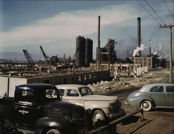
Every summer morning, a good share of the water coming out of taps and sprinklers from Provo to Salt Lake City has spent time behind a 235-foot wall of earth at the top of Provo Canyon. Deer Creek Dam, finished in 1941, is the centerpiece of the Provo River Project, a federal water system that also pulls water through a tunnel under the Uinta Mountains and a canal from the Weber River. It was born out of a drought that nearly emptied Utah Lake, and it still shapes how Utah Valley gets its water.
This guide traces that history from the Bureau of Reclamation's project records, the Provo River Water Users Association (the group that runs the system), the Utah State Archives, the Metropolitan Water District of Salt Lake and Sandy, and the federal Central Utah Project office, then explains how to see the dam from Provo.
Quick facts
| Feature | What the sources say | Source |
|---|---|---|
| Deer Creek Dam | Zoned earthfill, 235 ft high, 1,304-ft crest, built 1938 to 1941 | Reclamation; PRWUA |
| Reservoir capacity | About 152,570 acre-feet (PRWUA lists 152,564); about 2,700 acres full | Reclamation; PRWUA |
| Flood-control space | 110,000 acre-feet | Reclamation |
| Location | Provo River, about 16 miles northeast of Provo | Reclamation; PRWUA |
| Powerplant | Two 2,475-kilowatt generators, in service 1958 | Reclamation; PRWUA |
| Duchesne Tunnel | Six miles through the Uintas, finished 1954 | PRWUA |
| Weber-Provo Canal | About 9 miles, enlarged to carry up to 1,000 cfs | Reclamation; PRWUA |
| Salt Lake Aqueduct | 42-mile pipeline, built 1940 to 1951 | Metropolitan Water District |
| Provo River Aqueduct | Former Murdock Canal, piped from 2010, about 21 miles | PRWUA; Reclamation |
| Irrigation served | Supplemental water to 48,156 acres | Reclamation |
| Cities served | Salt Lake City, Provo, Orem, Pleasant Grove, Lindon, American Fork, Lehi | Reclamation |
| Operator | Provo River Water Users Association (organized May 1935) | Reclamation |
Why the valley needed it
Utah Valley's farms and towns grew up on the Provo River and the smaller creeks coming off the Wasatch. Reclamation's project history notes that the first settlers at Fort Utah in March 1849 planted about 200 acres, that settlements followed at American Fork, Lehi and Pleasant Grove in August 1850, and that Brigham Young outlined a plan for use of the river's water in 1856. For decades the system ran on what the river delivered each season, with Utah Lake serving as the big natural reservoir at the bottom. (For the long view of the city those ditches fed, see our history of Provo.)
The weakness of that arrangement was timing. Mountain snowmelt comes in a rush in spring, and the river shrinks just as crops and towns need it most. Utah Valley had already reached across the mountains once to fix that problem: the federal Strawberry Valley Project tunneled water from the Colorado River side of the Wasatch into southern Utah County early in the 20th century. The northern half of the valley and Salt Lake City still had no large storage reservoir of their own.
Utah's Legislature created the Utah Water Storage Commission in 1921, and the commission and Reclamation began the first investigations of a Provo River project in 1922, according to Reclamation. What turned studies into construction was the drought of the early 1930s. Reclamation's history says a severe drought from 1931 to 1935 dropped the storage in Utah Lake from 850,000 acre-feet to 20,000 acre-feet. An acre-foot is enough water to cover an acre one foot deep, so the lake lost almost all of its usable storage in four years.
The Provo River Water Users Association's own history adds that Salt Lake City was short of water in the 1930s too. The city of Provo and five other Utah County communities joined Salt Lake City and irrigation interests to sponsor the project because they needed "additional domestic water supplies," the association says. The arguments over who gets the Provo River's water did not start or end with this project; our piece on Utah Valley's water wars covers that longer fight.
Organizing and paying for it
The project came together during the Depression, and New Deal money is a big part of the story. Reclamation says construction began under the National Industrial Recovery Act of June 16, 1933, and President Franklin D. Roosevelt approved the project on Nov. 16, 1935. The Utah State Archives, which holds Gov. Henry H. Blood's records on the effort, describes it as "a Public Works program" and says "the money for the project was advanced by the federal government," to be paid back in 40 annual installments without interest.
Two local organizations were formed in 1935 to sign for that repayment and run the works. Reclamation says the Provo River Water Users Association was organized in May 1935, followed in August by the Metropolitan Water District of Salt Lake City (today the Metropolitan Water District of Salt Lake and Sandy). The association's history says Reclamation contracted with it to "maintain and operate Project features" and loaned it money for construction, operation and maintenance, with full repayment of the original construction costs expected in 2023.
The archives' records also show the project was broader than one dam. The state archives' description groups the Deer Creek work, the Salt Lake Aqueduct and a Utah Lake diking effort aimed at cutting evaporation under the single name of the Provo River Project.
Building Deer Creek Dam
Construction started in May 1938, Reclamation and the association agree, at a site on the Provo River about 16 miles northeast of Provo. The dam is a zoned earthfill structure: a mountain of compacted earth and rock arranged in layers, rather than a concrete wall. Reclamation lists it at 235 feet high with a crest 1,304 feet long and 2,810,000 cubic yards of fill.
The first water became available in 1941, when the dam was finished. Behind it, Deer Creek Reservoir holds 152,570 acre-feet by Reclamation's count (the association's page lists 152,564) and covers about 2,700 acres at full capacity, according to the association. Reclamation says 110,000 acre-feet of that space is set aside for flood control, and it credits the dam with $22,000,000 in flood-control benefits from 1950 to 1999.
Water leaves the reservoir two ways. A concrete chute spillway on the right abutment, controlled by two radial gates, can pass 12,000 cubic feet per second in a flood. The outlet works, controlled by two tube valves, release up to 1,500 cubic feet per second into the river below.
Power came later. Reclamation says the Secretary of the Interior authorized the Deer Creek Powerplant on Aug. 20, 1951, and it was completed in 1958 with two 2,475-kilowatt generators, 4,950 kilowatts in all. The association says it staffs the plant around the clock, and that power sales help offset its operating, maintenance and repayment costs.
Bringing in more water: the Weber-Provo Canal
Deer Creek was designed to hold more water than the Provo River alone could reliably fill. The association says the dam stores water from three sources: Provo River flood flows, the Weber River by way of the Weber-Provo Diversion Canal, and the headwaters of the Duchesne River by way of the Duchesne Tunnel.
The Weber link came first. According to the association, the Weber-Provo Canal was originally built in 1929 and 1930 under an earlier federal undertaking, the Weber River Project, with a capacity of 210 cubic feet per second. The Provo River Project added Weber River water rights when it was authorized in 1935, obtained more rights in the 1940s, and enlarged the canal between 1941 and 1947 so it could carry up to 1,000 cubic feet per second.
The canal starts at a concrete diversion dam on the Weber River about one mile east of Oakley, in Summit County. The association describes that dam as about 19 feet high and spanning the full width of the river. From there the canal runs about nine miles generally south to the Provo River. A gauge at Francis, about three miles southwest of Kamas, measures how much water the canal hands off to the Provo; the association says it was built in 1941 as part of the enlargement. Along the way, a diversion at Kamas can also pull in water from Beaver Creek.
Under the Uintas: the Duchesne Tunnel
The bolder piece of the plan reached east into a different river basin. The North Fork of the Duchesne River drains toward the Uinta Basin and, eventually, the Colorado River. The Duchesne Tunnel carries part of that flow west under the mountains into the Provo River drainage, where it can be stored behind Deer Creek.
The association describes the tunnel as a six-mile, concrete-lined, horseshoe-shaped rock tunnel running from the Duchesne Diversion through the Uinta Mountains to the Provo River. Its diversion dam sits on the North Fork of the Duchesne River, which the association places about 21 miles east of Kamas and Reclamation places about 30 miles east of Heber City.
The tunnel was the project's longest job, and World War II and the Korean War both slowed it. Reclamation says wartime shortages halted work on the Duchesne Tunnel in 1942 and full-scale work resumed in 1947. The association's tunnel page gives a more detailed schedule: construction began in 1948, stopped in 1951 at the outbreak of the Korean War, resumed in 1953 and was completed in 1954. The association also repeats a story that the crews, who started at both ends and worked toward the middle, were only inches apart when they met; it labels that account unverified.
The two agencies' numbers for the tunnel differ slightly. Reclamation lists it at 9.25 feet in diameter with a capacity of 600 cubic feet per second; the association says 10 feet and 621 cubic feet per second. The association dates its present diversion dam to 1952 and describes a smaller Broadhead Diversion nearby, built in 1953 and rebuilt in 1964, that pipes water from Little Deer Creek into the Duchesne just above the tunnel intake.
Carrying it north: the Salt Lake Aqueduct
Salt Lake City's share of the water needed its own route out of the canyon. Reclamation says presidential approval for the Salt Lake Aqueduct came on Oct. 24, 1938, and that the aqueduct division was built from 1939 to 1951. The Metropolitan Water District of Salt Lake and Sandy, which operates it, says construction began in 1940 and was completed in 1951.
The district describes the aqueduct as a 42-mile pipeline that "carries water from Deer Creek Reservoir in Wasatch County to a storage reservoir in Salt Lake City," moving entirely by gravity. Thirty-three miles carry untreated water and nine miles carry treated water, the district says. It is built of 69-inch-diameter concrete pipe, each 20-foot section weighing 41,300 pounds. The district gives a design capacity of 175 cubic feet per second, or 113 million gallons a day; Reclamation's older project page lists 150 cubic feet per second and a length of 41.7 miles.
Reclamation's description also lists two tunnels on the line, the Alpine-Draper Tunnel (15,037 feet long) and the Olmstead Tunnel (3,614 feet), along with a Terminal Reservoir of 1,228 acre-feet at the Salt Lake end.
The Murdock Canal and the Provo River Aqueduct
Utah County's share left the river at the mouth of Provo Canyon. There, the Murdock Diversion Dam turns water out of the Provo River into what was long called the Provo Reservoir Canal, or the Murdock Canal. The association says the dam was completed in 1950, with a 22-foot concrete weir and a capacity of 550 cubic feet per second.
The canal itself was older than the project. The association says the Provo Reservoir Company built it in the early 1900s with a capacity of 180 cubic feet per second, and that in the 1940s Reclamation bought the canal and its right-of-way for the Provo River Project and enlarged it to 550 cubic feet per second. It ran along the foothills from Orem toward the Point of the Mountain, serving irrigators and cities in northern Utah County and Salt Lake County.
As houses filled in around it, the open canal was replaced with a pipe. The association says that beginning in 2010 the canal was enclosed in a welded-steel pipe, mostly 126 inches in diameter, and renamed the Provo River Aqueduct, now with a capacity of 612 cubic feet per second. KUER reported that local leaders celebrated completion of the 21-mile pipeline on April 5, 2013, after nearly two decades of planning and negotiation. Reclamation said in an October 2014 release that the enclosure was completed in 2012, that the project would conserve 8,000 acre-feet of water to support flows for the endangered June sucker, and that it transferred ownership of the aqueduct to the association at a ceremony on Oct. 31, 2014, under the Provo River Project Transfer Act.
The same release says a $12 million Federal Highway Administration grant and local partners paid for the Murdock Canal Trail on top of the pipe, a 17-mile paved trail from Orem to Lehi through seven Utah County communities.
Jordanelle: the next reservoir upstream
For about half a century, Deer Creek was the main storage reservoir on the Provo. That changed with Jordanelle, built upstream as part of the Central Utah Project's Bonneville Unit. Reclamation's facility record says Jordanelle Dam was built from 1987 to 1992 on the Provo River about six miles north of Heber City, that its reservoir holds 320,300 acre-feet, and that the Central Utah Water Conservancy District operates it. The Interior Department's Central Utah Project office describes the dam as 296 feet high and gives total storage of 363,000 acre-feet; the two federal sources measure differently.
Jordanelle changed how the river works. The Central Utah Project office says the reservoir captures Provo River water that would otherwise flow to downstream users at Utah Lake, and that an equal amount is delivered to Utah Lake from Strawberry Reservoir through the Diamond Fork System. Water released from Jordanelle flows down through Heber Valley into Deer Creek, and the association says the Provo River Aqueduct now carries stored water from both Deer Creek and Jordanelle.
The Central Utah Project's municipal and industrial system delivers about 90,000 acre-feet a year, the federal office says: about 70,000 to the Salt Lake area and about 20,000 to Orem and Provo. Its Alpine Aqueduct carries water to the Utah Valley Water Treatment Plant in north Orem. For more on the two reservoirs as places to visit, see our Deer Creek and Jordanelle guide.
What it means for Utah Valley water today
The numbers show how much of northern Utah depends on this system. Reclamation says the project delivers an average of 73,454 acre-feet a year to 479,221 people, and provides supplemental irrigation water to 48,156 acres in Utah, Salt Lake and Wasatch counties. The association's description of its current intake project puts the reach of the Deer Creek intake at drinking, secondary irrigation, industrial and agricultural water for "1,500,000 people in Utah." The two figures measure different things, but both make the same point: the dam serves well beyond Provo.
For people in Utah Valley, the connection runs through two kinds of water. Treated culinary water comes to several north county cities in part from Provo River supplies, and the untreated secondary water that waters lawns and fields relies on the same river and reservoirs. Our explainers on where Provo's water comes from and secondary water in Utah Valley cover how that reaches individual homes.
The original works are also aging. The association's Deer Creek Intake Project page says the intake and guard gates, from the original design, are past their useful life, lack a bypass, and were not covered by the 2007 seismic upgrades to the dam's foundation and spillway gates. It also says the dam has "no effective defense" against invasive quagga mussels. The association estimates the project at $100,000,000, with $24 million in funding from the Central Utah Water Conservancy District and a $65 million loan authorized by the state Board of Water Resources. The page says design began in 2021, construction was scheduled to start in spring 2023, and the closure of Sailboat Beach that began May 1, 2023 was expected to last until spring 2026. The association's page does not give a current completion status, so check with the association (801-796-8770) or the state park for the latest.
How to see it from Provo
The dam is an easy drive. Head north on University Avenue, which is US-189, and keep going up Provo Canyon on the same highway. An OSRM routing estimate from Center Street in downtown Provo to the dam area comes to about 15.7 miles and roughly 27 minutes without traffic, almost all of it on US-189. Our Provo Canyon guide covers the stops along the way, and our history of the Provo Canyon road explains how the highway itself came to be.
Beyond the dam, US-189 continues along the reservoir toward Heber Valley. The dam and powerplant are operating federal infrastructure, so look at them from public roads and park areas rather than trying to walk onto the structure. UDOT has been widening US-189 along the reservoir; see our report on the Deer Creek widening before you go.
To spend time on the water, Deer Creek State Park runs the recreation areas around the reservoir. Utah State Parks lists park hours of 6 a.m. to 10 p.m. year-round, with the main office generally open 8 a.m. to 4 p.m. in winter and closed Nov. 26 and 27. The park notes that its hours don't reflect when gates are staffed, and that self-pay options are available at all entrances. The park's phone number is 435-654-0171.
Fees from the park's fee page, checked Saturday, Nov. 21, 2026:
- Winter day use (Oct. 21 to March 18): $15 per vehicle; $10 for Utah seniors 65 and older
- Summer day use (March 19 to Oct. 20): $20 per standard vehicle, up to eight people; $10 for Utah seniors
- 2026 annual pass: $125 for Utah residents, $65 for seniors 65 and older
On that date the park listed both the main Deer Creek boat ramp and the Island boat ramp as open, two campgrounds closed for the season and Fox Den campground open for walk-in reservations, and warned of cold-water boating conditions. Life jackets are required for each person on a vessel, including kayaks and paddleboards, the park says. If you plan to visit several state parks, our guide to the Utah State Parks pass explains the options.
If you want to see the far ends of the system, the Weber-Provo Canal and the Francis gauge are near Kamas and Francis, and the Duchesne Tunnel's intake is in the Uinta Mountains east of Kamas. Those are working water facilities; the association lists the work it does at each site to keep debris and gates clear, so treat them as places to view, not to explore.
A short timeline
- 1921: Utah Legislature creates the Utah Water Storage Commission (Reclamation).
- 1922: First Provo River project investigations begin (Reclamation).
- 1931 to 1935: Drought drops Utah Lake storage from 850,000 to 20,000 acre-feet (Reclamation; PRWUA).
- 1935: Provo River Water Users Association organized in May; Metropolitan Water District of Salt Lake City in August; President Roosevelt approves the project Nov. 16 (Reclamation).
- May 1938: Construction begins (Reclamation; PRWUA).
- 1941: Deer Creek Dam completed; first water delivered (Reclamation; PRWUA).
- 1941 to 1947: Weber-Provo Canal enlarged to 1,000 cubic feet per second (PRWUA).
- 1950: Murdock Diversion Dam completed (PRWUA).
- 1951: Salt Lake Aqueduct completed (Metropolitan Water District).
- 1954: Duchesne Tunnel completed (PRWUA).
- 1958: Deer Creek Powerplant completed (Reclamation).
- 1987 to 1992: Jordanelle Dam built upstream (Reclamation).
- 2012 to 2013: Murdock Canal enclosed as the Provo River Aqueduct; completion celebrated April 5, 2013 (Reclamation; KUER).
- Oct. 31, 2014: Aqueduct ownership transferred to the association (Reclamation).
Sources
This guide draws on the Bureau of Reclamation's Provo River Project page and Jordanelle Dam record; the Provo River Water Users Association's history and pages on Deer Creek Dam, the Duchesne Tunnel, the Weber-Provo system, the Provo River Aqueduct and the Deer Creek Intake Project; the Utah State Archives; the Metropolitan Water District of Salt Lake and Sandy's Salt Lake Aqueduct page; the Central Utah Project office's municipal and industrial system page; Utah State Parks' Deer Creek page and fee schedule; Reclamation's October 2014 news release; and KUER's 2013 report. All were checked Nov. 21, 2026.
Frequently Asked Questions
What is the Provo River Project?
When was Deer Creek Dam built?
Why was Deer Creek Dam built?
How big is Deer Creek Dam?
What is the Duchesne Tunnel?
Who runs Deer Creek Dam today?
How do I get to Deer Creek Dam from Provo?
How much does it cost to visit Deer Creek State Park?
Sources
The facts in this guide were checked against these sources. Hours, fees and rules change, so confirm anything time-sensitive with the source before you go. How we make Provo.com.
- Provo River Project, Bureau of Reclamation. Checked November 21, 2026.
- Jordanelle Dam, Bureau of Reclamation. Checked November 21, 2026.
- Reclamation transfers title of Provo River Aqueduct, Bureau of Reclamation. Checked November 21, 2026.
- Series 189: Provo River Project records, Utah State Archives. Checked November 21, 2026.
- Salt Lake Aqueduct, Metropolitan Water District of Salt Lake and Sandy. Checked November 21, 2026.
- Municipal and Industrial System, Central Utah Project Completion Act Office, U.S. Department of the Interior. Checked November 21, 2026.
- Deer Creek State Park, Utah State Parks. Checked November 21, 2026.
- Deer Creek State Park Fees, Utah State Parks. Checked November 21, 2026.
- Association History, Provo River Water Users Association. Checked November 21, 2026.
- Deer Creek Dam & Reservoir, Provo River Water Users Association. Checked November 21, 2026.
- Duchesne Tunnel System, Provo River Water Users Association. Checked November 21, 2026.
- Weber-Provo Canal System, Provo River Water Users Association. Checked November 21, 2026.
- Provo River Aqueduct System, Provo River Water Users Association. Checked November 21, 2026.
- Deer Creek Intake Project, Provo River Water Users Association. Checked November 21, 2026.
- Provo Reservoir Canal Enclosure and Trail Completed, KUER. Checked November 21, 2026.