Devils Garden is the trailhead at the very end of the Arches National Park road, and it is the one place in the park where a single parking lot can give you a 40-minute stroll or a long day on slickrock. The National Park Service lists Landscape Arch, one of the longest stone spans in the world, at 1.9 miles round trip on an easy trail. Past it, the route to Double O Arch climbs onto sandstone fins and becomes what the park rates difficult, at 4.1 miles round trip. The Primitive Trail, which turns Double O into a loop, is rated most difficult, with route-finding, drop-offs and a pool that may hold water. This guide covers the drive from Provo, the trail-by-trail distances, what the Primitive Loop asks of you, a full-day plan, fees, seasons, and the people who should stop at Landscape Arch and turn around.
For the bigger trip, start with our Moab from Provo guide. This page is the detail on one trailhead.
| Item | Detail | Source |
|---|---|---|
| Managing agency | National Park Service, Arches National Park | NPS |
| Landscape Arch | 1.9 miles round trip, easy | NPS Devils Garden page |
| Double O Arch | 4.1 miles round trip, difficult | NPS Devils Garden page |
| Primitive Trail | 2.1 miles one way, most difficult | NPS Devils Garden page |
| All trails and spurs | 7.9 miles | NPS Devils Garden page |
| Park hours | Normally open 24 hours, year-round | NPS hours page |
| Timed entry in 2026 | Not required | NPS news release, Feb. 18, 2026 |
| Vehicle fee | $30 | NPS fees page |
| Dogs on trail | Not allowed | NPS pets page |
| Trailhead from visitor center | About 18 miles, 45 minutes | NPS Devils Garden page |
| From Provo | About 204 miles, a little over 4 hours | OSRM estimate |
| Park phone | 435-719-2299 | NPS |
Who this hike is for
Devils Garden works for more kinds of groups than any other trailhead in Arches, because the first mile is easy and the hard parts are optional. A family with young children, a grandparent who walks well on flat ground, or a carload of students who arrive at 4 p.m. can all reach Landscape Arch and get back to the car. The longer route to Double O Arch is for people who are comfortable using their hands on rock and walking along a ledge with a drop beside them. The Primitive Loop is for experienced hikers in dry conditions who can follow cairns across bare rock.
If you have scrambled on the upper parts of Timpanogos, the moves on the Double O fins will feel familiar. The difference is the surface. The park's trail guide says sandstone "is often called slickrock and can be slippery even when dry," and sand on rock makes it worse.
The drive from Provo
An OpenStreetMap routing estimate (OSRM) puts the Devils Garden trailhead about 204 miles from downtown Provo, a little over four hours of driving without stops. Our Moab guide describes the route: I-15 to Spanish Fork, US-6 southeast through Spanish Fork Canyon and Price to Green River, east on I-70, then south on US-191 to the Arches entrance, which sits north of Moab. You reach the park before you reach town.
The extra piece for Devils Garden is the park road. The NPS Devils Garden page says the trailhead is at the end of the paved road, about 18 miles and 45 minutes north of the Arches Visitor Center. Add that to the highway drive and a stop for fuel in Green River, and plan on roughly four and a half hours from Provo to the trailhead, longer with a line at the entrance. The park's current conditions page, last updated March 18, 2026, says entrance waits between March and October may exceed 60 minutes.
Check UDOT's traffic site, udottraffic.utah.gov, before you leave. It shows incidents, construction, cameras and color-coded road weather, and it lets logged-in users set notifications for a route. Our road conditions guide explains how to use it for US-6, the leg of this drive that most deserves care.
Reservations, fees and hours
Timed entry. Arches does not require a timed-entry reservation in 2026. The Park Service announced the change on Feb. 18, 2026, and the park's Plan Your Visit page says, "In 2026, advanced timed-entry reservations will not be required at Arches." As of Nov. 15, 2026, the park's timed-entry page carries only a note that it "is currently being worked on." None of the Arches pages checked for this guide say what happens in 2027. Our Arches entry reservations explainer covers the history and how to check.
What still needs a reservation. The Plan Your Visit page says reservations "continue to be required for Devils Garden Campground and self-guided and ranger-led Fiery Furnace hikes." Fiery Furnace is a separate area off the same road; our Fiery Furnace guide explains the permits.
Entrance fees. The Arches fees page, last updated April 18, 2025, lists:
- Private vehicle: $30. Recreation.gov's campground page says the vehicle pass is valid for seven days.
- Motorcycle: $25, valid seven days.
- Per person (cyclists, hikers, pedestrians): $15; youth 15 and under are free.
- Southeast Utah parks annual pass: $55, which the park lists as available to U.S. residents only.
- America the Beautiful annual pass: $80 for U.S. residents, $250 for nonresidents, with senior, military, access and fourth-grade versions.
The Arches fee page does not list a separate nonresident surcharge. Visit Utah's page on 2026 fee changes says a $100 nonresident fee applies at 11 of the most-visited national parks and names Bryce Canyon and Zion among them, but it does not name Arches. International visitors should confirm on nps.gov/arch before the trip. Our national park passes guide works through which pass makes sense for a Utah Valley household.
Hours. The hours page says Arches is "normally open year-round, 24 hours a day," and that fees apply. It recommends entering before 8 a.m. or after 3 p.m. during the busy March to October season. The visitor center is open daily and closed Dec. 25, according to the same page, which does not list daily opening times. Call 435-719-2299 if you need them.
Parking. The Devils Garden page says the lots "can be very busy during peak season and during holiday weekends." The park's February news release says that when lots fill, staff may temporarily restrict access to specific locations, and it asks drivers not to wait in the roadway for a space. The conditions page adds a request not to park on vegetation or where you block the road.
The trail, segment by segment
All figures below come from the current NPS Devils Garden page and are round trip from the trailhead unless marked otherwise. The park's printed trail guide, dated July 2018, lists slightly different numbers (1.6 miles to Landscape Arch, 4.2 to Double O, 7.2 for all trails), which is a reminder that trail mileage is an estimate.
| Destination or segment | Distance | NPS rating |
|---|---|---|
| Landscape Arch | 1.9 miles round trip | Easy |
| Pine Tree and Tunnel arch spurs | Add 0.5 mile combined | Easy |
| Double O Arch | 4.1 miles round trip | Difficult |
| Navajo and Partition arch spurs | Add 0.8 mile combined | Easy |
| Dark Angel via the main trail | 4.9 miles round trip | Difficult |
| Dark Angel with a Primitive Trail return | 6.6 miles round trip | Most difficult |
| Primitive Trail | 2.1 miles one way | Most difficult |
| Private Arch spur | 0.52 mile | Not rated; reached from the Primitive Trail |
| All trails including spurs | 7.9 miles | Mixed |
The ratings for the Navajo and Partition spurs come from the park's printed trail guide, which calls all four side trails easy and hard packed with gravel, sand or rock. The Private Arch spur sits on the Primitive Trail, so you reach it only by hiking part of that route.
Trailhead to Landscape Arch
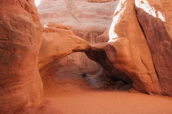
The first stretch is the easy one. The NPS describes "no significant elevation gain, only moderate hills," and the trail guide describes a graveled, graded path that "winds among tall fins." The fins are the reason the area has its name: tall, parallel walls of sandstone left standing where cracks widened, according to the trail guide's geology section.
Along the way, two spur trails branch off to Pine Tree Arch and Tunnel Arch. The park lists them together as an extra half mile and calls them easy. They are the right add-on for a family that wants more than one arch without committing to the fins.
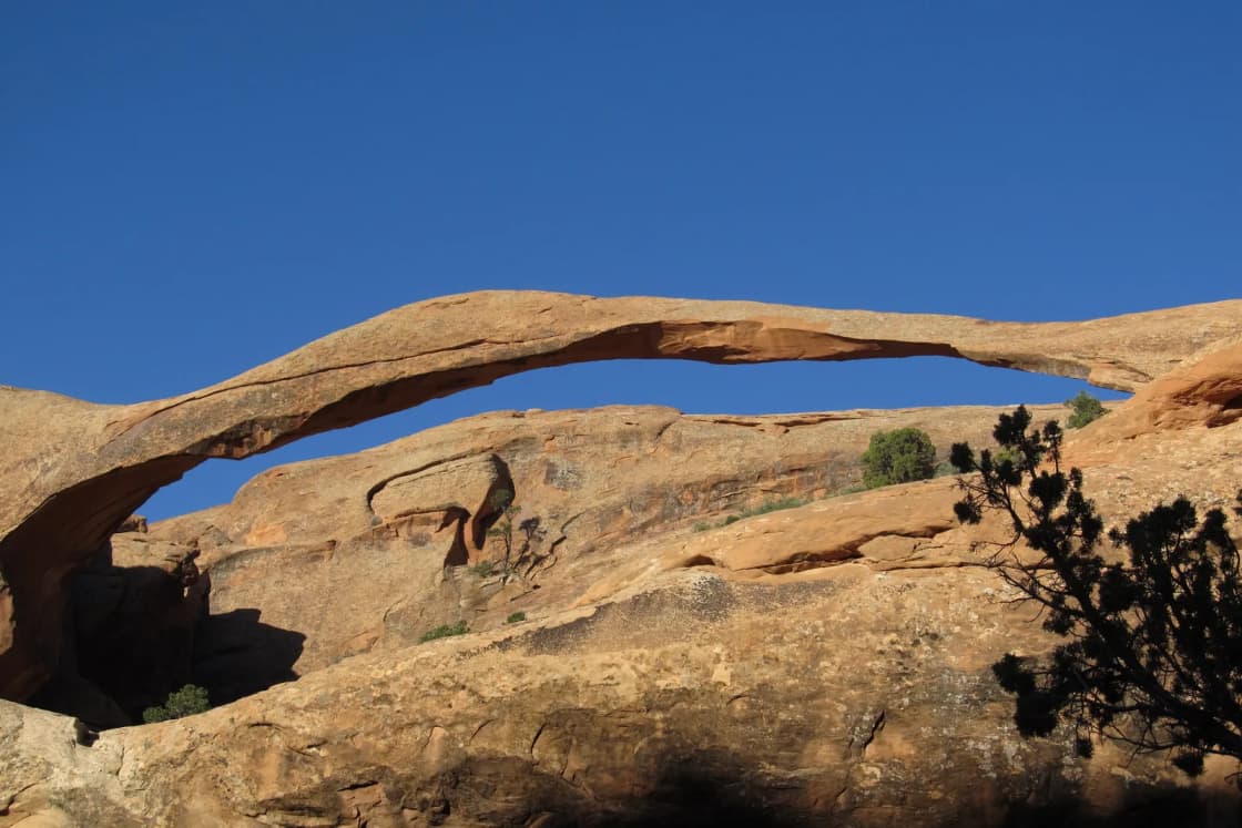
Landscape Arch is the payoff. The trail guide says it "stretches 306 feet (93 m), yet is only about 11 feet (3.3 m) thick at its center." The Devils Garden page says "large segments of the arch came crashing down in the 1990s" and that it "still hangs on by a very thin thread."
The 1991 rockfall and the closed ground beneath the arch. An NPS article on the event says a piece fell from Landscape Arch on Sept. 1, 1991, at about 2:45 p.m., and that visitors who had walked beneath the arch captured photos and video of it. The trail guide says the slab was 60 feet long and dropped "from the underside of the arch's thinnest section," and that some of the boulders on the slope below are remnants of it. "That area has since been closed to hiking for visitor safety," the NPS article says, and the trail guide notes that vegetation is slowly recovering where the old trail ran under the arch. The same article says if you hear an arch popping, snapping or cracking, move away from it. Stay on the trail and view the arch from the front.
Landscape Arch to Double O Arch
This is where the trail changes character. The trail guide says it "becomes more difficult," with "steep, sloping surfaces and close proximity to drop-offs." The Devils Garden page says the route "steeply climbs up and on the sandstone fins," that "footing is rocky; there are narrow ledges with steep drop-offs," and that hikers must scramble and climb with hands and feet. The trail guide puts it plainly in capital letters: "The trail beyond Landscape Arch is DIFFICULT, especially in hot weather."
About a third of the way from Landscape Arch to Double O, the park says, short spurs lead to Navajo Arch and Partition Arch, together adding about 0.8 mile. Both are easy side walks and a good place to rest in the middle of the harder section.
The main trail ends at Double O Arch. From there, the NPS describes Dark Angel as "the tall, dark spire seen off in the distance from Double O," reached by an optional spur that brings the round trip to 4.9 miles on the main trail.
The fins are the part to weigh before you go. Because the trail runs on top of them, the drop-offs are on both sides in places, and a pack that pulls you backward or a gust of wind matters more than it would on a canyon floor. If anyone in the group freezes on the first fin past Landscape Arch, that is the signal to turn around. The trail does not get easier on the way to Double O.
The Primitive Loop: what makes it hard
The Primitive Trail runs 2.1 miles one way and joins the main trail at the Double O end, letting you return to the trailhead by a different route instead of retracing the fins. The NPS calls it the most difficult segment in Devils Garden. Taken together, the park's Devils Garden page and printed trail guide describe five hazards:
- Route-finding. The trail guide says "there are fewer trail markers to follow." The route crosses bare rock where there is no worn path, so you follow cairns, the small rock piles the park uses as markers. The park's hiking page says some trails "cross broad rock surfaces" and asks hikers to pay attention to find the route. Do not move existing cairns or build your own, the trail guide says, because the next hiker depends on them.
- Slickrock slopes and exposure. The park lists "steep slopes, narrow drop-offs, and rock scrambling," and the trail guide adds "exposure to heights." The Devils Garden page says the Primitive Trail is not recommended "for those uncomfortable with heights."
- The pool. "Hiking the Primitive Trail requires crossing a pool that may contain water," the NPS says. The trail guide map adds that the "crossing can be difficult." Separately, the park's hiking page asks visitors not to swim, bathe in or drink from desert potholes.
- Sand. The trail guide lists "sandy conditions" on the Primitive Trail. Sand on sandstone is one of the main reasons people slip.
- Wet, icy or snowy rock. The Devils Garden page says the route "is not recommended when rock is wet or icy," and the trail guide says the park does not recommend it "when snow or ice cover the routes."
The park does not recommend a direction for the loop on its Devils Garden page. Whichever way you go, the practical rule is the same: if you lose the cairns, stop and go back to the last one you saw rather than pushing forward on a guess. The Arches safety page says cell service is unreliable in remote areas and that trails may be unmarked, and it recommends offline maps in the NPS App, a physical map and a compass, and telling someone at home your route.
The Private Arch spur, 0.52 mile, leaves the Primitive Trail 0.42 mile from the Double O and Primitive Trail junction, the park says. Adding it means more time on the hardest part of the system.
A full-day plan from Provo
Devils Garden fits a two-night Moab trip better than a one-day drive. At four-plus hours each way from Provo, a same-day trip leaves too little margin for the full loop. Here is a plan for the hiking day itself, built around a night in Moab or at Devils Garden Campground.
Early morning. Leave Moab with water, food and a full tank. The park's hours page recommends entering before 8 a.m. in the busy season, and the trailhead is 45 minutes past the visitor center. On a spring or fall weekend, arriving early is the difference between finding a space and being turned away from the lot.
First mile. Walk to Landscape Arch, then take the Tunnel and Pine Tree spurs on the way out or back. This is where to decide, as a group, whether everyone continues.
The fins. Continue toward Double O Arch, adding the Navajo and Partition spurs about a third of the way. Eat at Double O. Decide there, with a look at the sky and the rock, whether to add Dark Angel and whether to return by the Primitive Trail.
The return. If the rock is dry, the group is comfortable with exposure and you have water to spare, return on the Primitive Trail. Otherwise retrace the main trail, which the park rates difficult rather than most difficult. Either way, aim to be off the fins before the heat of the afternoon in warm months, since the park's Devils Garden page says to avoid hiking in midday summer heat.
Afternoon. The Devils Garden page notes a day-use picnic area just south of the campground entrance. For a second stop with less walking, our Delicate Arch guide covers the two short viewpoints on the way back toward the entrance.
The park does not publish hiking times for these routes. Budget generously: the scrambling sections are slow, groups bunch up at narrow spots, and photographs at every arch add up. Our two-day Arches and Canyonlands itinerary shows how this hike fits with the rest of a weekend.
Daylight by season
Daylight is the constraint in the cold months. The U.S. Naval Observatory's calculator for the Devils Garden area gives these times:
| Date | Sunrise | Sunset |
|---|---|---|
| April 15, 2026 | 6:42 a.m. | 7:55 p.m. |
| June 21, 2026 | 5:54 a.m. | 8:47 p.m. |
| Oct. 15, 2026 | 7:28 a.m. | 6:40 p.m. |
| Nov. 15, 2026 | 7:01 a.m. | 5:05 p.m. |
In mid-November civil twilight ends at 5:33 p.m., which leaves about ten hours of usable light. That is enough for the main trail to Double O, but it does not leave much room for a late start, a wrong turn on the Primitive Trail and a 45-minute drive out. Carry a headlamp in any season.
When to go
The Arches weather page calls spring (April and May) and fall (mid-September through October) the most temperate seasons, with highs around 60 to 80 degrees and lows around 30 to 50. Its monthly averages list April at a high of 71 and a low of 42, and October at 74 and 42.
Summer is the hard case for Devils Garden. The weather page lists a July average high of 100 degrees with 16 days above 100, and it warns that "late summer monsoon season brings violent storm cells which often cause flash floods." The fins hold heat and offer little shade. If you hike in summer, start at first light and be back before late morning.
November and winter bring cold and ice. The weather page lists a November average high of 56 and low of 30, with 18 days below freezing, and winter highs of about 30 to 50 degrees with lows near 0 to 20. It warns that "even small amounts of snow or ice can make local trails and roads impassable," and that daily temperature swings can top 40 degrees. A clear November day can be excellent for the easy walk to Landscape Arch. The Primitive Trail on frosty rock is a different question, and the park's answer is not to do it.
For the statewide picture, our Utah weather by month guide compares Moab with the Wasatch Front.
What to bring
- Water. The Arches safety page says to carry at least 2 to 3 liters per person on front-country hikes, and the printed trail guide says at least 1 quart for every two miles. Water is available at the visitor center and at Devils Garden Campground, the safety page says, not on the trail. The Devils Garden page also suggests salty snacks.
- Shoes with grip. Sticky rubber helps on slickrock. Smooth-soled sneakers do not.
- Hands free. A pack, not a tote or a handheld bottle, for the scrambling sections.
- Navigation. The safety page recommends downloading offline maps in the NPS App and carrying a paper map and compass.
- Layers, a hat and sun protection, given swings of 40 degrees in a day.
- A headlamp, especially from November through February.
- Your entrance pass or payment, since no reservation is needed in 2026 but a pass is.
Safety and conditions
Heat. The hiking page says many search and rescue incidents in Arches involve "heat and sun exposure," along with injuries and getting lost, and the safety page says rangers respond to hundreds of incidents a year. It lists dizziness, weakness and excessive sweating as early signs of heat exhaustion and says to rest in shade, drink and seek care if symptoms worsen.
Lightning. If you hear thunder, the safety page says, get to shelter, avoid tall rock formations and isolated trees, and wait at least 30 minutes after the last thunder. The fins are exposed, high ground.
Flash floods. The safety page says flash floods can happen even when it is sunny where you stand, and that 6 inches of moving water can knock you down. Do not cross a flooded wash.
Arches themselves. The Devils Garden page says, "Do not walk or climb on any arches." The hiking page says climbing, scrambling, walking or standing on, or rappelling off any arch is prohibited in the park.
Soil crust. The hiking page asks hikers to walk only on trails, rock or in sandy washes to protect biological soil crust. The trail guide says the crust needs five to ten years of undisturbed growth before it is even visible, and that "a single footprint left by a careless hiker can destroy decades of growth."
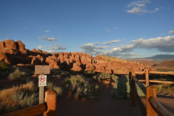
Dogs. The pets page says pets are not allowed on any hiking trail or overlook, even in a carrier. They may go on roads, in parking areas, in campgrounds and at picnic areas on a leash of 6 feet or less. Do not plan to leave a dog in the car while you hike: the page says a pet in a vehicle may die when the air temperature is above 65 degrees, even with the windows cracked.
Camping at Devils Garden
Devils Garden Campground sits near the trailhead and is the only campground in the park. Recreation.gov lists 51 sites, including two group tent sites and one accessible site, at about 5,200 feet, with drinking water and flush toilets but no showers, hookups or dump station. From March 1 through Oct. 31, all sites are by reservation, and the NPS camping page says reservations open up to six months ahead and the campground "is usually full every night" in that season.
From November through February, sites are first-come, first-served. The NPS asks winter campers to download the Recreation.gov app before arriving and pay with its Scan & Pay feature, since cell service in the park is unreliable. Recreation.gov lists a stay limit of 7 days per month and 14 days per year, generator hours of 8 to 10 a.m. and 4 to 8 p.m., and says firewood is not sold at the campground. Neither page fetched for this guide listed the nightly fee, so check Recreation.gov when you book. Our camping reservations guide explains the system.
Who should skip the fins, or change the plan
- Anyone uncomfortable with heights. The park says so directly about the Primitive Trail, and the main trail to Double O has narrow ledges too. Landscape Arch and the Tunnel and Pine Tree spurs are the right hike.
- Families with small children. The easy first mile is a good outing. The fins past Landscape Arch are not a place to carry a child or manage one who runs ahead.
- Dog owners. Dogs cannot go on any trail in Arches. Our Dead Horse Point guide covers a nearby park where leashed dogs are allowed on trails.
- Anyone after rain, snow or ice. Stay on the easy section.
- Summer midday hikers. Wait for evening or come back at dawn.
- Same-day drivers from Provo. With more than eight hours of round-trip driving, the full loop is a poor fit. Stay the night.
If Devils Garden is too much, Dead Horse Point and the Windows section of Arches offer big views with short walks.
What to check before you go
- The Devils Garden page at nps.gov/arch for current distances and warnings.
- Current conditions at nps.gov/arch for closures, road status and parking notes.
- The weather page and the National Weather Service forecast for Moab, especially for storms and freezing nights.
- Timed entry and fees on the Arches Plan Your Visit and fees pages, particularly for 2027 trips.
- Recreation.gov for Devils Garden Campground and Fiery Furnace.
- UDOT traffic at udottraffic.utah.gov for US-6, I-70 and US-191.
- Sunrise and sunset for your date on the U.S. Naval Observatory calculator.
- The park at 435-719-2299 for visitor center hours and anything the website does not answer.
Related Guides
- Moab from Provo: Planning the Drive, Arches and Canyonlands
- Delicate Arch Trail Guide
- Arches Fiery Furnace: Permits and Ranger Hikes
- Arches and Canyonlands: A Two-Day Itinerary From Provo
- Arches Entry Reservations: What Happened and How to Check
- Dead Horse Point State Park Guide
- Utah National Park Passes Explained
- Canyonlands Island in the Sky Guide
- Why Utah Has So Many Arches, and How One Forms
Frequently Asked Questions
How long is the hike to Landscape Arch?
How hard is the trail to Double O Arch?
What is the Primitive Loop in Devils Garden?
Should I hike the Primitive Loop in winter?
How far is Devils Garden from Provo?
Do I need a reservation to hike Devils Garden in 2026?
Can I bring my dog on the Devils Garden trail?
Can I walk under Landscape Arch?
Sources
The facts in this guide were checked against these sources. Hours, fees and rules change, so confirm anything time-sensitive with the source before you go. How we make Provo.com.
- National Park Service, Arches National Park: Devils Garden, National Park Service, Arches National Park. Checked November 15, 2026.
- Plan Your Visit, National Park Service, Arches National Park. Checked November 15, 2026.
- Arches Will Not Require Timed-Entry Reservations in 2026 (news release, Feb. 18, 2026), National Park Service, Arches National Park. Checked November 15, 2026.
- Make Your Reservation (timed entry), National Park Service, Arches National Park. Checked November 15, 2026.
- National Park Service, Arches National Park: Fees & Passes, National Park Service, Arches National Park. Checked November 15, 2026.
- Operating Hours & Seasons, National Park Service, Arches National Park. Checked November 15, 2026.
- Current Conditions, National Park Service, Arches National Park. Checked November 15, 2026.
- National Park Service, Arches National Park: Weather, National Park Service, Arches National Park. Checked November 15, 2026.
- National Park Service, Arches National Park: Safety, National Park Service, Arches National Park. Checked November 15, 2026.
- National Park Service, Arches National Park: Hiking, National Park Service, Arches National Park. Checked November 15, 2026.
- National Park Service, Arches National Park: Pets, National Park Service, Arches National Park. Checked November 15, 2026.
- National Park Service, Arches National Park: Camping, National Park Service, Arches National Park. Checked November 15, 2026.
- The 1991 Landscape Arch Rock Fall, National Park Service. Checked November 15, 2026.
- Devils Garden Trail Guide (2018), National Park Service, Arches National Park. Checked November 15, 2026.
- Devils Garden Campground, Recreation.gov. Checked November 15, 2026.
- Utah Department of Transportation: UDOT Traffic, Utah Department of Transportation. Checked November 15, 2026.
- Sun and Moon Data for One Day, U.S. Naval Observatory. Checked November 15, 2026.
- OSRM routing estimate, Provo to Devils Garden trailhead, Project OSRM (OpenStreetMap). Checked November 15, 2026.
- National Park Fee Changes, Visit Utah (Utah Office of Tourism). Checked November 15, 2026.