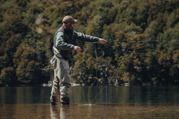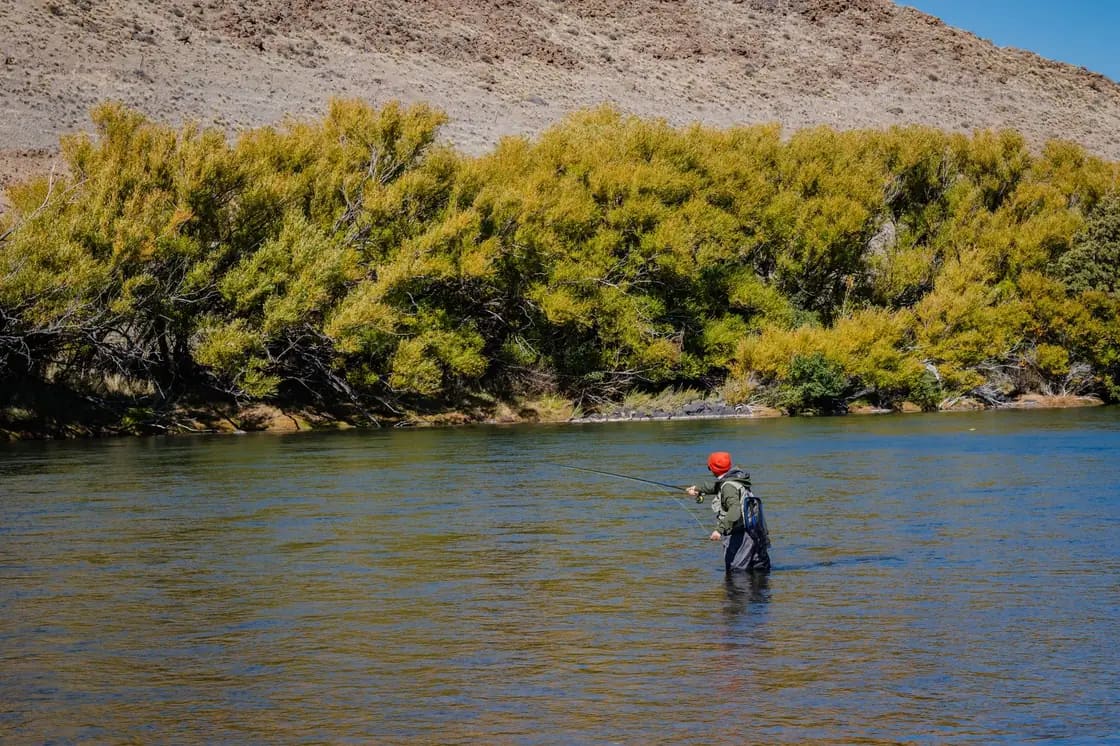

There is no such thing as fishing "the Provo River." There are three rivers, they behave differently, they hold different fish, and at least on paper they are governed by different rules that change at a bridge you can drive past without noticing.
That is the single most useful thing a visiting angler can know, and it is the thing most trip reports skip. The river runs from high in the Uinta Mountains down to Utah Lake at Provo, and along the way it gets dammed twice. Those two dams do not just interrupt the river — they manufacture two entirely new ones.
Our general fishing guide covers the whole neighborhood: Utah Lake, the reservoirs, licenses, what fishes when. This page is narrower and deeper. It is about fly water, reach by reach.
Why a dam makes a great trout river
A freestone stream — a river fed by snowmelt and tributaries, running free — has a summer problem. By August the flow has dropped, the water has warmed, and trout are stressed or gone.
A tailwater does not have that problem. Water released from the bottom of a deep reservoir comes out cold and comes out steady, regardless of what August is doing on the surface. That is the whole story of the Provo's reputation. Below Jordanelle Dam and below Deer Creek Dam, the river runs in a narrow, cold temperature band all year, which means insects hatch on a predictable schedule and trout grow without interruption.
The trout densities that get quoted for these stretches — figures in the thousands of fish per mile appear routinely in fishing press — are extraordinary numbers, and they come from the same source as the reliability: water that never gets too warm and never runs out.
The Middle Provo: the one with the reputation
Jordanelle Dam down to Deer Creek Reservoir, through the open ranch country of the Heber Valley, with Mount Timpanogos on the western skyline.
This is the reach that people fly into Salt Lake City to fish. It is a Blue Ribbon fishery, it is dense with brown trout with rainbows mixed in, and it is hard. The local shorthand for the Middle Provo is "finicky," and that is accurate: these fish see a great many flies, the water is clear, and the current is even enough to give a trout a long, unhurried look at your drift.
The technical answer is smaller and lighter than you want. Anglers fish 5X and 6X here as a matter of course, and fluorocarbon earns its cost in the slow clear pools where fish have time to inspect. Drag-free drift matters more than pattern selection on most days.
Access along this reach is unusually good for a Western river, and that is not an accident. A major river restoration project reworked the channel and left dedicated public access with parking areas along the road through the valley. You can park, walk down, and fish without negotiating with anyone.
Tackle rules change partway down. The upper portion — from Legacy Bridge on Midway Lane upstream toward Jordanelle Dam — has historically been artificial flies and lures only with a reduced trout limit. The lower portion, from Legacy Bridge down toward Charleston and the reservoir, has historically run under general statewide rules where bait is legal and the limit is higher. Same river, same afternoon, two rulebooks, and the boundary is a bridge.
The Lower Provo: the one in our backyard
Deer Creek Dam down through Provo Canyon, with US-189 running alongside the whole way.
For anyone living in Provo, Orem or Springville, this is the practical answer. You can be standing in blue-ribbon trout water fifteen minutes after leaving downtown Provo, which is an absurd thing to be able to say about a city of this size.
The character is different from the Middle. This is canyon water — tighter, faster in places, with pocket water and pools rather than long even runs. The first several miles below Deer Creek Dam are the classic stretch and have historically carried the same artificial-only, two-fish, size-restricted rules as the upper Middle Provo. It is one of Utah's original catch-and-release-minded fisheries and the fish are correspondingly educated.
Access is roadside and generous. US-189 has pullouts through the canyon. The Bridal Veil Falls area holds good pocket water, and the run near the mouth of the canyon is a long-standing local spot. Below the Olmstead Diversion Dam the character changes again — shallower riffles, warmer water in summer, general statewide regulations — and by the time the river reaches Utah Lake it is a warm-water fishery with an entirely separate set of rules involving walleye seasons, northern pike that must be killed rather than released, and protections for the June sucker.
The Upper Provo: the wild one
Above Jordanelle Reservoir, up toward the confluence of the north and south forks and on into the Uintas along the Mirror Lake Highway.
Small water. Pocket water and short runs, wild brown trout and Bonneville cutthroat rather than dense tailwater populations, and fish that are measured in inches rather than pounds. It has historically been artificial-only, with cutthroat and rainbow required to be released and only brown trout retainable under a size limit — a rule designed to protect native cutthroat rather than to manage a trophy fishery.
Nobody flies to Utah for the Upper Provo. That is exactly its appeal. Attractor dry flies work, the trout are not educated, and on a July weekday you can have a mile of it to yourself while the Middle Provo is shoulder to shoulder. If you have small children learning to cast, this is the water, not the Middle.
The hatch calendar, simplified
Spring into early summer. Blue Winged Olives on gray days. Then Pale Morning Duns, which become the backbone of the dry fly fishing and stay relevant for months.
Green Drake. The event. A large mayfly, a short window, and the one hatch people rearrange their schedules for. It is worth asking a fly shop rather than guessing, because the timing shifts with the water year.
Late summer into fall. Terrestrials — small hoppers, ants, beetles blown onto the water. A relief after months of tiny mayflies, and often the most fun fishing of the year.
October and November. Brown trout move toward spawning and get aggressive. This is the big-fish window and the crowds are gone. If you fish the Provo once a year, fish it now.
Winter. Midges and streamers, cold hands, empty parking lots, and a river that keeps working because tailwaters do not freeze the way freestone streams do. Genuinely underrated.
What lives in it
Brown trout dominate, and they dominate everywhere. They are wild, they are wary, and on the tailwaters they grow to sizes that surprise people who assumed a river running past a highway could not hold serious fish. Browns in the mid to upper teens are an ordinary day on the Middle Provo and larger fish are caught with enough regularity that nobody treats it as a story.
Rainbows are mixed through both tailwaters and tend to be a larger average fish on the Lower Provo than the Middle. Cutthroat appear more as you move up into the Upper Provo and the headwaters, where they are the native species and the regulations reflect it. Tiger trout and Arctic grayling turn up in the wider drainage.
At the bottom end, the river stops being a trout stream entirely. As it flattens toward Utah Lake it becomes warm water, and the species list shifts to walleye, white bass, catfish and northern pike. Northern pike are an introduced predator that Utah manages aggressively, and the rules on that stretch have historically required anglers to kill any pike they catch rather than release it. The same stretch carries protections for the June sucker, the endangered native fish that Utah Lake's restoration story is largely built around. It is the same river, and it could not be a more different fishery.
Reading a tailwater when everything looks the same
The hardest thing about the Middle Provo for anglers used to freestone streams is that it lacks obvious structure. There are no boulder gardens announcing where a fish should be. It is a long, even, clear river, and to an untrained eye every hundred yards looks like every other hundred yards.
Three things break up that sameness and they are what to look for.
Seams. Anywhere fast water runs alongside slow water, trout sit on the slow side and eat what the fast side delivers. On even water the seams are subtle — a shade change, a line of bubbles — and finding them is most of the skill.
Depth changes. A drop of even a foot creates a holding lie. In water this clear you can often see them if the light is behind you and you take the time to look rather than casting immediately.
Bank structure. Undercut banks, willow roots, anything overhanging. Big browns in particular sit tight to cover and a fly drifted eighteen inches off the bank will be ignored by the fish that a fly drifted two inches off the bank would have caught.
The general advice that follows from all of this: walk more, cast less. Most anglers on this river fish the first two hundred yards from the parking area and cover it exhaustively. Walking fifteen minutes puts you on water that has seen a fraction of the pressure, and on the Provo that is worth more than any fly in your box.
The summer problem nobody tells visiting anglers about
In July and August, Provo Canyon is a tubing corridor. Tubing the Provo is a beloved local summer institution and it is completely incompatible with fishing the same run at the same time.
This is not a complaint about tubers, who have as much claim to the river as anyone. It is a scheduling fact. A float of inner tubes coming through the pool you are working does not spook the fish for a minute; it ends that spot for the afternoon.
The workarounds are simple. Fish before nine in the morning, when the water is empty and the light is better anyway. Fish weekdays. Or in midsummer, drive the extra half hour and fish the Middle Provo, where the conflict does not exist.
Where you are allowed to stand
Utah's stream access law is stricter than what anglers arriving from most Western states assume, and it is the single most common way a visiting fly fisher ends up in a conversation they did not want.
The short version is that touching the bed of a stream where it crosses private property is not automatically permitted the way it is in some neighboring states, and public access depends on the specific reach. Our fishing guide covers the rule in detail, and it is worth reading before your first trip rather than after.
The practical consequence: use the marked public access points. On the Middle Provo the restoration-project access is well signed. In Provo Canyon the roadside pullouts and the trail corridor are the safe answer. Where a bank is posted, it is posted for a reason and the fine is real.
Flows, and the thing that changes under your feet
Both tailwaters are release-controlled, which is the source of their reliability and also the source of their one hazard.
Irrigation demand drives releases, and releases can change substantially over the course of a day and dramatically over the course of a season. A crossing that is comfortable at eight in the morning in September may not be comfortable in June at all. Current flow data is published and easy to check, and checking it is a five-second habit that occasionally matters a great deal.
The related point for planning: high runoff in late spring can make the whole system difficult for weeks. In a big snow year, the productive window shifts later. Ask a shop rather than assuming the calendar.
Gear, honestly
A nine-foot five-weight covers almost everything on this river. A four-weight is more pleasant on the Upper Provo; a six is more useful if you intend to throw streamers for big browns in November.
Bring tippet finer than you think — 5X and 6X — and bring more of it than you think, because fishing fine means breaking off. Waders are worth having year-round; this is cold water in August and very cold water in January. Polarized sunglasses are not optional on water this clear.
For anyone flying in without gear, guide services running half-day and full-day trips on the Middle and Lower generally supply everything, which makes a guided first day the efficient way to start a trip rather than an indulgence.
A realistic first day
Arrive at the Middle Provo by seven. Park at a signed access point on the Heber Valley side, walk fifteen minutes upstream past the water everybody fishes, and nymph the seams until something starts hatching. When it does, switch and fish the hatch. Break at midday, because the middle of the day is the weakest fishing and the best time to eat.
Late afternoon, either stay for the evening rise or drop down into Provo Canyon and fish the last two hours of light on the Lower Provo, which puts you fifteen minutes from dinner in Provo instead of an hour.
That is an excellent day of trout fishing, available on a Tuesday, inside an hour of a city with an airport thirty minutes up the freeway. It is the thing Utah Valley is quietly best at and the thing it advertises least.
Why the landowners along here let you through at all
The section above sets out where you may stand. This one answers the question that follows from it, which anglers rarely ask: if the public has a right to float through private property, what happens when somebody gets hurt doing it?
The answer is a second statute that was written to sit on top of the first. Utah Code § 57-14-101 states the purpose of Utah's landowner-liability chapter as limiting the liability of public and private landowners toward a person entering the land as a trespasser or for recreational purposes, whether by permission or by operation of Title 73, Chapter 29 — the Public Waters Access Act. The Legislature wrote the float right and the liability shield as a matched pair. Without the second, the first would have been unworkable, because no riparian owner would have accepted a public easement across their water that also carried a duty of care.
Utah Code § 57-14-202 carries the operative language: an owner of land who permits recreational use without charge, or an owner of a public access area open to public recreational access under the Public Waters Access Act, does not represent that the land is safe, does not confer the legal status of invitee or licensee on the person entering, does not assume responsibility for injury caused by that person or by anyone else who enters, and owes no duty to curtail their own use of the land while it is being used for recreation.
That last clause is the one worth carrying to the water. A landowner running cattle, moving irrigation, or working equipment on the bank has no obligation to stop because you are wading through. Fishing is listed by name in the recreational-purpose definition at Utah Code § 57-14-102, so a landowner along the Provo owes you no duty to keep the bank safe and no duty to warn you about the hole, the wire, or the bull.
The reservoir carve-out, which explains the tailwater
The immunity normally evaporates the moment the owner charges — that is Utah Code § 57-14-204. Applied literally, that would strip protection from every impoundment where a visitor pays a day-use fee, which in practice means Deer Creek and Jordanelle, the two structures that create the water you are fishing.
The same section handles it explicitly. Owners of a dam or reservoir who allow recreational use of the dam, the reservoir and the surrounding area, and who do not themselves charge for that use, are treated as not having charged even though the visitor pays a fee to the Division of State Parks or the Division of Outdoor Recreation for services and facilities there. The park fee is the park's; it does not attach to the dam owner.
What none of it excuses
Utah Code § 57-14-205 preserves every obligation you would otherwise have to exercise care, and Utah Code § 57-14-204 preserves liability for willful or malicious failure to guard or warn against a dangerous condition and for deliberate injury. Immunity from ordinary negligence is not immunity from everything, and a landowner who sets a hazard deliberately is outside the chapter entirely.
The practical upshot is unglamorous but useful: the reason this river is as open as it is has less to do with goodwill than with a Legislature that made tolerating anglers a nearly costless decision for the people who own the banks. Behave in a way that keeps it that way.
Related Guides
- Fishing Near Provo: The Complete Guide
- Tubing and Rafting the Provo River
- Deer Creek and Jordanelle Reservoirs
- Bridal Veil Falls
- Provo Canyon: What to See and Do
- Utah Lake: A Complete Guide
- Provo Weather Through the Year
- Day Trips from Provo
- Hunting Near Provo: How Utah's System Works Before You Worry About Where
- Utah Fishing and Hunting Licenses
Last updated August 2026. Fishing regulations change between guidebook editions and reach boundaries are precise — read the current Utah Fishing Guidebook for the stretch you are standing on.
Frequently Asked Questions
Which section of the Provo River is best for fly fishing?
Do I need a special license to fly fish the Provo River?
Where does the Provo River have artificial flies and lures only restrictions?
When is the best time of year to fly fish the Provo?
What flies work on the Provo River?
Can you wade the Provo River?
Is the Provo River crowded?
Do I need a guide to fish the Provo?
Sources
The facts in this guide were checked against these sources. Hours, fees and rules change, so confirm anything time-sensitive with the source before you go. How we make Provo.com.
- 2026 Utah Fishing Guidebook, Utah Division of Wildlife Resources. Checked October 12, 2026.
- Utah Code 57-14-101: Legislative purpose, Utah State Legislature. Checked October 12, 2026.
- Utah Code 57-14-102: Definitions, Utah State Legislature. Checked October 12, 2026.
- Utah Code 57-14-202, Utah State Legislature. Checked October 12, 2026.
- Utah Code 57-14-204, Utah State Legislature. Checked October 12, 2026.
- Utah Code 57-14-205, Utah State Legislature. Checked October 12, 2026.