Stand almost anywhere in Utah Valley and look east. The Wasatch Range does not rise in one smooth slope. Partway up, there is a flat step, a bench cut into the foothills like a shelf. That step is a beach. Utah Valley sits on the bed of a lake that was once more than 1,000 feet deep, and the shoreline it left behind is still visible from the sidewalk.
This guide explains what you are looking at, where in Utah Valley and along the Wasatch Front you can see it up close, and what the Utah Geological Survey and the U.S. Geological Survey say about how it formed. It is a looking-and-learning trip, not a single destination. Most of it can be done in an afternoon from Provo.
Elevations, ages and access rules on this page come from the sources named in the text, and some of them disagree with each other, which we point out where it matters. Trail conditions, fees and closures change, so check the managing agency before you head out.
Quick facts
| Topic | Detail | Source or note |
|---|---|---|
| What it is | Raised benches and terraces left by ancient Lake Bonneville | Utah Geological Survey |
| Lake size at its largest | About 20,000 square miles; about 325 miles long, 135 miles wide | Utah Geological Survey |
| Maximum depth | Over 1,000 feet | Utah Geological Survey |
| Main shorelines | Stansbury, Bonneville, Provo, Gilbert | Utah Geological Survey |
| Best Provo viewing | The foothill bench east of town, the Bonneville Shoreline Trail | Trail guide on this site |
| Nearest developed shoreline stop | Flight Park State Recreation Area at Point of the Mountain | Utah State Parks, about 30 minutes by car (our estimate) |
| Cost | Our trail guide lists no fee at city trailheads; state park day use requires a Day Pass | Verify before you go |
| Best seasons | Spring, early summer and fall; low-angle light in the morning and evening | See timing section |
Who this is for
This is for curious residents who have driven past the bench for years and never asked what it is. It also suits families looking for a low-cost outing that teaches something, BYU and UVU students who want a quick field trip, hikers who want to know why the Bonneville Shoreline Trail has its name, and visitors who want a sense of Utah's geology without driving to a national park.
It is a good fit for a mixed-ability group, because the best views of the shoreline come from the valley floor and from short walks, not from summit hikes. If you want a longer walk along the bench, our Bonneville Shoreline Trail guide for Provo and Orem covers the segments.
What Lake Bonneville was
According to the Utah Geological Survey, Lake Bonneville existed from about 32 to 14 thousand years ago. It occupied the lowest closed depression in the eastern Great Basin and, at its largest, covered about 20,000 square miles of western Utah along with smaller portions of eastern Nevada and southern Idaho. It was about 325 miles long and 135 miles wide, with a maximum depth of over 1,000 feet.
The lake contained islands, and the Survey notes that they are the mountain ranges of western Utah today. Its water was relatively fresh, fed by rain, rivers, streams and meltwater from glaciers. The climate then was somewhat wetter and colder than it is now. Utah Valley was under deep water, and what we call the Wasatch Front was a coastline.
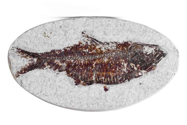
The Survey adds that fish lived in the lake, waterfowl and other birds used its marshes, and animals such as bison, horses, bears, deer, camels, bighorn sheep, musk oxen and mammoths roamed its shores. Archaeologists, the Survey says, place the arrival of humans in the basin at about 10,000 years ago.
Utah History to Go says Gilbert named the lake after Captain Bonneville. Gilbert studied it in the 1870s, first with the Wheeler Survey and then with the U.S. Geological Survey, and published his findings in 1890 as USGS Monograph 1, according to Utah History to Go. The same source says that mapping, aerial photographs and dating methods since the 1940s have confirmed much of Gilbert's work.
The four shorelines, in plain terms
The Utah Geological Survey names four main shorelines. Three belong to Lake Bonneville and one to the early Great Salt Lake that followed. A lake leaves a shoreline when it stays at one elevation long enough for waves to cut a bench or build a beach, so each shoreline marks a long pause in the lake's history.
The Survey's table gives these elevations at Antelope Island, in feet above sea level, with approximate ages in calendar years before present:
- Stansbury: 4,445 feet, about 24,400 to 23,200 years ago.
- Bonneville: 5,220 feet, about 18,000 to 16,800 years ago.
- Provo: 4,840 feet, about 16,800 to 16,200 years ago.
- Gilbert: 4,275 feet, about 12,800 to 11,600 years ago. This one belongs to the Great Salt Lake, not to Lake Bonneville itself.
The Survey says the Provo and Bonneville shorelines are the ones you can see as terraces or benches along many mountains in western Utah. The Stansbury and Gilbert shorelines are less obvious and found lower in the valleys.
In Utah Valley, the higher of the two, the Bonneville shoreline, is the bench you see high on the mountain slopes. The Provo shoreline is the lower one, and it is where much of the valley's development sits. Utah History to Go notes that the University of Utah, Brigham Young University, Utah State University and Weber State University campuses all sit on the Provo level.
Why the numbers do not match
You will see different elevations and dates in different places, and none of the people publishing them is necessarily wrong.
The Survey's table gives Antelope Island elevations, but the elevation of a shoreline changes from place to place. The reason is isostatic rebound. The weight of the lake pressed the crust down, and when the water left, the crust slowly rose. The Bonneville Shoreline Trail site says the Bonneville bench is locally up to 200 feet higher than the roughly 5,100 foot level where the lake originally stood. The same shoreline therefore sits at different heights in different places.
Dates also vary. The Survey's public information sheet gives the flood as roughly 16,800 years ago, while the Bonneville Shoreline Trail site says the lake overflowed about 14,500 years ago. A USGS-published chapter by David M. Miller places the Provo lake at about 18.2 to 14.8 thousand calendar years before present, lasting roughly 3,400 years. Dating methods and calibrations differ, and scientists have revised the numbers over time. Treat any single age as an estimate.
The flood that made the Provo shoreline
For a long period, the Survey says, Lake Bonneville was a terminal lake with no rivers draining from it. Its lowest outlet was at Red Rock Pass in Idaho, at an elevation of about 5,090 feet. When the lake rose to that elevation, water began to spill north into the Snake River drainage.
The flow cut rapidly into the soil and rock of the pass and caused a catastrophic flood. Researchers believe, according to the Survey, that it probably lasted less than a year and lowered the outlet by about 375 feet. Utah History to Go and the Bonneville Shoreline Trail site give a drop of more than 300 feet and about 350 feet respectively. The lake then stabilized, and the Survey says the Provo shoreline formed during the following 600 years. Miller's chapter describes the Provo shoreline as the most prominent landform of Lake Bonneville, which is why it is easier to spot than the older, higher bench in much of the valley.
Later work has argued about details, including the exact outlet location and how long the lake held at the Provo level. If you want the current state of the science, the USGS and Utah Geological Survey publication pages linked in the sources are the place to look.
What happened to the lake
After the flood, the Great Basin gradually became warmer and drier. The Survey says Lake Bonneville began to shrink from increased evaporation. The Great Salt Lake is a large remnant of it and occupies the lowest depression in the basin. Other relics, the Survey notes, are Utah Lake, Sevier Lake and the Great Salt Lake Desert with the Bonneville Salt Flats.
That connection is the reason this guide pairs well with the Great Salt Lake and Bonneville Salt Flats day trip, and with our explainer on why the Great Salt Lake is salty. Utah Lake, a few minutes from downtown Provo, is covered in our Utah Lake history.
Where to see the shorelines from Provo and Utah Valley
The foothill bench from the valley floor
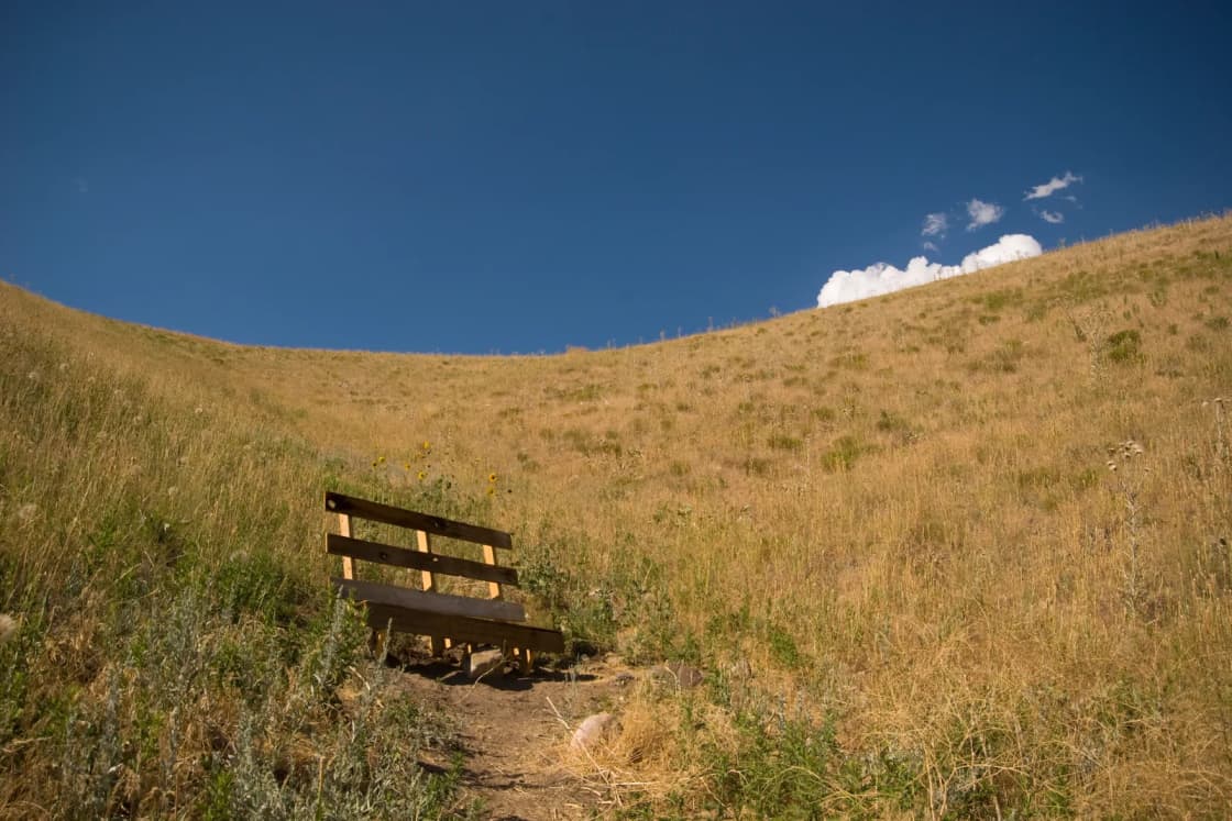
Start with the easiest view. From most of Provo, Orem and Pleasant Grove, face the mountains and look for the horizontal step at the base of the slope. Our Bonneville Shoreline Trail guide describes it as a flat step in the foothills where the slope pauses before continuing up. You do not need to leave your car for it.
The best light comes when the sun is low. In the early morning and evening, shadows pick out the edge of the bench, and the straight line of the shoreline reads clearly against the irregular mountain face. At midday in summer, haze and flat light wash it out.
The Bonneville Shoreline Trail in Provo and Orem
The trail is the best way to stand on the old lake edge. The Bonneville Shoreline Trail Committee's site says the trail follows the eastern shoreline of the ancient lake and the upper benches, while many Utah cities sit on the lower ones. It runs along the Wasatch Fault for most of its length, and streams and rivers have cut canyons and ravines across the old shoreline, so the trail repeatedly descends and climbs. The site describes the route as anything but gentle.
Our trail guide lists the access points in Provo as the Rock Canyon, Y Mountain and Slate Canyon trailheads, and in Orem the Cascade Drive trailhead and the mouth of Provo Canyon. It also flags one important restriction: part of the Orem to Provo Canyon stretch crosses the Timpanogos Wildlife Management Area, which has a seasonal closure. Read the full trail guide and check posted signs before planning a winter walk.
If you are already planning a hike up the Y, the Y Mountain trail guide notes that the route can be reached via the Bonneville Shoreline Trail. Standing on that bench and looking west across the valley is a good way to picture where the water stood.
The Provo Bench and Orem
The word bench is written into local geography. Our short history of Orem describes the Provo Bench as a broad, flat terrace north of the Provo River, an ancient shoreline of Lake Bonneville running along the base of Mount Timpanogos. Early settlers found the bench had good soil and a long growing season but needed canal water, and the Provo Bench Canal, completed in 1864, made farming possible. The orchards that followed, and the street grid that grew on top of them, sit on a lake terrace.
Driving east toward the mountains in Orem, you cross from the lower valley onto that level terrace before the slope steepens. We did not survey it, so treat that as a way to look, not a measurement.
BYU and Provo's campuses
Utah History to Go lists Brigham Young University among the campuses built on the Provo level. That means a walk up the hillside of campus is, in effect, a walk up the old beach. The Provo shoreline here is not a dramatic cliff. It is a gentle, long rise that you notice more in a map or a bicycle ride than on foot. If you are visiting BYU already, it is a small piece of geology to keep in mind.
Point of the Mountain
The most dramatic shoreline landform near Utah Valley is the Point of the Mountain, where Utah County meets Salt Lake County. The Utah Geological Survey's GeoSights column, written by Mark Milligan and published in Survey Notes in May 2016, calls the Point of the Mountain spit and the Steep Mountain beach two of the most notable shoreline features in the basin.
The Survey explains that the Steep Mountain face is quartzite from the Oquirrh Group, about 300 million years old. Waves pulverized it, and longshore currents carried much of the resulting sand and gravel to build the spit. The Traverse Mountains sit where the Salt Lake City and Provo segments of the Wasatch fault meet.
For access, the Survey's article describes a Utah County approach from I-15 exit 284 for UT-92 toward Highland and Alpine, then onto Digital Drive and Flight Park Road to Flight Park State Recreation Area. That description is from 2016, so confirm directions on a current map. Utah State Parks' Flight Park page, which we opened today, lists day use as open with no closures posted, says it is managed by Utah Lake State Park, and says day use requires a Day Pass. The page did not list the pass price or daily hours. Check the page or call Utah Lake State Park before you drive.
Two cautions from the Survey. The top of the spit is cut by a large gravel quarry and can no longer be crossed. And its article warns that the walls of the sand and gravel pits are very high and may be unstable, so stay well away from them.
From Provo, expect something like a 30 minute drive to the Utah County side. That is our estimate for normal traffic, so check a live map before you go.
Antelope Island and the Great Salt Lake
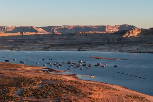
The Survey's shoreline table is based on measurements at Antelope Island, which is why its elevations are the ones quoted most often. The island rises from the Great Salt Lake and carries Bonneville-era terraces on its slopes. From Provo, the Syracuse causeway is roughly an hour or a little more by car. For the island itself, see our Antelope Island guide, and check Utah State Parks for the current fee, hours and any causeway closures before you go.
Further afield
Several places farther away are worth a mention if you are building a longer trip. The Utah History to Go entry says the Stansbury level is visible above refineries near the State Capitol in Salt Lake City, by the Kennecott smelter, and just east of Wendover. It also says Bonneville-era shorelines stand as much as about 1,000 feet above the present Great Salt Lake. We did not visit or verify viewing conditions at these places for this guide.
Timing and season
The shoreline does not change with the season, but your view of it does.
Spring brings green foothills and snow on the high peaks, which makes the bench easy to pick out. It also brings mud and, on the Bonneville Shoreline Trail, the seasonal wildlife closure in places. Slopes above the bench can be slick.
Summer gives long days but harsh midday light and haze. Early morning is the best time for walking and photography, and the foothill bench can be hot and exposed.
Fall is a favorite for many people. The air clears, the light is low and golden, and the bench catches it well.
Winter can be sharp and clear after a storm, with snow outlining the bench. Trails may be icy or closed in places, so check conditions and signs.
Our Provo sunrise and sunset guide lists daylight hours by month, which helps if you are planning a low-light visit.
A simple half-day plan
- Morning: Drive or walk the lower edge of the bench in Orem or Provo and look east. Take a short stretch of the Bonneville Shoreline Trail from a trailhead you have confirmed is open.
- Midday: Visit BYU or the Orem bench neighborhoods, and read our short history of Orem for context on the Provo Bench.
- Afternoon: Drive north to Flight Park State Recreation Area for the Point of the Mountain view, after checking the Day Pass requirement.
That fits in a day without much driving. If you only have an hour, stick with the foothill view and a short trail segment.
What to bring
- Water. The bench is exposed, and there is little shade on many segments.
- Sun protection and sturdy shoes. The trail crosses ravines, and footing can be loose.
- A map or trail app. Trail layouts and detours change, and city and agency pages are the authority.
- Binoculars or a long lens. They help you pick out terraces on distant slopes.
- A printed or saved copy of the shoreline table above. It gives you something to compare against what you see.
- A Day Pass or payment method if you plan to stop at a state park.
- A layer. The foothills can be breezy, and weather changes quickly along the Wasatch.
Who should skip it
Skip the trail portions if you need a level, paved route. The Bonneville Shoreline Trail dips in and out of ravines, and our trail guide rates some segments as hard. If you are after dramatic scenery that photographs well in a single glance, the shoreline can be underwhelming from a distance, because the bench is a subtle feature. People who want a close look at the Point of the Mountain spit should know the top is cut by a quarry and cannot be crossed.
If you are not interested in geology and just want a hike, one of the other trails in our Provo hiking guides will give you better views for the effort.
Safety
- Quarry and pit walls. The Utah Geological Survey warns that walls near the Point of the Mountain are very high and may be unstable. Keep well back.
- Fault terrain and slopes. The Bonneville Shoreline Trail site notes that the trail runs on top of the Wasatch Fault for most of its route, and our Y Mountain guide describes steep, dry slopes where debris flows can occur after storms. Avoid steep slopes after heavy rain.
- Heat and exposure. Foothill benches have little shade in summer.
- Wildlife and seasonal closures. Respect the posted Wildlife Management Area closures.
- Earthquakes. The Wasatch fault is active, which is part of why the benches are so well preserved. For household preparation, see our earthquake preparedness guide.
What to check before you go
- Provo City or Orem City trail pages for trailhead closures, construction or detours.
- The Bonneville Shoreline Trail site and posted signs for segment conditions and the Timpanogos Wildlife Management Area closure.
- Utah State Parks for Flight Park State Recreation Area and Antelope Island fees, hours and closures.
- Weather and air quality before any outing. Winter inversions can hide the bench entirely.
- Your route in a current map, since directions in older articles can be out of date.
- Parking rules at trailheads, which can differ by city and season.
What we could not confirm
We opened the Utah Geological Survey's public information sheet on Lake Bonneville, its GeoSights article on Point of the Mountain, the USGS publication record for the Provo shoreline chapter, Utah History to Go's Lake Bonneville entry, the Bonneville Shoreline Trail site and the Utah State Parks Flight Park page. We could not open Provo City's trails page, so trailhead details come from our own Bonneville Shoreline Trail guide and should be confirmed with the city. We did not find a National Park Service page on this topic. Drive times in this guide are our own estimates, and we did not measure the bench elevations on the ground.
Related guides
- Bonneville Shoreline Trail: The Provo and Orem Guide
- The Great Salt Lake and the Bonneville Salt Flats From Provo
- A Short History of Orem
- Utah Lake history
Frequently Asked Questions
What is the easiest way to see a Lake Bonneville shoreline from Provo?
How high was Lake Bonneville?
What is the difference between the Bonneville and Provo shorelines?
Is the Bonneville Shoreline Trail on the actual shoreline?
Can I see Lake Bonneville shorelines from the Great Salt Lake or Antelope Island?
Why do the shorelines sit at different heights in different places?
Can I walk to the Point of the Mountain spit?
Is Utah Lake a leftover of Lake Bonneville?
Sources
The facts in this guide were checked against these sources. Hours, fees and rules change, so confirm anything time-sensitive with the source before you go. How we make Provo.com.
- Lake Bonneville (Public Information Series 39), Utah Geological Survey. Checked November 10, 2026.
- GeoSights: Point of the Mountain, Utah Geological Survey. Checked November 10, 2026.
- The Provo shoreline of Lake Bonneville, U.S. Geological Survey. Checked November 10, 2026.
- Flight Park State Recreation Area, Utah State Parks. Checked November 10, 2026.