
More on Springville: every guide we have published there, in one place.
Springville was called Hobble Creek first. The settlement took the name in 1850, kept it for three years, then swapped it for Springville and let the canyon keep the older one. That is the small historical oddity underneath every road sign east of town: the city gave up the name, and the mountains did not.
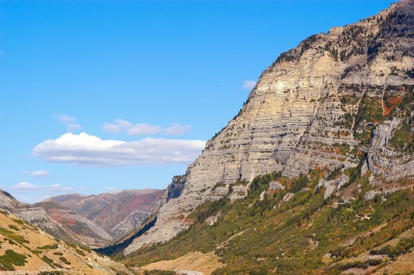
Hobble Creek Canyon is the closest thing south Utah County has to a private canyon. It has a municipal golf course that crosses its own creek eight times, two Forest Service campgrounds, a dirt road over the top into Diamond Fork, and a maple canopy that turns the whole place orange for about three weeks a year. It is also, by some distance, the easiest canyon in the valley to get into — you are in it minutes after leaving Main Street.
Where the name comes from
In early 1849, a small trading party came into Utah Valley to trade with the Utes and camped on a stream east of what is now Springville. Among them were Oliver B. Huntington and Barney Ward. They hobbled their bell mare for the night — the standard way to keep a horse herd from wandering, since the rest of the band follows the bell.
The mare slipped her hobbles in the creek, and the herd went with her. The men tracked the horses to the mouth of Maple Canyon and brought them back. The hobble had come off in the water, and the stream got its name from the incident.
Sources disagree on the month — the city's own historical walking-tour document says spring of 1849, other accounts say January, and others February. The event is well attested; the date is not, and we are not going to pick one.
When Aaron Johnson's pioneer company arrived in September 1850 and settled here, the place was already Hobble Creek and the settlement took that name. Springville City was formally founded in April 1853 under its present name, chosen for the springs. The creek, the canyon and the golf course all kept the original.
Getting in, and the fork that decides your day
From I-15, take exit 260 into Springville, head east on 400 South, and turn onto Canyon Road where it ends. Follow it east and the town gives way to canyon within a couple of miles. There is no fee station, no gate, and no pass required — this is not a designated recreation fee area, which is a genuine difference from American Fork Canyon and worth knowing if you are choosing between them on a budget.
About six miles up, past the golf course, the road forks, and the two branches offer completely different days.
The Right Fork is the one you want first. It carries both campgrounds, most of the trailheads, and the road that eventually climbs over the ridge into Diamond Fork. Pavement continues for roughly eight miles up the canyon before it turns to dirt.
The Left Fork runs past a long string of private cabins and works its way, eventually, toward Wallsburg. The road deteriorates as it goes and is not a casual drive. It is beautiful, and it is not where a first visit should go.
Hobble Creek Golf Course, and the two things listings get wrong
Springville City owns and runs an eighteen-hole course inside the canyon, at 94 Hobble Creek Canyon Road, and it is one of the better municipal golf bargains in the state. Par 71, a shade over 6,400 yards from the tips, and a layout that defends itself with accuracy rather than length — narrow fairways under mature trees, small greens, canyon walls on both sides.
The signature characteristic is the water. The course crosses Hobble Creek eight times over eighteen holes. It runs down-canyon on the front nine and climbs back up on the back, which means the wind and the elevation change are doing something different to the ball on nearly every hole.
Now the two facts that circulate wrong.
The architect. Regional listings credit the design to William P. Bell. That is not possible. William P. Bell — Billy Bell Sr., who worked with George C. Thomas on Riviera, Bel-Air and Los Angeles Country Club — died on 21 June 1953, more than a decade before the earliest date anyone gives for Hobble Creek. His son, William F. Bell, ran the family firm afterwards under the father's company name and built more than two hundred courses across the American West, including Torrey Pines. Hobble Creek is the son's. The confusion is not a local error: Torrey Pines itself carried a plaque crediting the wrong Bell for years, and the mistake has traveled with the name ever since.
The opening year is genuinely unsettled. Golf directories split between 1967 and 1973, roughly evenly, and Springville City's own golf pages state neither. Both dates fall inside William F. Bell's working period, so the architect question does not settle it. We are recording the disagreement rather than manufacturing a resolution.
Green fees, cart rates and seasonal opening change year to year, and the course typically opens as early as mid-March when the weather allows. Check the city's own golf pages for current rates rather than a directory. For the wider picture, our Utah Valley golf guide covers how this course sits against the rest of the county's options.
The campgrounds, and the water problem nobody mentions
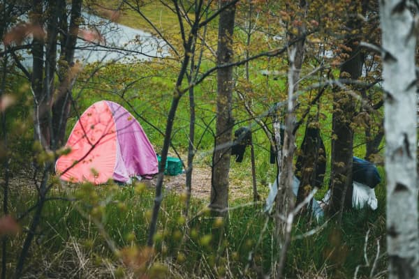
Two Forest Service campgrounds sit on the Right Fork, both operated by a concessionaire, both seasonal, both in maple and cottonwood along the creek.
Cherry Campground is about 5,200 feet, roughly six miles from Springville and only about 1.3 miles up the Right Fork from the junction past the golf course. Paved roads and spurs, cement pads under the tables, fire pits with grills, vault toilets, a horseshoe pit and a volleyball court. Single and double family sites are first-come, first-served; the four tent-only group sites — three taking up to 75 people, one up to 50 — are reserved through Recreation.gov. Two trails leave from inside the campground: Left Fork Days Canyon and Kirkman Hollow.
Balsam Campground is about 6,000 feet and roughly twelve miles from town, past the junction of Forest Roads 132 and 058 and then right onto Forest Road 062. It has single-family sites plus group capacity, with the largest group site taking up to 100 people and reached on foot by a steep paved path from the parking area. Deer Springs Trail starts at the top of the campground and runs about a mile. The Forest Service has listed its season as roughly 15 May to 13 September.
Here is the part that matters and that almost no listing carries. The Forest Service's own page for Cherry states plainly that the campground's water source is not passing testing and that visitors should bring their own water, as they have in the past. Third-party campground directories describe both sites as developed campgrounds and leave that out entirely; several list Balsam as having water available. Plan to arrive self-sufficient in drinking water at both, and treat any water spigot you find as a bonus rather than a plan.
Both campgrounds are in bear country, and the posted penalties for improper food storage run to fines of up to $5,000. Firewood is generally available for purchase from the host at Cherry. Cell coverage at Cherry is effectively nil; ten minutes back toward town is usually enough for a call.
If neither has space — and on summer weekends neither will — our camping near Provo guide covers the rest of the county's developed sites, and dispersed camping covers the free option and its rules.
Fishing the creek
Hobble Creek is a small-stream fishery, and it runs directly through both campgrounds, which makes it one of the more accessible places in the county to teach someone to fish moving water.
Brown trout and rainbow trout are both present. The cutthroat is the only species native to the drainage — everything else arrived by stocking or by working its way up from the valley over the last century and a half. Hobble Creek Reservoir sits lower in the canyon and fishes differently from the stream above it.
Regulations vary by section and change year to year, so check current Utah Division of Wildlife Resources rules before you cast. Our fishing near Provo guide covers the county's other options, from the Provo River's blue-ribbon water to the reservoirs.
The back road to Diamond Fork, which almost nobody advertises
This is the most useful thing in this guide for anyone who already knows the canyon.
The paved Right Fork road ends about eight miles up. It continues as Forest Road 058, a well-maintained dirt and gravel road that climbs to a ridge summit with views back down Hobble Creek and forward into Diamond Fork, then drops the other side and becomes paved Forest Road 029 — Diamond Fork Road.
That road delivers you to the Fifth Water trailhead, and the hot springs are roughly 2.3 miles of walking each way from there.
Why this matters: virtually every write-up of Diamond Fork Hot Springs sends people up Spanish Fork Canyon and along Diamond Fork Road, which on a summer Saturday is a queue. The Hobble Creek approach is longer in driving time, prettier, and comes at the trailhead from the empty side. In dry conditions the gravel section is passable in an ordinary passenger car, taken slowly. It is not a wet-weather road, and it is not a winter road.
The same route is a well-liked gravel ride, and it connects up to the Packard Cutoff and Mapleton Ridge trail network. Expect vehicles, ATVs and dirt bikes; it is a shared road, not a trail.
The railroad that was surveyed here and never came
Hobble Creek Canyon nearly became a main line.
In 1902, the Denver and Salt Lake Railway began construction on a route intended to link its two namesake cities through the Uinta Basin. Hobble Creek Canyon was surveyed as the connection between the Wasatch Front and the basin — the gap the whole scheme depended on. Most of the Colorado portion of that railway was built and remains in use today. The company went bankrupt before it ever reached Utah, and the line through Hobble Creek was never laid.
The idea of a rail link to the Uinta Basin did not die with it; it has resurfaced in modern form in the last decade and remains one of the more contested infrastructure questions in the state. Hobble Creek's own moment as a proposed rail corridor, though, was over by the time the survey stakes weathered out.
Standing on the Right Fork road on a quiet weekday it is worth a moment's thought: the canyon that stayed a canyon because a railroad company in Denver ran out of money.
The trail along the creek
Lower down, before the campgrounds, a paved path runs along the creek — the Hobble Creek Parkway. By local account the proposal went in during February 1997, a $55,000 grant came through in January 1998, construction ran from August to November 2001 with help from the Forest Service, the Division of Wildlife Resources, Utah County and Springville City, and the asphalt went down in spring 2002.
It is short, flat, shaded and directly beside moving water, which makes it an unusually pleasant place to walk a stroller or take an easy run — a very different proposition from the exposed valley-floor paths. For the county's other options, see our running routes guide.
Seasons
Autumn is the headline. This canyon is maple, and the color through late September and October is among the best in Utah Valley — comparable to the Alpine Loop and enormously less crowded. Our fall guide covers the timing across the county; here, plan for the last week of September through the middle of October and go on a weekday if you can.
Summer works because of the temperature. The canyon runs meaningfully cooler than the valley floor, which is the reason the golf course books out on July mornings and the campgrounds fill on Fridays. It is also why an evening drive up the canyon is a standing local habit rather than an event.
Spring is variable. The lower canyon greens up early; the upper Right Fork and the dirt road over to Diamond Fork stay unusable considerably longer than people expect.
Winter limits you to the lower canyon. Roads above the campgrounds are not maintained for winter travel. Fire restrictions, road closures and campground seasons all move year to year — check the Uinta-Wasatch-Cache National Forest's current conditions before an upper-canyon trip rather than assuming last year's dates.
A first visit, planned
Drive up Canyon Road, stop at the golf course to see the creek crossings even if you do not play, take the Right Fork, and go as far as Balsam. That is under half an hour of driving and shows you the whole character of the place.
If you want more: park at Cherry and walk Kirkman Hollow or Left Fork Days Canyon; or keep going, take the dirt road over the top, and come out at Fifth Water having approached the busiest hot spring in the county from the quiet side.
Springville itself is worth the stop on the way back — see our Springville things to do guide and the living in Springville profile for the town at the canyon mouth that used to share its name.
What the canyon road is, legally, and why nobody warns you about the deer
A canyon road with a creek beside it, deer on it, and fire season over it is the exact fact pattern Utah's Governmental Immunity Act was drafted around, and it produces a set of answers most drivers would not guess.
Title 63G, Chapter 7 of the Utah Code begins from immunity. Utah Code § 63G-7-101 provides that a governmental entity and its employees are immune from suit unless the chapter expressly waives it, and that the immunity is restored where an injury arises out of any of the conditions the Act specifically retains. Utah Code § 63G-7-201 is the list, and four entries on it describe this canyon.
Wildlife on the road. Immunity is retained for injury arising out of an activity of wildlife, as defined in Utah Code § 23A-1-101, that arises during the use of a public or private road. A deer that comes off the bank into your lane at dusk on the Right Fork is, in the statute's own terms, an activity of wildlife during the use of a road. No agency owes you a duty about it, and the absence of a fence, a sign or a reflector array is not actionable.
Fire. Immunity is retained for the activity of fighting fire, for responding to a disaster or potential disaster, and for an emergency evacuation. Wasatch canyons close and reopen on fire and flood conditions, sometimes abruptly, and decisions about when to do that sit inside the protected category.
Water. Immunity is retained for the management of flood waters and for the construction, repair, or operation of flood or storm systems — which covers a great deal of what is built along a creek that has a history of moving.
Natural conditions. Immunity is retained for a natural condition on publicly owned or controlled land. Rockfall, a leaning tree, a washed bank and high water are all natural conditions.
What is left over
Two things, and the boundary between them is subtle. Utah Code § 63G-7-301 waives immunity for injury caused by a defective, unsafe, or dangerous condition of a highway, road, culvert, bridge, or other structure located on them. But Utah Code § 63G-7-201 retains immunity, and overrides that waiver, where the condition of the same road or structure is latent — hidden rather than discoverable. A visible washout is on one side of the line and a concealed structural failure in the same culvert is on the other, which is the reverse of what most people's intuition produces.
Immunity is also retained for the exercise or performance, or failure to perform, a discretionary function, whether or not the discretion is abused, and for making an inadequate or negligent inspection or failing to inspect at all. Between them, those two cover most decisions about when a canyon road gets attention.
The clock, if it ever matters
Utah Code § 63G-7-402 bars a claim against a governmental entity unless a written notice of claim is filed within one year after the claim arises, delivered to the officer named in Utah Code § 63G-7-401 — the city or town clerk, the county clerk, or the attorney general for the state. Utah Code § 63G-7-403 gives the entity sixty days to respond, bars suit for sixty days, and requires the action to be commenced within two years. Utah Code § 63G-7-501 keeps it out of small claims court entirely.
The reason to know any of this before driving up: it tells you, accurately, how much of your safety in a canyon is being managed by somebody else. The answer is less than the pavement suggests.
Related Guides
- Jolley's Ranch: Camping in Hobble Creek Canyon, Twenty Minutes from Provo
- Tibble Fork Reservoir: What to Know Before You Go
- RV Parks & Hookups Around Provo: How Camping With a Rig Actually Works Here
- Rock & Ice Climbing in Provo: Rock Canyon, Provo Canyon & the Gyms
- Hiking Mount Nebo: The Highest Peak in the Wasatch, and Nobody Agrees How High
- The Murdock Canal Trail: Utah County's Flat 17 Miles
- Horseback Riding in Utah Valley: Where to Ride, What It's Actually Like, and Who Takes Beginners
- Canyon & commute conditions — the Right Fork gate shuts weeks before the lower canyon gate does
Frequently Asked Questions
Where is Hobble Creek Canyon?
Do you have to pay to enter Hobble Creek Canyon?
Which fork should I take in Hobble Creek Canyon?
Is there camping in Hobble Creek Canyon?
Can you fish Hobble Creek?
How do you get from Hobble Creek to Diamond Fork Hot Springs?
When is the best time to visit Hobble Creek Canyon?
Who designed the Hobble Creek Golf Course?