Most Utah Valley residents know Spanish Fork Canyon as the road to somewhere else. It carries US-6 east over Soldier Summit toward Helper and Price, and plenty of people drive it without ever turning off. That is a mistake, because the canyon and its side roads hold three of the most interesting places in the county: the Diamond Fork road with its campgrounds and the Fifth Water Hot Springs, the Sheep Creek backroad that loops through the high country above it, and the site of Thistle, the railroad town that drowned under a landslide lake.
This guide covers all three, plus what you need to know about the gates, fees and seasons that shape a visit, how to drive US-6 with a little care, and how to fit the whole canyon into a single day from Provo.
The Canyon at a Glance
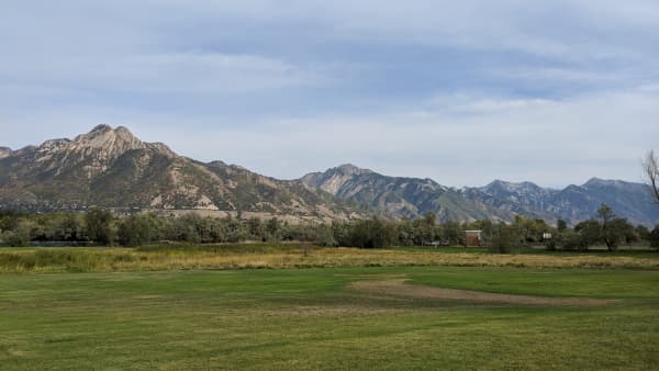
Spanish Fork Canyon opens just southeast of the city of Spanish Fork, where US-6 heads east into the mountains. The canyon carries the Spanish Fork River, a busy highway and a major rail line, and it is lined by national forest managed by the Spanish Fork Ranger District of the Uinta-Wasatch-Cache National Forest.
The main landmarks, with the Forest Service's mileages where it gives them:
- The Diamond Fork road turns north off US-6 a few miles into the canyon. It leads to Diamond Campground, the Red Ledges area and the Three Forks trailhead for Fifth Water.
- The Sheep Creek road turns north off US-6 farther up the canyon, about 12 miles in by the Forest Service's count, and climbs into the high country before meeting the Diamond Fork road.
- The Thistle junction is where the canyon splits and the highways part ways, and where the landslide of 1983 created a lake that swallowed a town.
Who to call. The Spanish Fork Ranger District office is at 44 West 400 North in Spanish Fork, and its phone number is (801) 798-3571. It is the best source for gate status, fire restrictions and campground questions.
Before you go. Much of the canyon's backcountry is seasonal. Check our canyon conditions page before any trip outside summer, and assume that gates, snow and runoff can change a plan.
Diamond Fork
The Diamond Fork road is the canyon's playground. It follows Diamond Fork Creek north through a narrow valley of cottonwoods, red rock ledges and sagebrush slopes, and it ends at the Three Forks trailhead, the start of the trail to Fifth Water.
Diamond Campground. The main developed campground sits among shady cottonwoods and willows at an elevation of about 5,200 feet. Its family sites are about 15 miles from Spanish Fork, and its group sites are a few miles farther up the road. It is listed on Recreation.gov, but it is closed for the rest of the 2026 season and expected to reopen around April 9, 2027; in a normal year summer weekends fill, so book ahead. The campground's listing notes that Diamond Fork Creek and Wanrhodes Creek run through the site and hold brown and cutthroat trout, and anyone fishing needs a Utah license; our guide to fishing and hunting licenses explains them.
Red Ledges and the Diamond Fork Arch. Less than a mile from the campground, the Red Ledges Picnic Area sits beneath red rock formations, including a natural arch. It is an easy stop for families and a good lunch spot after a morning hike.
Monks Hollow. Recreation.gov's campground description notes that the Monks Hollow Trail, used for hiking, biking and off-highway vehicles, begins a few miles from the campground, which makes Diamond Fork a base for more than soaking.
Dry Canyon. Near the top of the road, about a mile below the trailhead, Dry Canyon is a small, tent-only Forest Service campground with no water. The Forest Service notes that the name "Three Forks Campground," which some maps and apps use, is not correct. Sites here are simple, and the parking area is small.
Dispersed camping. There are also dispersed sites along the Diamond Fork road, which make the canyon one of the closest places to Provo for free, primitive camping. Our guides to camping near Provo and dispersed camping cover the rules, including where you may camp and how to leave a site.
Fees. The Diamond Fork trailhead area is a fee site, even though the hot springs themselves cost nothing to soak in. The Forest Service sells per-vehicle passes for a few days, a week or a full season, and it accepts interagency passes, so keep yours on the dashboard.
Fifth Water Hot Springs
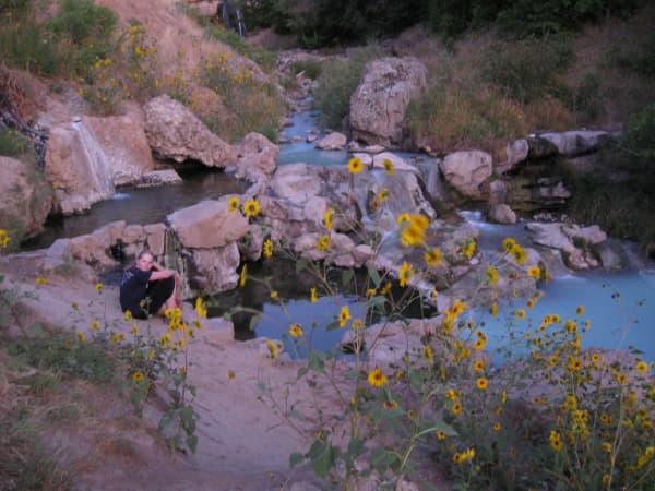
Fifth Water is one of the most popular hikes in this half of the state, and for good reason: a series of natural hot pools cascades down a hillside beside a waterfall, at the end of a pleasant canyon walk.
The trail. The Forest Service describes Fifth Water Trail #015 in plain terms. From Three Forks, you cross a footbridge and follow Sixth Water Creek for a shaded 1.1 miles. After a second footbridge, the trail forks; Sixth Water continues to the left, and you follow Fifth Water Creek to the right. Pools, small rapids and odd conglomerate rock formations line the way, and you will smell the sulfur before you see the springs. The largest springs sit 1.5 miles up Fifth Water Creek, where a cold waterfall meets the hot, bubbling water. The trail continues beyond the springs toward Rays Valley Road and Strawberry Ridge for those who want a longer day.
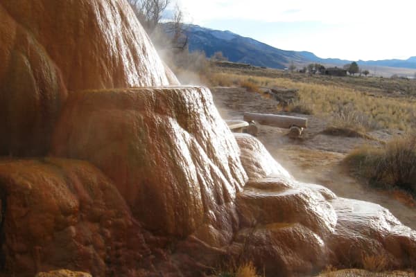
The water. The pools are not all the same. The soakable ones mostly sit around body to bath temperature rather than scalding, and each pool's temperature depends on where it sits, because the hot spring water mixes with the cold creek. Test before you settle in, and move up or down the hillside to find the temperature you like.
Crowds. The springs sit on a maintained trail that families hike, and the pools are in plain view of it. On summer weekends the trail is busy and the best pools fill early, so start at first light or go on a weekday.
The seasonal gate. The Diamond Fork road is gated seasonally, the closure moves with conditions rather than sitting on a fixed date, and there is more than one gate on the road. When the gate is closed, the walk to the springs becomes far longer than the summer hike. Check the canyon conditions page before any winter or shoulder-season attempt, rather than assuming the gate matches last year's schedule.
Good manners. Pack out everything you bring, including food waste. Keep glass away from the pools. Keep voices down; many people come here for quiet. And give families and first-time visitors space in the popular upper pools.
For more soaking options, including springs where you do not need to hike, see our guide to hot springs near Provo.
Sheep Creek and the High Country
Farther up the canyon, the Sheep Creek road opens up the high country north of US-6, and it is the part of the canyon that most valley residents have never seen.
The road. The Forest Service lists Sheep Creek as a winter recreation area about 12 miles up Spanish Fork Canyon on US-6. The Sheep Creek road turns north off the highway, runs paved for most of its length, and then continues on gravel until it meets the Diamond Fork road. In the snow-free season, with both roads open, that makes a scenic loop possible: up Sheep Creek, across to Diamond Fork, and back down to US-6 past the Fifth Water trailhead. Check both roads' status before you try it, since gates and conditions differ.
Rays Valley and Fourth Water. Farther up the Sheep Creek road, a turnoff to Rays Valley leads farther into the backcountry. The Forest Service's directions for the Fourth Water Trail follow that route along the Rays Valley road to the trailhead. Fourth Water is a relatively easy hike that follows Fourth Water Creek and connects Rays Valley Road with the Center Trail, part of the long-distance Great Western Trail. The Fifth Water trail also reaches Rays Valley Road from below, so the backcountry here links together in ways that reward a map and a free day. Our Diamond Fork trail guide gives every trail in the basin its Forest Service length.
Winter. Sheep Creek's designation as a winter recreation area makes it a trailhead for snow play and over-snow travel when the high country is buried. Our guide to snowmobiling near Provo covers the sport and where to rent.
Go prepared. This is remote country. Cell coverage is limited, services are nonexistent, and some roads are rough. Carry water, a paper map, a spare tire and warm layers, and tell someone your route.
The Thistle Site
At the Thistle junction, the canyon tells one of the most dramatic stories in Utah history.
In April 1983, after an exceptionally wet season, a hillside on the south side of Spanish Fork Canyon began sliding toward the canyon floor and did not stop. The slide dammed the Spanish Fork River, and the water backed up into a lake that rose, over the following weeks, to about 160 feet deep, swallowing the railroad town of Thistle at the junction of the canyons. The town's residents were evacuated, the lake stood for months, and the town was never rebuilt. The highways were moved onto a new alignment cut into the north wall of the canyon, well above the slide, and the railroad was rebuilt through a tunnel.
What you can see. Today, the highways cross the canyon high on the north wall, and the old townsite lies at the bottom of the canyon below and east of the junction, partly buried under sediment left by the lake and partly still visible. A roadside view area honors the destroyed town, and from it you can see how the canyon's transportation lines have been layered over one another: the abandoned railroad grade and the abandoned highway, and the modern railroad and modern highway that replaced them. The photograph at the top of this page was taken from that view area.
The railroad. The rail line through the canyon is still active, and Amtrak's California Zephyr follows it on its way east from Provo. If you ride it, you pass through the tunnels at Thistle; our guide to the California Zephyr from Provo covers the trip.
Visiting respectfully. Stay at the view area and other legal pull-outs. The railroad right-of-way is active and dangerous, and the land around the old townsite is not a public park. Take your photographs from the roadside and leave the ruins alone.
Our full history of the Thistle landslide covers the town, the slide, the week the water rose and the rebuilding of the highway and railroad in detail.
Driving US-6 With Care
US-6 through Spanish Fork Canyon is a working highway, not a scenic byway, and it carries truck traffic along with commuters and travelers headed east. A few habits make a canyon day safer.
Plan your turns. Turnoffs such as Diamond Fork and Sheep Creek come up quickly. Know where you are going, signal early, and do not stop in a travel lane to check a map.
Watch the weather. The canyon can be snowy or icy when the valley floor is dry, especially in the upper reaches toward Soldier Summit. Check road conditions before winter trips.
Expect wildlife. Deer and other animals cross the canyon roads, especially at dawn and dusk.
Pull out safely. Use designated pull-outs and view areas for photos, and keep well away from the rail line.
What to Bring
For Fifth Water. Water shoes or sandals with a good grip, since the rocks around the pools are slick; a swimsuit and a quick-drying towel; a dry bag for your phone and keys; plenty of drinking water, because the hike out is warm in summer; sun protection; and a trash bag so you can carry out everything you brought.
For the backroads. A full tank before you leave the valley, a paper map, a spare tire, warm layers even in summer, and more water and food than you think you need. Cell coverage fades quickly once you leave US-6.
For shoulder seasons and winter. A headlamp in case the day runs long, traction devices for icy trail sections, and a plan for the extra distance if the Diamond Fork gate is closed.
Families and Dogs
With kids. The Fifth Water trail is a family hike, with footbridges, creek views and a destination children love. Keep young children close around the pools and the waterfall, where rocks are slippery and the water temperature changes from one pool to the next. The Red Ledges area and the campground's creekside sites are easy, low-effort stops for smaller children.
With dogs. Spanish Fork Canyon is national forest land, where leashed dogs are generally welcome, but dogs must be leashed in developed sites such as trailheads and campgrounds. Keep dogs out of the hot pools, which other people are soaking in, carry water for them on the hike, and pack out their waste. Our guide to things to do with your dog covers the valley's dog rules in more detail.
A Day in Spanish Fork Canyon
Morning: Fifth Water. Leave Provo early, drive up US-6, turn onto the Diamond Fork road and reach the Three Forks trailhead before the crowds. Hike to the springs, soak, and hike out before midday.
Lunch: Red Ledges. Picnic below the red rock at the Red Ledges area, or at a dispersed site along Diamond Fork Creek.
Afternoon: the high country or Thistle. If the roads are open and your vehicle suits them, take the Sheep Creek road into the high country for the views. Otherwise, return to US-6 and drive up to the Thistle view area to see the landslide site.
Evening: back to the valley. Head back down the canyon to Spanish Fork for dinner; our guide to things to do in Spanish Fork covers the town.
Seasons
Spring. Runoff swells the creeks and makes the rivers dangerous, while the lower roads green up first. Gates on the Diamond Fork road may still be closed early in the season, so check before you go.
Summer. Peak season for camping, hiking and soaking. Weekends are busy, campgrounds fill, and midday heat is best spent in the shade or the water.
Fall. Cooler temperatures, thinner crowds and changing colors make fall one of the best times to hike to Fifth Water and drive the backroads, before the seasonal gates close.
Winter. The Diamond Fork gate closes, making Fifth Water a long walk, while Sheep Creek comes into its own as a winter recreation area. Check conditions every time.
Camping and Leave No Trace
Whether you stay at Diamond Campground, Dry Canyon or a dispersed site, a few rules keep the canyon healthy. Camp only where it is allowed, use existing fire rings and follow any fire restrictions in effect, carry out all trash, and keep camps away from streams. Human waste is a real problem at popular hot springs; use toilets where they exist and pack out or bury waste properly where they do not.
The Short Version
Spanish Fork Canyon starts just southeast of Spanish Fork on US-6. A few miles in, the Diamond Fork road leads north to Diamond Campground, the Red Ledges and its arch, the small tent-only Dry Canyon campground, dispersed sites, and the Three Forks trailhead for Fifth Water Hot Springs, a hike of 1.1 miles along Sixth Water Creek and 1.5 miles up Fifth Water Creek to pools beside a waterfall. The trailhead area is a fee site and the road is gated seasonally. About 12 miles in, the Sheep Creek road climbs north into the high country, running paved and then gravel to meet the Diamond Fork road, and serves as a winter recreation area. At the Thistle junction, a view area honors the town drowned by the 1983 landslide lake. Check the canyon conditions page before any trip outside summer.
Related Guides
- Hot Springs Near Provo
- The Thistle Landslide of 1983
- Camping Near Provo
- Dispersed Camping Near Provo
- Things to Do in Spanish Fork
- Canyon Conditions
- Nine Mile Canyon, Helper and Price From Provo
Frequently Asked Questions
How do you get to Fifth Water Hot Springs?
Does it cost anything to visit Fifth Water?
Is the Diamond Fork road open in winter?
Where can you camp in Diamond Fork Canyon?
What is Sheep Creek in Spanish Fork Canyon?
What happened to Thistle, Utah?
Can you still see the town of Thistle?
How far is Spanish Fork Canyon from Provo?
Sources
The facts in this guide were checked against these sources. Hours, fees and rules change, so confirm anything time-sensitive with the source before you go. How we make Provo.com.
- Three Forks Trailhead, USDA Forest Service, Uinta-Wasatch-Cache National Forest. Checked October 12, 2026.
- USDA Forest Service, Uinta-Wasatch-Cache National Forest: Sheep Creek, USDA Forest Service, Uinta-Wasatch-Cache National Forest. Checked October 12, 2026.
- Diamond Campground, Recreation.gov (Uinta-Wasatch-Cache National Forest). Checked October 12, 2026.
- GeoSights: Thistle Landslide Revisited, Utah County, Utah, Utah Geological Survey. Checked October 12, 2026.
- Fifth Water Trail #015, USDA Forest Service, Uinta-Wasatch-Cache National Forest. Checked October 12, 2026.
- Fifth Water Hot Springs Trail, AllTrails. Checked October 12, 2026.