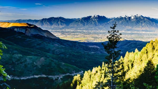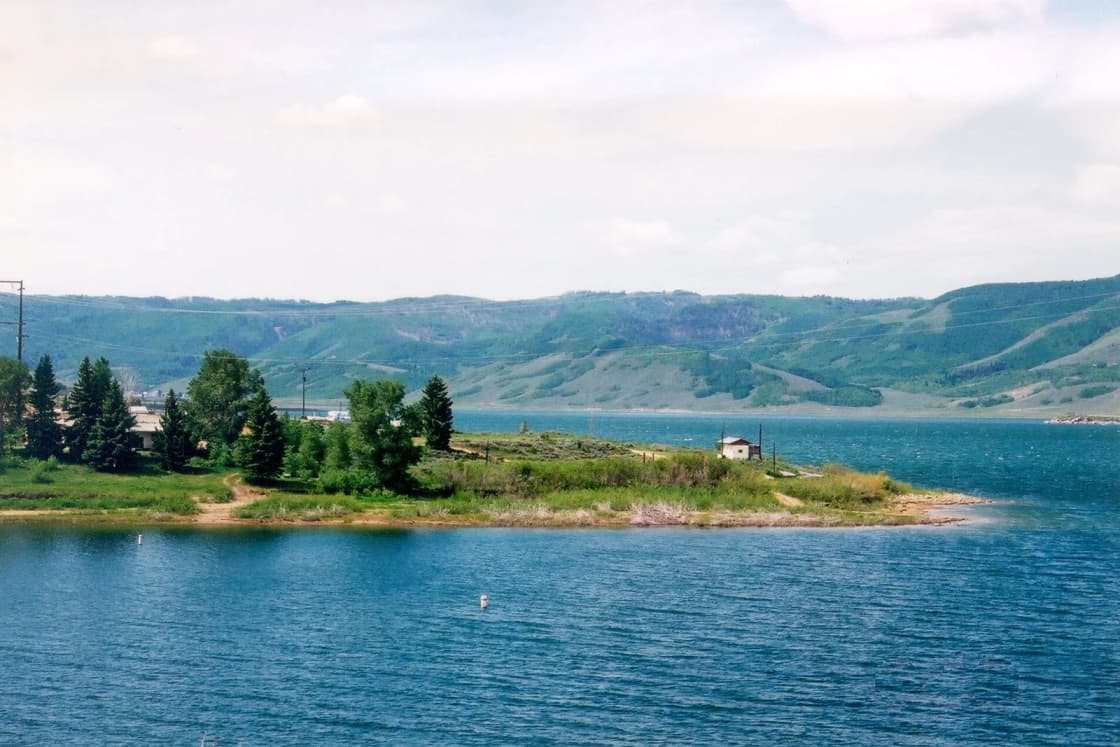

Southeast of Utah Valley, past Soldier Summit, the Wasatch Plateau rises to a high country of reservoirs, aspen and long gravel roads that most Provo residents only see from US-6. Three places make the trip worth planning: Scofield Reservoir, a big trout lake at about 7,600 feet with a state park on its shore; Electric Lake, higher and quieter, up the road toward Huntington Canyon; and the Skyline Drive, the gravel road along the plateau's crest at 10,000 feet and above. Paved highways connect them in a loop you can drive in a day.
Drive times are OpenStreetMap routing (OSRM) from Center Street and University Avenue in Provo, without traffic. Park facts are from Utah State Parks and the Manti-La Sal National Forest.
The loop, in one table
| Leg | Route | Distance | Drive |
|---|---|---|---|
| Provo to Scofield State Park | US-6, SR-96 | 61 mi | about 79 min |
| Scofield to Electric Lake | SR-96, SR-264, SR-31 | 38 mi | about 72 min |
| Electric Lake to Provo | SR-31 (Fairview Canyon), US-89, US-6 | 72 mi | about 107 min |
That is about 171 miles and four hours and 20 minutes behind the wheel before stops. Sanpete County's tourism page calls the SR-31 and SR-264 pairing the Energy Loop: SR-31 climbs east from Fairview up Fairview Canyon, and past the summit you can follow SR-31 toward Huntington or SR-264 toward Scofield. Our scenic byways ranking compares it with the other drives near Provo.
UDOT's seasonal-roads page lists the state highways it closes for winter, such as SR-92 on the Alpine Loop and SR-150 on the Mirror Lake Highway. SR-96, SR-264 and SR-31 are not on that list. That does not mean they are easy in a storm; it means they are plowed rather than gated.
Scofield Reservoir
The basics
Utah State Parks puts Scofield State Park "high in the Manti-La Sal Mountains" in the Pleasant Valley area, with the reservoir at 7,616 feet. That is more than 3,000 feet above Provo, and it is why the park lists summer for water recreation and winter for ice fishing, snowmobiling and cross-country skiing. For the ice season, see ice fishing Strawberry, Scofield and Yuba.
Hours: 7 a.m. to 10 p.m. in summer; 8 a.m. to 5 p.m. in winter.
Fees (Utah State Parks):
| Item | Price |
|---|---|
| Day use, per vehicle (up to 8) | $10 |
| Senior day use | $5 |
| Walk-in or bike access | $5 per person |
| Standard campsite | $20 a night |
| Partial hookup (electric and water) | $30 |
| Full hookup | $35 |
The two campgrounds
- Madsen Bay, on the north shore, was recently renovated. Sites are paved and larger, with electric and water hookups, suited to modern trailers.
- Mountain View, near the dam, sits on a shoreline terrace with lake views and suits smaller trailers and tents. It also has a group site for 25 to 50 people.
The fishing
Utah State Parks calls Scofield a Blue Ribbon Fishery for cutthroat, rainbow and tiger trout, fished from shore or boat, with winter ice fishing for rainbows and cutthroat. That is the main reason Utah Valley anglers make the drive. Limits differ by species and size and change by year, so read the current Utah Fishing Guidebook before keeping fish. Our licenses guide covers what you need, and our ice fishing guide covers the winter season closer to home.
Boats. The park has a ramp, slips and kayaking. Boat decontamination at Scofield is by appointment only. Every watercraft launched in Utah, paddleboards included, requires the annual mussel-aware boater course from the Division of Wildlife Resources.
What the park was posting in October 2026
- Algae: WARNING. The park links to the Utah Department of Environmental Quality's Scofield page. A DEQ warning advisory means do not swim or water-ski, do not drink the water or get it in your mouth, avoid scum when boating, keep pets out, and clean fish well and discard the guts.
- Water level: 40 percent.
- Avian influenza confirmed in local wild birds. Do not touch dead birds; report them to the DWR office in Price at 435-613-3700.
Advisories change week to week. Check the DEQ map the morning you go.
The town and the 1900 disaster
The name Scofield carries a heavier history. Utah's state history office calls it the Scofield Mine Disaster: on May 1, 1900, the Winter Quarters No. 4 mine of the Pleasant Valley Coal Company exploded at 10:28 a.m. and killed about 200 miners, the worst mine disaster in America up to that time. Sixty-one of the dead were Finnish immigrants. For more of the region's coal and rock-art story, see our Nine Mile Canyon, Helper and Price day trip.
Electric Lake
Electric Lake sits higher still, at the head of Huntington Creek on the east slope of the Wasatch Plateau. Utah's Watershed Restoration Initiative puts it at 425 surface acres at full pool, with a maximum depth of 217 feet and 35,500 acre-feet of storage, and calls it a popular angling fishery that the Division of Wildlife Resources surveys every three years. A 0.75-mile road from Highway 31 near the dam, across PacifiCorp land, is the only vehicle access to the south shore; heavy monsoon rains rutted it, and the state regraded it in May and June 2026.
Access. SR-264 runs along the north shore for about half a mile, with latrines and a concrete boat ramp. SR-31 passes the south shore for about half a mile near the dam, with no ramp. That makes the SR-264 side the one to aim for with a boat or a kayak.
Nearby camping. The Forest Service's Lake Canyon Recreation Area sits at about 9,000 feet between Huntington and Cleveland reservoirs, just off SR-31 about 18 miles east of Fairview. Recreation.gov lists group sites, about 50 dispersed family sites at $5 per vehicle first-come, first-served, vault toilets, and no drinking water. The same listing says nearby Huntington Reservoir has good tiger and cutthroat trout fishing.
The Skyline Drive
There are two ways to describe this road, and both are right.
The full Skyline Drive. Sanpete County describes it as following the spine of the Wasatch Plateau for more than 100 miles, from near Tucker on US-6 to I-70, at 10,000 to 11,000 feet. It is accessible July through September because of the altitude, and the county says high-clearance four-wheel drive is required.
The North Skyline Drive scenic backway. The Manti-La Sal National Forest's page covers the northern piece: it climbs to the plateau from US-6 and runs 27 miles south to SR-31, on gravel, with views into the Lake Fork and Fish Creek drainages. The Forest Service says it is suitable for passenger cars but lists high-clearance vehicles under its restrictions; read that as "a sturdy car on a dry day, not a low sedan after rain." There is no potable water and no restroom information on the route. The road closes in winter and becomes a groomed snowmobile trail, with opening and closing dates that depend on snowmelt. For current conditions, the Forest Service refers drivers to the Price Ranger District at 435-636-3500.
How it fits the loop. Because the northern backway ends on SR-31 at the top of Fairview Canyon, a high-clearance vehicle can trade the paved SR-264 leg for the gravel crest: US-6 to the Skyline turnoff near Tucker, 27 miles south on the plateau, then SR-31 east to Electric Lake or west down Fairview Canyon. The Forest Service notes the area is prime fall hunting country, so wear bright colors in the fall if you get out to walk.
Timing the trip
Summer is the only time all three pieces are open. The Skyline Drive's July-to-September window is set by snow at 10,000-plus feet.
Late September and October are the shoulder season. The paved Energy Loop is the low-risk way to see the plateau then; the Skyline Drive's opening and closing depend on weather and snow, and Sanpete County's window ends in September.
Winter turns this into a different trip. Scofield State Park stays open on winter hours for ice fishing, snowmobiling and cross-country skiing. The paved highways are plowed. The Skyline Drive is a snowmobile trail. Carry winter gear, and check UDOT conditions for US-6 through Spanish Fork Canyon; our winter tire guide covers what your car needs.
Practical notes
- Fuel and food. Plan on few or no services on the plateau itself. Fill up in Utah Valley before US-6 and pack lunch.
- Altitude. Scofield is at 7,600 feet, Electric Lake at 8,600 and the Skyline Drive above 10,000. Bring layers in every season; our Provo elevation guide explains why visitors from sea level feel it.
- Water. Lake Canyon has none, and the Skyline Drive has none. Carry what you need.
- Maps. Download offline maps before you leave the valley; the Skyline Drive and the forest roads off it are long and remote.
Where this fits
Scofield is the trout reservoir on the US-6 side of the mountains, as Strawberry is on the US-40 side. For a warm-water lake at lower elevation instead, see Yuba State Park. For every reservoir within two hours of Provo, side by side, see our full roundup. And for another long scenic drive with lakes at the end, compare the Mirror Lake Highway in the Uintas or the Nebo Loop closer to home.
Related Guides
- Every reservoir within two hours of Provo
- Strawberry Reservoir from Provo
- Nine Mile Canyon, Helper and Price from Provo
- Ice fishing in Utah Valley
- The Mirror Lake Highway and the Uintas
- Fishing near Provo
Frequently Asked Questions
How far is Scofield Reservoir from Provo?
How much does Scofield State Park cost?
What fish are in Scofield Reservoir?
Is Scofield open in winter?
What is the Skyline Drive?
Can you drive the Skyline Drive in a car?
Where is Electric Lake, and can you boat on it?
Can you do Scofield, Electric Lake and Fairview Canyon as one loop?
Sources
The facts in this guide were checked against these sources. Hours, fees and rules change, so confirm anything time-sensitive with the source before you go. How we make Provo.com.
- Scofield State Park, Utah State Parks. Checked October 20, 2026.
- Scofield State Park Fees, Utah State Parks. Checked October 20, 2026.
- North Skyline Drive State Scenic Backway, USDA Forest Service, Manti-La Sal NF. Checked October 20, 2026.
- Scenic Drives (Skyline Drive, Energy Loop), Sanpete County. Checked October 20, 2026.
- Lake Canyon Rec Area, Recreation.gov. Checked October 20, 2026.
- The Scofield Mine Disaster in 1900 Was Utah's Worst, Utah Division of State History (History to Go). Checked October 20, 2026.
- Harmful Algal Blooms, Utah Department of Environmental Quality. Checked October 20, 2026.
- Seasonal Roads, Utah Department of Transportation. Checked October 20, 2026.
- Boating in Utah in 2026, Utah Division of Wildlife Resources. Checked October 20, 2026.
- Electric Lake Angler Access Improvement, Utah Watershed Restoration Initiative. Checked October 19, 2026.
- OSRM routing API (OpenStreetMap data), drive times from Center St & University Ave, Provo, Project OSRM / OpenStreetMap contributors. Checked October 20, 2026.