
Provo has six ZIP codes. You can live in three of them.
That gap accounts for most of the confusion people run into — the form that rejects a code that is definitely real, the university address that looks nothing like the residential one across the street, the package that insists you are in Orem.
None of it is a mistake. ZIP codes were never designed to describe places. They were introduced to route mail efficiently, and every strange thing about them follows from that one fact.
The six, and what each one is
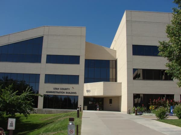
84601 — Central and west Provo. Downtown, the older grid around Center Street and University Avenue, and the west side out toward the lake. This is the code the county's own offices use, and if you are writing to a business downtown it is probably this one.
84602 — Brigham Young University. The entire ZIP code is one institution, though not without residents: the Census Bureau counts roughly 2,300 people in it, the students living in BYU's on-campus housing.
84603 — A non-delivery code. It does not correspond to a residential area with streets and houses.
84604 — North and northeast Provo. The area around campus, the Tree Streets, the foothills, up toward the mouth of Rock Canyon. Much of the off-campus student housing sits here.
84605 — Another non-delivery code, used for post office box mail rather than street addresses.
84606 — South and east Provo. East Bay, the south end of the city, the neighborhoods along the bench going south.
So: three residential codes, one university, two that are administrative rather than geographic.
Why BYU has its own ZIP code
This is not a Provo quirk. The Postal Service assigns dedicated ZIP codes to organizations that receive enough mail to justify their own handling — large universities, major hospitals, some federal agencies, a few very large corporations.
BYU qualifies comfortably. Mail addressed into 84602 goes to the university's own mail operation, which distributes it internally to departments, offices and campus mailboxes. It never enters a normal residential carrier route.
The practical consequence catches new students every single autumn. Your campus address and your home address are different addresses in different ZIP codes, and they behave differently. A department address in 84602 is routed through campus mail. Your apartment three blocks off campus is in 84604 or 84606 and gets a normal carrier.
Send something to the wrong one and it does not vanish — it takes a detour, sometimes a long one, and packages from carriers that are not the Postal Service add another layer, because a private carrier delivering to a campus building follows the university's receiving rules rather than the postal ones.
If you are moving here for school, our move-in guide is the better place to sort your address out before it becomes a problem.
The boundaries do not follow the map in your head
Here is the thing that costs people actual money.
A ZIP code is a delivery route, not a jurisdiction. It is drawn so a carrier can cover it sensibly, and it will happily cross a city line if that is more efficient.
So your mailing address can carry one city's name while your property sits inside a different city. The mailing address tells you where the post arrives from. It does not tell you:
- which police department answers your call
- which school district your children attend
- which city issues your building permit — and therefore which city's permit counts you show up in, a distinction our housing data guide leans on
- who supplies your power and water
- which city council you can address
Every one of those is set by the municipal boundary, and the municipal boundary is not the ZIP boundary. Provo has its own power utility, for instance, which is a city service and follows city limits — not the postal map.
If you are buying, this is worth checking explicitly rather than assuming, and the parcel record is the place to check it. Our guide to property records covers how to pull the parcel and see which jurisdiction it sits in.
The Provo–Orem boundary at the north end of the city is the one that catches the most people. On the ground it is not intuitive, University Parkway runs through the middle of the confusion, and some addresses near it carry a postal city that is not the city they are in.
The rest of Utah County
The county's ZIP codes, verified against postal geography:
| City | ZIP code(s) |
|---|---|
| Provo | 84601, 84602 (BYU), 84603, 84604, 84605, 84606 |
| Orem | 84057, 84058, 84059, 84097 |
| Lehi | 84043 |
| American Fork | 84003 |
| Pleasant Grove | 84062 |
| Lindon | 84042 |
| Alpine | 84004 |
| Eagle Mountain | 84005 |
| Spanish Fork | 84660 |
| Springville | 84663 |
| Payson | 84651 |
| Santaquin | 84655 |
| Mapleton | 84664 |
Codes outside Provo are listed for orientation; confirm any address with the USPS ZIP Code lookup.
Orem having four codes for a smaller population than Provo's is a good illustration of the underlying logic. Codes are allocated by delivery volume and route structure, not by headcount or civic importance.
Several of the county's smaller towns do not have their own code at all and share one with a larger neighbor. That is a genuine administrative annoyance for places like the ones covered in our guide to Utah County's small towns — a town can have its own mayor, its own council and its own identity while its mail says somewhere else.
Where the numbers themselves come from
The five digits are not arbitrary, and reading them tells you something.
The first digit is a broad region of the country. Utah sits in the 8 group, shared with the mountain states. The next two narrow it to a sectional center — the regional processing facility that sorts for a cluster of post offices. Utah County's 846 is that middle layer, which is why nearly every code in this article starts the same way. The last two digits identify the individual post office or delivery area within it.
So 84601 and 84660 are near neighbors in the numbering because they are near neighbors on the ground, both served through the same sectional structure. Orem's 840-series codes belong to a different grouping, which is a historical artifact of how the offices were established rather than a statement about distance.
This also explains why the numbers do not run in any geographic order you would recognize. They were assigned as offices came into the system, and nobody has ever renumbered them, because renumbering ZIP codes would be enormously disruptive for no delivery benefit.
The places where the wrong code costs you money
Most of the time an incorrect ZIP code means a slower letter. In a few situations it means something more expensive, and they are worth knowing.
Insurance quotes are rated partly by ZIP code. Auto and home premiums vary between codes based on claims history, theft rates and similar factors. Entering the wrong one produces a quote for somewhere you do not live, and the correction usually arrives at the point where the policy is issued rather than when you are comparison shopping. Our guide to car insurance costs in Utah covers how the rating works.
Sales tax on delivered goods is determined by the destination, and retailers calculate it from the address you enter. Utah's local option taxes vary between jurisdictions, so a wrong code can produce a wrong tax figure on an order.
Voter registration and jury summonses follow your actual residence, not your postal designation. If those two disagree, the disagreement is generally resolved in favor of the real address — which can mean discovering that the precinct you assumed was yours is not.
Emergency services dispatch on location rather than on ZIP code, so this is not a safety issue in the way people sometimes fear. But if you are giving an address over the phone, the city name matters, and giving a postal city that is not your actual city is a genuine source of confusion.
If you are a student, the address changes more than once
Provo's population turns over on an academic calendar, and the postal consequences are underrated.
A student typically has a permanent home address elsewhere, a campus address in 84602 if they are receiving mail through the university, and an apartment address in 84604 or 84606 that changes most Augusts and sometimes at the end of each term.
Three things follow from that. First, mail forwarding is worth setting up properly rather than relying on the next tenant to be conscientious — the turnover in student housing is high enough that the next tenant may be a stranger who moves out themselves in four months. Second, anything financial or official should be updated directly with the sender rather than left to forwarding, which expires. Third, at the end of a lease, packages already in transit are the most commonly lost items in the entire city; ordering nothing in the final week of a lease is a small discipline that saves a lot of irritation.
ZIP+4, and why it matters more here than most places
The four digits after the hyphen narrow delivery from thousands of addresses down to a very small group — frequently one side of one block, sometimes a single building.
For a letter to a house, you can ignore it. For Provo specifically, there is a reason to care: this is an unusually apartment-dense city. Large student complexes can hold hundreds of units behind a single street address, and the ZIP+4 plus a correctly formatted unit number is what distinguishes your door from three hundred others.
If packages have gone missing at a complex before, the fix is usually the unit format and the full nine digits rather than anything more exotic.
Finding the right code for a specific address
One rule: use the USPS ZIP Code Lookup with the complete street address. It is free, authoritative, and returns ZIP+4.
Do not infer a code from:
- a neighbor's address, if you are anywhere near a boundary
- a map layer you found, which may be a ZCTA rather than a ZIP
- what the previous occupant used, in a newly built area
- an online form's autofill, which is guessing from partial data
That third point deserves a note. New construction is where assignments are least predictable. Utah County has been building fast, and a new subdivision can be assigned differently from the blocks around it. If your address is new, look it up rather than assuming.
The ZCTA trap, if you go looking at maps
If you search for a ZIP code map you will likely end up looking at a ZCTA — a ZIP Code Tabulation Area — without being told.
These are Census Bureau constructions. The Census needs areas with actual boundaries in order to publish statistics, and ZIP codes are collections of delivery points rather than enclosed shapes. So the Bureau builds approximate polygons from them and calls them ZCTAs.
They are close. They are not the same thing. ZCTAs do not exist for non-delivery codes like 84603 and 84605, they smooth over irregularities, and they are updated on the Census schedule rather than the Postal Service's.
For understanding roughly where a code sits, a ZCTA map is fine and is what nearly every online map is showing you. For determining which code an address belongs to, it is the wrong instrument. Use the USPS lookup.
Provo's grid makes addresses look wrong to outsiders
One last source of postal trouble, and it is specific to this city.
Provo uses a coordinate grid rather than conventional street names for much of its area, so a legitimate address can read like 1200 North 900 East — two numbers, no street name in the ordinary sense. The numbers describe a position relative to a central origin point, which our guide to University Avenue explains in full.
Address validation software written elsewhere frequently mishandles this. Forms reject it. Autocomplete mangles it. Delivery drivers unfamiliar with the system read the second number as a house number. And people typing an address from memory transpose the two halves, which produces a real address somewhere else entirely in the city.
The postal formatting that works is the plain one: directional and number exactly as the county has it, unit number on its own line as an apartment or suite designation, then Provo, UT, then the ZIP. If a form will not accept it, the ZIP+4 lookup output is the version worth copying, because it is already formatted the way the Postal Service expects to read it.
None of this is a defect in the grid, which is easier to navigate than named streets once you understand it. It is a mismatch between a local convention and software that assumes a different one.
The short version
- Six Provo codes, three residential: 84601 central and west, 84604 north and northeast, 84606 south and east.
- 84602 is BYU — an institutional code, routed through campus mail.
- 84603 and 84605 are non-delivery codes, not neighborhoods.
- ZIP boundaries are not city boundaries. Your postal city does not determine your police, schools, permits or utilities.
- ZIP+4 earns its keep in a city this full of large apartment complexes.
- Look up new addresses; new construction is where assumptions break.
- Most ZIP maps online are ZCTAs, which are approximations built by the Census.
The other boundary system, and the one that legally counts
Everything above is about a delivery network. There is a second set of lines over the same ground — the corporate limits of the cities themselves — and they were drawn by a completely different process, for completely different reasons, and they are the ones with legal consequences. Confusing the two is the single most expensive mistake people make with a Utah Valley address.
City limits move by statute; ZIP codes move by logistics
A ZIP code changes when the Postal Service decides a route should change. A city limit changes only through the procedures in Utah Code Title 10, Chapter 2, and they are demanding.
Under Part 8, an annexation may only take in land that is unincorporated, contiguous in itself, and contiguous to the annexing city, and it generally may not leave or create an unincorporated island or peninsula (Section 10-2-804). The area has to already sit inside an expansion area the city adopted in advance in an annexation policy plan under Section 10-2-803 — a public document that has to include a map, the criteria guiding future annexations, the plan for extending municipal services and how they will be financed, and an estimate of the tax consequences both for existing residents and for people in the expansion area.
Under Part 9, a boundary adjustment between two adjoining cities runs on notice, hearing and protest (Section 10-2-903), with express provisions on bonds and property taxes (Section 10-2-904) and on the effect on local and special service districts (Section 10-2-905).
Under Part 5, territory can be disconnected from a city at the request of property owners (Section 10-2-501), decided by the city's legislative body after a hearing (Section 10-2-502.5) with court action available (Section 10-2-502.7).
None of those processes consult the Postal Service, and none of them triggers a ZIP code change. The reverse is equally true: a ZIP realignment moves no jurisdiction whatsoever.
Annexation has no election, which is why the line can surprise you
Worth stating plainly, because it explains how a boundary can move without anyone you know hearing about it. Annexation is started by petition under Section 10-2-806, signed by owners of private real property covering a majority of the private land area in the proposed area, worth at least one-third of the total value of private real property there, plus all rural real property in it. Section 10-2-806(3)(d) requires every signature page to carry a bold notice stating substantially that there will be no public election, because Utah law does not provide for annexation to be approved by voters at a public election.
Protest, under Section 10-2-810, is available only to affected entities and to owners of rural or mining-protection-area property, is filed with the county clerk, and must come within 30 days of certification. A county boundary commission hears it (Sections 10-2-809, 10-2-811).
The five things that follow the city line, not the ZIP code
- Property taxes and which taxing entities bill the parcel. The county recorder's record, not the envelope, is the source of truth.
- Building permits and inspections. Applying to the wrong city wastes weeks. Our building permits guide has the Provo process.
- Police and fire response, and the right non-emergency number.
- Business licensing and code enforcement.
- Who you can vote for. Municipal elections are decided by residence inside the corporate limit. A mailing address that says Provo does not put you on the Provo ballot.
And one that follows neither
School attendance boundaries are drawn by the district and match neither system. Provo City School District and Alpine School District boundaries cross city lines in places, so a house can be inside one city for taxes, inside a ZIP shared with a second city, and zoned to a school run by a district named for neither.
How to resolve a specific address
Start with the Utah County Recorder's parcel record for the taxing jurisdiction, confirm against the city's own GIS boundary viewer, check the district's attendance lookup separately, and use the USPS ZIP lookup for mail and nothing else. Where the recorder and a city map disagree, that disagreement is the thing to resolve before you sign anything — and Section 10-2-306, which has all Utah courts take judicial notice of a municipality's existence and classification, means the answer is a matter of public record rather than a matter of proof.
Boundaries and delivery routes both change. Verify both for a specific address before relying on either.
Related Guides
- Looking Up Property Records in Utah County — how to check which city a parcel is in
- University Avenue: The Street Every Address in Provo Is Measured From — the grid, which is a separate system again
- Provo vs Orem
- Utah County's Small Towns
- Moving to Provo: The Complete Guide
- Provo Neighborhoods
- Tax Prep in Provo: From Free VITA Labs to Paid CPAs, and How to Tell Which You Need
- Doing Laundry in Provo When Your Building Has Four Machines for Sixty People
- Phone & Computer Repair in Provo: Who Fixes What, and When Not To
- Adopting a Pet in Utah County: Two Shelters, No Humane Society, and Nobody Open on Saturday
- Family Court in Utah County: The 30 Days, the Two 90s, and What the Forms Assume You Know
- Calling Provo Police Without Calling 911: The Non-Emergency Line, Online Reports & Records
- Finding Someone in the Utah County Jail: Search, Visits, Money & Mail
- The Utah County Courts, Explained: Which One Has Your Case & What It Costs
- Annexation and City Boundaries in Utah County
Frequently Asked Questions
What are Provo's ZIP codes?
Which Provo ZIP code is BYU?
What is the difference between 84601, 84604 and 84606?
Do ZIP code boundaries match city boundaries?
How do I find the ZIP code for a specific address?
What is ZIP+4 and does it matter?
Why does my package say Orem when I live in Provo?
What ZIP codes cover the rest of Utah County?
Sources
The facts in this guide were checked against these sources. Hours, fees and rules change, so confirm anything time-sensitive with the source before you go. How we make Provo.com.
- ACS 5-Year Estimates 2020-2024, Table B01003: Total Population by ZIP Code Tabulation Area (via USAFacts Government Data Connector, accessed 2026-10-12), U.S. Census Bureau. Checked October 12, 2026.
- Utah Address System Quadrants, Utah Geospatial Resource Center (UGRC). Checked October 12, 2026.