
Provo has four canyons its residents actually use. Rock Canyon gets the climbers and the crowds, the Y trail gets everyone else, Provo Canyon gets the traffic. Slate Canyon, at the far south end of the city, gets whoever is left — and on most weekends that is not many people.
That is the practical case for it. The more interesting case is that Slate Canyon is the only one of the four where the live story right now is a legal document rather than a trail condition. What happens at the mouth of this canyon has been contested for two years, and the outcome is not settled, whatever the trail listings say.
Four things share this name, and it causes real confusion
Before any of the practical detail, sort out which Slate Canyon someone means. There are at least four, and people routinely quote figures from one while describing another.
- Slate Canyon Park — a city park at roughly 660 South Slate Canyon Drive, about 64 acres, of which only the first phase has ever been built. The rest sits in long-term master plans with no short-term funding, which the city restated during the easement discussion: conservation of the land is not the same thing as a plan to develop the park on it.
- The Slate Canyon Connector — a paved city path just over half a mile long, running south from the roundabout at Center Street and Olympic Boulevard to the trailhead and to an entrance onto the Bonneville Shoreline.
- Slate Canyon Trail #061 — the Forest Service trail up the canyon itself. This is the hike.
- The Slate Canyon Loop — a longer circuit that uses #061, drops over into Slide Canyon on trail #062, and returns along the Bonneville Shoreline Trail.
And a fifth, unrelated: there is a well-known restaurant in downtown Provo called Slate. It has nothing to do with the canyon, is nowhere near it, and turns up in searches for both.
Getting there, and the parking that people get wrong
The trailhead is tucked into the southeast corner of Provo behind a residential neighborhood. The Forest Service's own driving directions run east on Center Street, south on 900 East, and then through a short sequence of neighborhood streets — Oakmont Lane onto Oak Cliff Drive, right again to stay on Oak Cliff, right at Terrace Drive, then left and into the lot.
Two things worth knowing before you go:
Park in the marked spaces only. The Forest Service says so explicitly on its trail page, and the reason is that the last quarter mile of the approach is somebody's street. Overflow parking on the verge is how trailheads acquire permit systems.
There is a restroom, and it is often locked. Multiple hikers have reported arriving to find it shut. Treat it as a bonus rather than a facility.
If you would rather not drive into the neighborhood at all, the Slate Canyon Connector is a genuinely good approach: half a mile of paved path from the Center Street and Olympic Boulevard roundabout, which also links straight onto the Bonneville Shoreline. Cyclists and runners coming from central Provo tend to use it and skip the parking question entirely.
Nobody agrees how long this hike is, and there is a reason
You will see Slate Canyon quoted at 3.7 miles, 7.5, 7.7, 8.4, 8.8, 9 and 13. All of those figures appear on reputable platforms, and none of them is a typo.
The mechanism is that the name covers four different routes:
| What you are measuring | Rough distance | Rough gain |
|---|---|---|
| Slate Canyon Trail #061, one way | ~3.7 mi | ~3,300 ft |
| The same, out and back | ~7.5–7.7 mi | ~3,300 ft |
| The Slate–Slide–Bonneville loop | ~8.4–9 mi | ~3,400 ft |
| Continuing to Provo Peak | ~13 mi | very large |
The Forest Service's own description of #061 is the useful anchor: the trail heads east for 2.7 miles, then turns north and climbs about a mile to meet Slide Canyon Trail #062. Everything above roughly eight miles is a loop or a peak extension, not the canyon trail.
This is the same trap the Murdock Canal Trail sets from the opposite direction, and the same answer applies. Do not pick a number and call the others wrong. Work out which route you are doing, then take the figure that matches it.
What the trail is actually like
Slate Canyon climbs on an old road bed rather than a built singletrack, which shapes the whole experience. It is wide, it is steady, and it does not switchback much — you gain elevation the entire time rather than in bursts, which is more tiring than it sounds and is the reason so many reviews use the word "steep" about a trail with no dramatic pitches on it.
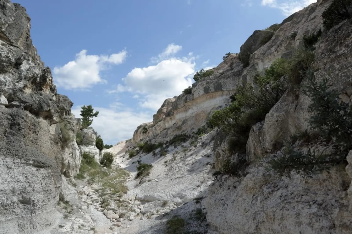
The scenery improves as you go. The lower canyon is scrub oak and open slope with valley views behind you. Higher up, several cliff bands close in on both sides and give the canyon its character, and the drainage runs water in spring with a few crossings. Higher still it opens into meadow and aspen, and the aspens are the reason to come in the first half of October.
There is one honest caveat about the low section: it is exposed, it faces the valley, and in July and August it bakes. Locals treat Slate Canyon as a shoulder-season trail for that reason. The bugs in midsummer draw more complaints than the heat does.
Where it connects — and this is the real appeal
For a canyon with no landmark at the top, Slate Canyon is unusually well connected.
North to Slide Canyon and the Y. Trail #061 tops out at a junction with Slide Canyon Trail #062, which drops toward the Y trail on the other side. Linking them is the classic long day out of this trailhead, and it is how people who have done every trail on Provo's east bench keep finding new ways to combine them. See the full Provo hiking guide for how the pieces fit together.
Onto the Bonneville Shoreline. The trailhead is an access point for the BST heading both directions along the foothills, which is what makes it useful to runners as well as hikers.
Up to Provo Peak. From the Slate–Slide junction, a connector runs about a mile east to the road along the ridge, where the west-ridge route up Provo Peak (11,068 feet) starts. That final ascent is famously brutal — roughly 2,700 feet in a mile and a half — and doing the whole thing from Slate Canyon is a thirteen-mile day that most people break into an overnight. The road you meet up there is the one long known as Squaw Peak Road; it and the peak above it were officially renamed in 2022, and we cover the whole tangle on the Kyhv Peak guide.
On a bike. This is the one context in which Slate Canyon is not the quiet option — among Provo's advanced mountain-bike routes it is one of the better known, precisely because the punishing climb and the loose, technical descent are the point. Logged distances and gain for the ride differ again from the hiking figures; the Provo mountain biking guide has it in context.
The land at the mouth: what is actually happening
This is the part no trail listing gets right, and it is worth reading carefully because two of the most-read sources on the internet currently state the outcome as settled when it is not.
The sequence, as reported:
In May 2025, at a neighborhood meeting, the owners of Splash Summit Water Park floated buying city-owned land at the base of Slate Canyon and building a resort on it. The reaction from residents near the canyon was strongly negative, and no plan was ever formally submitted to the city.
In July 2025, then-mayor Michelle Kaufusi stated publicly that Slate Canyon is not for sale.
In December 2025, the City Council unanimously placed a conservation easement on city-owned land in Bunnell's Fork, up South Fork of Provo Canyon — the city's own public-benefit analysis put that parcel group at 152.90 acres — with Utah Open Lands holding the easement. That established the template.
On 28 April 2026, the Council voted unanimously, in a work meeting, to pursue a conservation easement on roughly 115 acres of city-owned parcels at the mouth and foothills of Slate Canyon. The city would keep ownership; Utah Open Lands would hold the easement and the legal authority to stop the city violating it. A public open house followed at Slate Canyon Park on 13 June 2026, and Conserve Utah Valley set out to raise the $10,000 stewardship contribution that Utah Open Lands requires to hold and defend an easement in perpetuity.
What was still outstanding at that point, per the reporting: a memorandum of understanding between the city and Utah Open Lands, a drafted easement agreement, and a public-interest valuation study. A city policy analyst noted that most of the land in question sits at around a 30% grade and very little of it is buildable in the first place.
And here is the problem. A trail description on one of the largest hiking platforms, updated in July 2026, tells hikers the land is already permanently protected by a community conservation easement. The advocacy group's own project page opens by saying the mouth of the canyon will stay that way forever — on the same page that invites people to an event celebrating the beginning of an easement being placed on it. One of those two sentences has run ahead of the process.
We could not confirm that the easement has been recorded. The accurate statement as of publication is that it is agreed in principle, unanimously supported, and not yet finished. If you care about the outcome, that distinction is the whole point — and if you are reading this well after publication, it is exactly the fact worth re-checking with the city rather than with a trail app.
There is also an 18-hole disc golf course here
Easy to miss if you arrive with boots on: Slate Canyon Park holds one of Provo's five disc golf courses, and by reputation it is the most spectacular and the most punishing of them.
Eighteen holes, roughly 2.4 miles, free, rated moderate, and about two hours to play. It carries the joint-best scenery rating of any course in the city, and the reviews are a study in mixed feelings — blind baskets, serious elevation change and summer weeds that swallow discs whole. Our Utah Valley disc golf guide covers it against the other four.
One detail from that guide belongs here too, because it changes the advice about dogs: foxtails. The seed heads are all over this course in late summer, they work into paws, ears and noses, and they are a veterinary problem rather than a nuisance. If you are bringing a dog up here in July or August, that is the reason to think twice — not the wildlife.
Water: what is actually up there
Worth being precise about, because the answer changes with altitude.
At the trailhead, plan on nothing. There is no drinking water at the lot, and the restroom is often locked.
Higher up, there is water, and it is one of the canyon's genuine assets. Accounts of the through-route to Slide Canyon describe several springs in the upper canyon and more over the far side — enough that people use this as an approach for multi-day trips, which is unusual on the Provo side of the valley. The drainage in the lower canyon also runs seasonally, with crossings in spring.
The caveat is the obvious one: none of it is treated, spring flow varies by year and by month, and a source that ran in June may be dry in September. Carry what you need for the day and treat anything you find up there as a bonus you filter, not a plan.
Wildlife, and why it matters here more than elsewhere
The lower canyon is winter range. Mule deer come down onto these slopes when the snow line drops, which is the ecological argument that has been made for the easement and is also a reason to keep dogs close and stay on the trail between roughly December and April.
Higher up, the usual Wasatch cast: deer, the occasional moose, and mountain lions that are present, seldom seen, and reported often enough by hikers on this specific trail to be worth mentioning rather than glossing. Gopher snakes turn up on the lower road bed in warm weather and are harmless.
The wildflower window is short and good — paintbrush and lupine through late spring, in a canyon that most people are not in.
How it compares to the rest of Provo's canyons
If you have limited time in Provo and want one canyon hike, this is probably not the one — Rock Canyon is more dramatic and the Y is more iconic. Slate Canyon earns its place on a different axis:
- You want quiet. This is the best answer in Provo proper.
- You want distance without driving. Nine miles and 3,400 feet, fifteen minutes from downtown.
- You are training. A steady, relentless grade with no technical sections is close to ideal for it.
- You have done the others. The Slide Canyon link opens up combinations that the individual trails do not.
For genuinely lesser-known options across the valley, including the quieter Payson Canyon trails, see six trails past the famous five. For camping rather than day hiking, camping near Provo covers the developed sites and dispersed camping covers the rest.
Practical summary
- Trailhead: southeast Provo, above Slate Canyon Park, near 660 S Slate Canyon Drive. Approach via Oak Cliff Drive and Terrace Drive.
- Parking: free, in the marked lot. Marked spaces only — it is a residential approach.
- Fees or permits: none.
- Restroom: at the lot, frequently locked.
- Water: nothing at the trailhead. Springs are reported in the upper canyon and in Slide Canyon; all untreated and seasonal.
- Distance: ~3.7 miles one way on trail #061; 7.5–9 miles for the common out-and-back and loop options.
- Gain: roughly 3,300 feet for the full canyon.
- Best months: late April to early June, and late September through October.
- Dogs: allowed. Leashed on city land; leash sensible everywhere else here.
- Connects to: Slide Canyon #062, the Bonneville Shoreline Trail, Provo Peak, and by a long route the Y.
Conditions in the upper canyon change with the season and the year. The Uinta-Wasatch-Cache National Forest's Spanish Fork Ranger District administers the trail above the city land and is the right place to check current conditions before a long day.
Related Guides
- Jolley's Ranch: Camping in Hobble Creek Canyon, Twenty Minutes from Provo
- Rock & Ice Climbing in Provo: Rock Canyon, Provo Canyon & the Gyms
- Provo Canyon: The Complete Guide to US-189, the Stops, and the Seasons
- Horseback Riding in Utah Valley: Where to Ride, What It's Actually Like, and Who Takes Beginners
- Utah Valley Hike Finder — filter every trail by difficulty, length, season, dogs and fees
- Canyon & commute conditions — the seasonal gate map for the canyons on Provo's south side
Frequently Asked Questions
Where is the Slate Canyon trailhead and is there parking?
How long is the Slate Canyon trail?
Is Slate Canyon a hard hike?
Is Slate Canyon less crowded than Rock Canyon or the Y?
Can you get to the Y from Slate Canyon?
Are dogs allowed in Slate Canyon?
Has Slate Canyon been permanently protected from development?
When is the best time to hike Slate Canyon?