
Here are 13 short hikes in Utah Valley that AllTrails times at under an hour on average, with each one's distance, elevation gain and season, and an estimate of how long it takes to drive there from six places around the valley. The point is the "from anywhere" part: a trail list built in Provo is useless to a family in Eagle Mountain, so the drive tables below are measured from Lehi, Eagle Mountain, Orem, Provo, Spanish Fork and Payson.
Trail figures are from AllTrails, checked October 19, 2026. Drive times are estimates from the OSRM routing service, from each city's center to the trailhead or the park beside it, with no traffic. Your Monday evening will be slower.
What "under an hour" means here
It means the hike, not the drive. Every trail below has an AllTrails average completion time under 60 minutes. A family with small children will take longer than the average; a family of teenagers will take less. The point is that each one fits between dinner and bedtime once you've arrived.
Two popular hikes didn't make the list, and here's why:
- Battle Creek Falls in Pleasant Grove is listed on AllTrails as a 4.2-mile, 1,850-foot trail averaging over three hours, because the listing continues far past the falls. Plenty of families turn around at the waterfall; our Battle Creek Falls guide covers that version.
- The Y above BYU appears on AllTrails as a 6.8-mile route to the summit. The trip to the letter itself is shorter, and our Y Mountain guide has it, but it's steep switchbacks, not a weeknight stroll with a 5-year-old.
Bridal Veil Falls would normally top a list like this; AllTrails rates its paved trail easy, about 36 minutes on average. The area is in the middle of a multi-year Utah County reconstruction. Our Bridal Veil Falls guide explains what's closed; check the county's notice first.
North and west: Lehi, Highland, Eagle Mountain
| Trail | Distance and gain | AllTrails average | Season and catch |
|---|---|---|---|
| Footloose Loop, Lehi | 0.7 mi loop, 111 ft | 19 min | Best March to August; leashed dogs |
| Golden Eagle Pass, Eagle Mountain | 1.3 mi loop, 298 ft | 40 min | Best February to September; no dogs |
| Lower Hog Hollow, Highland | 2 mi out and back, 180 ft | 46 min | Leashed dogs |
Estimated drive, in minutes:
| Trail | From Lehi | From Eagle Mountain | From Orem |
|---|---|---|---|
| Footloose Loop | 13 | 31 | 25 |
| Golden Eagle Pass | 18 | 14 | 30 |
| Lower Hog Hollow | 18 | 38 | 28 |
Footloose Loop starts on the bald hilltop above Eagle Summit Park in north Lehi, per AllTrails, with views over the surrounding neighborhoods. The park itself, at 5097 N. Ravencrest Lane, had a Google-listed closing time of 10 p.m.
Golden Eagle Pass is the west side's evening view: AllTrails describes the summit of the pass looking out over ridges to Utah Lake. Its review summary warns of steep sections and confusing intersecting trails, so open the map before you start.
Lower Hog Hollow begins across West Beacon Hill Boulevard from Beacon Hill Park in Highland and follows the creek north into the trees to the Angel's Gate trailhead, according to AllTrails. It's the shadiest of the three.
The middle: Orem, Provo and Provo Canyon
| Trail | Distance and gain | AllTrails average | Season and catch |
|---|---|---|---|
| BYU Botany Pond | 1 mi loop, 39 ft | 19 min | Most of the year; no dogs |
| Upper Falls, Provo Canyon | 0.5 mi out and back, 301 ft | 28 min | April to November; stairs, poison ivy |
| Buffalo Peak | 1 mi out and back, 282 ft | 34 min | Road closed mid-October to mid-May |
Estimated drive, in minutes:
| Trail | From Orem | From Provo | From Lehi |
|---|---|---|---|
| BYU Botany Pond | 12 | 3 | 24 |
| Upper Falls | 14 | 18 | 26 |
| Buffalo Peak trailhead | 31 | 35 | 43 |
BYU's Botany Pond is the shortest drive on this page for most of Provo, and the flattest walk: a partly paved loop at the north end of campus. Good for the evening when nobody has the energy for a real hike.
Upper Falls sits in Upper Falls Park, a short way up Provo Canyon past Bridal Veil. AllTrails describes a bridge over the river, multiple flights of stairs and a 40-foot waterfall at the top, and warns there's "a lot of poison ivy on the trail." Long pants. The park's Google listing shows it open 5 a.m. to 11 p.m.
Buffalo Peak gets you to 8,015 feet in a mile, which is the reason teenagers like it. The catch is the road: AllTrails notes that Kyhv Peak Road, formerly Squaw Peak Road, is closed from mid-October to mid-May, and its reviewers recommend a high-clearance vehicle. That makes it a June-to-early-October idea. Our Buffalo Peak guide has the road detail.
South: Springville, Spanish Fork and Payson
| Trail | Distance and gain | AllTrails average | Season and catch |
|---|---|---|---|
| Dripping Rock, Spanish Fork | 0.7 mi, paved, 9 ft | 12 min | Year-round; stroller friendly |
| Spanish Fork River Trail loop | 2.3 mi loop, paved, 22 ft | 40 min | Year-round; bring bikes |
| Spanish Oaks Lookout | 1.6 mi loop, 334 ft | 48 min | April to November; bike traffic |
| Hobble Creek Trail, Springville | 2.5 mi out and back, 45 ft | 45 min | Year-round; partly paved |
| Grotto Falls, Payson Canyon | 0.6 mi out and back, 127 ft | 18 min | March to October; seasonal road |
Estimated drive, in minutes:
| Trail | From Spanish Fork | From Payson | From Provo |
|---|---|---|---|
| Dripping Rock (Spanish Fork River Trailhead) | 8 | 16 | 20 |
| Spanish Fork River Trail (Sports Park) | 5 | 13 | 20 |
| Spanish Oaks Lookout (reservoir) | 11 | 16 | 22 |
| Grotto Falls trailhead | 31 | 21 | 41 |
Dripping Rock follows the Spanish Fork River through cottonwoods to a place where springs emerge from the far bank and drip into the river, per AllTrails, which rates it stroller and wheelchair friendly. The Spanish Fork River Trailhead's Google listing shows it open 24 hours.
The Spanish Fork River Trail loop starts at the Spanish Fork Sports Park, 295 Volunteer Drive, which Google lists open until 11 p.m. Flat and paved, so it's the family bike ride of the south county.
Spanish Oaks Lookout circles above Spanish Oaks Reservoir. AllTrails' review summary mentions confusing trail signs and bike traffic.
Hobble Creek Trail is a partly paved, nearly flat walk along the creek in Springville's Hobble Creek Canyon. We haven't given a drive time because the AllTrails listing doesn't pin its trailhead to a named park we could verify; open the AllTrails map for the start.
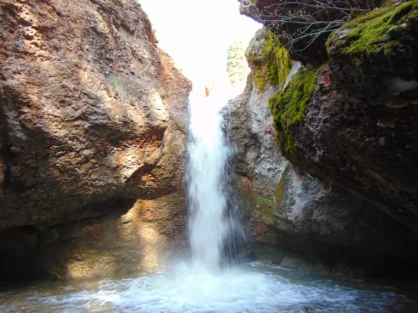
Grotto Falls is the one everyone in Payson knows: a trail that crosses its stream on timbers to a waterfall falling into a pool between rock walls, per AllTrails. It's on the Nebo Loop road. Our Nebo Loop guide explains why there's no fixed opening date, and Payson Lakes and Payson Canyon covers the rest of the canyon.
Up the canyons: worth it in summer
| Trail | Distance and gain | AllTrails average | Season and catch |
|---|---|---|---|
| Cascade Springs | 0.8 mi loop, boardwalk, 101 ft | 20 min | May to October; seasonal road |
| Tibble Fork Reservoir loop | 1.4 mi loop, 49 ft | 27 min | Summer; fee area |
Estimated drive, in minutes:
| Trail | From Orem | From Provo | From Lehi |
|---|---|---|---|
| Cascade Springs | 46 | 50 | 57 |
| Tibble Fork Reservoir | 38 | 45 | 35 |
These are the two that fail the "from anywhere" test: from Eagle Mountain, OSRM estimates 77 minutes to Cascade Springs, and from Payson, 71. They're here because, for the north half of the valley in July, a boardwalk over springs at 6,300 feet is the best cool-evening walk there is.
Cascade Springs is a loop of boardwalks and paved paths past springs and pools, with interpretive signs, rated stroller friendly by AllTrails. It sits off the seasonal Alpine Loop road, near Midway; see our Cascade Springs guide for which roads are open when.
Tibble Fork Reservoir is in American Fork Canyon, a designated recreation fee area, which our Alpine Loop guide explains. The dirt loop circles the reservoir with views of Lone Peak, per AllTrails.
Timing an evening hike
From Sunrise-Sunset.org's data for Provo, mid-month:
| Month | Sunset | Last usable light |
|---|---|---|
| April | 8:06 p.m. | 8:33 p.m. |
| June | 8:59 p.m. | 9:30 p.m. |
| August | 8:25 p.m. | 8:53 p.m. |
| October | 6:48 p.m. | 7:14 p.m. |
The "last usable light" column is the end of civil twilight, the official point when it gets too dark to see well outdoors without a light. In a canyon, the mountain blocks the sun earlier. Plan to be back at the car by sunset, carry a headlamp anyway, and from November through February move hikes to Saturdays.
Making it a home evening
Lesson at the trailhead, not the top. Everyone listens better before they're tired.
Give each child a job. One carries the water, one reads the trail map, one is the "sweeper" who makes sure nobody's left behind.
Let the trail pick the topic. A waterfall at Grotto or Upper Falls is a natural lead-in to talking about water and renewal. A summit view from Golden Eagle Pass or Buffalo Peak is one about perspective.
Treat afterward, not on the trail. Plan the stop: the FHE treats guide lists what's open late on Mondays.
For trails that are about distance rather than an after-dinner hour, our complete Provo hiking guide and lesser-known hikes go further, and hikes for kids under 8 applies a stroller test.
Related Guides
- Family Home Evening in Utah Valley: 52 Ideas for the Year
- FHE With Toddlers
- FHE With Teenagers
- Paved Trails in Utah Valley
- Dog-Friendly Hikes Near Provo
Frequently Asked Questions
What is a short family hike near Provo for a weeknight?
Is there a short hike near Lehi or Eagle Mountain?
Is there a paved, stroller-friendly short walk in south Utah County?
Can you hike Grotto Falls in the fall or winter?
Is the road to Buffalo Peak open?
Is Battle Creek Falls a short hike?
How accurate are the drive times?
What time should we start an evening hike?
Sources
The facts in this guide were checked against these sources. Hours, fees and rules change, so confirm anything time-sensitive with the source before you go. How we make Provo.com.
- AllTrails: Footloose Loop, AllTrails. Checked October 19, 2026.
- AllTrails: Golden Eagle Pass, AllTrails. Checked October 19, 2026.
- AllTrails: Lower Hog Hollow Creek Trail, AllTrails. Checked October 19, 2026.
- AllTrails: Upper Falls Trail, AllTrails. Checked October 19, 2026.
- AllTrails: Brigham Young University Botany Pond, AllTrails. Checked October 19, 2026.
- AllTrails: Dripping Rock Falls, AllTrails. Checked October 19, 2026.
- AllTrails: River Trail Loop from Sports Park, AllTrails. Checked October 19, 2026.
- AllTrails: Hobble Creek Trail, AllTrails. Checked October 19, 2026.
- AllTrails: Grotto Falls Trail, AllTrails. Checked October 19, 2026.
- AllTrails: Cascade Springs Interpretive Trail, AllTrails. Checked October 19, 2026.
- AllTrails: Spanish Oaks Lookout Point Trail, AllTrails. Checked October 19, 2026.
- AllTrails: Buffalo Peak Trail, AllTrails. Checked October 19, 2026.
- AllTrails: Tibble Fork Reservoir Loop, AllTrails. Checked October 19, 2026.
- AllTrails: Battle Creek Falls Trail, AllTrails. Checked October 19, 2026.
- AllTrails: The Y Mountain Trail, AllTrails. Checked October 19, 2026.
- AllTrails: Bridal Veil Falls Trail, AllTrails. Checked October 19, 2026.
- Sunrise and sunset times for Provo, Utah (API, mid-month 2027), Sunrise-Sunset.org. Checked October 19, 2026.
- OSRM routing service (drive-time estimates), Project OSRM. Checked October 19, 2026.
- Google Places listings (hours, addresses), checked Oct 19, 2026, Google. Checked October 19, 2026.