Where you sleep on a Moab trip from Provo shapes the whole weekend more than any single hike does. A reserved site inside Arches puts you minutes from a trailhead at dawn but is gone months ahead in spring. A first-come site on the Colorado River can be shady and pretty but has no water and often fills by morning. A motel on Main Street has a shower and air conditioning but means driving into the parks with everyone else. This guide compares the main options around Moab, from Devils Garden and the two Canyonlands campgrounds to the BLM sites on State Routes 128 and 279, Kane Creek Road, Sand Flats Recreation Area, Dead Horse Point State Park and the motels and RV parks in town, using what the Park Service, the Bureau of Land Management, Grand County and Utah State Parks say on their own pages as of Nov. 18, 2026.
Campground fees below come from those official pages. We have not listed hotel or motel prices, which change by the night and the season. Check the property directly.
Quick comparison
| Option | How you get a site | Water and toilets |
|---|---|---|
| Devils Garden (Arches) | Reservation March 1 to Oct. 31; first come Nov. 1 to Feb. 28 | Drinking water and flush toilets, per the park; no showers |
| Willow Flat (Island in the Sky) | First come, first served year-round; 12 sites | Vault toilets; no water at the campground |
| The Needles Campground | Loop B reservable March 15 to Nov. 15; Loop A first come | Seasonal drinking water; flush toilets seasonal, vault toilets year-round |
| BLM campgrounds (SR-128, SR-279, Kane Creek, SR-313) | Mostly first come; group sites and a few individual sites reservable | Vault toilets; no water or electricity |
| Sand Flats Recreation Area | 140 first-come sites; 6 reservable group sites | Vault toilets; no water |
| Dead Horse Point State Park | Reservations up to four months ahead; same-day sales when available | Modern restrooms at Kayenta; no RV water fill |
| Town motels, hotels and commercial RV parks | Book directly; reservations strongly recommended in spring and fall | Showers and running water at most commercial campgrounds |
Getting there from Provo, and why it matters for where you stay
The usual route from Utah Valley runs southeast from Spanish Fork on US-6 through Spanish Fork Canyon and Price to I-70, then east to Crescent Junction and south on US-191 into Moab. The Park Service puts the Arches entrance 236 miles southeast of Salt Lake City and 22 miles south of I-70 at Crescent Junction, and five miles north of Moab. Provo is closer than Salt Lake, but it is still a long drive. Our Moab from Provo guide covers the route, the US-6 cautions and timing, and our road conditions guide explains where to check before you leave.
That drive is the reason campsite strategy matters. Most first-come campgrounds around Moab fill in the morning in busy months. Leaving Provo after work on Friday means arriving in the dark, when the first-come options are mostly gone. If you can't leave until evening, either book something reservable or plan to sleep in town the first night and hunt for a first-come site on Saturday morning.
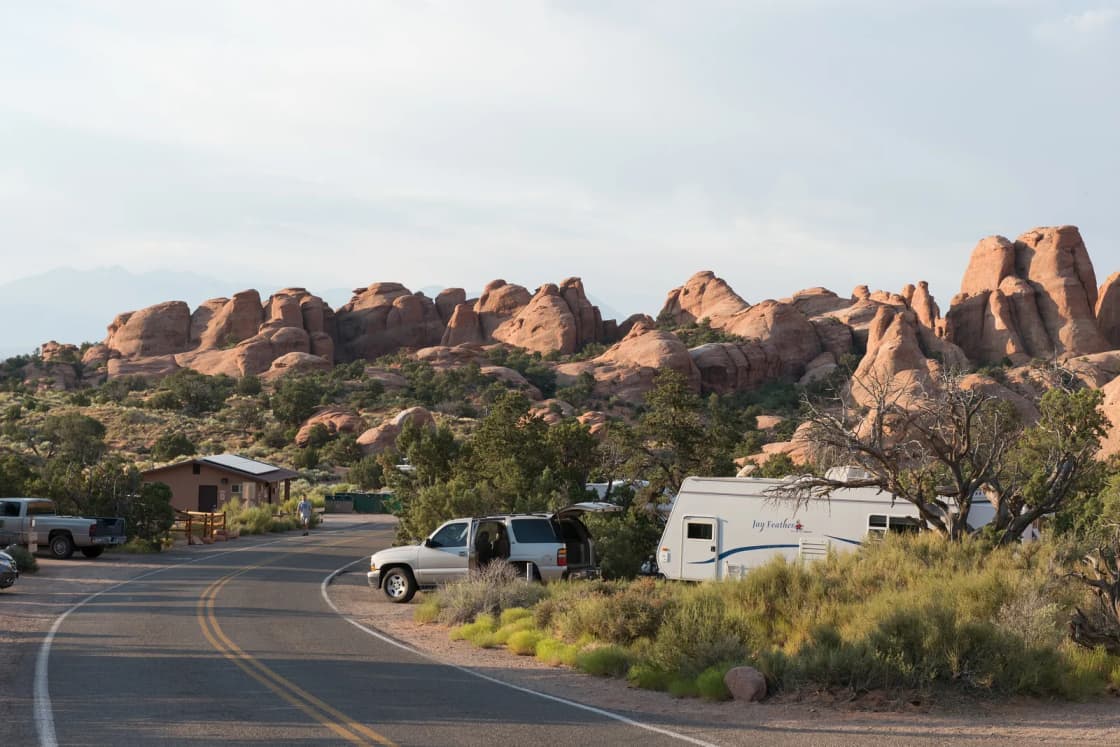
Inside Arches: Devils Garden Campground
Devils Garden is the only campground in Arches National Park. It sits at about 5,200 feet, 18 miles up the park road from the entrance and 23 miles from Moab, according to its Recreation.gov listing. The park's own drive-time table puts Devils Garden 40 to 45 minutes from the entrance station, so even campers here spend a fair amount of time on the park road if they want to see the Windows or Delicate Arch.
Booking. The Park Service says you can reserve sites for nights between March 1 and October 31, and that the campground is "usually full every night" in that season. Standard sites open at 10 a.m. Eastern time, six months ahead, and the latest you can book is four days ahead. From November 1 through February 28, every site is first come, first served. Since this is mid-November, that winter rule is in effect now, and the park asks winter campers to download the Recreation.gov app before they arrive and use its Scan and Pay feature, because cell service is limited. In season, the park notes that walk-in sites are not available.
Size and fees. The Recreation.gov listing gives 51 sites, including two group sites and one accessible site. The Park Service lists $25 a night for a standard individual site, with a limit of 10 people and two vehicles. Two group sites, Canyon Wren and Juniper Basin, can be booked up to 12 months ahead.
Facilities. The listing describes flush toilets, drinking water, picnic tables and fire rings, with no showers, no dump station and no RV hookups. Firewood is not sold at the campground; buy a firewood coupon at the visitor center. Burning collected wood is prohibited.
Noise and quiet. Park rules set quiet hours from 10 p.m. to 8 a.m. Generators are allowed only from 8 to 10 a.m. and 4 to 8 p.m. The campground has an amphitheater, and rangers may give evening programs there spring through fall.
Shade. The listing describes the campground as "forested with mixed stands of Utah juniper and pinyon pine," set among sandstone fins. Juniper and pinyon are short trees, so expect partial shade at best.
Who should pick it. Devils Garden is the best choice for people who want to start a hike from camp. The Broken Arch Trail begins inside the campground, and the Devils Garden trailhead is at the end of the same road. Our Devils Garden trail guide covers Landscape Arch and the primitive loop. If you miss the six-month booking window, plan on staying outside the park.
Canyonlands: Willow Flat at Island in the Sky
Island in the Sky Campground, also called Willow Flat, is the small one. The Park Service lists 12 sites, first come, first served, open year-round, at $15 a night per site. The park says sites fill most days spring through fall.
To get there, turn onto UT-313 about 10 miles north of Moab, drive 22 miles to the park entrance, then continue about 7 miles and turn right toward Upheaval Dome. The campground sits near the Green River Overlook.
Facilities. There are vault toilets, picnic tables and fire rings, but no water at the campground. The park says drinking water is available outside the Island in the Sky Visitor Center spring through fall. Plan to haul in everything else. There's no firewood for sale and no wood gathering, so bring firewood you bought outside the park.
Quiet. Canyonlands sets quiet hours from 8 p.m. to 8 a.m., which is earlier than Arches. Generators are allowed only 8 to 10 a.m. and 4 to 8 p.m. Each site holds up to 10 people and two vehicles, and the stay limit is seven consecutive nights.
Who should pick it. Willow Flat suits a self-sufficient pair or small group with a smaller vehicle who wants the quietest, most remote option on the Island in the Sky mesa and is willing to arrive early to compete for 12 sites. It is a bad bet for a family arriving after dark on a spring Friday. Our Island in the Sky guide covers Mesa Arch and Grand View Point, both a short drive from camp.
Canyonlands: The Needles Campground (Squaw Flat)
The Needles Campground, still often called Squaw Flat on older maps and websites, is the only campground in this guide that is not near Moab. Its Recreation.gov listing says it's 1.5 hours from Moab and 1.25 hours from Monticello, at about 4,900 feet. You reach it by driving 40 miles south of Moab on US-191, then about 35 miles west on UT-211, the only paved road into the district.
Booking. The park lists 26 individual sites at $20 a night. Loop B individual sites can be booked on Recreation.gov up to six months ahead for nights between March 15 and November 15. Loop A is first come, first served only. In winter, when the district is less busy, the park says Loop B closes and Loop A stays open. The district also has three reservable group sites, open March 15 through November 15.
Facilities. Drinking water and flush toilets are seasonal, with vault toilets year-round. There are no hookups, showers, electricity or dump station. Maximum vehicle and trailer length is 28 feet. The listing warns that there's no cell coverage and no lights on park roads or campsites, and it recommends arriving before dark.
Quiet. Quiet hours are 8 p.m. to 8 a.m., and the park says food must be stored properly and not hung in trees.
Who should pick it. The Needles is for people coming to hike, not to sightsee around Moab. Chesler Park, Druid Arch and the Joint Trail start from this district. If your weekend is built around Arches and Island in the Sky, sleeping here adds a lot of driving.
BLM campgrounds: the river roads and the mesa
The BLM's Moab Field Office runs most of the developed camping around town. Discover Moab, the county tourism office's site, says the BLM maintains 26 campgrounds in the Moab area. The BLM's own visitor guide lays out the common rules:
- Booking: Individual sites are first come, first served and not reservable, except Ken's Lake Loop A and Courthouse Rock sites 5 and 6, which are booked on Recreation.gov. Group sites can be reserved up to six months ahead and up to eight days before arrival.
- Fees: Most sites are $20 a night. Pay at the campground kiosk with cash (U.S. currency) or a check made out to USDI - BLM. The guide says most sites accept credit cards or electronic payment, often at a nearby campground's kiosk.
- Water and power: None at any BLM campground. Vault toilets, fire rings, picnic tables and dumpsters are provided.
- Generators: 8 a.m. to 8 p.m.
- Firewood: No gathering or cutting. Buy it at convenience stores in and around Moab.
- Stay limit: 14 days at one location, then you must move at least 30 miles away.
Discover Moab asks campers not to drive through campgrounds when "Full" signs are posted, because the noise and headlights bother people already camped there.
State Route 128, the Colorado River road
SR-128 leaves US-191 just north of Moab and follows the Colorado River northeast. The BLM visitor guide lists a string of riverside campgrounds by distance from US-191: Goose Island (1.4 miles, 19 sites), Grandstaff (3 miles, 16 sites, no trailers), Drinks Canyon (6.2 miles, 17 sites), Hal Canyon (6.6 miles, 11 sites), Oak Grove (6.9 miles, 7 sites, no trailers), Big Bend (7.4 miles, 33 sites), Upper Big Bend (8.1 miles, 8 sites), Upper and Lower Onion Creek (21 and 22 miles), Fisher Towers (22 miles, 5 sites, no RVs), Hittle Bottom (23 miles, 15 sites) and Dewey Bridge (29 miles, 7 sites).
Shade. This corridor has the best shade the BLM promises anywhere near town. The BLM says Goose Island and Grandstaff are popular partly for "its shade in the summer," and both "typically fill in the morning, from March-October." Goose Island takes tents, RVs and trailers, with all sites fitting RVs up to 40 feet, according to Discover Moab. Grandstaff is tents only. During 2026, the BLM closed part of Grandstaff from March 9 to Oct. 31 to stage equipment for the Colorado River Trail extension, keeping sites 1 through 10 open. Check its BLM page for any later changes.
Distance to the parks. Goose Island and Grandstaff are only a few miles from the US-191 junction, which puts them close to the Arches entrance. Hittle Bottom and Dewey Bridge are much farther out, so expect a longer drive to either park.
River safety. The BLM's riverside campground pages warn not to enter the river without a life jacket because "it has dangerous under currents." Hittle Bottom is a popular launch for the Moab Daily stretch. Our Moab with kids guide covers river trips with children.
State Route 279, Potash Road
Potash Road heads west along the Colorado just south of the Arches entrance. The BLM guide lists Jaycee Park (4 miles, 7 sites, walk-in tents, no RVs), Williams Bottom (6 miles, 17 sites) and Gold Bar (10 miles, 9 sites). The BLM describes Jaycee Park as having "shady walk-in tent sites near the popular Wall Street climbing area," and Williams Bottom as "shady campsites for tents and small trailers." Both sit between the river and the cliffs, close to the Wall Street climbing area and the Poison Spider 4WD trailhead, so expect climbers and off-road traffic during the day. The Corona Arch trailhead is also on this road.
An archived BLM news release, posted before 2025, said canyon pour-offs and flooding had damaged Williams Bottom and King's Bottom and temporarily closed Williams Bottom and the lower part of King's Bottom. Flash floods do reach these canyon-bottom sites. Call the Moab Field Office at 435-259-2100 to check current status.
Kane Creek Road
Kane Creek Road leaves the south end of town and follows the river southwest. The BLM calls the Kane Creek Recreation Area a base for camping, group sites, and "world-class mountain bike and OHV trails." King's Bottom is the closest campground, about 2 miles past the stop sign and just beyond the Moab Rim Trailhead. The BLM's page lists 21 individual sites, 11 of them walk-in tent sites, with toilets but no water or hookups, and says it takes tents and small RVs only. The visitor guide lists the Ledge campgrounds farther out on a gravel road, with 98 sites across five areas. Kane Creek is the closest BLM option to town on the south side. Because the area is known for OHV trails, expect more engine noise during the day than on the river road.
State Route 313 and the north side
Horsethief Campground sits on the mesa 12 miles out UT-313, the road to Dead Horse Point and Island in the Sky. The BLM says its 83 sites are "tucked in the pygmy pinyon-juniper forest on the mesas above Moab." Three loops take RVs. The fourth, Dapple, has 28 tent sites where generators aren't allowed, which is the closest thing to a guaranteed quiet loop in BLM camping around Moab. The visitor guide lists Horsethief at $25 a night, while the campground's own BLM page still shows $20, so bring enough to cover the higher figure. Cowboy Camp, 18 miles out, has 7 sites and no trailers.
If you want to wake up close to Island in the Sky and Dead Horse Point but missed both, Horsethief is the logical fallback. The BLM notes many mountain bike trails and 4WD roads nearby, and Dead Horse Point's Intrepid trails are farther out the same road. Our Moab mountain biking guide covers which trails suit beginners.
Ken's Lake and the south side
Ken's Lake is about 10 miles south of Moab at 5,085 feet, beside a reservoir with a gravel boat ramp (electric motors only). It's the BLM's main reservable option for individual sites. The BLM says Loop A sites are booked only through Recreation.gov, from the same day up to six months ahead, with no cash or check accepted on site. Loop B is first come, first served, paid by cash, check or Recreation.gov Scan and Pay. The BLM warns that lows drop below freezing October through March and that June-to-August highs run 95 to above 100 degrees. For a family that wants a booked site without competing for Devils Garden, Ken's Lake Loop A is a strong choice.
Sand Flats Recreation Area
Sand Flats sits on the slickrock plateau directly east of town, about 2.5 miles up the Sand Flats Road from Millcreek Drive, according to Discover Moab. It's home to the Slickrock Bike Trail and the Hells Revenge and Fins and Things 4x4 trails. Grand County manages it day to day in partnership with the BLM.
Booking. Grand County says Sand Flats has 140 individual campsites, first come, first served, plus 6 group sites reservable on Recreation.gov. The county's advice is specific: "In the spring and fall campgrounds are typically full Thursday, Friday and Saturday nights and 75% to full other nights. Approximately 20% of the campsites turn over each morning. Your best chance of getting a campsite is to arrive before noon."
Fees and passes. The county's camping rules say each vehicle pays $20 a night; the fee is "per vehicle not per campsite." Discover Moab adds $2 per extra person beyond five and a $5 nightly trailer fee. Sand Flats also charges its own day-use fee. Grand County says federal and state passes are not accepted, except the federal Access Pass, so an America the Beautiful pass won't get you in.
Facilities. Discover Moab says the sites are spread over nine campgrounds between 4,500 and 5,700 feet, with picnic tables, metal fire rings and nearby vault toilets. There's no water anywhere; bring all of it. Some sites take RVs, with the best choices in campgrounds A, B, E and Juniper, and there are no hookups.
Noise and rules. Grand County sets quiet hours from 10 p.m. to 6 a.m. and bans generators from 8 p.m. to 8 a.m. (Discover Moab's version of the same rules lists quiet hours ending at 8 a.m.; the county's page is the managing agency's.) After-hours noise complaints go to the Grand County Sheriff at 435-259-8115. The county says campground loop roads are "not training or testing grounds for ATV's and dirt bikes," but many campers here come for the 4x4 and motorcycle trails. Daytime engine noise is part of the place. Checkout is 11 a.m., and stays are limited to 14 days in a 28-day period.
Who should pick it. Riders who want to pedal from camp to the Slickrock trailhead, and groups with off-road vehicles. It's also close to town for anyone who wants dinner in Moab without much driving. It's a poor fit for anyone looking for shade or silence.
Dispersed camping: the rules near Moab are tight
Dispersed camping, meaning camping outside a developed campground, is legal on some BLM land around Moab but not near town or most popular areas. The BLM visitor guide says: "Due to high visitation, many areas near developed campgrounds and the city of Moab are closed to dispersed camping."
Where it is allowed, the BLM's rules are:
- Use only areas that have already been disturbed by camping, outside the camp-only-in-campground zones and designated backcountry zones shown on the BLM map.
- Choose hard rock surfaces and don't expand or create new sites. Avoid biological soil crust and vegetation.
- In designated backcountry zones, camp only at sites marked with a tent symbol on a brown post.
- Don't build new fire rings, and don't gather or cut wood.
- "A portable toilet system, or human waste disposal bag, is required for all dispersed camping." The guide says portable toilet systems are required throughout Grand County if no toilet is available, and that human waste bags don't go in BLM dumpsters. Take them to the Moab Transfer Station at 2295 S. Hwy 191 during business hours.
Discover Moab puts it more bluntly: digging a cathole is illegal in Grand County. If you're used to dispersed camping in the Wasatch, these rules are stricter. Our dispersed camping near Provo guide covers the Utah Valley version. Get the current BLM Moab map from the Moab Field Office at 82 E. Dogwood Ave. or the Moab Information Center at 25 E. Center St. before you pick a spot.
Dead Horse Point State Park: campgrounds and yurts
Dead Horse Point sits at the end of UT-313, on the same mesa as Island in the Sky. It has the most developed public camping in the area, run by Utah State Parks rather than the Park Service.
Kayenta Campground. The state park says Kayenta's 21 sites sit "within a grove of junipers" and offer "a peaceful, shaded respite," with lighted shade structures, picnic tables, fire rings, tent pads and 20/30/50-amp electrical hookups at every site. It has modern restrooms. The park's page says Kayenta is open until Nov. 30, so it closes for the season later this month.
Wingate Campground. Wingate has 31 sites: 20 with electrical hookups for RVs or tents, and 11 hike-in, tent-only sites where a physical tent is required. The park says camper van and rooftop tent bookings for those tent sites "will be voided upon arrival." Wingate is open year-round, and its dump station is open.
Yurts. Wingate has four yurts, and the Moenkopi area has five more, both open year-round. The park says each Moenkopi yurt sleeps up to six on a bunk bed and futon, with a mini fridge, microwave, outdoor propane grill, heat, air conditioning and outlets. The fee page notes that no bedding is provided. Dogs are not allowed in the Wingate yurts; the Moenkopi yurts are pet friendly.
Fees and booking. The fee page lists RV sites at $60 a night in peak months (March through June, September and October) and $50 otherwise, and hike-in tent sites at $45 peak and $40 off-peak, with $20 per extra vehicle. Check yurt rates on the park's page. All campsites and yurts can be booked up to four months ahead at reserveamerica.com or 1-800-322-3770. First-come sites, when there are any, are sold the same day at the visitor center gift shop, but the park says it is "typically booked solid" from March through November.
Water and rules. There's no water for RV fill-ups anywhere in the park, so fill tanks in Moab or Green River. Each site allows up to 8 people and one camping unit. The park closes to day users at 10 p.m., and campers and yurt guests can stay in the park after that, which matters at an International Dark Sky Park. Our Dead Horse Point guide covers the overlook, trails and day-use fees.
Who should pick it. Dead Horse Point is the best public option for families who want shade structures, power and modern restrooms without staying in town. It's also the only place in this guide with heated, air-conditioned yurts. It's the closest booked site to Island in the Sky, but far from Arches.
Staying in town: motels, hotels, vacation rentals and RV parks
Discover Moab says the town has "a wide variety of locally owned and nationally branded hotels and motels," along with vacation homes, condos and bed-and-breakfasts, and that local property management companies can help with rentals. The tourism office doesn't rank them, and neither do we. Book directly and confirm parking for a trailer or bike rack if you need it.
Commercial campgrounds and RV parks. Privately owned campgrounds in and around town "generally have many conveniences such as showers, running water, RV hook-ups, flush toilets, and more," and most take reservations, according to Discover Moab, which says reservations are "strongly recommended" in March through May and September through October. Its campground pages link to a list of services at each one.
Showers if you're camping. Discover Moab keeps a list of town businesses that let visitors use their showers. Check each business for hours and fees. It also lists RV fill and dump stations and laundry services.
The trade-offs. Town puts groceries, gas, restaurants and the Moab Information Center within reach and adds walls, beds and air conditioning, which count for more in July than in October. Arches is five miles north on US-191, but you'll be driving in with day visitors. Expect road and town noise to replace the campground generator rules. In-town lodging also fills on spring and fall weekends, so book early.
Seasons: what changes when
- Spring and fall are the busy seasons everywhere in this guide. Devils Garden, The Needles Loop B and Dead Horse Point book out, and Grand County and the BLM say the first-come campgrounds fill in the morning.
- Summer brings heat. The BLM's Ken's Lake page lists June-to-August highs of 95 to above 100 degrees at about Moab's elevation, and the Park Service says summer often exceeds 100. Shade is the key factor: the BLM's shady river sites and Dead Horse Point's shade structures matter more than view, and a motel with air conditioning starts to look better.
- Winter changes the booking rules. Devils Garden switches to first come, first served Nov. 1 through Feb. 28. Needles Loop B closes. Kayenta closes after Nov. 30, while Wingate and both yurt areas stay open. BLM pages warn of freezing lows October through March, so bring cold-weather gear.
Who should pick what
Families with young kids. Book something. Devils Garden (if you can get it), Ken's Lake Loop A, The Needles Loop B or Dead Horse Point all let you drive down from Provo without wondering where you'll sleep. Dead Horse Point's shade structures, power and modern restrooms, or a town motel with air conditioning, are the gentlest options in hot months. Our Moab with kids guide covers what to do once you're there.
BYU and UVU students on a budget. First-come BLM sites and Sand Flats are the low-cost choices, but they work only if you arrive in the morning. Split a site within the 10-person, two-vehicle limit, bring all your water and firewood, and have a backup campground in mind. Sand Flats charges per vehicle, so carpooling saves money there. For timing around school breaks, see our spring break from Provo guide.
Mountain bikers. Sand Flats for Slickrock and Porcupine Rim, Horsethief or Dead Horse Point for the mesa trails, and Kane Creek for the trails west of town.
RVs and trailers. Watch the length limits. Devils Garden and The Needles have no hookups, and The Needles caps combined length at 28 feet. Goose Island, Big Bend, Hittle Bottom and Ken's Lake have sites that fit 40-foot rigs, according to Discover Moab, and Dead Horse Point has electrical hookups. Commercial RV parks in town offer full hookups.
Light sleepers. Choose Canyonlands' 8 p.m. quiet hours, a generator-free tent loop like Horsethief's Dapple, or walk-in tent sites. Avoid Sand Flats and Kane Creek on busy off-road weekends.
What to check before you go
- Recreation.gov for Devils Garden, The Needles Loop B, Ken's Lake Loop A and BLM group sites.
- The Canyonlands Island in the Sky page and the Needles Visitor Center (435-259-4711) for first-come conditions.
- The BLM Moab Field Office at 435-259-2100 for closures, flood damage and current dispersed camping maps.
- Grand County's Sand Flats fee schedule and Facebook page for current fees and updates.
- Dead Horse Point's fee and camping pages, and Reserve America for availability.
- Fire restrictions. The BLM guide says it is your responsibility to know and follow them.
If you can't find anything open, our camping when everything is booked guide and our explainer on Recreation.gov, state parks and first-come camping cover the backup options.
Related on Provo.com
- Moab from Provo: Planning the Drive, Arches and Canyonlands
- Moab With Kids: Short Hikes, River Trips and the Heat Problem
- Moab Mountain Biking: The Slickrock Trail and Where Beginners Should Start Instead
- Dead Horse Point State Park: The Overlook, the Fees and the Intrepid Bike Trails
- Canyonlands Island in the Sky: Mesa Arch, Grand View Point and the Short Drive In
- Devils Garden in Arches: Landscape Arch, Double O Arch and the Primitive Loop
- Arches and Canyonlands in two days from Provo
- Camping Near Provo: Best Campgrounds and Tips
- Dispersed Camping Near Provo: The Rules and The Roads
Frequently Asked Questions
Can I reserve a campsite at Devils Garden in Arches?
Do any campgrounds in Canyonlands take reservations?
Do BLM campgrounds around Moab have drinking water?
How much does camping cost at BLM campgrounds and Sand Flats?
Does my national parks pass cover Sand Flats or Dead Horse Point?
Can I just pull off and camp anywhere on BLM land near Moab?
Which Moab campgrounds have showers?
Is it better for a family to camp or stay in a motel in Moab?
Sources
The facts in this guide were checked against these sources. Hours, fees and rules change, so confirm anything time-sensitive with the source before you go. How we make Provo.com.
- Camping (Devils Garden Campground), National Park Service, Arches National Park. Checked November 18, 2026.
- Directions and Transportation, National Park Service, Arches National Park. Checked November 18, 2026.
- Island in the Sky (Willow Flat) Campground, National Park Service, Canyonlands National Park. Checked November 18, 2026.
- The Needles Campground, National Park Service, Canyonlands National Park. Checked November 18, 2026.
- National Park Service, Canyonlands National Park: Camping, National Park Service, Canyonlands National Park. Checked November 18, 2026.
- National Park Service, Canyonlands National Park: Directions, National Park Service, Canyonlands National Park. Checked November 18, 2026.
- Devils Garden Campground, Recreation.gov. Checked November 18, 2026.
- Canyonlands National Park Needles District Campground, Recreation.gov. Checked November 18, 2026.
- Moab Field Office, Bureau of Land Management. Checked November 18, 2026.
- BLM Moab Visitor Guide, Bureau of Land Management. Checked November 18, 2026.
- Goose Island Campground, Bureau of Land Management. Checked November 18, 2026.
- Grandstaff Campground, Bureau of Land Management. Checked November 18, 2026.
- Hittle Bottom Recreation Site, Bureau of Land Management. Checked November 18, 2026.
- Jaycee Park Campground, Bureau of Land Management. Checked November 18, 2026.
- Williams Bottom Campground, Bureau of Land Management. Checked November 18, 2026.
- King's Bottom Campground, Bureau of Land Management. Checked November 18, 2026.
- Horsethief Campground, Bureau of Land Management. Checked November 18, 2026.
- Ken's Lake Campground, Bureau of Land Management. Checked November 18, 2026.
- Roads and Campgrounds Damaged by Flooding (archived), Bureau of Land Management. Checked November 18, 2026.
- Sand Flats Recreation Area, Grand County, Utah. Checked November 18, 2026.
- Sand Flats Fees, Grand County, Utah. Checked November 18, 2026.
- Sand Flats Camping Rules and Regulations, Grand County, Utah. Checked November 18, 2026.
- Dead Horse Point Lodging and Camping, Utah State Parks. Checked November 18, 2026.
- Dead Horse Point Park Fees, Utah State Parks. Checked November 18, 2026.
- Dead Horse Point State Park, Utah State Parks. Checked November 18, 2026.
- Sand Flats Recreation Area, Discover Moab (Moab Office of Tourism). Checked November 18, 2026.
- BLM Campgrounds, Discover Moab (Moab Office of Tourism). Checked November 18, 2026.
- Commercial Campgrounds, Discover Moab (Moab Office of Tourism). Checked November 18, 2026.
- Discover Moab (Moab Office of Tourism): Campgrounds, Discover Moab (Moab Office of Tourism). Checked November 18, 2026.
- Discover Moab (Moab Office of Tourism): Lodging, Discover Moab (Moab Office of Tourism). Checked November 18, 2026.
- Shower Facilities, Discover Moab (Moab Office of Tourism). Checked November 18, 2026.