
More on Saratoga Springs: every guide we have published there, in one place.
Saratoga Springs is the Utah Valley city where the usual neighborhood question is the wrong one. Ask a resident here which neighborhood is best and you will get a polite answer. Ask which way they drive to work and you will get the real one.
That is not a criticism of the city. It is a consequence of geography. Saratoga Springs sits on the northwest shore of Utah Lake, a little removed from I-15, and the west side connects to the rest of the valley through a small number of corridors. Where you sit relative to those corridors shapes your day more than any other single factor.
This guide is the area-by-area companion to our broader guide to living in Saratoga Springs.
Saratoga Springs at a glance
The city takes its name from natural hot springs near the Jordan River, and from the spa town of the same name in New York. In 1884 John Beck opened a hot-springs resort here. The resort eventually faded; the land became the seed of something much larger.
In the 1990s, as Utah's population boomed, landowners pursued organized development. The community incorporated as a town on 31 December 1997. What followed was staggering: Census counts show growth of over 1,600 percent between 2000 and 2010.
That explosive, master-planned origin is why the city looks the way it does: new, spacious, and designed around parks and the lake. It is also planning for build-out well above its current size, which means new communities, retail and amenities will keep arriving for years.
The one thing to know before you compare neighborhoods
Saratoga Springs' neighborhoods are not official designations.
Provo City operates a Neighborhood District Program, in which every resident lives in an official neighborhood and neighborhoods are grouped into districts with volunteer boards. Saratoga Springs has no such roster.
What it has instead is an unusually large collection of master-planned community names, chosen by developers, applied to phases of construction, and multiplying fast because the city has been built out community by community over a compressed period. There are more of these names here than in almost any other valley city, and they generate more confusion as a direct result.
Three consequences follow, and the third is the one that costs people money.
The edges are soft and contested. A community name gets applied loosely to everything nearby. Two listings can claim the same name from opposite sides of an arterial.
The names carry no HOA information reliably. Nearly everything here has an association, but scope varies enormously between developments. The name will not tell you which.
The names carry no school information at all. In a city adding a third high school and redrawing feeder patterns to fill it, this is not a theoretical risk. It is the most likely way a Saratoga Springs buyer gets a surprise.
Choose the corridor first
Before comparing communities, get clear on the road network, because it is the structural fact underneath every other choice here.
Saratoga Springs reaches the rest of the valley through three main arteries:
Pioneer Crossing runs east toward Lehi and I-15. This is the primary route to the Silicon Slopes job corridor and the freeway, and it is the busiest.
Redwood Road runs the length of the city north to south, functioning as the local spine and the connection north toward Salt Lake County.
SR-73, the Cory Wride Highway, runs west and south toward Eagle Mountain and Cedar Valley.
There is no FrontRunner station in Saratoga Springs. That distinguishes it sharply from Vineyard, American Fork and Lehi, all of which have rail, and it means the commute here is a driving problem with driving solutions.
The good news is that relief is actively under construction rather than merely promised. The state greenlit roughly $1.4 billion in road projects for northwest Utah County, including extending Mountain View Corridor south to SR-73 and adding Pioneer Crossing flex lanes. The city is widening local roads as well.
The honest framing: the trajectory is toward more capacity, not less — but a road project relieves congestion when it opens, not when it is announced. Drive your specific route at your actual hour before you commit.
The areas
The lakeside and the northwest shore
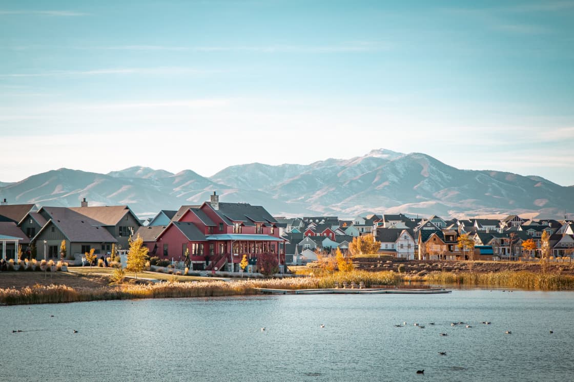
Along the water at the north end of the city. Lake views, shoreline access, and the shortest reach to Pioneer Crossing and the freeway. This is where the city's earliest development concentrated, which in Saratoga Springs terms means the most settled streets and the most mature landscaping available.
Suits: commuters to Lehi and Silicon Slopes; buyers who want the water. Costs you: generally the highest prices in the city; the busiest arterial access.
The Redwood Road spine
The central band running the length of the city. Most convenient position for local errands, schools and services, and the most flexible for households whose journeys go in more than one direction.
Suits: families who value being central; anyone with commutes that do not all point the same way. Costs you: arterial traffic; less distinctive character than the lakeside or the benches.
The western and southern communities
The newest construction, running out toward SR-73 and the Cedar Valley side. Generally the best value in the city, the largest supply of new-build inventory, and the furthest position from the freeway.
This is also where the empty-parcel question matters most. In a city planning for build-out well above its current size, the land behind your fence is very likely to become something.
Suits: buyers who want new construction at a lower entry point; families who can absorb a longer drive. Costs you: the longest commute; living amid ongoing construction; infrastructure arriving after the rooftops.
The northern end toward Lehi
Nearest the Lehi boundary and the shortest drive to the tech corridor. The commute case is strongest here and the price reflects it.
Suits: Silicon Slopes commuters who want a Saratoga Springs house. Costs you: you are paying for the geography, and the district changes at the line.
The district the west side voted into existence
Saratoga Springs is in Alpine School District today. Alpine dissolves on 30 June 2027, and the successor districts are operational 1 July 2027.
Saratoga Springs joins Eagle Mountain, Cedar Fort and Fairfield in the new Lake Mountain School District, named for the ridge separating that side of the valley from the lake.
The distinction worth understanding is how this district came about, because it explains the very different mood on this side of the valley.
The split ran through two ballot propositions. Proposition 14 created Lake Mountain out of the western cities. Proposition 11 created Aspen Peaks out of the north-central ones. Neither mentioned Orem, Lindon, Pleasant Grove or Vineyard — so those four became Timpanogos by subtraction, because when territory leaves a district what remains is still a district.
That difference is not trivia. In Saratoga Springs and Eagle Mountain the split is a thing residents chose and largely still defend — a west side that had grown enormously inside a district governed from elsewhere, voting itself boundaries that finally match its own growth. In the Timpanogos cities it is a thing that happened to them.
If you are reading anxious coverage about the oldest buildings, flat enrollment and per-student overhead in "the new district," check which district it means. That is the Timpanogos story, and it is close to the inverse of Lake Mountain's. Our Alpine dissolution guide covers the whole reorganization.
The capacity problem, honestly
Explosive growth strains schools before it strains anything else, and Saratoga Springs has felt that directly. Westlake and Cedar Valley high schools have both absorbed that growth, which is why the district broke ground in 2025 on a third high school in Saratoga Springs, expected to open around 2028.
For a buyer this has a specific and underappreciated implication: a new high school opening redraws feeder boundaries across the whole west side. That is not a risk of a boundary change; it is a certainty of one. Attendance areas have to be carved out of the existing two schools to populate the third.
So if a specific high school is part of why you are choosing a house, understand that the assignment you verify in 2026 may not be the assignment your child has in 2029. That is not a reason to avoid the city — it is growing because people want to be here — but it is a reason to hold school assignment loosely rather than treating it as a fixed attribute of an address.
Confirm at the address, confirm in the year you buy, and ask the district directly what the boundary process looks like. Our schools guide covers how valley schools compare more broadly.
How to read a master-planned community name
Because Saratoga Springs was assembled community by community rather than growing outward from a town center, decoding those names is a useful skill here. A few patterns hold across nearly all of them.
The name is chosen before the community exists. It is a marketing decision made at entitlement, often years before the first foundation. That means it describes an intention rather than an outcome, and intentions get revised when a market turns or a phase gets resold to a different builder.
One name frequently covers several phases built years apart. Phase one and phase five of the same community can differ in builder, product line, price point, lot size and HOA structure. Two houses under one name can be materially different purchases.
Amenities are promised at the community level and delivered on a schedule. The pool, the trail, the clubhouse in the sales material may be built, funded, permitted or drawn. Those are four different things and only the first is a fact. Ask which, in those words.
The name says nothing about the school. This bears repeating because it is where the real money is. In a city adding a high school and redrawing feeders, community branding and school assignment are set by entirely unrelated processes.
The practical upshot is that in Saratoga Springs you research a phase and an address, not a community. The community name is where the search begins, never where it ends.
The value equation, stated plainly
Saratoga Springs exists in its current form because of a trade that a great many households have decided is worth making, and it is worth stating without euphemism.
What you get. More house and more lot for the money than the central and eastern valley cities offer. New construction with predictable systems and warranty coverage. A parks-and-trails network designed in rather than retrofitted. Lake access. A young, family-heavy population, which for households with children is a genuine amenity — there are other children on the street, and there is no waiting for the neighborhood to turn over.
What you pay. Drive time. That is the whole of it, and it is not a small thing. The west side connects through a handful of corridors, there is no rail, and peak-hour capacity is the binding constraint on daily life.
The households who are happiest here are the ones who ran that trade and decided the drive was worth it. The ones who struggle are usually the ones who tested the commute on a Saturday, or who assumed a road project announced would be a road project open.
There is also a second-order factor worth naming: the trade is improving. Road capacity is being added, retail and services are filling in, and a third high school is coming. A buyer today is buying the current version of the trade with a reasonable expectation that it gets better. That is close to the opposite of buying into a settled city, where what you see is what you get.
What growth feels like
A city that grew at over 1,600 percent in a decade and is planning for build-out well beyond its current size feels different to live in, and the difference is worth describing because listings never do.
Construction is ambient. Not on your street necessarily, but somewhere in view, most of the time, for years. Trucks on the arterials, dust in dry months, road work rerouting familiar journeys.
Services chase rooftops rather than leading them. Grocery, medical, restaurants and retail arrive after the houses do. A community that feels underserved when you move in is often well served four years later — but you live through the gap.
Your neighborhood keeps acquiring neighbors. The field behind the fence becomes houses. The view you bought may be a temporary condition. This is the single most common source of buyer disappointment in fast-growing Utah cities, and it is entirely avoidable by asking what is entitled on the adjacent parcels.
Institutions are young. Schools, congregations, sports leagues and civic organizations are all newer here than in Springville or American Fork. That means fewer established traditions and more opportunity to shape them, which suits some households and unsettles others.
None of this is a warning. It is simply what a boomtown is, and Saratoga Springs is a well-run one. But the version of the city in the marketing is the finished version, and the finished version is some years out.
The resort that is still under the city
Saratoga Springs has an origin story that most residents know vaguely and few know precisely, and it explains a piece of the city's geography that otherwise looks arbitrary.
The natural hot springs near the Jordan River were the reason anyone came here in the first place. John Beck's 1884 resort was a destination at a time when the rest of Cedar Valley was open range. For decades the springs were the only reason the place had a name.
The resort faded, and for most of the twentieth century the land sat largely undeveloped. What survived was the name, the water, and a pattern of early settlement clustered near the shoreline rather than distributed evenly across the valley floor.
That is why the oldest parts of Saratoga Springs are the lakeside ones, and why the city's development has broadly moved outward from the water rather than outward from a Main Street the way pioneer towns did. In a city where almost everything is new, the shoreline is where "old" means anything at all — and it is why the lakeside streets have the mature landscaping that the western communities will not have for another fifteen years.
It is a small thing, but it reframes the map. Saratoga Springs is not a grid town that happens to sit near water. It is a resort site that grew a city around itself, and the water is the reason the pattern looks the way it does.
What differs between these areas
Which corridor you are on. The dominant variable in this city and the one to settle first.
How built out the surroundings are. Saratoga Springs is nowhere near finished. Some communities are settled; others sit beside fields with entitlements. Ask what is planned for the parcel behind the fence, because something is.
HOA scope. Close to universal, wildly variable. Read the specific documents.
Distance to the lake. A real amenity difference and a real price difference.
Age, within a narrow band. Almost everything here is under twenty-five years old. The differences are genuine but the range is compressed, and buyers from older markets tend to over-weight them.
Renting in Saratoga Springs
Rental supply here is growing but remains smaller relative to the city's size than in Provo or Lehi, and it skews toward newer purpose-built apartments and individual houses rather than the basement-unit market that dominates university towns.
Demand comes from the west-side workforce and from families staging a purchase rather than from an academic calendar, so turnover runs through the year without Provo's synchronised waves. The practical advice is the same as for buying: sort by corridor first. A rental that is ten minutes closer to Pioneer Crossing is a materially different lease from one that is not.
Our Utah Valley rent guide covers how asking rents order across the region.
What the map doesn't tell you
Build-out is a moving target. Planning for a much larger population means the city you buy into is not the city you will live in. That is exciting or unsettling depending on temperament, and worth being honest with yourself about.
The lake is a specific kind of neighbor. Utah Lake is a large, shallow, warm freshwater lake rather than an alpine reservoir. Trails, birdlife and long horizons; also insects in warm months and seasonal variation. Our Utah Lake guide covers what it is like.
The grid runs from a local origin. Utah cities measure numbered streets from their own origin point, and streets renumber across city lines. Our address grid explainer covers it.
The city grew by annexation and its edges reflect that. Addresses near a seam can be administratively surprising — which city responds to a call, which issues a permit, which council you vote for.
The seams, city by city
Toward Lehi, on the northeast. Same construction era, similar product, and from 2027 a different school district — Saratoga Springs to Lake Mountain, Lehi to Aspen Peaks. Two houses that look identical from the road, in different districts. This is the seam where an assumption is most likely to cost you, and our Lehi neighborhoods guide covers the other side.
Toward Eagle Mountain, on the southwest along SR-73. Same district from 2027, same west-side commute geometry, and a shared interest in the road projects. The two cities are more alike than either is to anywhere east of the lake.
Toward Cedar Valley, Cedar Fort and Fairfield, further west. Rural, sparsely populated, and in Lake Mountain from 2027 alongside the two large cities.
Toward Utah Lake, on the east. Not a municipal seam but the defining edge of the city.
Choosing in one pass
Which corridor? Settle this before you look at a single house. In Saratoga Springs it determines more about your life than the house does.
How much unfinished can you live beside? The west and south offer the best value precisely because they are least finished.
Which HOA scope? Not whether — which.
How firmly do you need the school? If very, understand that a third high school is coming and boundaries will move. Plan around the certainty rather than hoping against it.
For the broader relocation picture, our moving to Utah Valley guide covers settling in, and buying a home near Provo covers the purchase process.
Related Guides
- Living in Saratoga Springs — the full city guide
- Lake Mountain School District — the district the west side voted for
- Alpine School District — the split explained
- Living in Eagle Mountain — the other Lake Mountain city
- Eagle Mountain Neighborhoods Guide — area by area on the far west side
- Lehi Neighborhoods Guide — the neighbor across the district line
- Orem Neighborhoods Guide — the same treatment on the east side
- Annexation and city boundaries in Utah County
- The Utah address grid, explained
- Cedar Valley High vs Westlake High — the two schools west of the lake
- Saratoga Springs vs. Eagle Mountain: The Two Fastest-Growing Cities in Utah, Compared for People Deciding Between Them
Frequently Asked Questions
What are the best neighborhoods in Saratoga Springs Utah?
Are Saratoga Springs' neighborhoods official designations?
What school district will Saratoga Springs be in after 2027?
How bad is the commute from Saratoga Springs?
Why doesn't this guide publish home prices for Saratoga Springs?
Do all homes in Saratoga Springs have an HOA?
Are the schools in Saratoga Springs overcrowded?
What was Saratoga Springs before it was a city?
Sources
The facts in this guide were checked against these sources. Hours, fees and rules change, so confirm anything time-sensitive with the source before you go. How we make Provo.com.
- Neighborhood District Program, Provo City. Checked October 12, 2026.
- City of Saratoga Springs: History, City of Saratoga Springs. Checked October 12, 2026.
- Town of Saratoga Springs incorporation certificate, Utah State Archives. Checked October 12, 2026.
- Ground breaks on future high school in Saratoga Springs, Eagle Mountain City. Checked October 12, 2026.
- Voters approve split of Alpine School District, Eagle Mountain City. Checked October 12, 2026.
- State greenlights nearly $1.4 billion in new UDOT projects for northwest Utah County, UDOT. Checked October 12, 2026.
- UDOT to open new Pioneer Crossing lanes, UDOT. Checked October 12, 2026.
- Decennial Census PL 94-171, Saratoga Springs (place 67825), 2000 and 2010, U.S. Census Bureau. Checked October 12, 2026.