
More on Payson: every guide we have published there, in one place.
Payson is where Utah County stops.
It is the southernmost true city in the county, and being the last thing on the way out has shaped it in ways that are still visible. It kept an agricultural identity that the corridor cities shed. It kept a complete set of its own institutions rather than borrowing its neighbors'. And it sits at the bottom of a mountain road that most of the valley has to drive to reach.
The structural fact that matters most to a family is easy to state and unusual in this valley: Payson educates its own children from kindergarten through graduation, inside the city limits. Elementary schools, a junior high, and Payson High School, home of the Lions.
That sounds unremarkable until you look around. Lindon has no high school. Mapleton has no high school. Cedar Hills has no high school. Santaquin has no high school, and sends students to Payson High. In a valley where the school question is usually a boundary question, Payson is one of the few places where it mostly is not.
This guide is the area-by-area companion to our broader guide to living in Payson.
The one thing to know before you compare neighborhoods
Payson has no official neighborhoods.
Provo City does, through a formal Neighborhood District Program with 35 mapped neighborhoods grouped into five districts and volunteer boards approved by the City Council, which is why our Provo neighborhoods guide is organized around them.
Payson has nothing equivalent. What people call a neighborhood here is a subdivision name on the newer edges, a historic reference around the old grid, or plain geography — the bench, the west side, out by the freeway.
Those are useful for orienting yourself and carry no civic meaning. Zoning, utilities, animal rights and irrigation water are all parcel-level facts, and none of them can be read off an area name. This guide describes the areas as patterns and points you at the real boundaries instead.
Payson at a glance
Payson sits at the southern end of Utah Valley, with I-15 running along its west side and the Wasatch rising immediately to the east.
Its identity was built on onions and pioneers, and both are still present. Golden Onion Days has run every Labor Day weekend since 1929 and is named directly for the city's onion-farming heritage. The Peteetneet Museum and Cultural Arts Center occupies a restored 1901 schoolhouse and anchors a historic district that gives the old part of town a genuine civic core rather than a nostalgic one.
The modern city adds things that matter to a buyer more than heritage does. The Payson Utah Temple, completed in 2015, is a large and visually prominent building whose grounds are open to the public. Mountain View Hospital sits in the city, with an emergency department, which is a serious practical advantage for a city this far from the metro center. And the Nebo Loop Scenic Byway climbs straight out of town.
The school pipeline, and why it is worth naming
Most of our city guides spend their school section explaining a boundary problem. This one does not need to.
Payson has its own elementary schools, its own junior high and Payson High School inside the city. A child can start and finish school without leaving town. Payson High also serves students from nearby communities including Santaquin, which has no in-town high school of its own.
Why that matters practically:
Continuity. Children move through a single set of institutions with a stable peer group, rather than crossing a city line at fourteen into a school drawn from several communities.
Predictability for a buyer. In cities split between two high schools, the assignment is an address-level fact that can move. Where a city has one high school and it sits inside the limits, the question is far simpler. It is still worth confirming with Nebo for a specific address — boundaries exist even inside a single-high-school city, and growth changes them — but the range of possible answers is narrow.
Local identity. A city with its own high school has its own teams, its own Friday nights and its own graduation. That is a real component of small-town life and it is one of the things Payson has that the bedroom communities up the valley do not.
The district: nothing is changing
Payson is in Nebo School District, which serves Springville, Spanish Fork, Mapleton, Salem, Payson, Santaquin and south. Nebo was never part of Alpine and is not part of the reorganization.
The three-way split affects the north: Alpine, American Fork, Cedar Hills, Highland, Lehi and part of Draper go to Aspen Peaks; Eagle Mountain, Saratoga Springs, Cedar Fort and Fairfield go to Lake Mountain; Orem, Lindon, Pleasant Grove and Vineyard go to Timpanogos. Alpine dissolves 30 June 2027 and the successors are operational 1 July 2027. Our guide to the Alpine School District split has the full picture.
None of it reaches Payson. For a buyer weighing this city against a north-county alternative, that is worth real money in certainty: the district you research today is the district your children will attend in.
The areas
The historic grid and Main Street
The oldest part of Payson is laid out on the pioneer grid, and it has what old grids have: mature trees, a wide range of house ages on a single street, and a walkable civic center.
The Peteetneet building anchors it. Memorial Park hosts the festival calendar. Main Street is a real main street rather than a strip, and the trip to city services from anywhere in this area is short.
Housing here is mixed — early cottages, mid-century stock, later infill — and lots are modest by bench standards but often generous compared with modern subdivision lots. As with any old grid, the mature canopy is both the amenity and the maintenance obligation.
This is also where Golden Onion Days lands. Living near the parade route or the carnival is a real consideration in both directions: some people buy for it and some leave town for it.
Reads as: oldest, greenest, most walkable, most civic.
The bench and the east side
East of the grid the ground climbs toward the mountains, and this is where most of Payson's newer construction has gone.
The bench is the view side and the mountain side. Newer subdivisions, larger and more consistent lots, and the shortest access to Payson Canyon and the Nebo Loop. The temple sits in this general part of the city and is visible from a good deal of it, which for many local buyers is itself a locational factor.
Trade-offs are the standard bench trade-offs: more snow, later melt, steeper approaches, and a few more minutes to the freeway. Wildfire exposure is a consideration at the mountain interface, as along the whole Wasatch front, and defensible space around a structure is practical rather than decorative.
Reads as: newest, best views, closest to the canyon, most winter.
The west and north sides toward I-15
Toward the freeway the ground flattens and the city becomes more conventionally subdivided and more commercially adjacent.
This is the convenient side. Closest to I-15, closest to the big-box shopping that makes Payson's distance from the metro tolerable, and generally the most affordable residential ground in the city. For a commuter with a long drive already, saving several minutes at the start of it is not trivial.
What you give up is the character. This is the part of Payson that most resembles anywhere else, furthest from both the old town and the mountains.
Reads as: flattest, most convenient, most affordable, least distinctive.
The agricultural edges
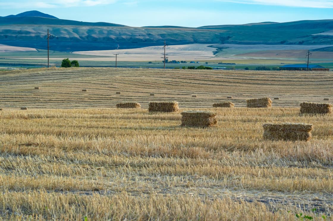
Around the built city, particularly on the flatter ground, sit the working and formerly working agricultural parcels the city grew out of. Onions were the crop that named the festival; the farmland is why there was a festival to name.
For a buyer these edges are where the careful diligence belongs. Irrigation water is a property interest with its own transfer rules and does not automatically follow a parcel. Animal rights and outbuilding allowances are separate permissions from each other and vary lot by lot. If you intend to use the land, establish in writing what attaches to it before closing.
What differs between these areas
Three things, and the rest follows:
Elevation. East is up toward the mountains, west is flat toward the freeway. This drives views, snow, street layout and price.
Canopy age. The historic grid has mature trees; the bench does not yet.
Distance to I-15. West side closest, bench furthest, old grid in between.
School district is the same across the whole city — Nebo, unchanged — and the high school is Payson High for the city generally, which is a materially simpler position than most of its neighbors.
The commute, priced honestly
Payson's affordability is real and it is paid for in distance.
I-15 gives a straight shot north, which is the good news: this is a simple, uncomplicated drive rather than a cross-valley puzzle. Provo is a manageable trip. The Lehi tech corridor is a long one. Salt Lake City is a serious daily commitment that a lot of people make and nobody enjoys in February.
There is no FrontRunner station in Payson and public transit is limited, so households here drive, usually with more than one vehicle. Budget for that honestly — two cars, more fuel and more maintenance is a real monthly number that offsets part of what the housing saved you.
The compensations are genuine. Housing costs less. Big-box shopping including a Costco is a short drive rather than a trek. And a great deal of what people leave the valley on weekends to find is at the top of your own street.
If the commute is the binding constraint, our guides to Spanish Fork and Springville cover the two cities that sit closer in and sell a different balance.
The mountains, which are the underrated argument
Most Utah Valley cities are near a canyon. Payson sits at the northern gateway of a full scenic byway.
The Nebo Loop Scenic Byway climbs from town past Mount Nebo — the highest peak in the Wasatch Range — with Payson Lakes and Grotto Falls accessible along the way, plus hiking, fishing and camping. In fall it is one of the most striking drives in the state, and it draws visitors from far outside the county.
For a resident that changes the shape of a weekend. Trailheads, water and camping are minutes away rather than an hour, which for an outdoors-oriented household can be worth more than the commute costs.
Two practical notes. The Loop is a seasonal mountain road, so confirm it is open before planning around it. And fall weekends bring real traffic through town — pleasant if you like the activity, less so if you are trying to run errands.
Renting in Payson
Rental supply is moderate and improving as the city grows, and it is concentrated on the flatter west and north sides rather than on the bench. The historic grid has some good rental stock in the form of houses and converted units, with the same trade as buying there: character and trees against older systems.
Payson is one of the more accessible entry points in the valley for renters priced out further north, and the same distance calculation applies — cheaper housing, longer drive, more reliance on a car.
Renters anywhere in the city should read our guide to Utah renters' rights. The statutory rules are identical statewide, and a small landlord renting one house is less likely to know them cold than a management company is.
What the map doesn't tell you
The K-12 pipeline is inside the city. This is Payson's quiet structural advantage and the reason its school section is shorter than everyone else's.
Mountain View Hospital matters more than people expect. Having a full hospital with an emergency department in town is a genuine practical difference when you are an hour from the metro center and someone in the household needs care.
Golden Onion Days is a real weekend. Every Labor Day since 1929, plus a Scottish Festival and a Salmon Supper on the civic calendar.
The temple is a landmark and a traffic generator. Completed 2015, grounds open to the public, visible from much of the city.
Two cars is the realistic assumption. No FrontRunner, limited transit, long distances.
Utilities and emergency response have their own boundaries. Confirm for the specific address who provides water and power and who responds to a 911 call, rather than assuming from the city name. Our living in Payson guide sets out the local arrangements.
Choosing in one pass
- You want trees, walkability and the old town → the historic grid around Main Street.
- You want views, newer stock and the canyon → the bench and east side, and look at the street in February.
- You want the shortest possible version of a long commute → the west and north sides toward I-15.
- You want your children in one set of schools from start to finish → Payson generally. Few cities in this valley can offer it.
- Certainty about your school district matters → Payson generally. Nebo is not part of the reorganization and will not be.
Reading the building eras
The city dates fairly cleanly from the street.
Straight pioneer grid, mature canopy, wide spread of house ages — the historic core around Main Street and the Peteetneet building.
Straight grid, thinner canopy, consistent mid-century stock — the first ring of post-war expansion outward from that core.
Curving streets, larger and more uniform lots, young trees, mountain views — the bench and east-side subdivisions.
Flat, regular, newest, closest to commercial — the west and north sides toward the freeway.
As everywhere in the valley, canopy depth is the most reliable indicator. On the bench you are reading subdivision geometry instead, because the trees are still filling in.
The hospital, and what being an hour out means
Mountain View Hospital being in Payson itself is the kind of fact that reads as a footnote until you need it.
Payson is a long way from the metro center. For most daily purposes that is an inconvenience priced into the housing. For medical care it is a different category of problem, and having a substantial hospital inside the city rather than forty minutes up the freeway changes the calculation for older buyers, for households managing a chronic condition, and for anyone with young children who has ever driven to an emergency room at two in the morning.
It also anchors a cluster of associated medical services that a city of this size would not otherwise support, which means routine care is generally local rather than a drive north.
This is one of the genuine structural advantages of the south end of the valley and it is consistently underweighted by buyers comparing on price and commute alone.
The onion story, and why the agriculture still matters
Golden Onion Days is not a whimsical name. Payson was an onion-farming town, and the festival that has run every Labor Day weekend since 1929 is named for the crop that paid for the place.
That history is still doing work. It is why the flatter ground around the city holds agricultural parcels rather than continuous subdivision. It is why irrigation infrastructure runs where it does. And it is part of why the city retains a settled small-town identity that predates its current growth — a festival with nearly a century of continuity behind it is a genuine civic institution rather than a marketing exercise.
For a buyer, the practical residue is the same as in every agricultural Utah city: irrigation water is a property interest with its own transfer rules, animal rights and outbuilding permissions are separate parcel-level questions, and the rural appearance of a road guarantees nothing about the rules on a given lot. Establish what attaches to the land in writing before closing.
Payson against the rest of the south valley
The realistic comparison set is Payson, Salem, Santaquin, Spanish Fork and Springville, and they sort fairly cleanly.
Springville is the established, full-service city closest to Provo, with a real downtown and an arts identity. Shortest commute, highest entry point of the group.
Spanish Fork is the growth story — the most master-planned inventory, its own municipal utilities including a city-run internet service, and two high schools splitting the city.
Salem is the small, quiet option between them, with a strong local identity and limited inventory.
Santaquin is further south again and more affordable still, and notably has no in-town high school — its students come to Payson High.
Payson is the one with a complete institutional set: its own K-12 pipeline, its own hospital, a full civic calendar and a scenic byway. It trades commute distance for a level of self-sufficiency the smaller south-valley cities cannot match.
All five are in Nebo, and none of them is touched by the Alpine reorganization. So this comparison is a straightforward one about housing, distance and services, without a governance question layered on top — which is not true anywhere in the north county right now.
Related Guides
- Living in Payson
- Nebo School District
- The Alpine School District split, explained
- The Nebo Loop Scenic Byway
- Mapleton neighborhoods
- Spanish Fork neighborhoods
- Springville neighborhoods
- Living in Salem
- Living in Santaquin
- Santaquin Neighborhoods Guide — the town that sends its teenagers to Payson High
- Salem Neighborhoods Guide — the pond town north and east
- Payson Lakes and Payson Canyon: The Complete Guide
Frequently Asked Questions
Is Payson affected by the Alpine School District split?
Does Payson have its own high school?
What are the best neighborhoods in Payson Utah?
Are these official neighborhoods with defined boundaries?
What is the Nebo Loop Scenic Byway?
What is Golden Onion Days?
How is the commute from Payson?
Why doesn't this guide publish home prices for Payson?
Sources
The facts in this guide were checked against these sources. Hours, fees and rules change, so confirm anything time-sensitive with the source before you go. How we make Provo.com.
- Golden Onion Days, Payson City. Checked October 12, 2026.
- Peteetneet Museum, Payson City. Checked October 12, 2026.
- Neighborhood District Program | Provo, UT, Provo City Council. Checked October 12, 2026.
- Voters approve split of Alpine School District, Eagle Mountain City. Checked October 12, 2026.
- Payson Utah Temple | Church News Almanac, Church News. Checked October 12, 2026.
- Mountain View Hospital - Payson, MountainStar Healthcare. Checked October 12, 2026.


